Earlier today, we experienced warm temperatures and heat indices as an area of high pressure settled in across the region. We can expect warmer temperatures and below-average precipitation throughout the rest of the week until tropical moisture returns early next week.

Tonight
Moving into the evening, we can expect a clear rest of the night across most of the region as an area of high pressure warded off most storm activity this afternoon.
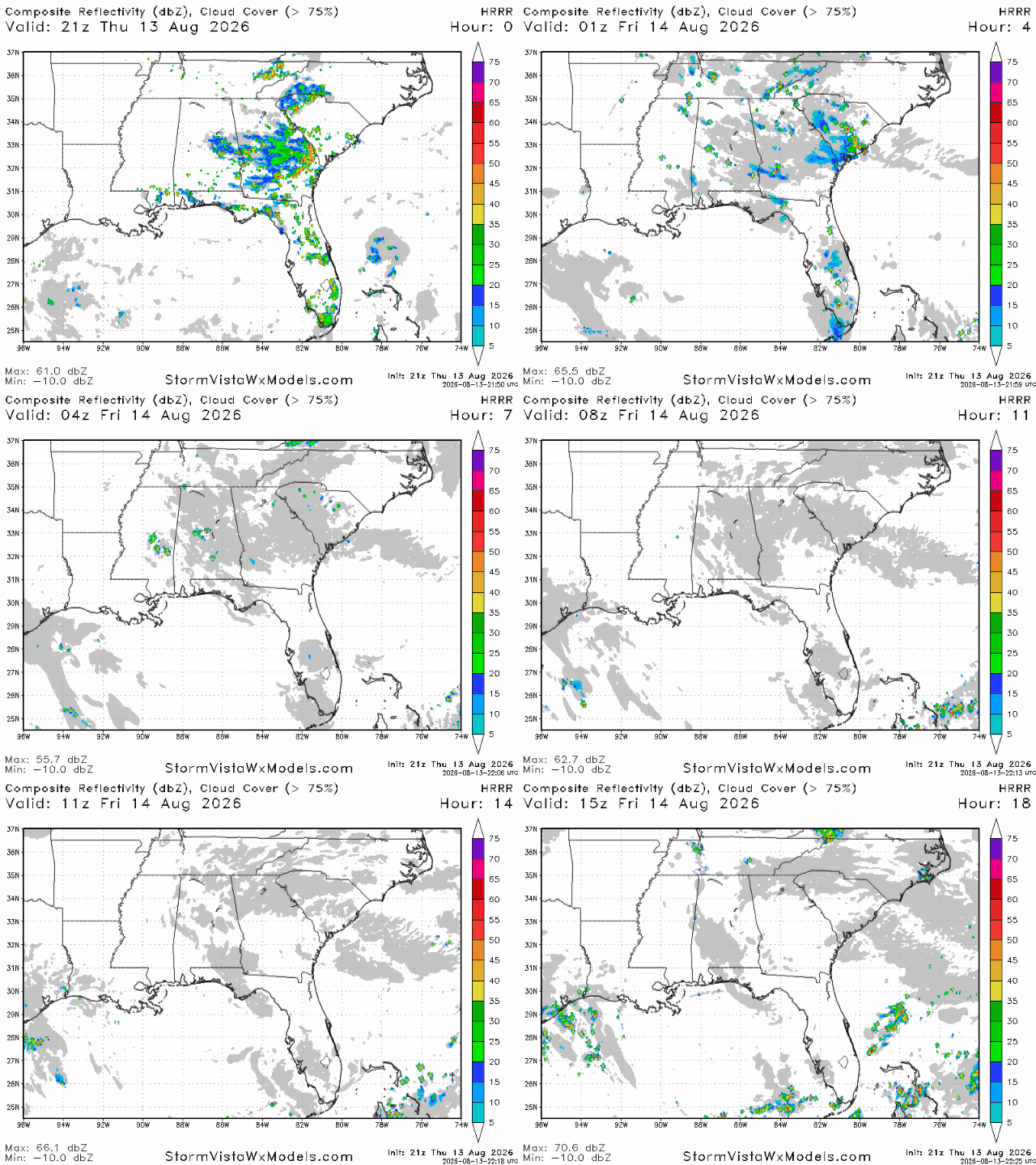
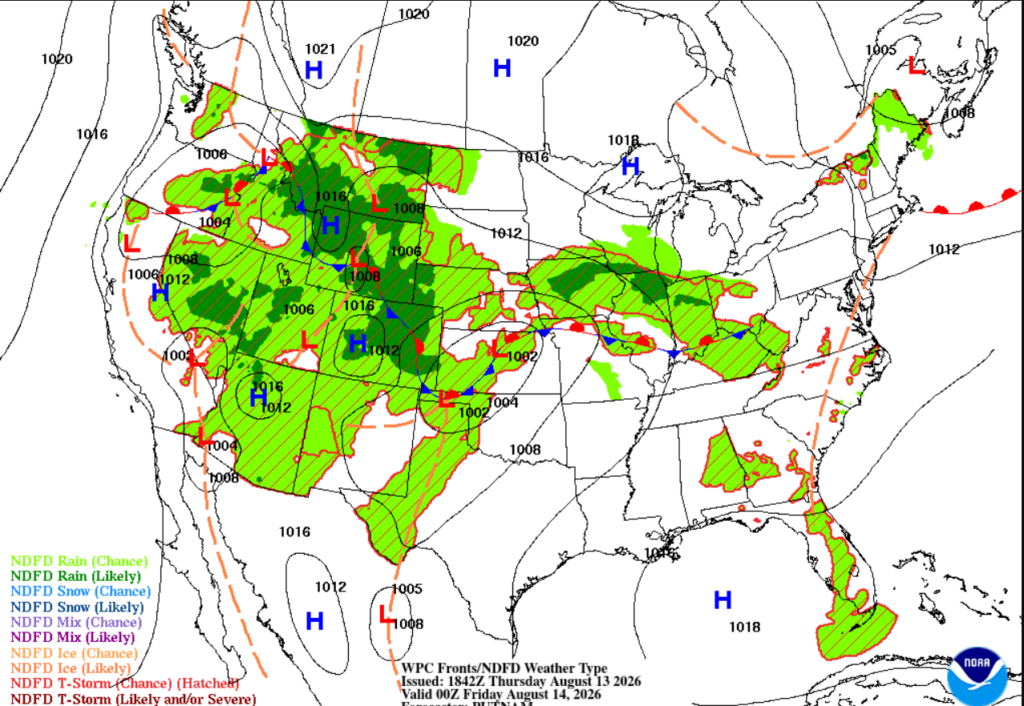
Below, we see the ridge in action, pushing away a majority of the water vapor aloft away from our area. You may have seen a few pop-up showers today; I know we had a few in Tallahassee that are not shown on the forecast below, but they were brief and nothing too severe. Since they were so isolated, they aren’t shown on the forecast below.
Into the nighttime hours, expect lows reaching into the mid 70’s across the region with a clear night perfect for stargazing. A light breeze should be hanging around the region this evening too, making the temperature feel a little more tolerable for your Thursday evening.
Tomorrow
The big idea for the next few days will be that Gulf ridge hanging around the Southern MS/AL/LA coast, keeping our temperatures high and storm chances lower than average.
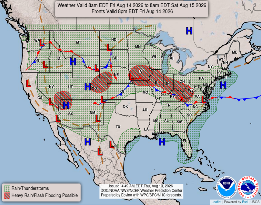
We do have the potential for some scattered showers tomorrow afternoon as daytime heating increases and overpowers the ridge in the Gulf. This ridge reduces the chance of any widespread storm formation, but there is still a chance of afternoon showers as the humidity and heating will push through the area of high pressure.

Saturday
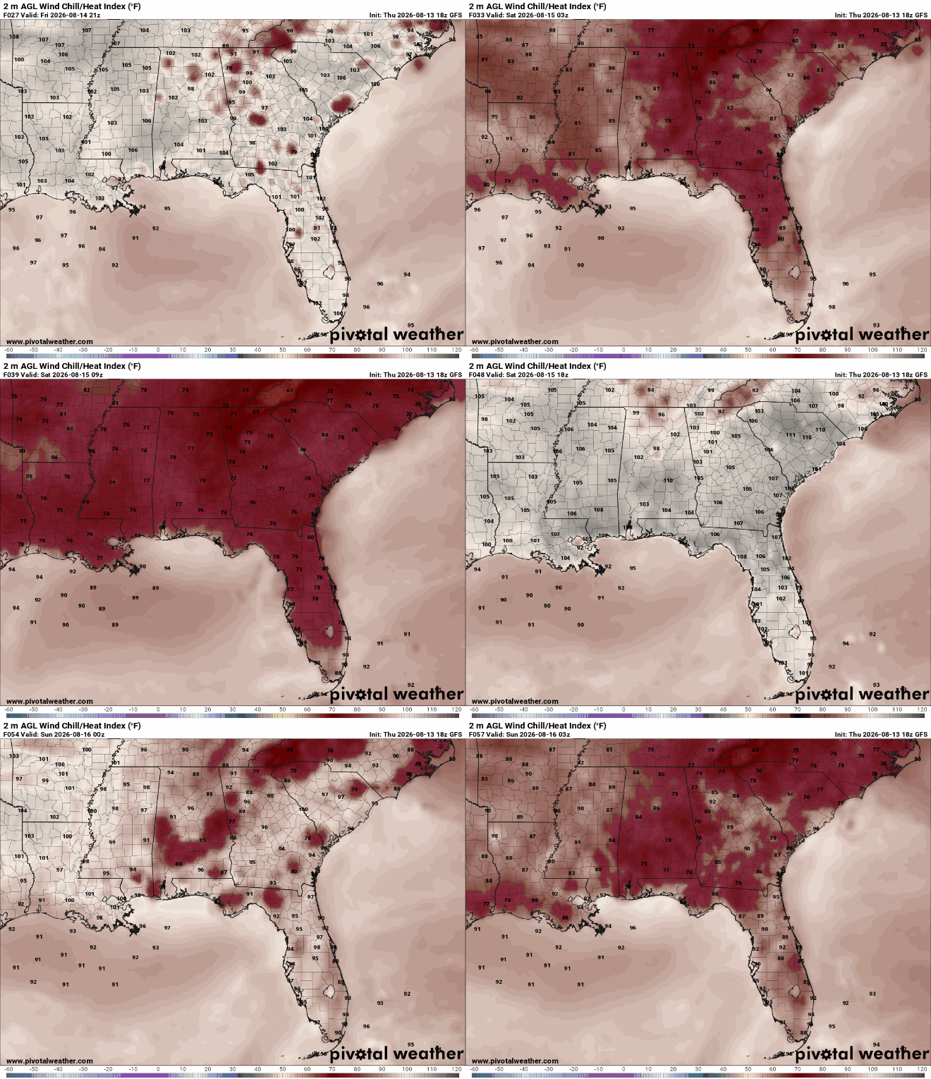
To kick off our weekend, we have some hot temperatures across the region. Below are the heat index values for Saturday, where we can see the feel-like temperatures reaching up to 108 degrees as we hit midday. Make sure you are staying hydrated and cool; this heat is no joke!
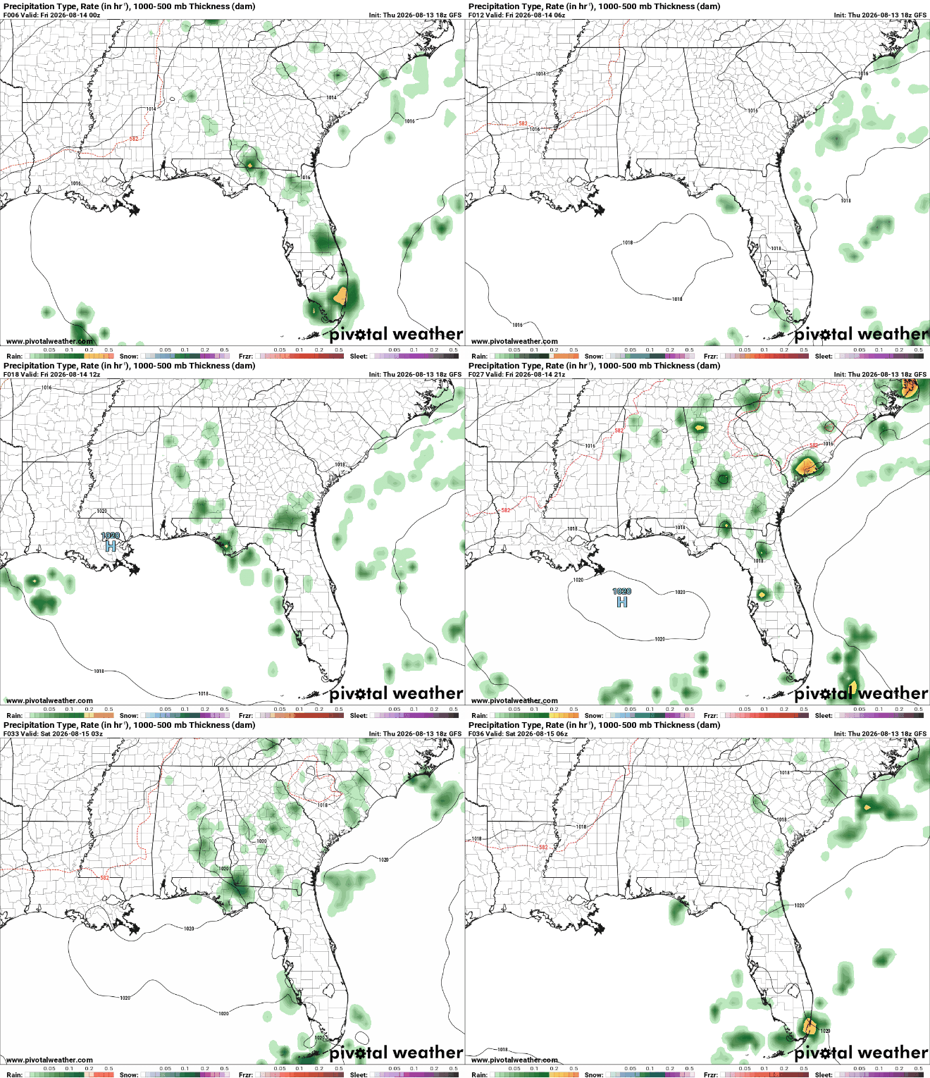
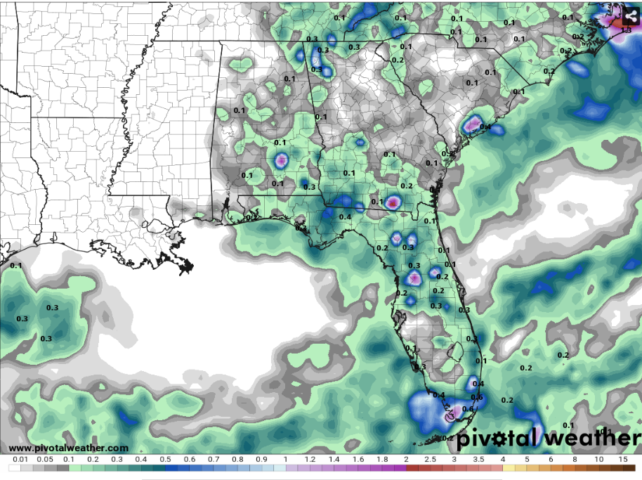
It’s interesting to see what the QPF from now until Saturday night looks like because of the ridge in the Gulf. I guess the high-pressure is doing its job fending off the storms!

Extended Forecast
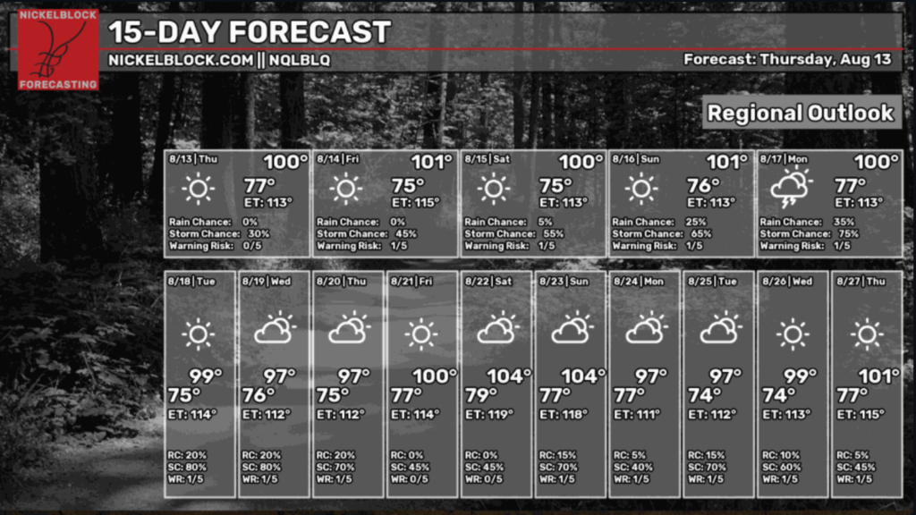
For our Nickelblock 15-day forecast, things are looking toasty with the potential to get even hotter next week! I’m sure everyone is excited for that. Rain chances will stay relatively low until the Gulf moisture returns in the beginning of next week. Try to stay cool, y’all!
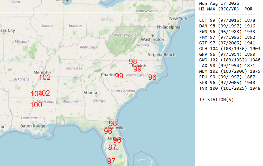
Below are the maximum high temperatures that are expected to tie or exceed the current records in cities across the Southeast. We see 3 cities across Mississippi that are expected to reach near record high’s on Monday of next week. This includes Greenwood/Leflore, Greenville, and Vicksburg. Take extra precautions in these areas and be ready for history to potentially be made with record-high temperatures for August!
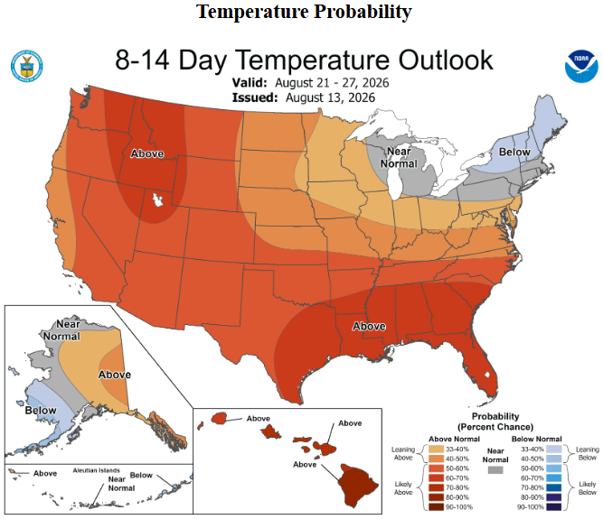
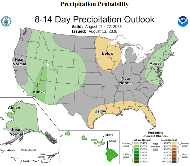
We can see pretty clearly that summer isn’t over yet, even with the kids going back to school already. The above-average temperatures and below-average rainfall trend seems to continue from now and all the way till August 27th. After this past July was announced as the hottest month on record, this outlook and the current temperatures have me wondering if August will be coming to take that title soon. Stay tuned for more!
Summer has also put together a video forecast highlighting the tropics and what you can expect weather-wise through the end of the week. Thanks, Summer!


