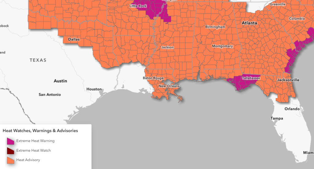
Closing out the week, and unfortunately, the heat is showing no signs of letting up! Heat advisories are already popping up all across the board from Shreveport to Jacksonville.
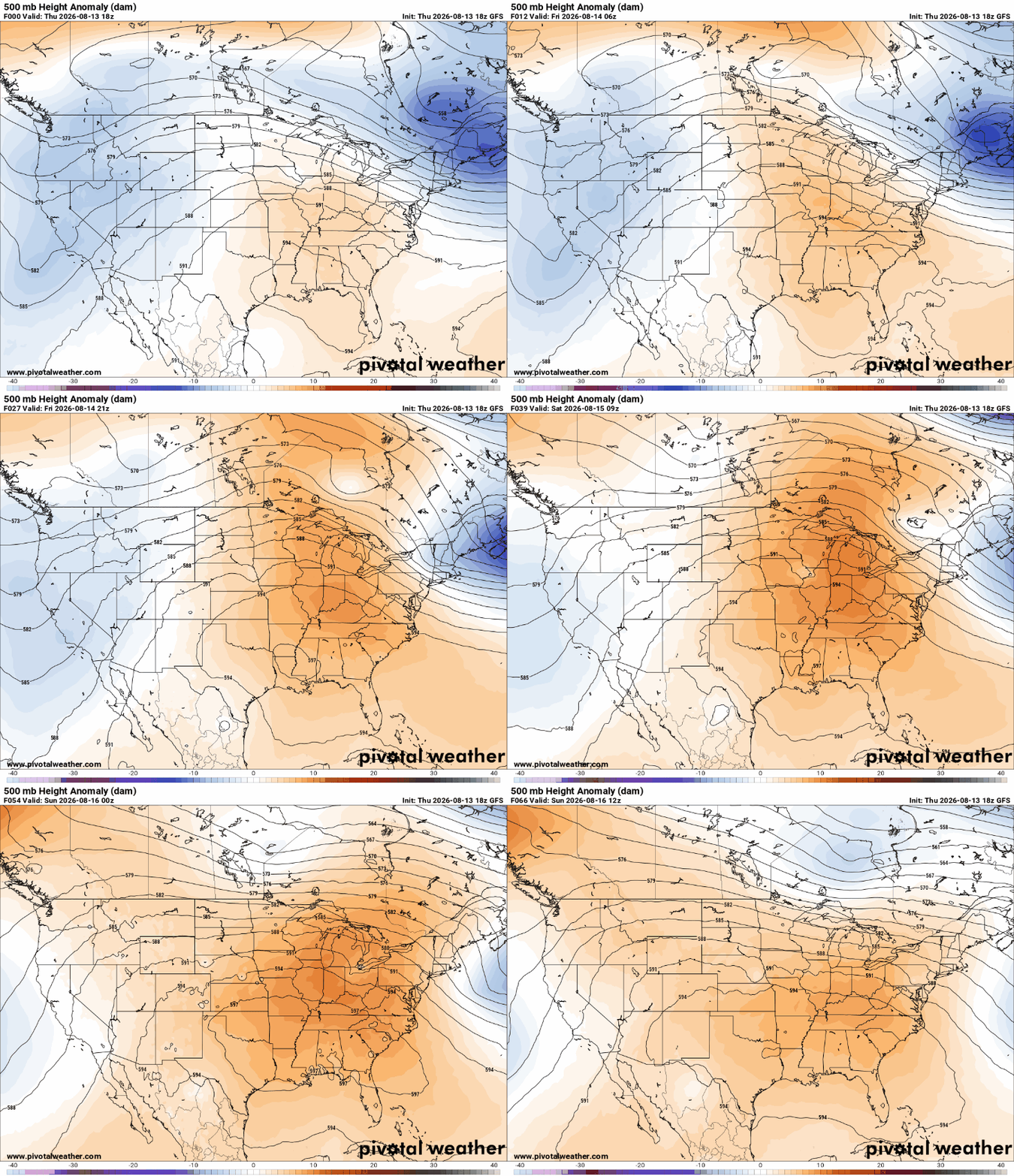
This is all thanks to a ridge in the mid-levels of the atmosphere building over the region.
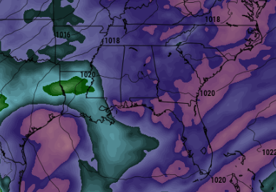
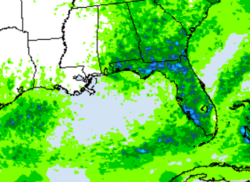
The sinking air from this ridge will drive temperatures up and squash rain chances across LA and MS. Meanwhile, in GA, FL, and TX, there is plenty of moisture in place, shown by the pinks (below, left). This will help generate a better chance for showers and storms this weekend, mainly in the Big Bend and south/central Georgia (below, right).
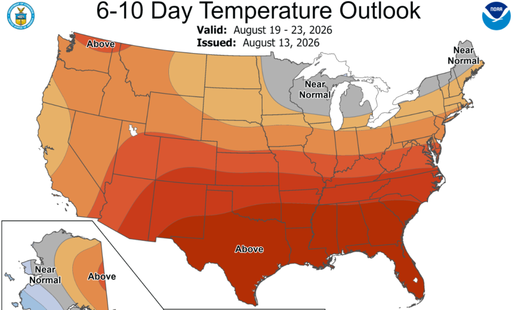
Yes, July and August are notably the hottest months of the year, but this summer’s heat looks to be hotter than average and persistent. The 6–10 day temperature outlook shows above-average temperatures continuing into late August…and when the heat sticks around day after day, that’s when heat stress can become especially dangerous!
3-DAY TRAVEL FORECAST
Airports
KIAH / KHOU (Houston) – Fog is possible overnight and into the early morning hours. Spotty storms are possible Friday, but aside from that, no major weather-related issues are anticipated through this weekend.
KSHV (Shreveport) – Except for heat, no weather-related issues are anticipated through this weekend.
KBTR (Baton Rouge) – Except for heat, no weather-related issues are anticipated through this weekend.
KMSY (New Orleans) –Low-end chance for an afternoon storm. Other than that, no weather-related issues are anticipated through Saturday.
KJAN (Jackson) – Except for heat, no weather-related issues are anticipated through Saturday.
KMOB (Mobile) – Low-end chance for an afternoon isolated storm each day. Other than that, no weather-related issues are anticipated through Saturday.
KBMH (Birmingham) –Low-end chance for an evening spotty storm each day. Other than that, no weather-related issues are anticipated through Saturday.
KTLH (Tallahassee) – Scattered showers and thunderstorms possible each day, mainly after 2pm. Some intermittent flight delays are possible for lightning.
KATL (Atlanta) – Scattered showers and thunderstorms possible each day, mainly after 2pm. Some intermittent flight delays are possible for lightning.
Highways
I-10
Looks dry between Houston and Mobile, with only a stray afternoon/evening spotty shower possible. There is a higher chance for scattered showers and thunderstorms as you travel closer to Tallahassee and the Florida Panhandle. Be prepared for gusty winds and heavy rainfall
I-20
Staying mostly dry between Shreveport and Jackson. Can’t rule out a pop-up storm near Birmingham during the afternoon-evening hours.
I-49
Looks good other than the extreme heat!
I-55 & I-59
Looks good other than a spotty storm near Laplace and New Orleans in the afternoon.
I-65
Weather story changes a bit… Afternoon scattered storms are likely with higher coverage near Montgomery and Mobile. Be prepared for gusty winds and heavy rainfall.
I-75
Hit-or-miss storms are possible each afternoon and evening, with a better chance of storms the farther south you drive from Macon, bringing gusty winds and heavy rain.
CITY FORECASTS
Houston, TX
Tonight – Partly cloudy skies tonight with patchy fog. Warm with a low of 80. Winds will be cranking 5–15 mph from the south.
Friday – Best shot at storms. Hot and sticky with a high of 95, but it will feel like 107. Mix of sun and clouds with scattered storms around lunchtime. Breezy, with winds blowing out of the south at 10–15 mph. Rain chance: 20%
Saturday – Hotter with plenty of sunshine. High of 96, but it will feel closer to 110. Winds calm down a bit to around 5 mph from the southeast.
Shreveport, LA
Tonight – Clear skies tonight with temps dropping to 76. Light breeze from the south at 5–10 mph.
Friday – Heat advisory in effect for a high of 100, but it will feel 8 degrees hotter. Abundant sunshine. Light breeze from the south at 5 mph.
Saturday – Worsening heat with a high of 100; it will feel like 110 in the afternoon. Plenty of sunshine with a light breeze out of the southwest at 5 mph. Drink water!
Baton Rouge, LA
Tonight – Clear skies tonight with temps dropping to 75. Light breeze from the south at 5 mph.
Friday – Heat advisory in effect for highs in the upper 90s, with a max heat index of 110. Sun shining bright. Light breeze from the south at 5 mph.
Saturday – Worsening heat and humidity with a high of 99, may feel like 10 degrees hotter in the afternoon. Calm winds and plenty of sunshine around.
New Orleans, LA
Tonight – Clear skies tonight and warm, with a low of 80. Light breeze from the south at 5–10 mph.
Friday – Heat advisory in effect for a high of 95, with a max heat index of 107. Abundant sunshine. Calm winds.
Saturday – Heat worsens with a high of 95, may feel like 110 in the afternoon. Mix of sun and clouds, but we can’t rule out a stray storm around lunchtime. Rain chance: 10%.
Jackson, MS
Tonight – Staying mostly dry tonight under clear skies. Warm and humid with a low around 77 and a light breeze from the south.
Friday – Heat advisory in effect for a high near 100, with a max heat index of 105. Abundant sunshine. Light breeze from the west at 5 mph.
Saturday – Heat worsens with a high of 100, may feel like 110 in the afternoon. Sunny skies and calm winds. Drink water!
Birmingham, AL
Tonight – Lingering showers before becoming quiet under partly cloudy skies. Low of 77. Rain chance: 15%
Friday – Heat advisory in effect for a high of 96, with a max heat index of 105. Mix of sun and clouds. Cannot rule out a brief storm in the evening. Rain chance: 20%
Saturday –Abundant sunshine and hot. High of 98; it will feel like 106 in the afternoon. Cannot rule out a stray storm in the evening. Rain chance: 15%. Calm winds. Drink water!
Mobile, AL
Tonight –Little overnight relief with a low of 77. Clear and calm night. Light breeze from the southwest at 5 mph.
Friday – Heat advisory in effect with a high of 97 and a max heat index of 107. Mix of sun and clouds. Cannot rule out a brief storm in the afternoon. Rain chance: 15%
Saturday – Similar story here. High of 98, may feel closer to 110. Mostly sunny skies with a pop-up storm in the afternoon-evening timeframe. Rain chance: 20%
Tallahassee, FL
Tonight –Isolated showers diminishing this evening before becoming quiet under partly cloudy skies. Low of 77. Rain chance: 15%
Friday – Extreme heat warning. High in the upper 90s, could feel like 115 in some places! Mix of sun and clouds with scattered storms possible during the afternoon-evening timeframe. Rain chance: 50%
Saturday – Plenty of sunshine with scattered showers and storms possible during the evening. High 96, may feel closer to 110. Light breeze from the west. Rain chance: 50%
Atlanta, GA
Tonight –Partly cloudy skies. Low of 77 with calm winds.
Friday – Heat advisory in effect for “feels like” temperatures up to 105. High of 95. Partly cloudy with stray showers/storms during the afternoon. Light breeze from the northwest at 5 mph. Rain chance: 20%.
Saturday – Mix of sun and clouds with scattered storms possible during the afternoon-evening timeframe. High 97, may feel closer to 105. Light breeze from the northwest. Rain chance: 20%


