Howdy!
Are you hoping for a break from the heat? Well, I hate to disappoint you, but it is not looking like that will be the case. It will be extremely hot for the region for the next couple of weeks, temperatures remaining above normal for this time of year. There may be a time looking ahead for a slight break, but it is still too far out to be confident. Limited chances of rain with high pressure and subsidence over us.

TODAY/TONIGHT
Looking out the window, currently (around 9:30am CT) there’s not much clouds for the region and a couple of showers out near Five Points and Summerfield in Alabama to start the day.
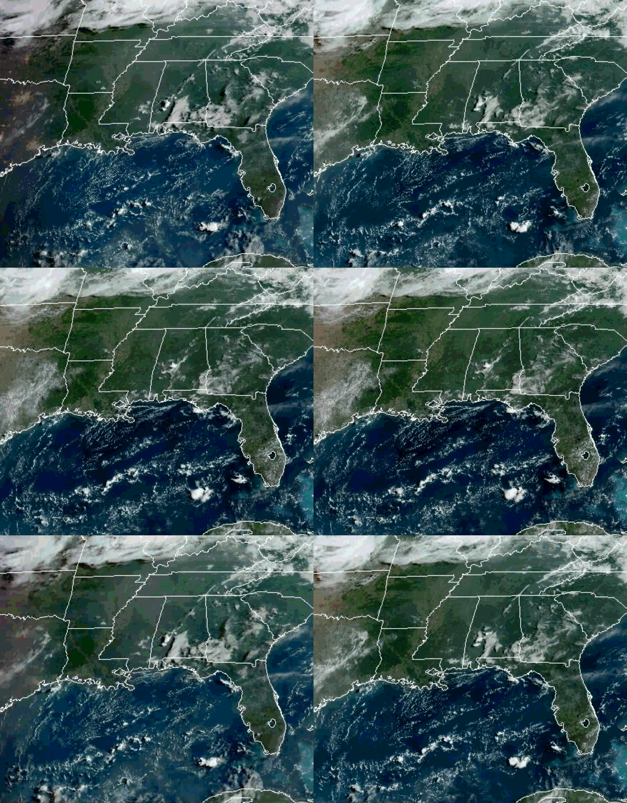
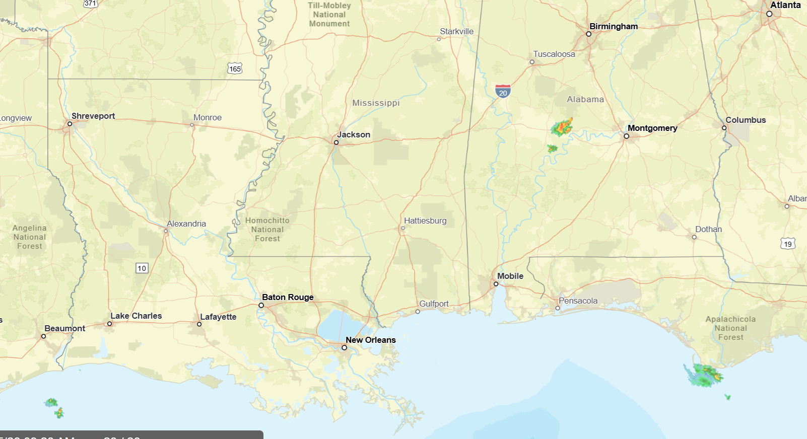
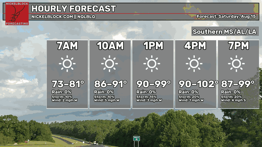
High pressure and upper-level ridging is keeping conditions hot and chances of rain limited. Temps are going to be in the 90s and could reach up to 102 for some areas, dewpoints in the 70s, increasing heat index values to above 100, reaching as high as 108-114.
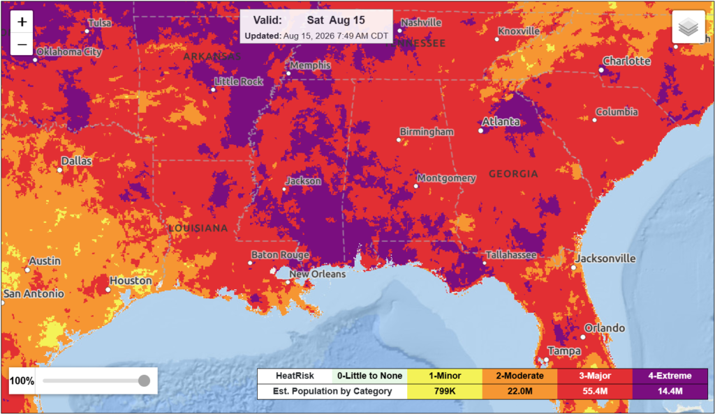
Heat advisories and extreme heat warnings are already in effect for today, the warnings being in the New Orleans/Baton Rouge area extended through the gulf coast of Mississippi (heat index values could reach up to 113 degrees).
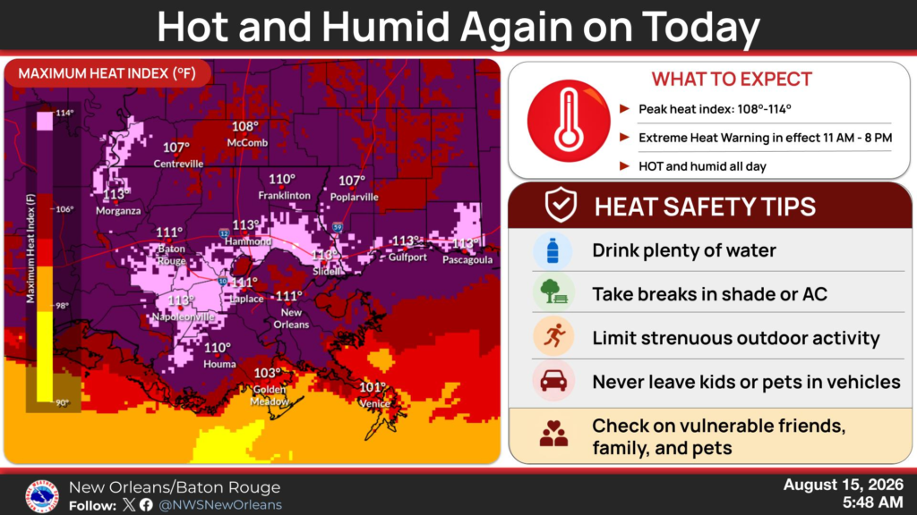
The National Weather Service has a good portion of the region under an extreme heat risk for today, others in major to moderate. With this in mind, drink plenty of water, try not to spend extended periods outside, and stay cool as best as you can. If you are able, go for a swim to combat this heat! If you go to the beach, be careful of rip currents.
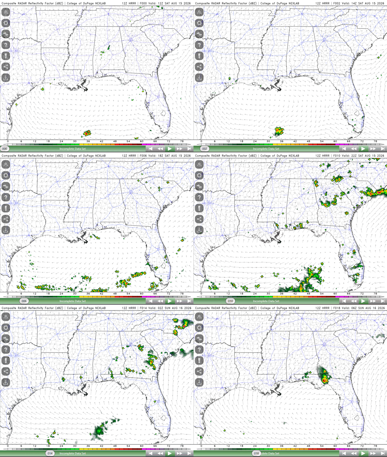
In terms of rain, there is a low chance of showers and thunderstorms, mainly some isolated cells closer to the coast. Most of us will not be seeing rain today, but plenty of sunshine.
TOMORROW
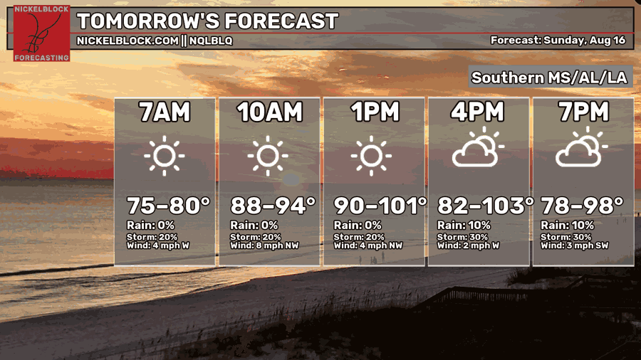
Highs tomorrow will reach up to 103 degrees for some people, another very hot day! Lows fall in the mid 70s to low 80s. Dewpoints remain higher, chances of rain limited but not zero. Some isolated to scattered showers and thunderstorms are possible tomorrow, especially during the heat of the day (in the afternoon).
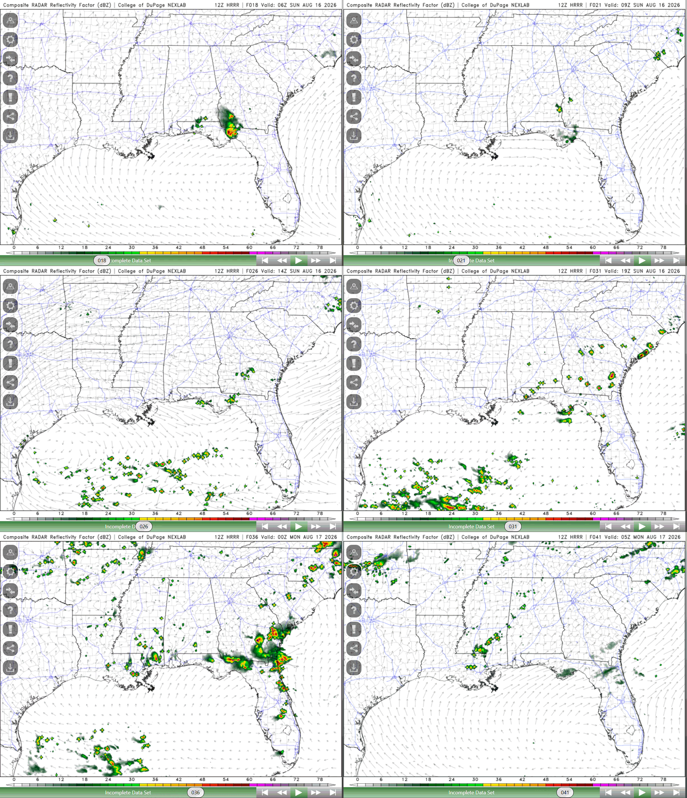
Below is the HRRR RADAR reflectivity for tomorrow. No risk for excessive rainfall or anything hazardous, though some stronger storms could produce locally strong wind gusts, heavy rain, and lightning.
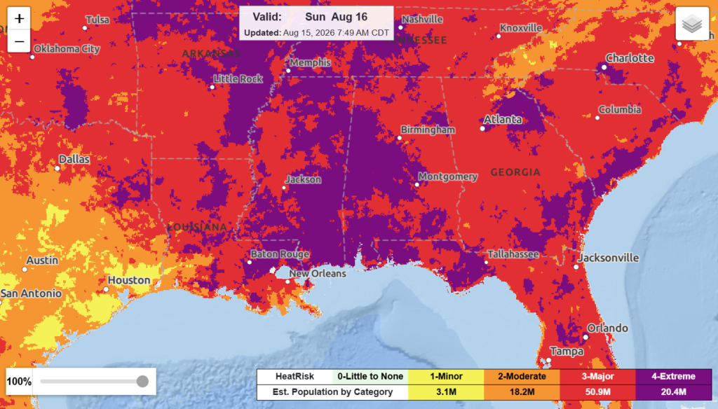
Even greater heat risk for Sunday, more of the region is predicted to have extreme heat risk, others falling under the major. It is vital now more than ever that you take this seriously and take all the proper precautions! This includes staying hydrated, not spending a lot of time outdoors, and paying attention to how you are feeling. There is not much room for relief under an extreme heat risk, not even overnight.

MONDAY (DAY AFTER TOMORROW)
Any change in the weather for Monday? Nope! Highs are still possible to reach up to 102 with little relief in the lows, falling in the mid 70s to low 80s. Muggy conditions will still persist. A slightly higher chance to see some thunderstorms in the afternoon, isolated to scattered showers and thunderstorms are possible.
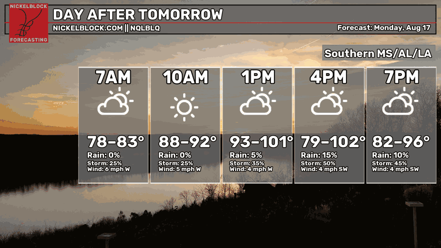
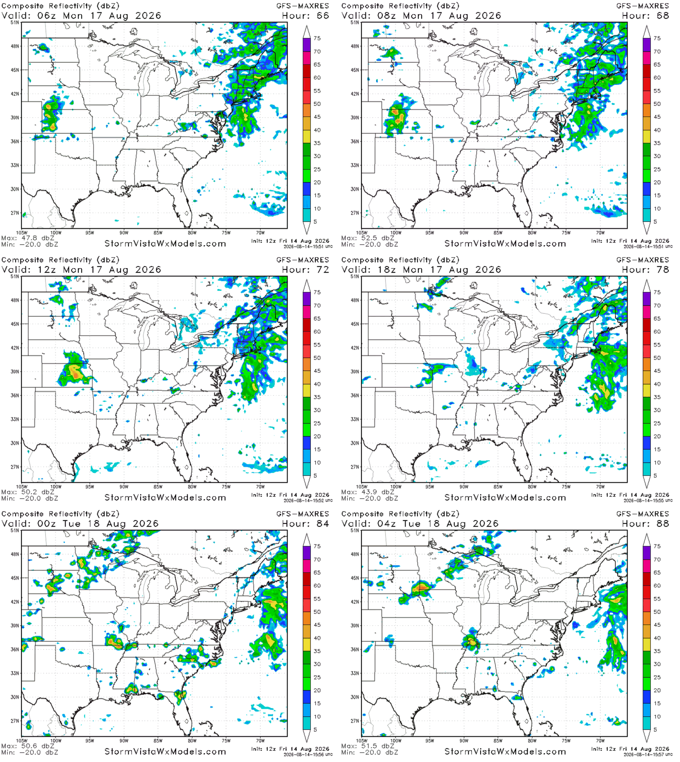
The greatest chance to see some stronger storms will be areas closer to the coast, but no severe weather is expected. Again, stronger storms could produce strong wind gusts and heavier rain with lightning, so keep this in mind.
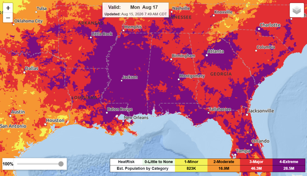
Heat risk will still be extreme for a majority of the region. Others falling under major to moderate. The main hazard for the next few days is the heat, summer is in full swing and is not allowing much relief for anyone currently.

EXTENDED FORECAST
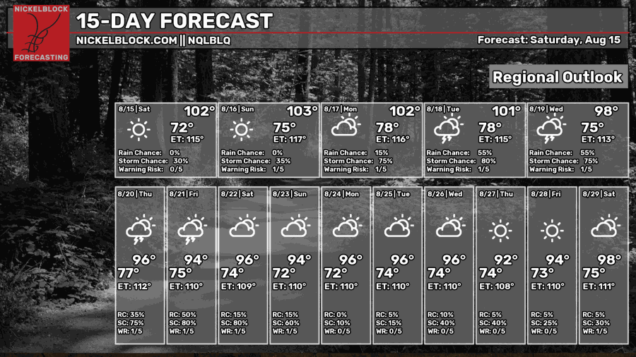
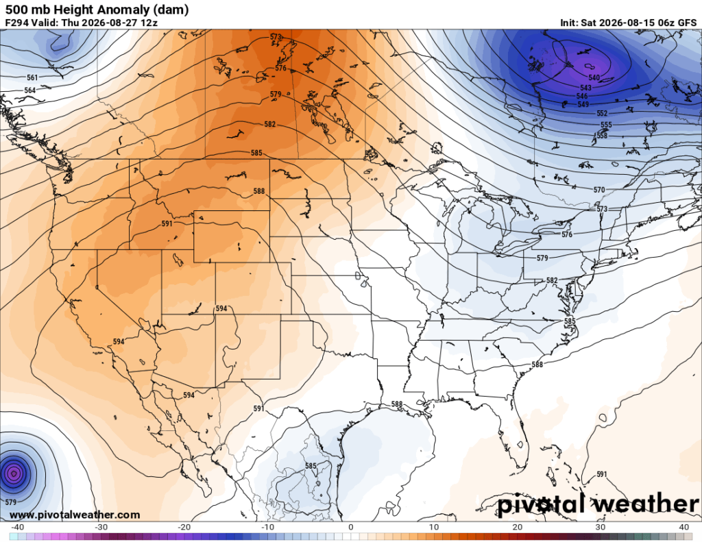
Looking ahead, hot conditions persist with the ridge and high pressure over us currently, the chance of rain possibly increasing going into next week, but will likely remain limited still. Models point to a northward shortwave that might try to knock out the ridge and cool temperatures slightly going into next weekend and the week after. This will continue to be monitored.
From August 22-28, the WPC predicts our region to have above average temperatures with below average precipitation. This could increase the risk for drought in some portions of the area, and the hot temperatures will do nothing for any relief.
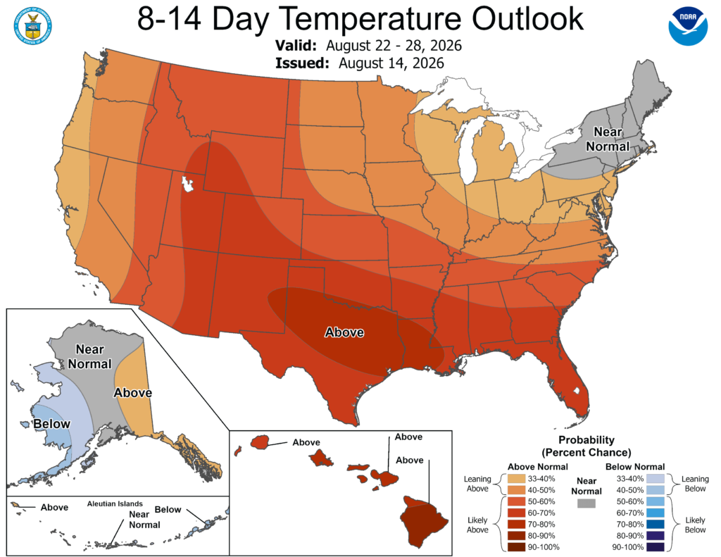
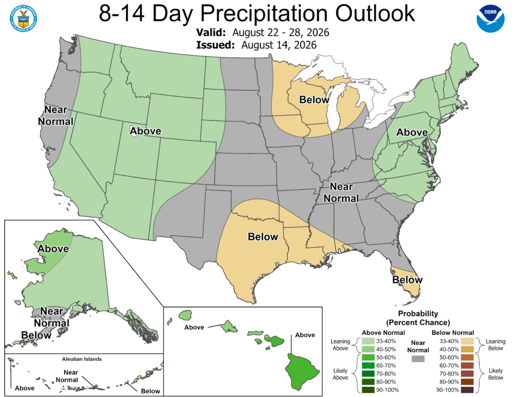
It is looking to remain hot for the next couple of weeks (no surprise there). As always, have a great rest of your day!


