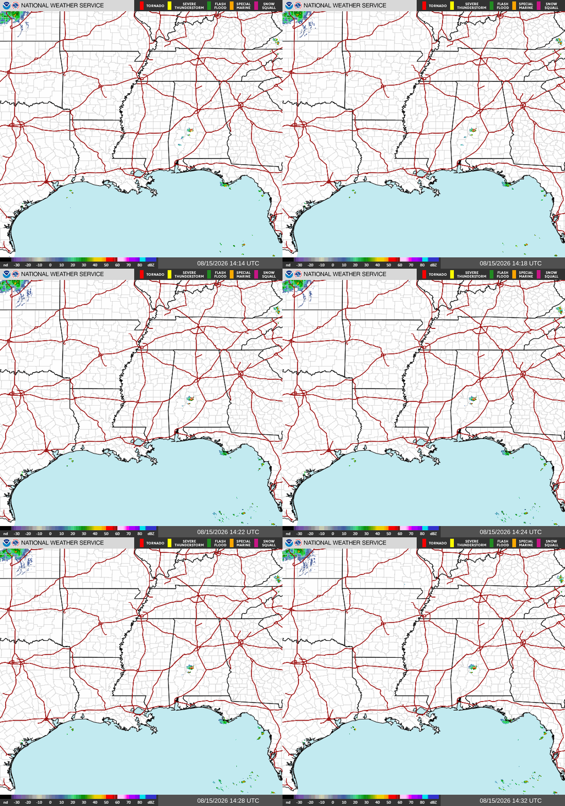
All I can say for today is it’s going to be HOT. You could definitely feel it this morning when you stepped outside and ran straight into a wall of humidity. Storm chances should remain relatively low, so don’t expect much relief from the heat today.
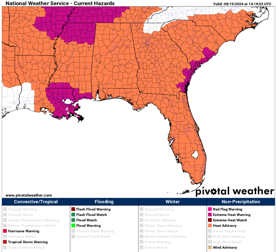
Numerous heat-related warnings are in effect across our area today. Our 3-day travel forecast below highlights city-specific alerts, while the graphic from Pivotal Weather shows Extreme Heat Warnings in effect across eastern and coastal Louisiana and southern Mississippi. The remainder of the Southeast is under a Heat Advisory, so be sure to take the heat seriously if you’ll be spending time outdoors.
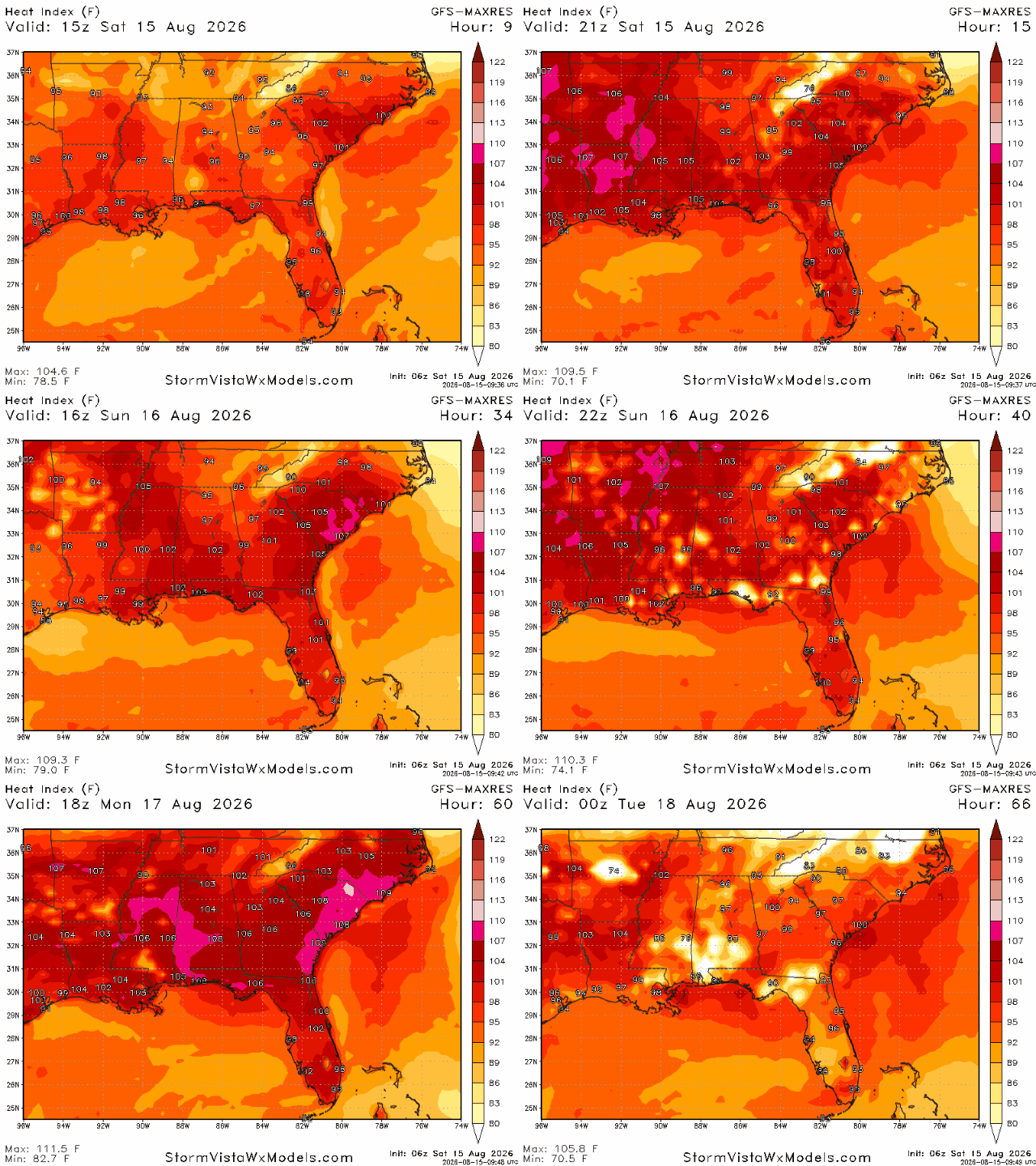
Below are the maximum heat indices expected over the next three days. Most of these triple-digit values will occur between 11 AM and 4 PM CT. If you’re susceptible to the heat or simply trying to stay cool, I’d recommend staying indoors during those hours whenever possible. Be sure to understand the impacts of extreme heat and watch for signs of heat-related illness, as this week is going to be a scorcher.
3 Day Travel Forecast
AIRPORTS
KIAH / KHOU (Houston) – Low delay risk due to weather.
KSHV (Shreveport) – Low risk for delays.
KBTR (Baton Rouge) – Mostly clear and sunny, so low risk for weather-related delays.
KMSY (New Orleans) – Low delay risk due to weather.
KJAN (Jackson) – Low delay risk from weather.
KBMH (Birmingham) – Low chance of delays.
KMOB (Mobile) – Possible afternoon delays due to afternoon showers.
KATL (Atlanta) – Potential delays due to afternoon thunderstorms.
KTLH (Tallahassee) – Possible delays from afternoon thunderstorms.
Highways
I-10: Afternoon thunderstorms are possible as you travel East or near the coast.
I-20: Mostly clear and hot; afternoon thunderstorm risk increases as you travel East.
I-49: Mostly warm and clear.
I-55 & I-59: Very hot, potential for showers further South.
I-65: Warm with potential showers/T-storms in the southern corridors.
I-75: Afternoon thunderstorms are to be expected and may turn severe at times.
3-Day City Forecast
Houston, TX: Saturday (15th): Sunny and mostly clear. High 97°F, low 77°F.
Sunday (16th): Sunny and clear. High 97°F, low 78°F.
Monday (17th): Warm and sunny. High 97°F, low 79°F.
Shreveport, LA: Saturday (15th): Very hot but clear. High 101°F, low 80°F.
Sunday (16th): Very Hot. High 102°F, low 80°F.
Monday (17th): Hot and sunny. High 102°F, low 80°F.
*Heat Advisory until 8 pm CDT Monday*
Baton Rouge, LA: Saturday (15th): Hot and sunny. High 100°F, low 78°F.
Sunday (16th): Sunny with a possible shower. High 99°F, low 78°F.
Monday (17th): Warm with a 20% chance of showers. High 98°F, low 78°F.
*Extreme Heat Warning until 8 pm CDT Saturday*
*Extreme Heat Watch Sunday 11 am until 8 pm CDT*
New Orleans, LA: Saturday (15th): Hot and mostly clear. High 95°F, low 80°F.
Sunday (16th): Sunny with a slight chance of afternoon showers. High 95°F, low 80°F.
Monday (17th): Warm and sunny, potential showers. High 95°F, low 780°F.
*Extreme Heat Warning until 8 pm CDT Saturday*
*Extreme Heat Watch Sunday 11 am until 8 pm CDT*
Jackson, MS: Saturday (15th): Sunny and clear. High 102°F, low 77°F.
Sunday (16th): Hot and clear. High 102°F, low 78°F.
Monday (17th): Hot and sunny. High 102°F, low 77°F.
*Heat Advisory until 8 pm CDT Monday*
Birmingham, AL: Saturday (15th): Hot. High 97°F, low 76°F.
Sunday (16th): Hot but clear. High 98°F, low 78°F.
Monday (17th): Dangerously warm. High 99°F, low 76°F.
*Heat Advisory until 9 pm CDT Monday*
Mobile, AL: Saturday (15th): Sunny with the potential for a shower. High 98°F, low 79°F.
Sunday (16th): Sunny with a shower. High 97°F, low 79°F.
Monday (17th): Warm and sunny, possible showers in the afternoon. High 97°F, low 80°F.
*Heat Advisory until 8 pm CDT Saturday*
Atlanta, GA: Saturday (15th): Hot with an afternoon T-storm. High 95°F, low 76°F.
Sunday (16th): Hot with a 20% chance of afternoon T-storms. High 95°F, low 77°F.
Monday (17th): Hot and sunny. High 98°F, low 77°F.
*Heat Advisory until 8 pm EST Saturday*
Tallahassee, FL: Saturday (15th): Sunny with developing T-storms. High 97°F, low 77°F.
Sunday (16th): Afternoon thunderstorms. High 96°F, low 78°F.
Monday (17th): Hot with afternoon T-storms. High 97°F, low 77°F.
*Heat Advisory until 7 pm EST Monday*


