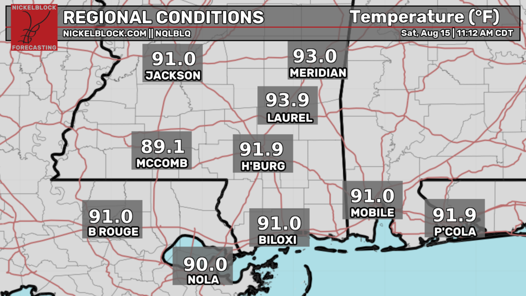
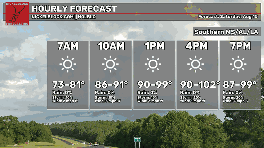
Happy weekend! As of noon CDT, temperatures are mostly in the lower 90s across our region. Temperatures will climb into the low 100s late this afternoon, which has prompted an excessive heating warning for some parts of our forecast region.
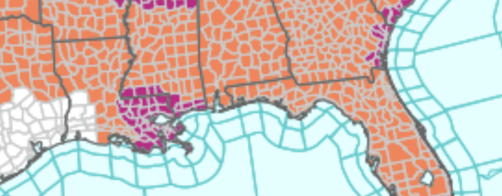
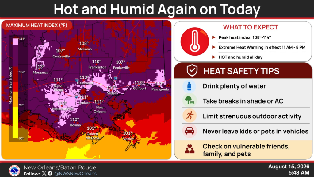
The NWS has issued an excessive heat warning for parts of southern Mississippi as well as southeastern Louisiana. Maximum heat indices could top 110ºF, so make sure to stay hydrated, wear sensible clothing, and avoid strenuous outdoor activities. A heat advisory is in effect for the rest of the area, so be sure to take similar heat precautions.
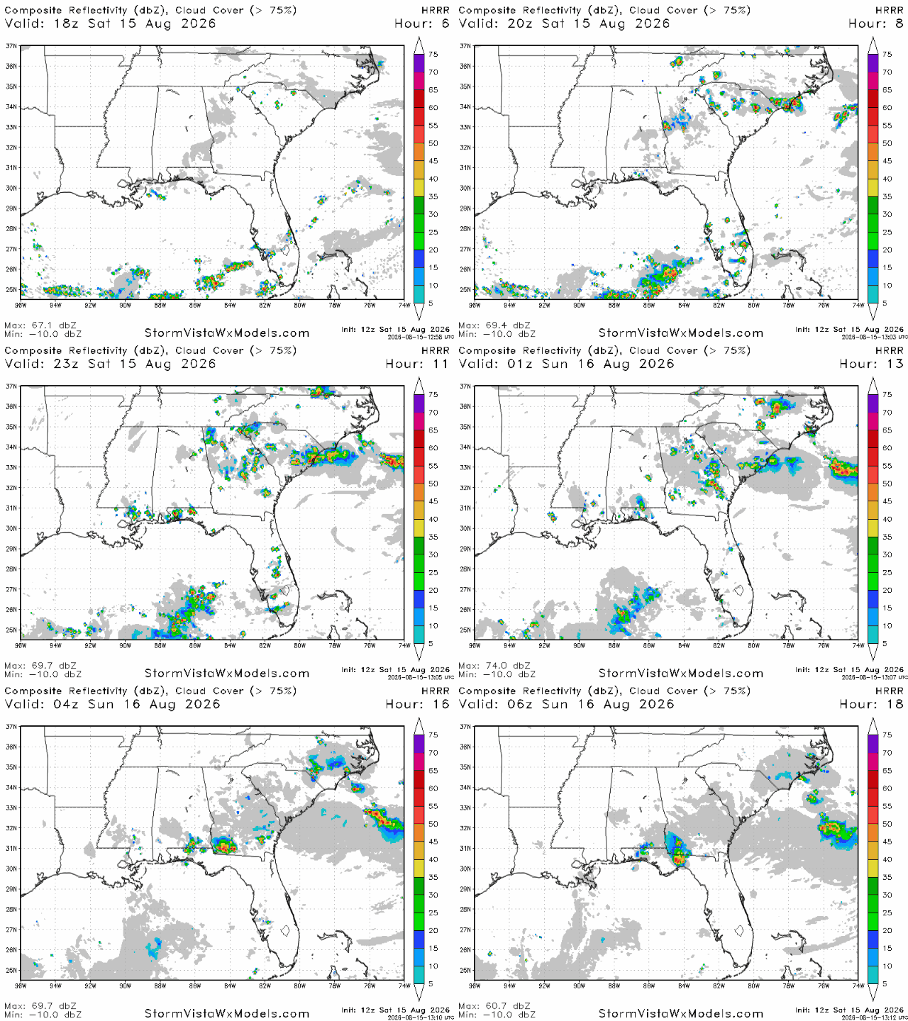
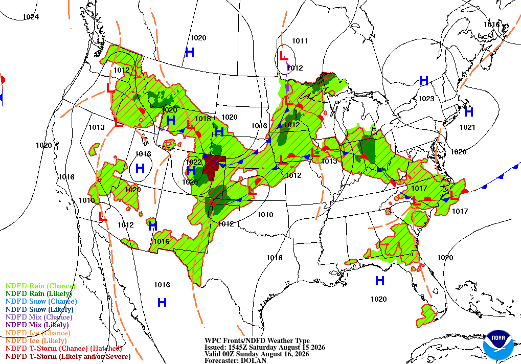
We’re still expecting some sea breeze storms tonight, mostly in areas very close to the coast. The western part of the Florida panhandle is still the “hotspot” for tonight, but some storms are still possible elsewhere, mostly in coastal areas and areas immediately north of the coast. Storms should be mostly wrapped up by 8 tonight, but some lingering storms could last until after midnight. Not much in the forecast has changed from yesterday.
Tomorrow
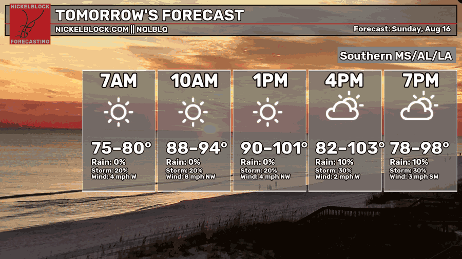
Another very hot day is on tap for us tomorrow with afternoon highs a few degrees above 100ºF possible. Morning lows won’t be refreshing tomorrow morning, dropping only into the upper 70s and lower 80s in most spots. Skies will be sunny in the morning and into the early afternoon, but cloud cover will increase as the day goes on.
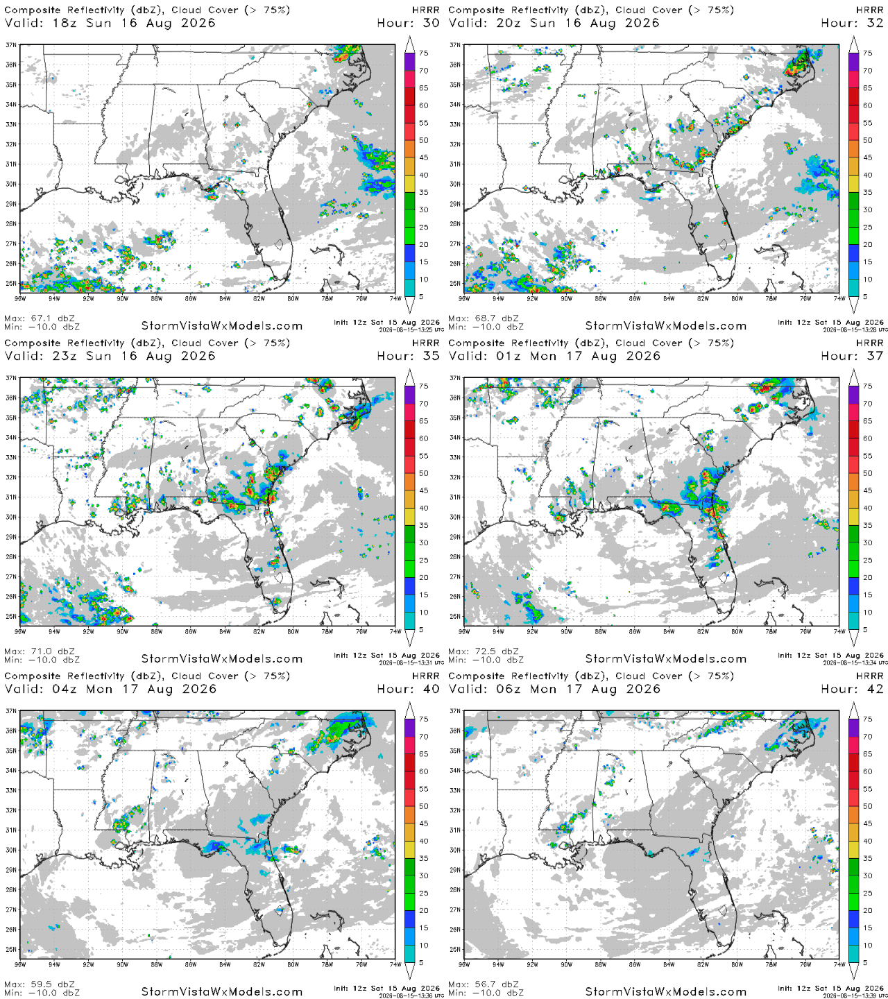
Storms look more potent tomorrow than they do today, with scattered storms between the Tallahassee area and the New Orleans area. Most of these storms will be sea breeze storms, so most of them can be expected near the coast and in areas immediately to the north. Most storms should be gone by 10 tomorrow night, but a few may linger until midnight or after.
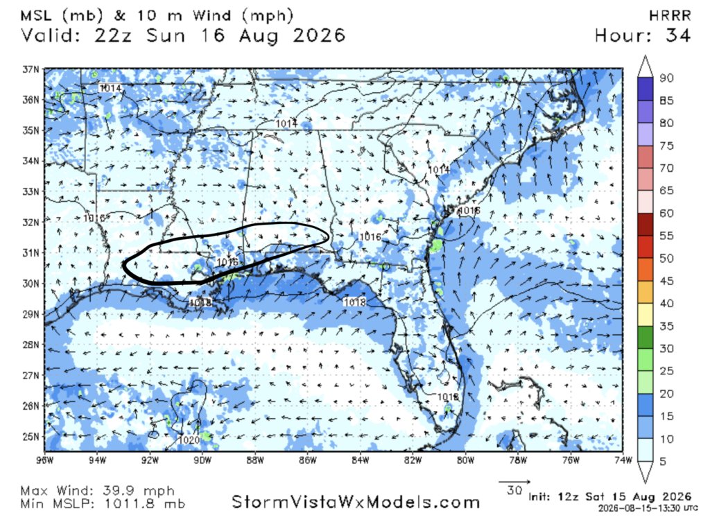
One big reason why storms look a bit more potent tomorrow is due to the fact that the sea breeze will be pretty strong tomorrow, and will clash with air moving perpendicular and even opposite to it. The air further north away from the coast is westerly and northwesterly, and is being circulated by the ridge we’re under, meaning it is dry and hot. The southerly wind is the sea breeze, and is transporting humid and warm air from the gulf to the north.
When they clash, the dry air will sink, pushing the humid air up, which causes thunderstorm development. This dynamic is very noticeable tomorrow.


