Mother Nature is throwing August at us in full force. A long duration ridging pattern remains entrenched over our region locking us into an endless cycle of extreme heat and humidity with little relief from afternoon pulse storms.
Surely this ridge will break down but the question is when. Heat like this is significantly more dangerous when it persists for weeks on end and the lack of frontal intrusions spells little for the foreseeable future.
What we will see will be steamy nights (with fog possible around sunrise) and very hot and muggy days, broken only if you’re one the few locations to be lucky enough to get poured on.

Tonight
It won’t rain but it’ll feel damper than the inside of a locker room.
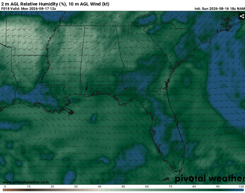
This will be most felt in Mississippi delta and central Louisiana. It’s not anything uncommon but it’s still worth noting. This could lead to some fog in those locations given the surface high pressure and lack of winds.
Clouds should gradually clear out throughout the night. Lows will be in the mid to upper 70s providing little relief from the heat.
Tomorrow
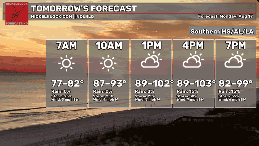
Warm will be an understatement. It will be downright unpleasant outside. The National Weather Service has issued an extreme heat warning through tomorrow evening.
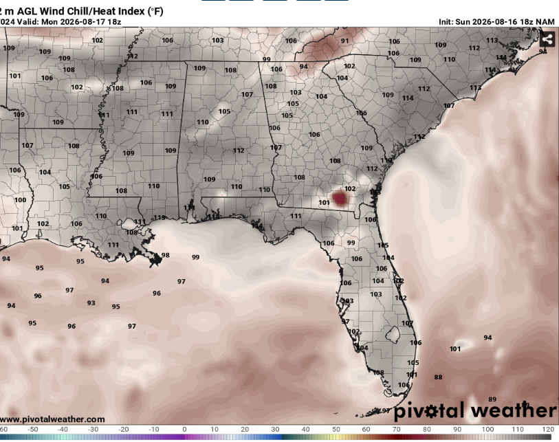
Heat indexes may exceed 110 in some places given mid 70s dew points and temperatures around 100. This will be very hazardous to everyone but especially the elderly and those with preexisting conditions. It will also cause cars to heat up extremely quickly so make sure to check those car seats. A good day to stay inside or go to the pool.
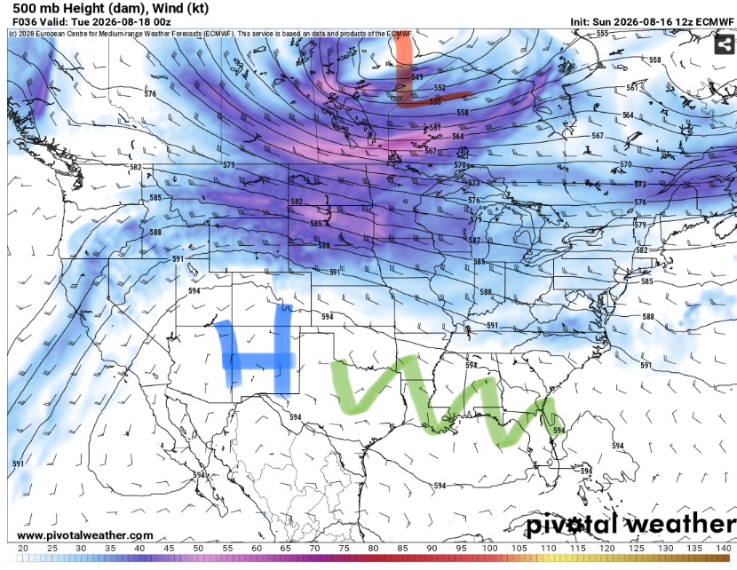
This heat is being driven by a ridge of high pressure over our region. This will force hot down onto us. Additionally, it will be very unfavorable for widespread convection as the lack of lift and vertical shear will keep storms disorganized and isolated.
While most locations will remain dry, it is likely that at least somewhere will get a storm. Any storms would be capable of very heavy rain and frequent lightning along with maybe some strong downbursts as they collapse.

The Day After Tomorrow
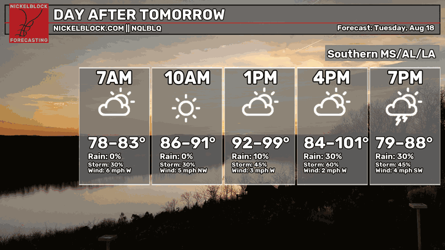
Similar to Monday. Very hot and humid but with a slightly higher chance of storms. The wide temperature range on the graph above is due to the uncertainty in convection causing a significant cool down. Heat indexes may again near 110.
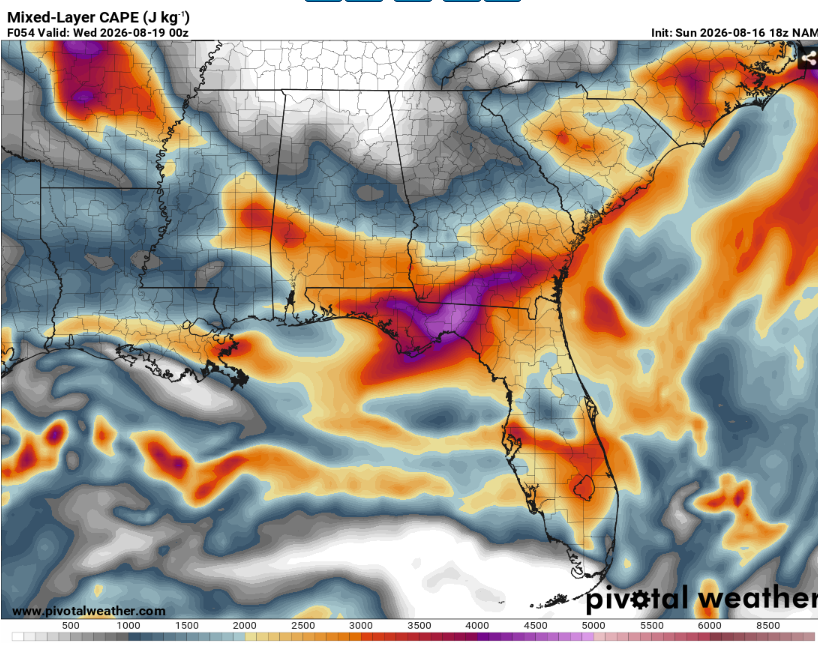
100 degree temperatures and 70s dewpoints is a lot of fuel for storms. It should therefore come as no surprise that instability will be seasonably strong (3000ish MLCAPE).
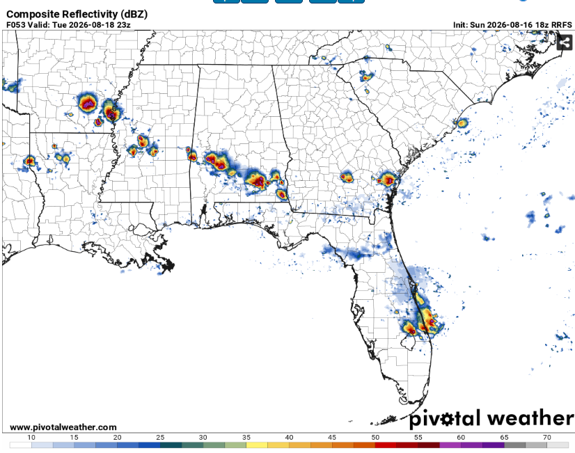
Convective allowing models generally struggle in weak shear/forcing environments but there appears to be a signal for some widely scattered storms across the region with coverage peaking across central Mississippi. These storms will be fairly benign but could still give you a soaking and some thunder.
For areas that don’t get storms it’ll be muggy enough to want to stay inside for most of the day. Clouds will gradually build throughout the morning and into the afternoon before fading with the loss of daytime heating.

The Extended Outlook
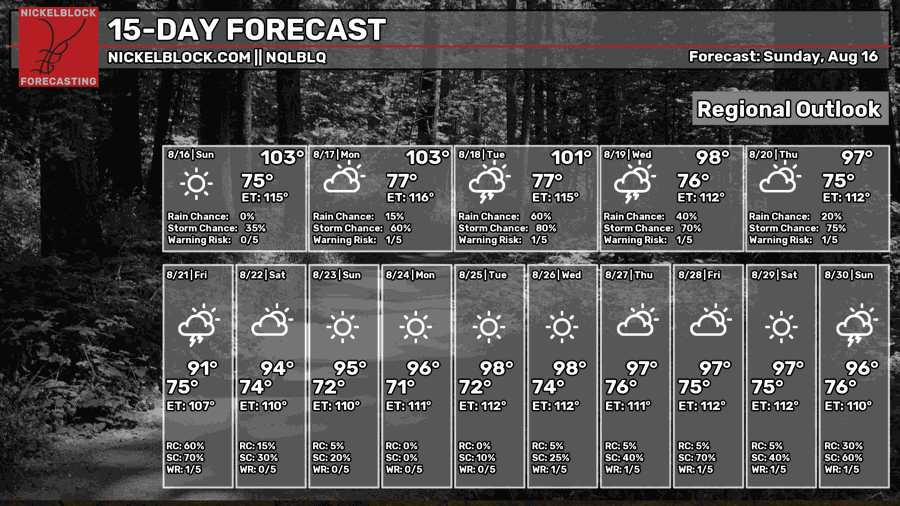
Yeah, the heat is gonna be here for a while. Ridging patterns like this are known to be stagnant and this one is no exception. Expect daily highs in at least the mid to upper 90s for the next ten days at least.
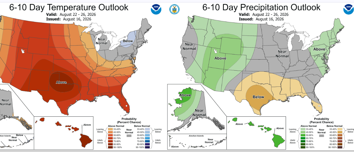
The Climate Prediction Center agrees with a warmer than normal forecast and also favors a drier one too. This would make sense given the lack of forcing for widespread rain. They have also outlined the entire Gulf region at a slight risk of excessive heat from August 24-28.
Day-By-Day Forecast
Tonight- Decreasing clouds with a low in the upper 70s. No rain but patchy fog possible around sunrise.
Tomorrow- Mostly sunny with a high around 100. Isolated afternoon thunderstorms possible.
Tomorrow Night- Partly cloudy with a low in the upper 70s. No rain.
Tuesday- Increasing clouds with a high in the upper 90s. Isolated afternoon thunderstorms possible.
Tuesday Night- Partly cloudy with a low in the upper 70s with no precip expected.
Wednesday-Widely scattered afternoon thunderstorms possible. Mostly sunny with a high in the upper 90s.
Wednesday Night- Isolated thunderstorms possible early. Partly cloudy with a low in the mid 70s.
Thursday- Mostly sunny with a high in the upper 90s. Isolated afternoon storms possible.
Thursday Night- Isolated storms possible early. Decreasing clouds with a low in the mid 70s.
Friday- Scattered afternoon thunderstorms possible. Increasing clouds with a high in the mid 90s.
Friday Night- Scattered thunderstorms possible. Partly cloudy with a low in the mid 70s.
Saturday- Partly sunny with a high in the mid 90s. Scattered afternoon thunderstorms possible.
Saturday Night- Partly cloudy with a low in the mid 70s. Dry but humid.


