Earlier this week, the National Hurricane Center was tracking three separate tropical disturbances in the Atlantic, with one of them briefly carrying a high (around 70–80%) chance of becoming a tropical cyclone. As of today, the National Hurricane Center is not monitoring any tropical disturbances, and no tropical cyclone formation is expected across the Atlantic, Caribbean Sea, or Gulf over the next seven days.
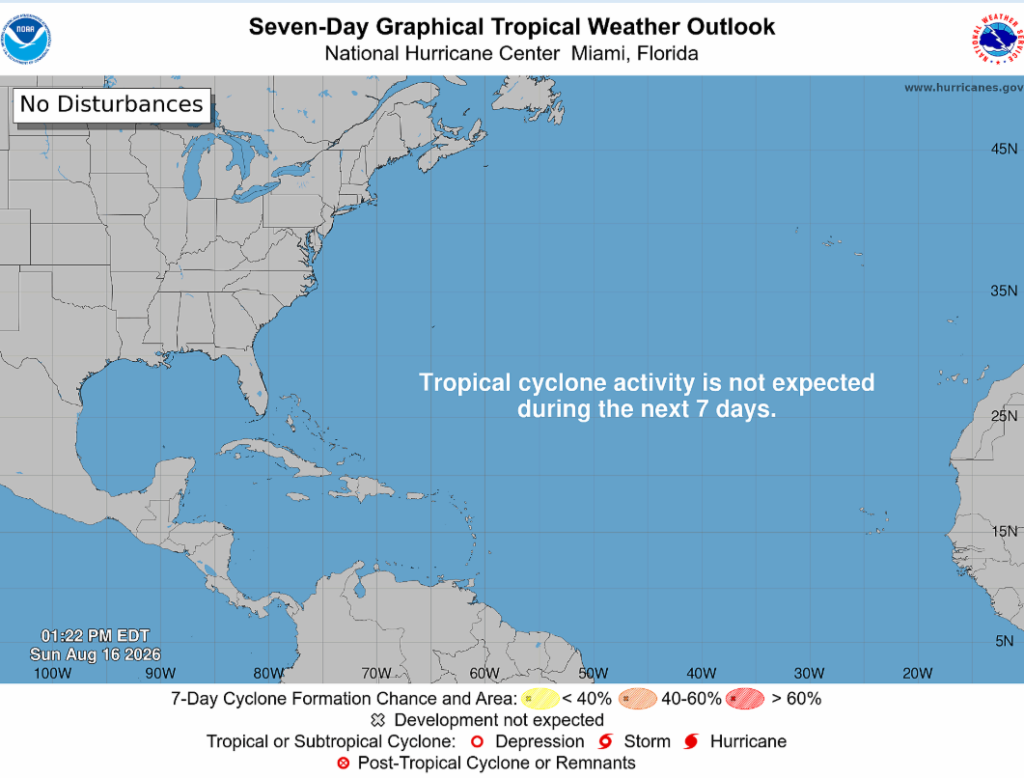
It’s crazy how earlier this week the NHC was monitoring 3 separate tropical disturbances, some with high potential for development, and now we have nothing! The reason for this is that El Niño is doing its job well, creating a less favorable environment that ultimately tears these storms apart. Strong vertical wind shear and dry, stable air associated with the El Niño season are inhibiting storm development over the Atlantic.
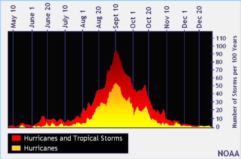
Strong winds high in the atmosphere are ripping the thunderstorms away from the center of these tropical waves, making it nearly impossible for them to develop into named storms. There has also been plenty of dry air across parts of the Atlantic, which can be drawn into these developing systems and weaken the thunderstorms they need to survive and intensify. We can thank these factors for keeping our Atlantic clean as we move closer to the climatological peak of hurricane season, which is late August through September.
While the Atlantic has been struggling to get anything going, the Central Pacific has been dealing with quite the opposite. Hurricane Lala brushed the Big Island of Hawaii this weekend, bringing hurricane-force wind gusts, torrential rainfall, and widespread flooding. The center stayed just offshore, so Lala did not officially make landfall, but its eyewall came close enough to produce some pretty serious impacts across the island.
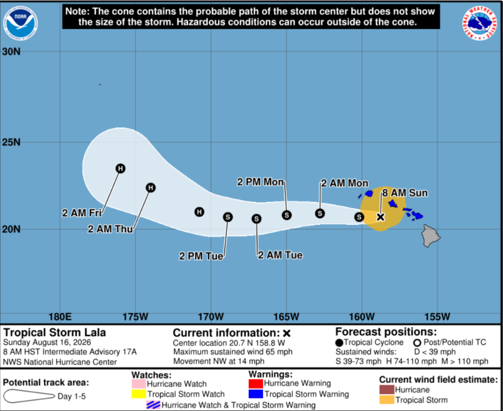
If Lala had made landfall on the Big Island, it would have been the first hurricane to ever make landfall there in the modern historical record. Instead, Lala’s eye passed just south of the island, sparing the Big Island from that historic first, but unfortunately not from some pretty significant impacts.
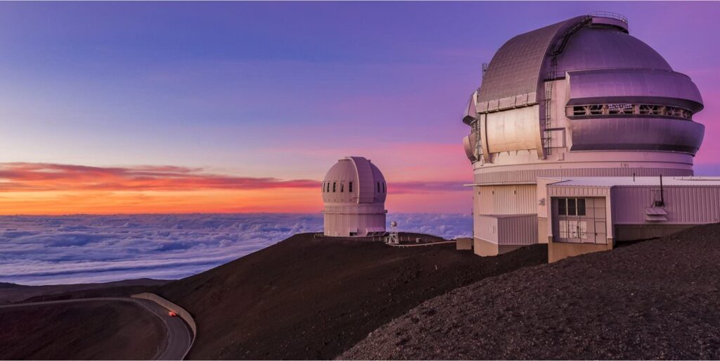
And here’s where things get really interesting: Lala also helped bring snow to the summit of Hawaii’s tallest mountains. At around 13,850 feet, snow was falling on Mauna Kea while thousands of feet below, the island was dealing with flash flood warnings and rainfall totals approaching three feet. Lala has created and continues to create dangerous conditions across the Hawaiian Islands, including mudslides, localized and coastal flooding, and apparently, snow in August. The snow itself isn’t unusual at that elevation, but seeing it happen while a hurricane is impacting the island is pretty dang cool!
And just like that, this is my final forecast of the internship! It’s definitely bittersweet, but I’ve had a ton of fun putting these forecasts together and have learned so much along the way. Thanks for sticking along!


