Tropical Storm Edouard
Hey everyone, and happy first day of Meteorological Fall! As of the 7 AM update from the NHC, Tropical Storm Edouard is moving through the northern Gulf this morning with winds around 40 mph, moving WNW at 8 mph. Some additional strengthening is expected before the storm reaches the southwestern Louisiana coast near the Texas border later today.
Winds could reach 65 mph at landfall, which is just below hurricane strength. Heavy rain, strong wind gusts, and some coastal flooding will be possible across southwestern Louisiana and eastern Texas. Edouard should weaken quickly once it moves inland tonight.
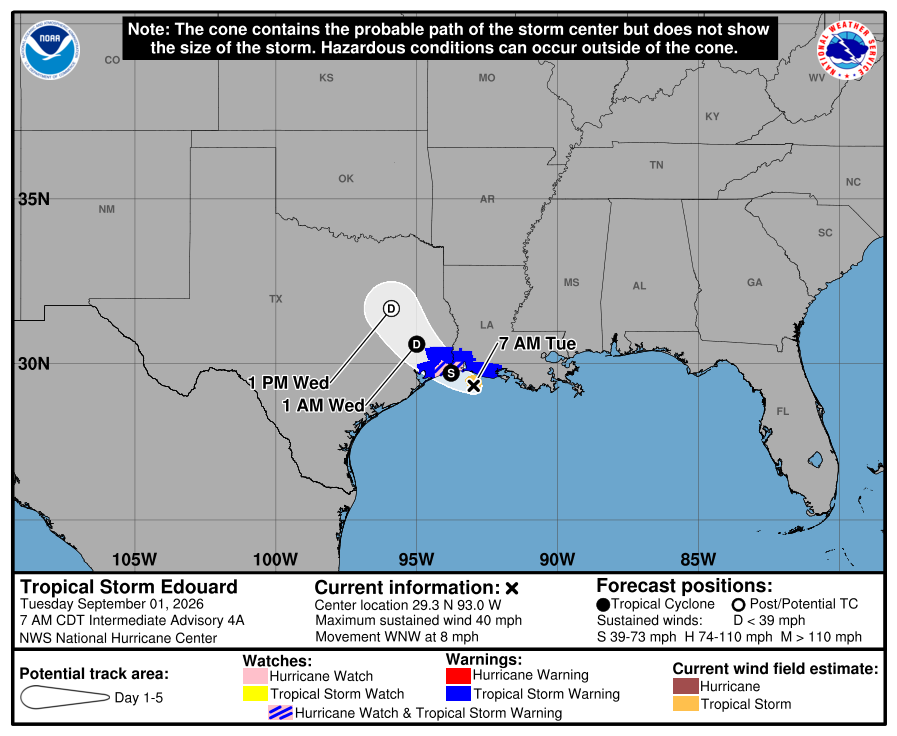
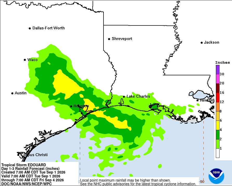
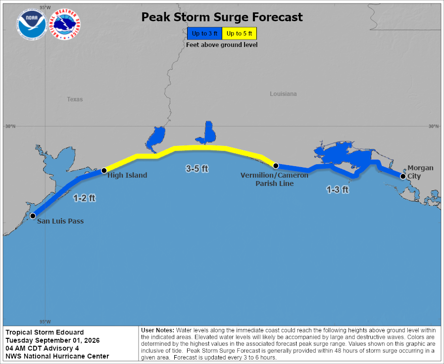
While Edouard is not expected to bring any major impacts to the NickelBlock forecast region, we know some of you may live in or have friends and family closer to southwestern Louisiana and southeastern Texas. Several inches of rain, strong winds and coastal flooding are expected near the storm’s path, with a storm surge of 3 to 5 feet possible along parts of the coast. If you have connections to these areas, make sure they are staying weather-aware today.

Today’s Forecast
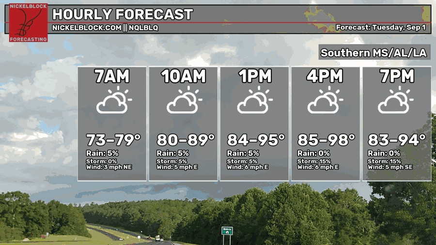
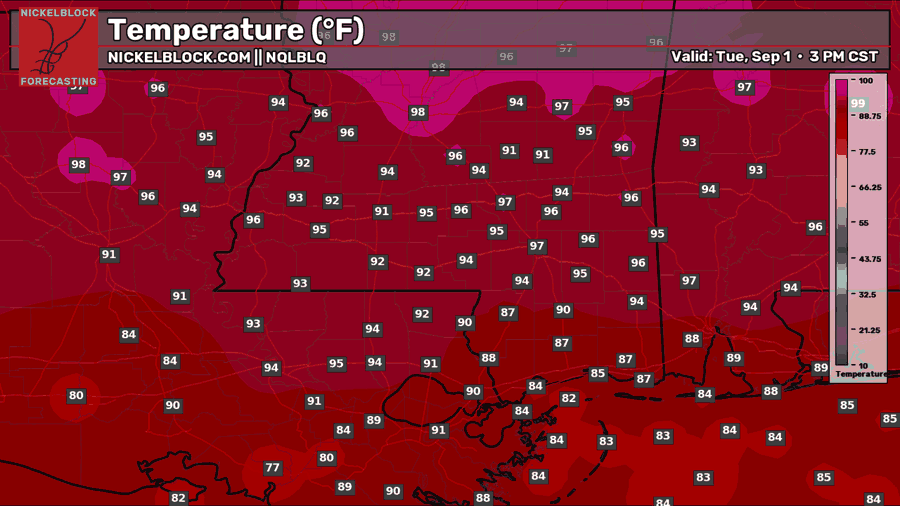
Although there is a tropical storm awfully close, most of our forecast region is actually in for a hot and mostly dry Tuesday. Expect a mix of sun and clouds with afternoon highs climbing well into the 90s, especially as you go north. A few showers or storms may pop up with the onshore flow, but chances are that you will not see much rain today if you’re in southern Mississippi or Alabama.
The exception will be southwestern Louisiana, where bands from Tropical Storm Edouard will move onshore throughout the day. As we know, tropical systems bring extra spin with them, so any stronger band moving inland could produce a quick spin-up tornado. That risk will be greatest this evening as Edouard strengthens before making landfall near the Louisiana-Texas border.
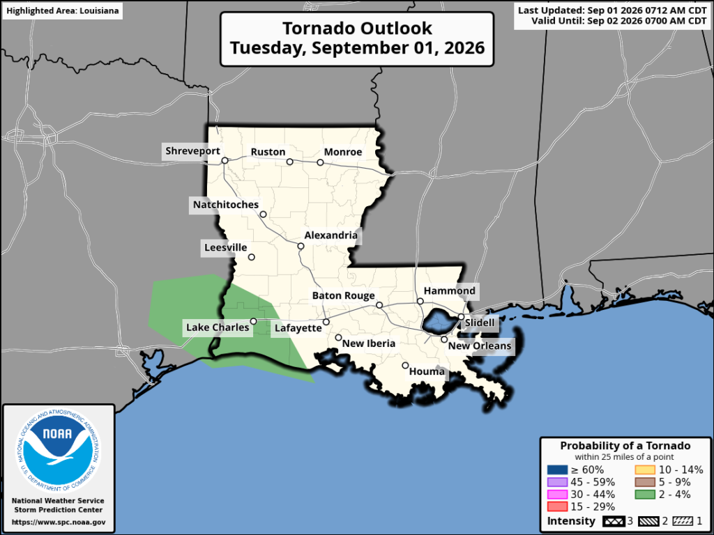
The tornado threat remains low and localized, but storms within these bands can rotate quickly and may not provide much warning. Anyone near Lake Charles and surrounding areas should stay weather-aware through the evening.

Tomorrow’s Forecast: Wednesday, September 2nd
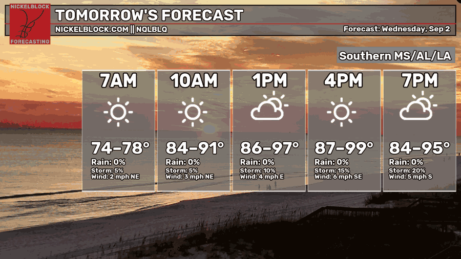
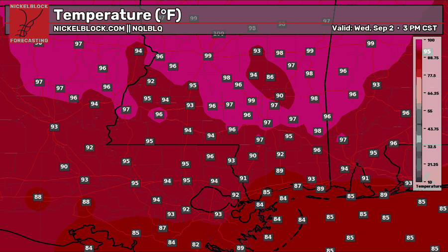
Wednesday starts mostly sunny and heats up quickly, with afternoon highs reaching the mid to upper 90s. A few communities across northern Mississippi and Alabama could get close to 100 degrees.
What remains of Edouard will continue moving farther inland and away from the NickelBlock region. Some lingering tropical moisture could still bring scattered showers and storms to parts of Louisiana, especially during the afternoon. A few isolated storms may also pop up across southern Mississippi and Alabama later in the day, but most locations will stay hot and dry.
Thursday’s Forecast: September 3rd
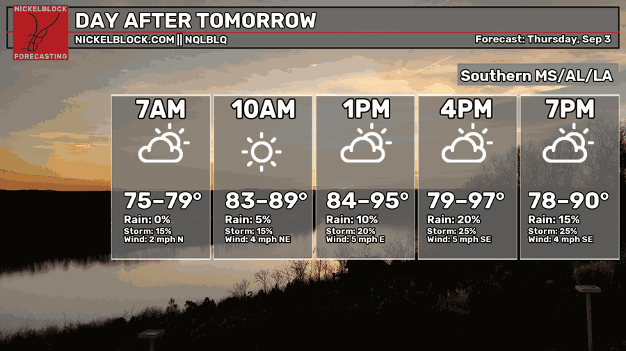
Thursday starts warm and humid with a mix of sun and clouds. Temperatures will climb into the 90s by the afternoon, with a few spots reaching the upper 90s.
Most of the morning looks dry aside from a few showers near the coast. As the day heats up, scattered showers and thunderstorms should develop, mainly across southeastern Louisiana and southern Mississippi. Rain will remain hit or miss, but any storm could bring a quick downpour and gusty winds before fading later in the evening.
Extended Local Outlook
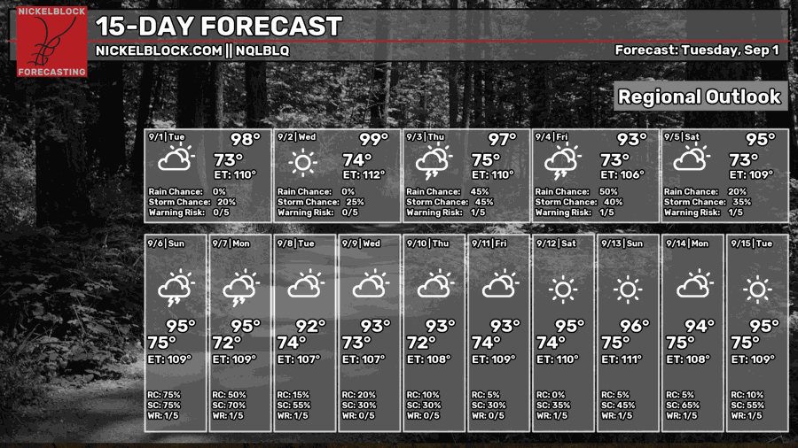
The heat is not going anywhere anytime soon. Highs remain in the 90s through the middle of September, with the humidity making it feel closer to 105 to 110 degrees on many afternoons.
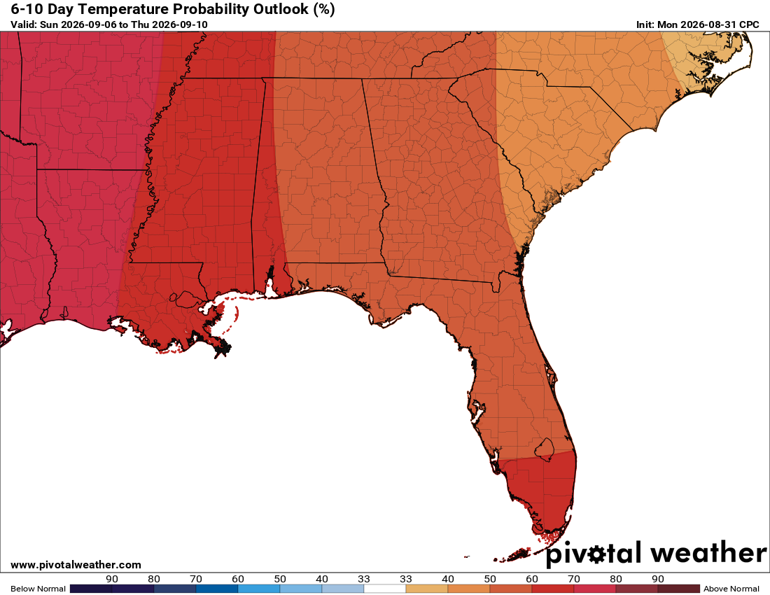
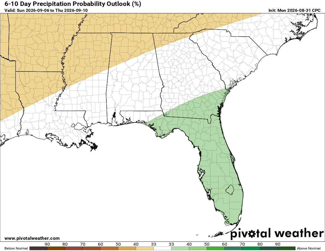
Rain chances increase Thursday and Friday, then become more widespread Sunday into Monday. After that, the forecast looks quieter again, with only a few afternoon storms possible each day. The latest 6-10-day outlook also favors hotter-than-normal temperatures across the entire region, while rainfall should remain near normal overall.


