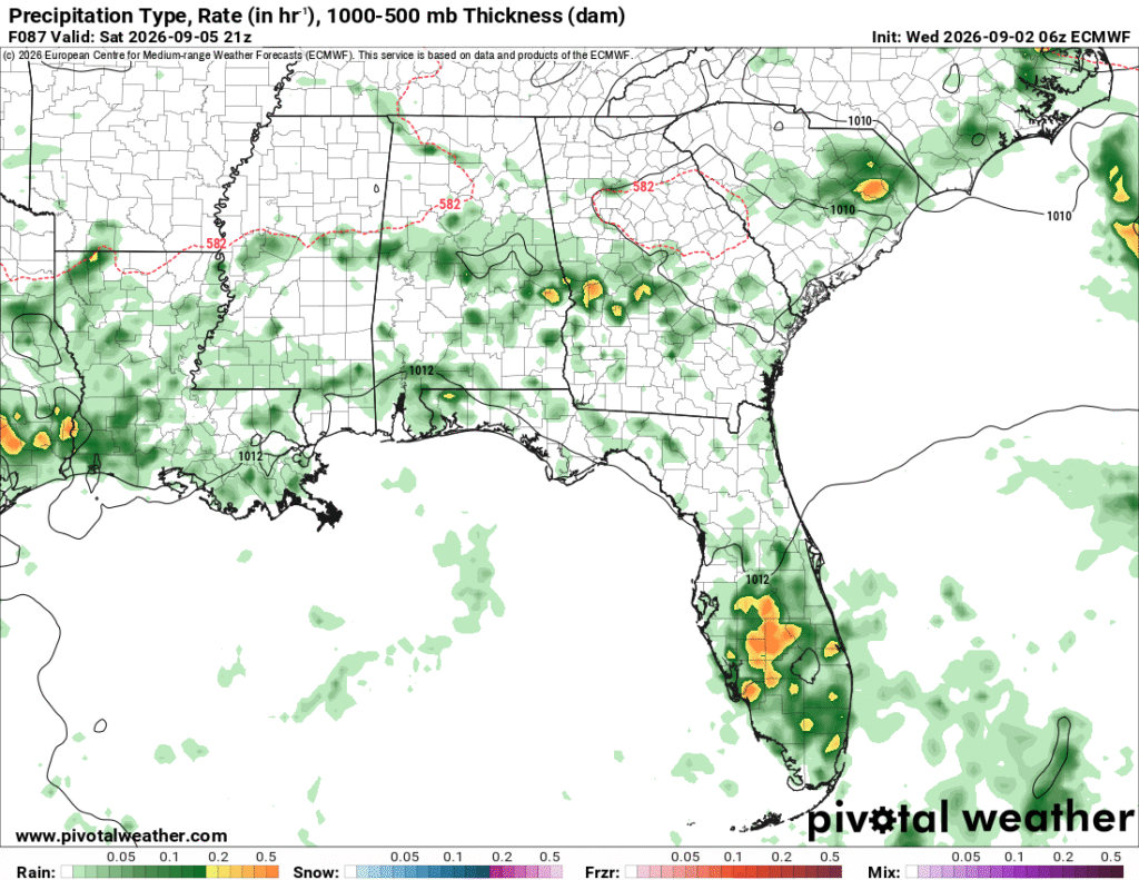
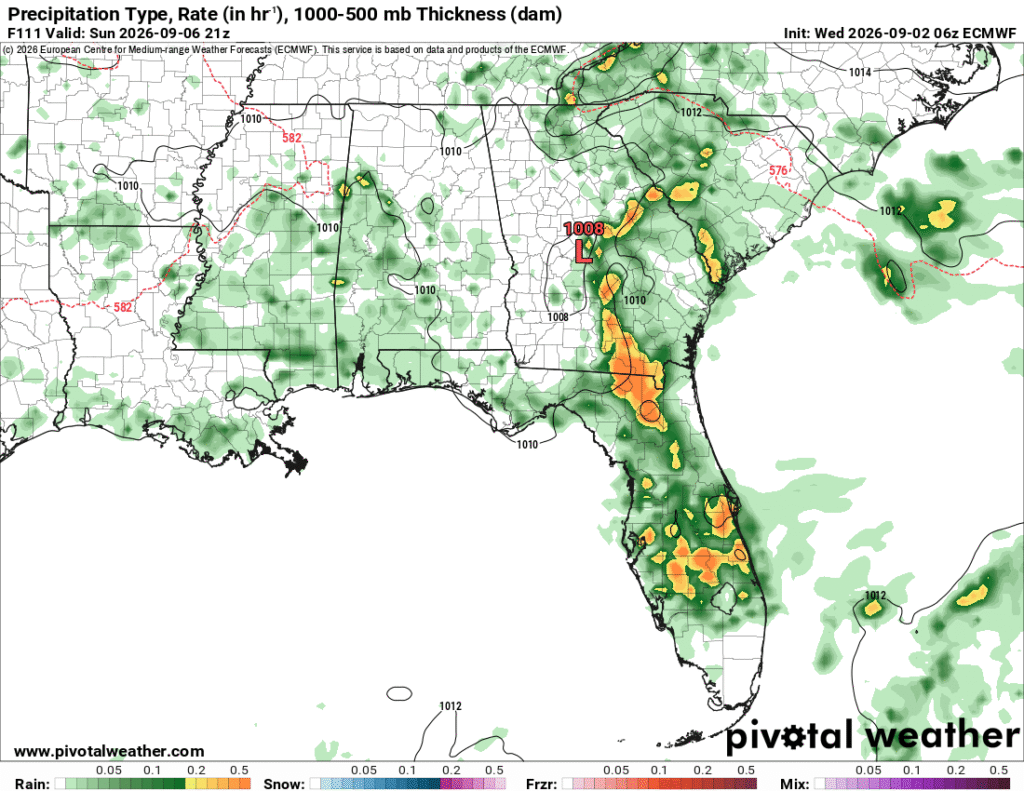
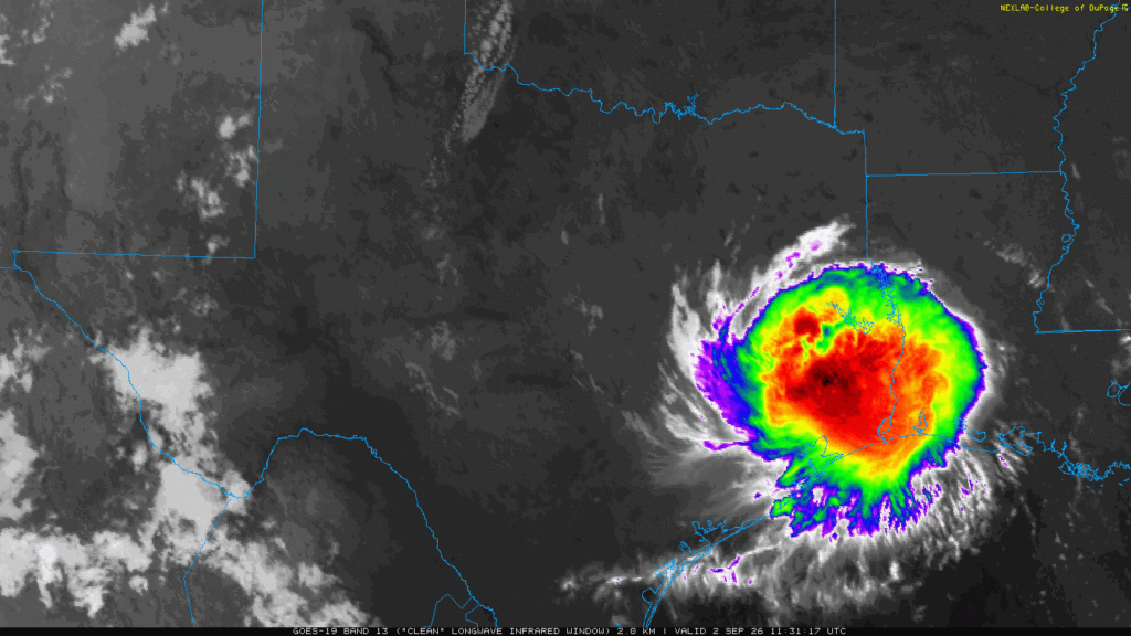
Edouard made landfall between Texas and Louisiana yesterday as a tropical storm. It intensified very fast over a 24 hour period with recorded 50+ mph wind gusts! Flash flooding has also been a big problem for many in east Texas. Those of us in the Gulf Coast region know how quickly a tropical system can explode in the warm waters of the Gulf and Edouard is testament to that. The storm has been downgraded but it has still retained its shape for now. While we only saw a little bit of that rain, most of the rain we’ll see towards this weekend will be a meandering Atlantic high and Gulf low. Let’s take a look!

Today
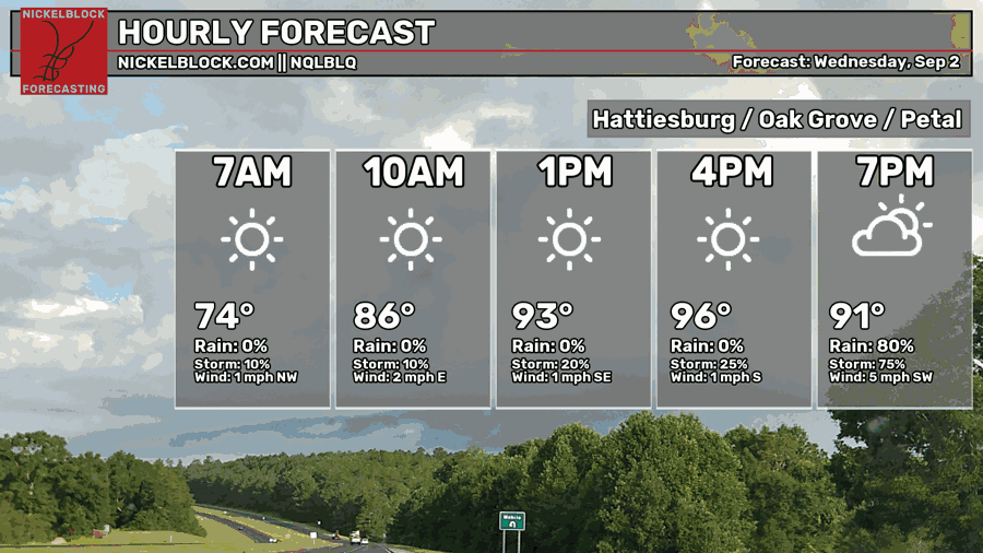
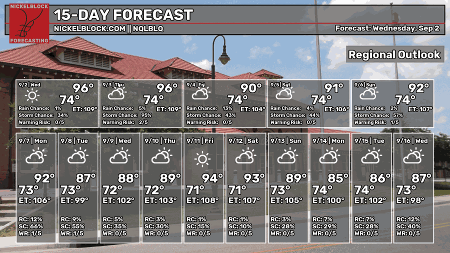
We’re in between a few systems that are cutting off most of the rain potential for us for today. Eduoard, the Atlantic high and a Gulf low are all spinning and colliding into each other. Florida may see a good chance of rain this afternoon, but the LA/MS coast and the Pine Belt will be more limited. Expect a few isolated thunderstorms by the late evening. Otherwise, it’s hot! The NWS has placed a heat advisory for the entire Jackson office county warning area (CWA) since the experienced temperature is going to feel like 105+. The rain will eventually dissipate before midnight and we’ll have a muggy night ahead with lows in the low to mid 70s.

Tomorrow
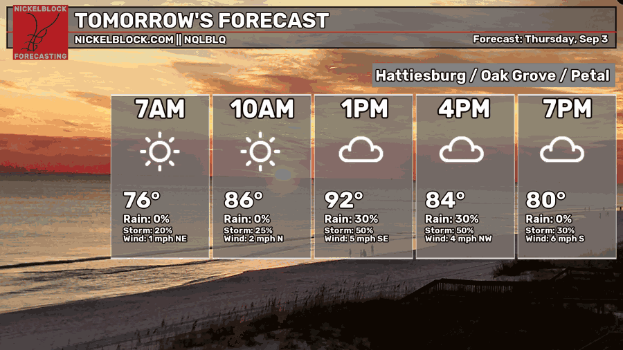
A broad area of low pressure is moving in the Gulf, leading to a chance of rain during the afternoon and evening hours. We’ll have a quick warmup leading to the afternoon which means it’ll be pretty hot and humid until the clouds roll in. In the likelihood of rain and thunderstorms during the afternoon, the temperature will stall out and eventually fall towards the 80s. The high will reach the low 90s and the low will reach the mid 70s. More rain is possible overnight into Friday morning.
Friday
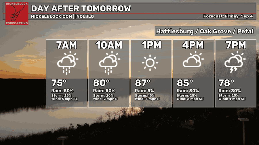
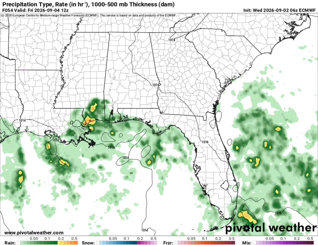
That broad low is still out in the Gulf churning up more rain to throw at the Gulf coast. Model guidance is suggesting we’ll see rain in the early morning hours which will in effect lower the temperature since it reduces the amount of daytime heating we’d normally see by the morning hours. Highs will top out around 90 with intermittent clouds. More storms are possible during the afternoon hours into the evening, so if you’re going to the football game or going out, I’d bring a poncho or jacket with you. Afterwards, temperatures will fall into the low to mid 70s.
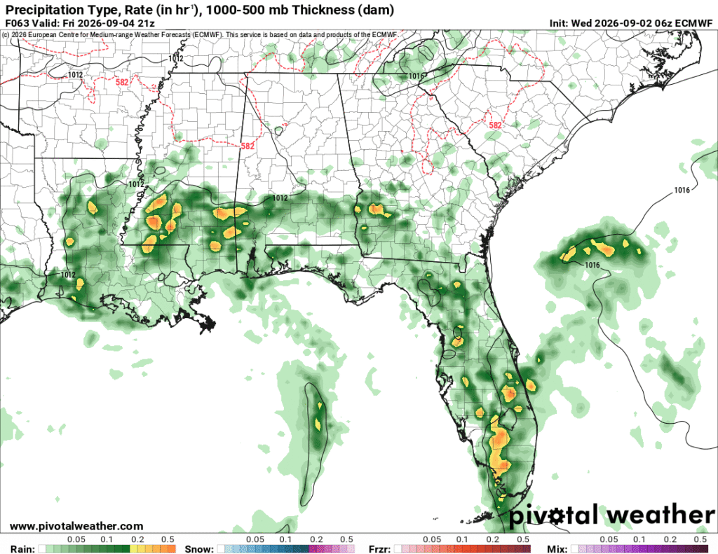
Humid Weekend Ahead
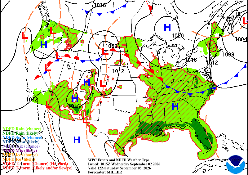
A long stationary front is slowly dipping southward during the weekend. The low pressure system in the Gulf is weakening which will lower the rain chances for much of us between Louisiana and Alabama. A few stray afternoon thunderstorms are still possible, but not as potent as Friday. As the front moves further southeast, the rain chances will move towards Georgia, Florida, and the Carolinas.
The humidity will be the largest factor for the weekend. With all the moisture being thrown at us, the relative humidity will be pretty high as well as the dewpoint. Highs will reach the low 90s Saturday and Sunday with intermittent cloud cover mainly on Saturday. Lows will be in the mid 70s again.