The Setup
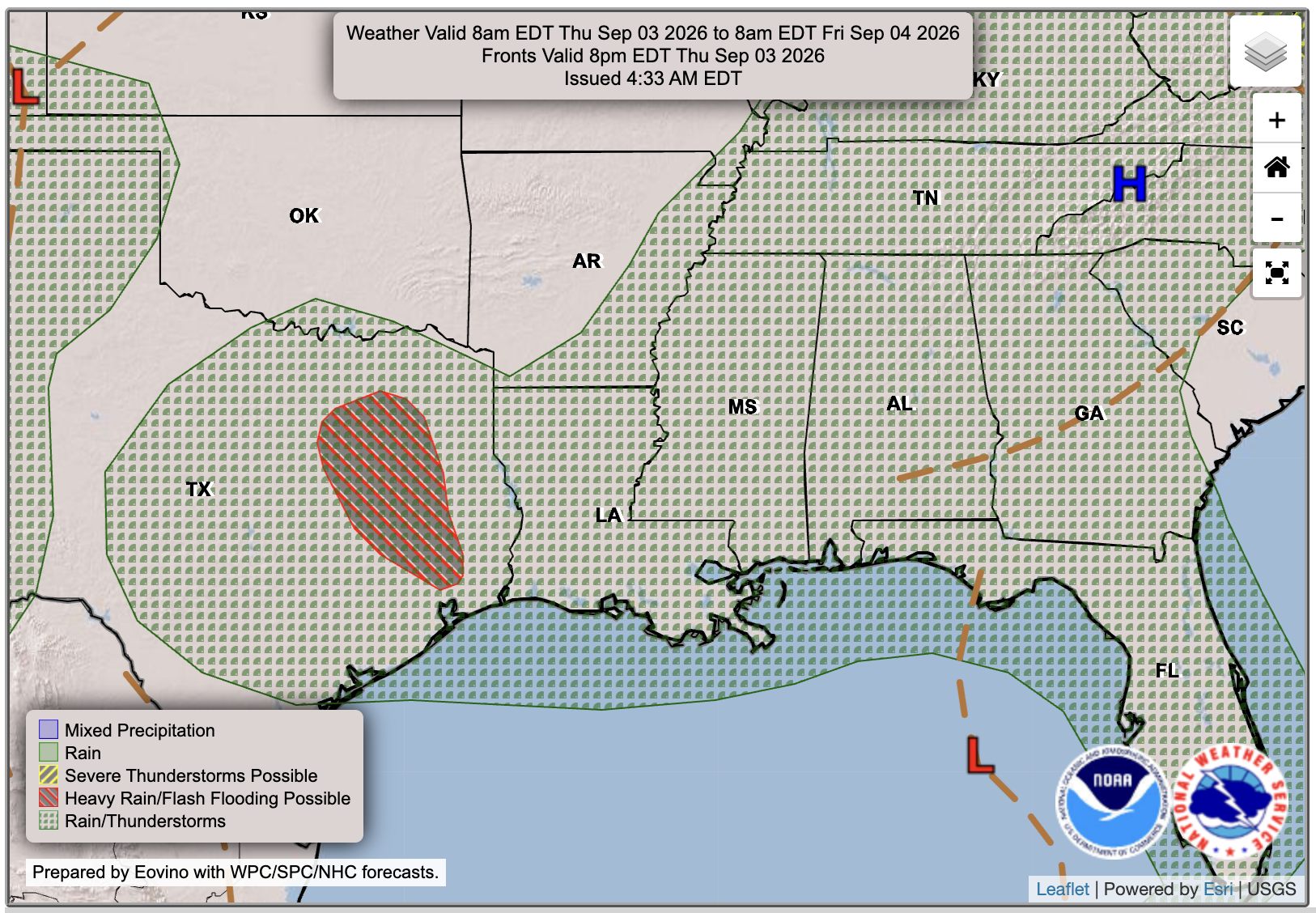
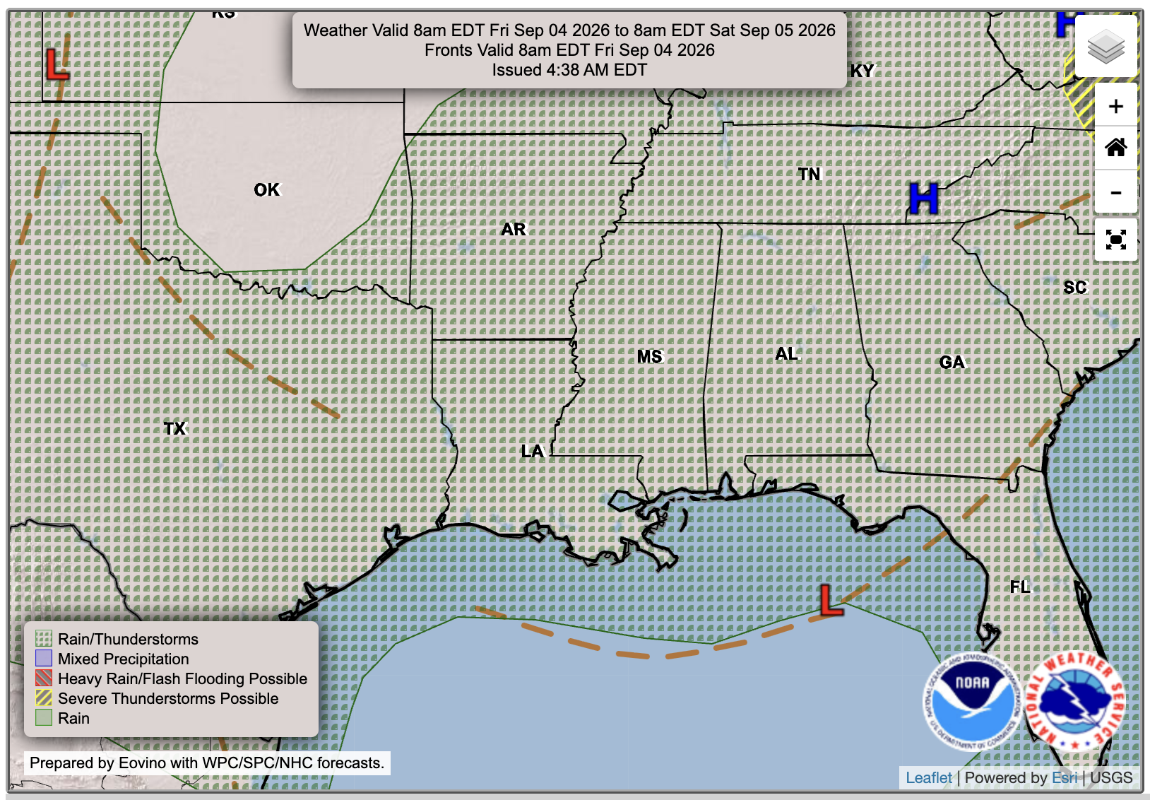
We have an unsettled stretch of weather setting up across the region as an area of low pressure lingers near the northern Gulf. As shown below, energy, or spin in the atmosphere, is swirling over the Gulf and into our area. As that energy interacts with the abundant moisture already in place, it will help produce rounds of showers and thunderstorms through the end of the week and possibly into the weekend.

Today’s Forecast
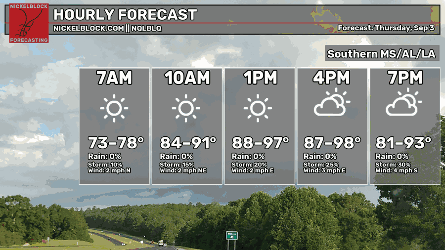
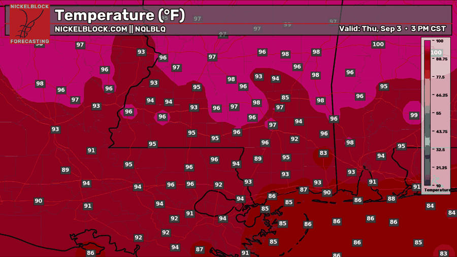
We have another hot and humid afternoon ahead, with temperatures reaching the 90s across most of the region and a few inland spots flirting with the upper 90s. Most areas remain dry through early afternoon before scattered showers and thunderstorms begin developing later in the day.
The HRRR shows one cluster moving north from the Gulf Coast into southern Mississippi during the late afternoon and evening, although where individual storms develop will be difficult to pinpoint. Many locations may miss the rain entirely, but anyone caught beneath a storm can expect a quick downpour, lightning, and a brief break from the heat before activity fades tonight.

Tomorrow’s Forecast: Friday, September 4th
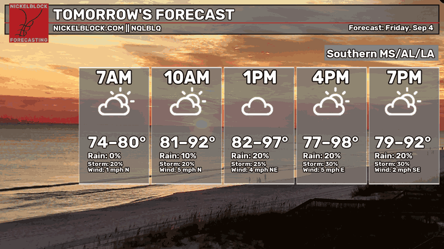
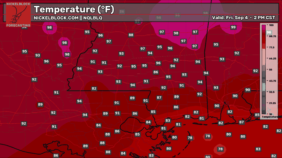
Friday looks cloudier and more unsettled as moisture circles around the Gulf low. Showers may already be brushing the coast during the morning before activity gradually expands inland through the afternoon and evening, especially across Louisiana and southern Mississippi. Temperatures will vary quite a bit depending on who sees clouds and rain, with 80s closer to the coast and lower to middle 90s farther inland. If you have plans for Friday night, keep the rain gear nearby because scattered downpours and thunderstorms may still be roaming around after sunset.
Saturday’s Forecast
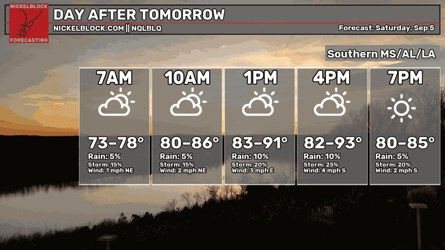
Saturday brings a similar story, although rain coverage may be a little lower than Friday. Expect a mix of sun and clouds with a few scattered showers or thunderstorms possible, mainly during the afternoon. There should be plenty of dry time to enjoy the day, but keep an eye on the sky if you have outdoor plans since a quick downpour could still pop up. Highs will range from the upper 80s near the coast to the lower 90s inland, with activity winding down around sunset.
Extended Local Outlook
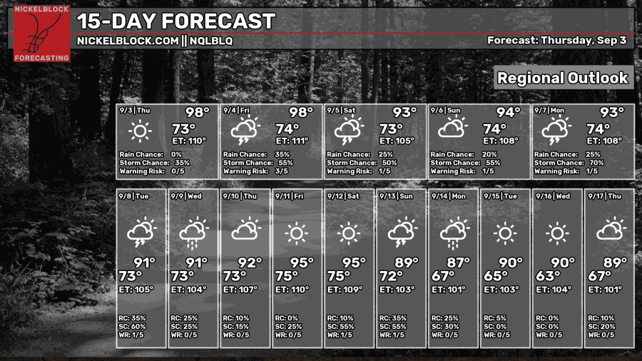
The unsettled pattern may hang around through the first half of next week, bringing more opportunities for scattered showers and thunderstorms. A drier stretch could then take shape late next week before rain chances possibly return around the following weekend.
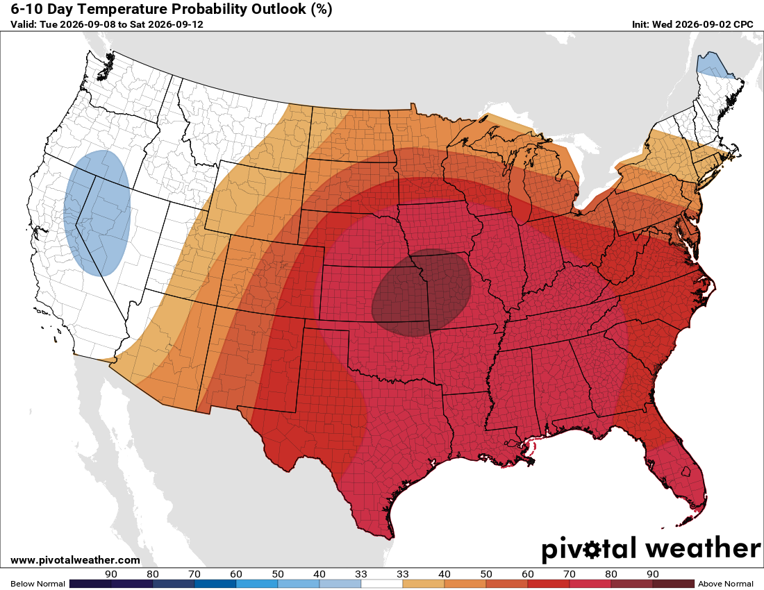
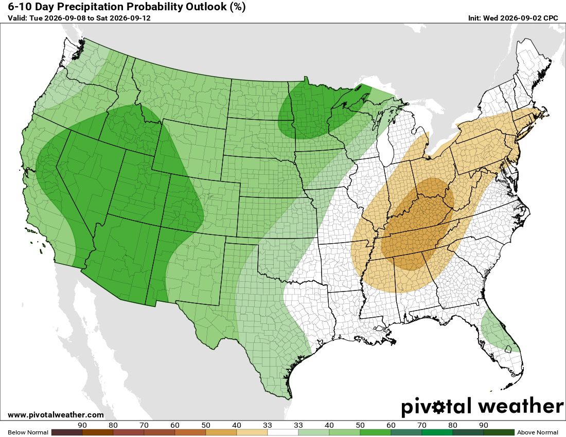
Temperatures are favored to remain above normal, so summer is not ready to loosen its grip just yet. However, there are hints of cooler and less humid nights arriving toward the middle of the month, with some locations possibly dipping into the 60s.
Quick Tropics Update
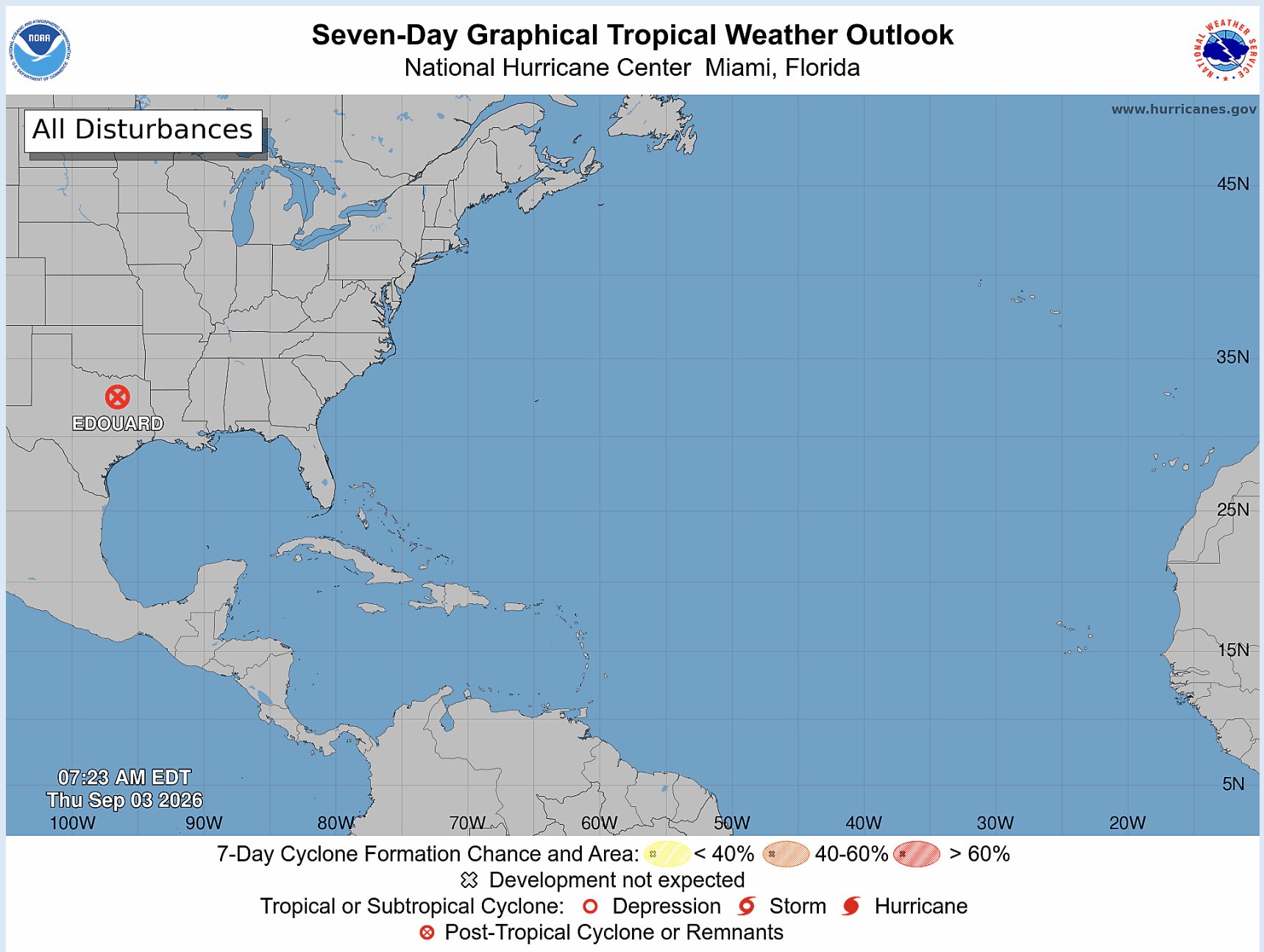
The Atlantic is unusually quiet for early September, with no new tropical development expected during the next seven days. Edouard has weakened into a remnant low over Texas and will continue fading inland. For now, there is nothing else on the map to track, giving the tropics a welcome break as we move closer to the traditional peak of hurricane season.
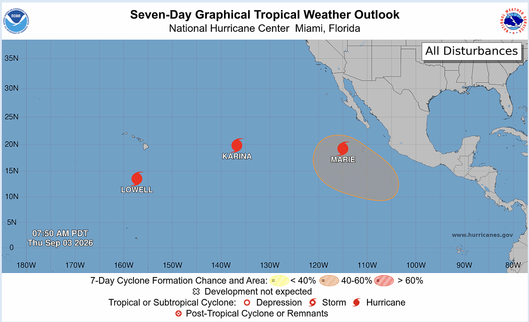
The Eastern Pacific is much busier, with hurricanes Marie, Karina, and Lowell all spinning at the same time. Some of Marie’s remnant moisture could get pulled into the southwestern United States this weekend, potentially increasing rain chances there. Lowell is also passing awfully close to Hawaii, so that system will need to be watched carefully for any shifts in its track or impacts to the islands.


