The disturbance in the Gulf is still hanging around for the next few days, driving in more rain chances to the Gulf coast. We’ve had a decent amount of rain that’s run through the central Pine Belt, too, this morning. More rain is possible into the afternoon for us before sunset, so keep your jacket on you if you’re going to the game tonight! This pattern will continue into the weekend and will eventually dry out a bit before the end of next week.

Today
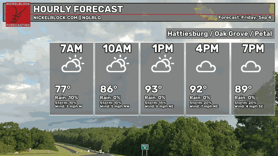
The rain and thunderstorms are moving in a bit earlier than the models are predicting which is a good thing in some ways! Temperatures may stay a little cooler today, however with the early departure of the rain, the sun will help reinforce that muggy feeling outside for the rest of the day. Highs will reach the low 90s in areas that didn’t receive rain, probably the upper 80s in areas that did. As we go into the evening, the clouds will hang around keeping conditions cooler. Lows in the low to mid 70s.

Tomorrow
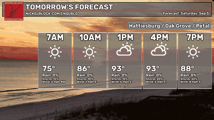
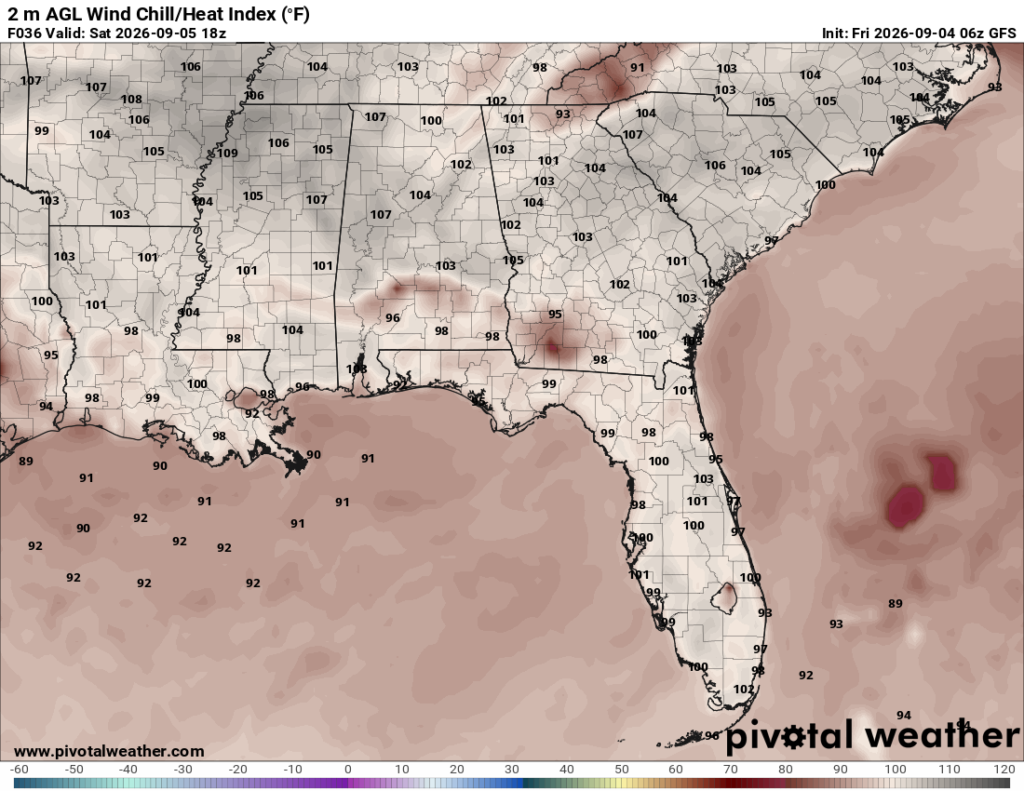
Cloud cover begins to dissipate overnight and will likely lead to higher temperatures tomorrow. The rain is also a bit more scattered as the low wanes. It’ll feel like another summer day and clouds will begin to increase into the mid-afternoon with a high in the low to mid 90s. Heat indices will reach above 100 for many of us and winds will be variable. If you’re out at the Southern Miss game tomorrow, drink a lot of water, but also bring your poncho just in case! Lows will be in the mid 70s.
Sunday
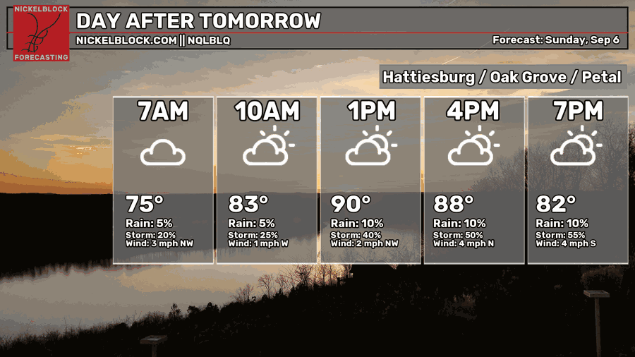
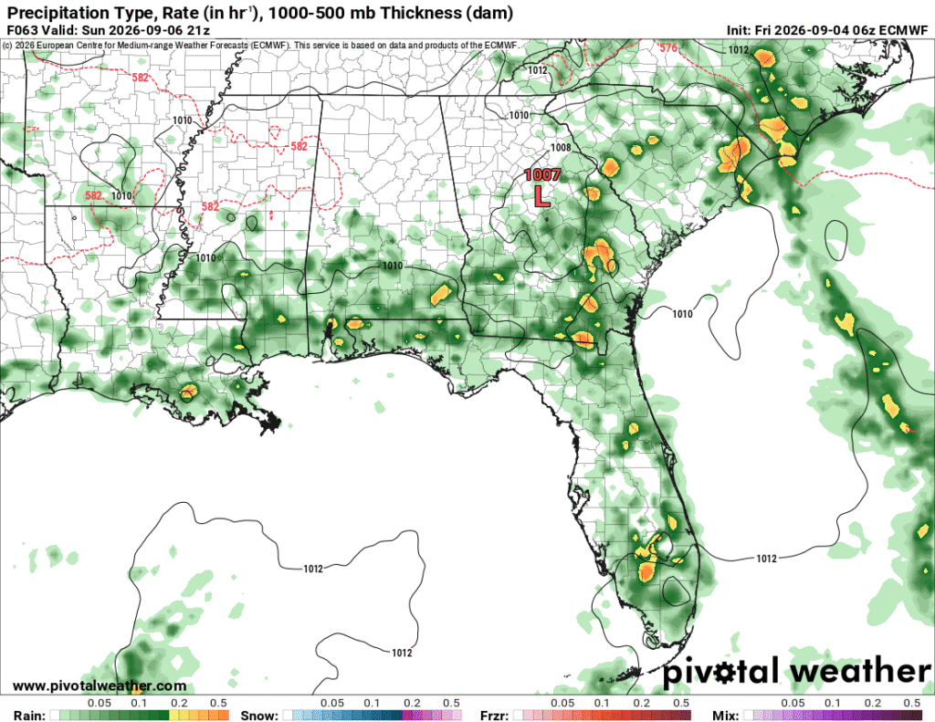
It’ll be a partly to mostly cloudy day for us in south Mississippi on Sunday. Rain and thunderstorms are possible during the afternoon hours moving in from the south. Overall, it’ll be slightly cooler than Saturday due to the early cloud cover, but still warm and humid. Lows will fall into the low to mid 70s overnight.
Next Week
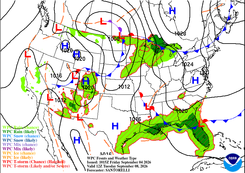
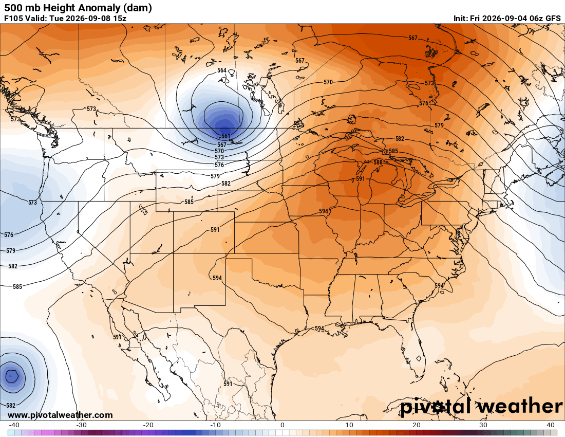
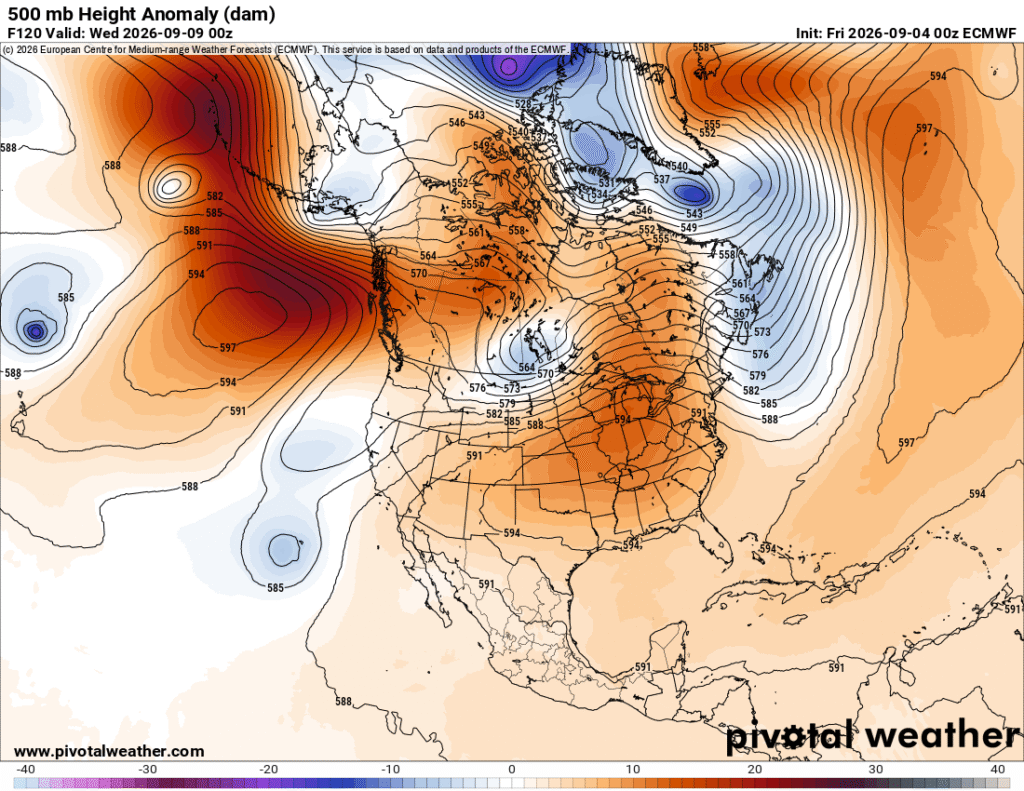
Looking at the two maps above (surface and 500mb on Tuesday), we can see that any sort of trough/low pressure system is having a hard time breaking through the southern ridge. Most of them eject towards Canada and move out towards the Atlantic. At the surface, a large high pressure system from Canada is squeezing between the low and the stationary front in the Deep South. What this means is the continuation of hot, humid weather, and afternoon thunderstorms for us in the next several days.
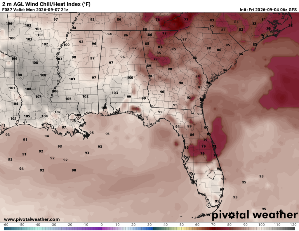
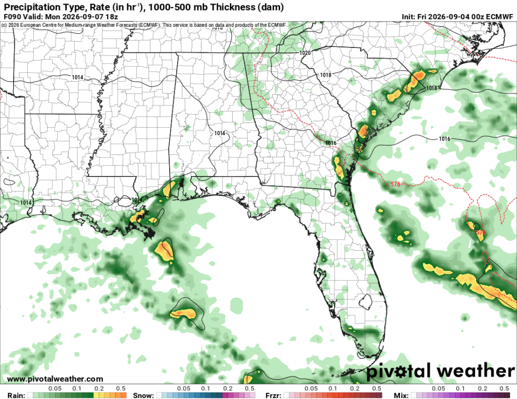
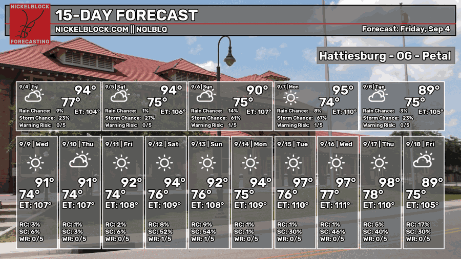
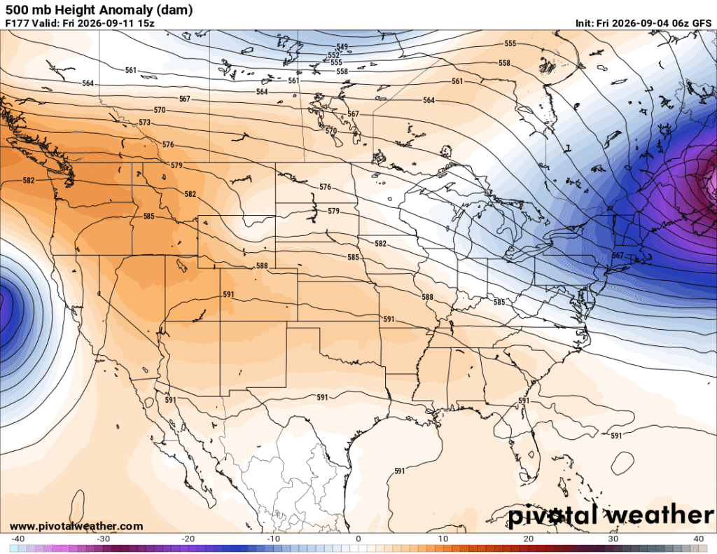
Now while these are two different models showing two different things, I think it speaks to the pattern we’re going to see for most of the week next week. It heats up in the afternoon, offshore storms begin to move in during the early afternoon, and they move onshore into the mid-afternoon. This pattern begins to cease by the end of the week, however as the ridge in the upper levels builds and more high pressure towards the surface begins to inhibit more convective development. In two words, “hot” and “drier.”
The Tropics
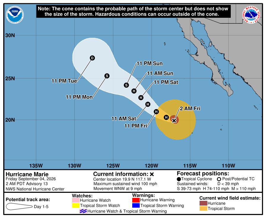
Currently, the Pacific has 3 hurricanes. Marie to the east, Karina, and Lowell to the west. Lowell is forecast to make a sharp turn to the north and may graze the western islands of Hawaii in the next few days. Karina is moving further northwest out to sea and looks to miss Hawaii. Marie is also forecast to move northwest, eventually downgrading to a Tropical depression and may even be absorbed into a trough in the Pacific that moves towards the US in the future.