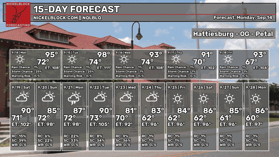
The front that brought us our late week rain last week has officially moved out and been replaced with a high pressure system in the Gulf. The high covers a pretty broad area which means that rain chances are going to be limited after today. The air will begin to feel a bit dry as well! While the temperatures are still in the 90s, the heat index won’t stray far from the actual temperature which is pretty nice considering the heat we’ve been dealing with all Summer.

Today
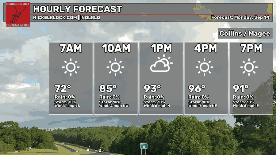
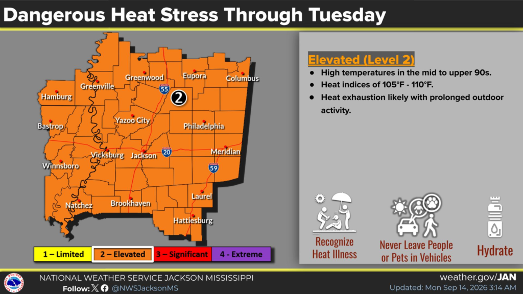
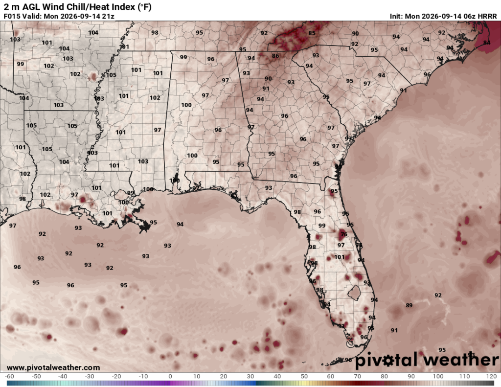
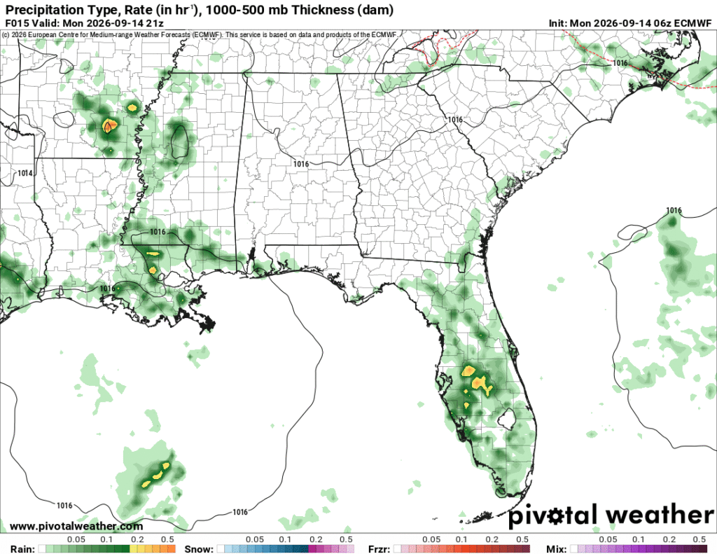
Humid conditions are back today with only a few clouds interspersed across the sky. A few stray showers and thunderstorms are possible across the coast, but it’s looking more like a hot day. The NWS in Jackson has placed us under a heat advisory since the heat index is likely to reach around 105 today, so drink plenty of electrolytes if you’re out in the sun! Winds will be light and variable with stronger winds in the evening from the east.

Tomorrow
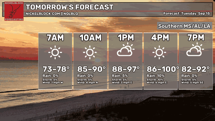
You’ll notice a pretty wide variety of temperatures for the regional forecast and there is a reason for that! The models are showing a significant dip in the dewpoint during the day on Tuesday which will affect the experienced temperature for some and not others.
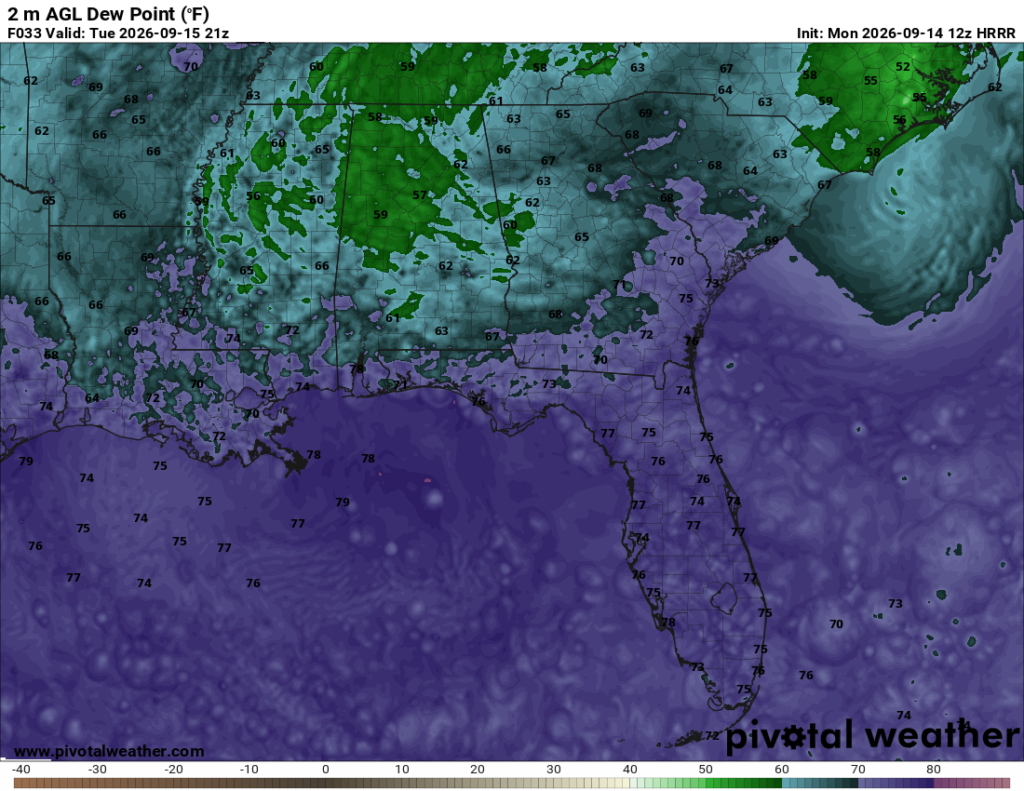
Looking at the dewpoint map above, the purple wave of 70’s dewpoints we’ve seen most of the summer has been cut back especially in the northern end of the state. For many of us in the Pine Belt and coastal areas, we’ll still have to deal with the summer heat, but it’s a pretty good sign of things to come. Heat indices will reach over 100, so be careful out there again tomorrow! Lows will be in the low to mid 70s.
Wednesday
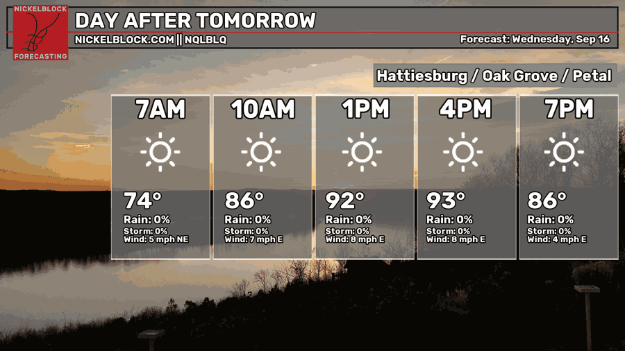
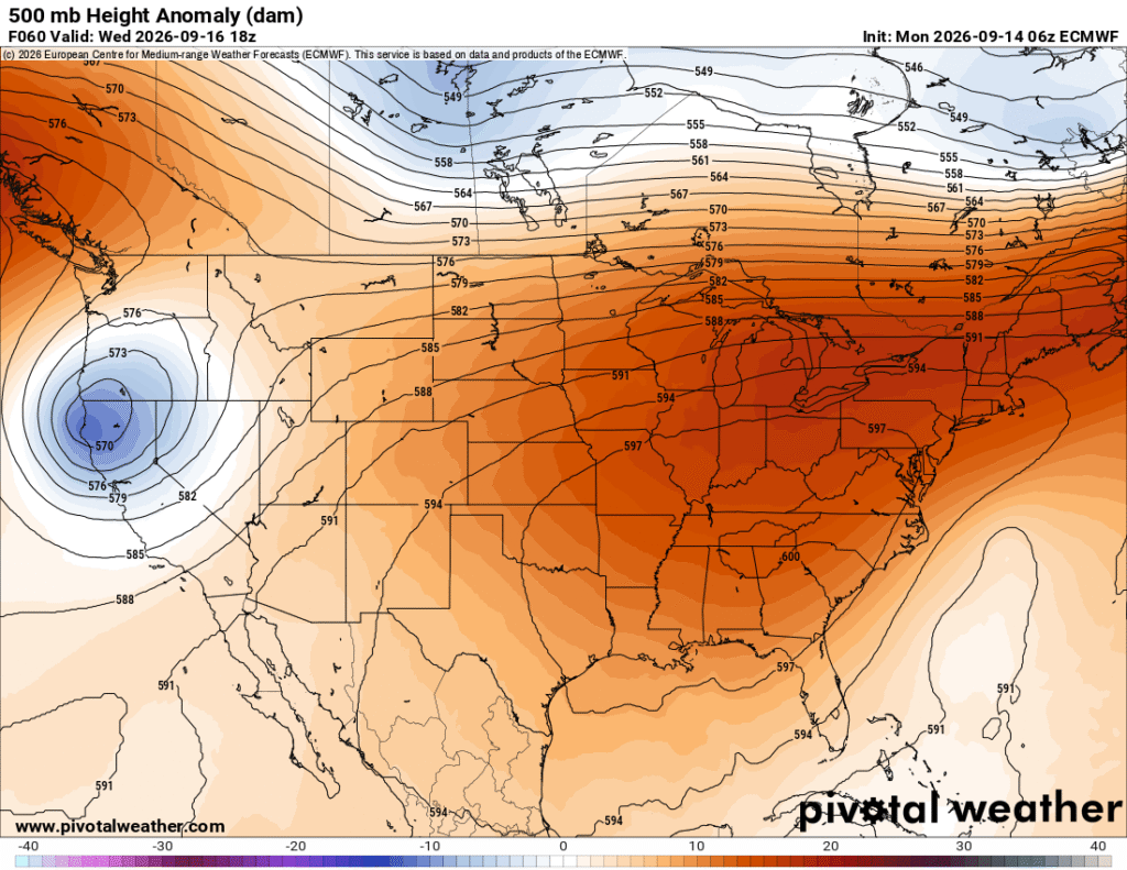
The heat index is beginning to decrease by the middle of the week! Clear conditions are likely along with a high in the low 90s. The experienced temperature is going to feel more like the mid to upper 90s and it’ll begin to feel a bit drier outside. Looking at the 500mb map below, a strong ridge has established itself over the eastern US, but looking in the Atlantic, you’ll notice a spot that is anomalously low compared to the US. That is a Bermuda low, and it will be moving into the Gulf very soon. Lows will be around 70.
Past Hump Day
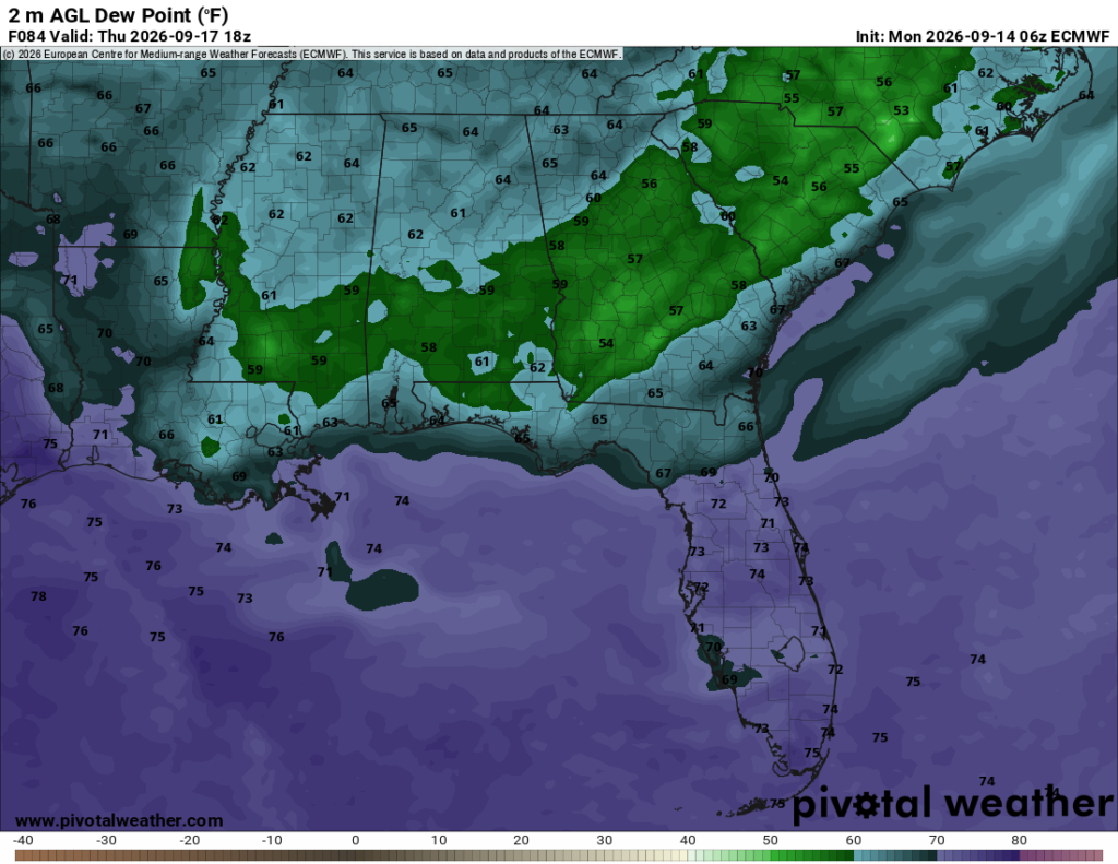
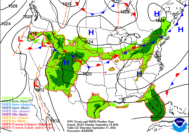
Hot, but dry conditions are ahead for the end of the week! The temperature will remain in the 90s, but the high’s (top right) undercutting of the moisture flow along with the Bermuda low will keep the experienced temperature down similar to the actual temperature. Friday will be a similar story as the temperature reaches the low 90s and the heat index stays the same.
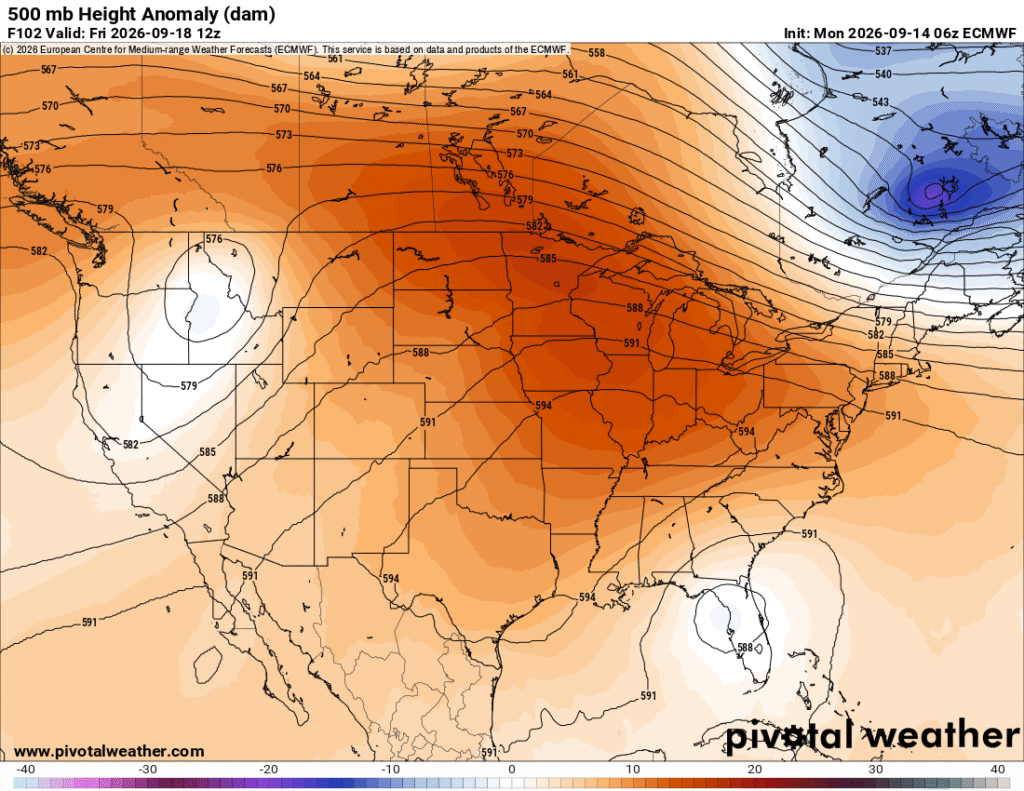
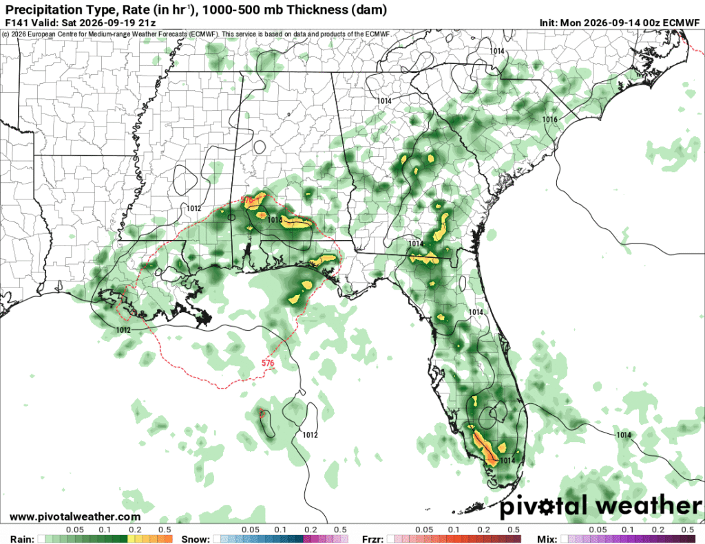
So that Bermuda low that I was talking about earlier? It does have an effect on our weekend as it’ll bring the moisture back to our area. The temperatures look above seasonal norms (low 90s), then begin to fall after the rain moves in. The dewpoint will increase back into the 70s, however we do have a chance of rain both Saturday and Sunday as the low moves in and dissipates by the end of the weekend.