The Setup
A large ridge of high pressure is taking shape over the eastern U.S. this week, which will keep rain chances fairly low and allow for temperatures to continue to soar into the 90s. It’s like summer just doesn’t want to go away just yet! The ridge will eventually weaken by the weekend and eventually be replaced by an area of troughing by next week, which will increase our rain chances.
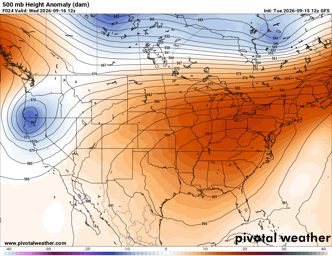
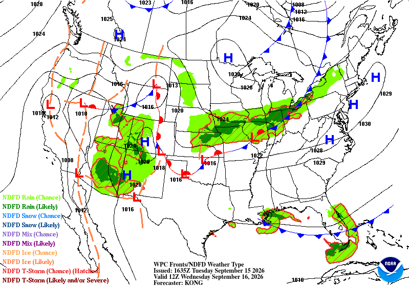
The southeast is fairly quiet tomorrow, since it’s sitting right under the ridge, suppressing most, if not all, vertical development underneath it. Just south of the ridge, off into the northeastern Gulf, there is a cold front that will be hanging around tomorrow, which will bring clusters of showers and thunderstorms mostly over the water, but some moisture and rain could make it to our coastal locations.

Tomorrow’s Forecast: Wednesday, September 16th
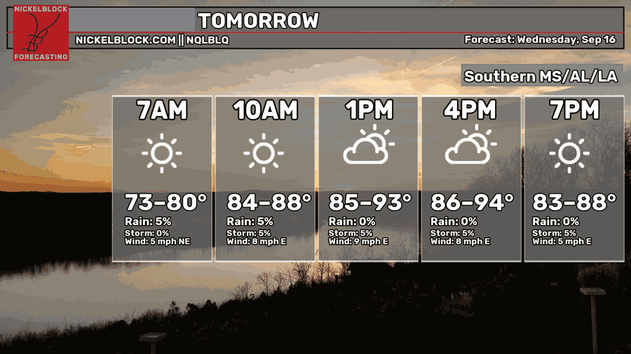
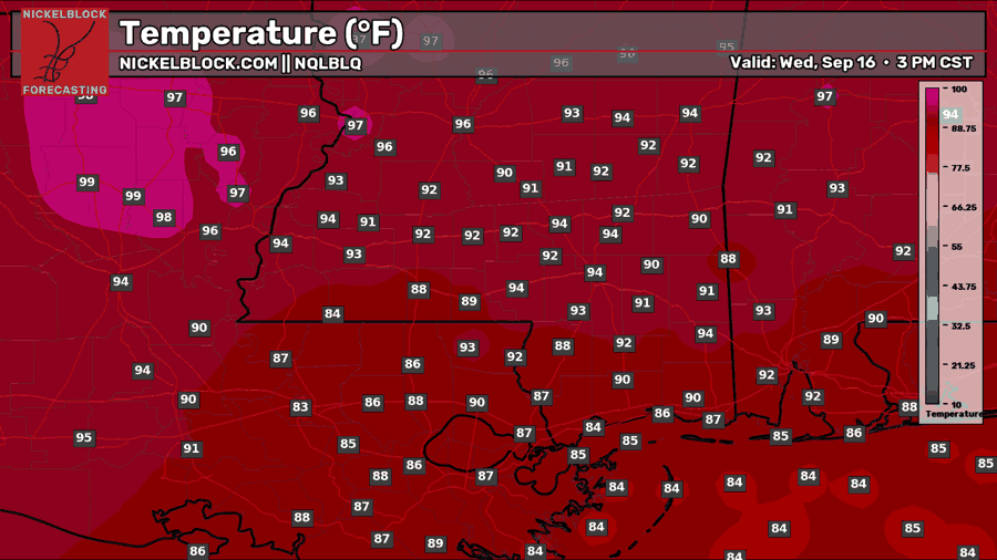
Tomorrow will be hot with a mix of sun and clouds. Highs will reach the low-to-mid 90s for most inland areas, and upper 80s for those near the coast.
You can see the areas of showers and thunderstorms over the Gulf, as depicted in the HRRR model above. Again, most of this will remain offshore, but a few cells could popup at any time, especially near New Orleans or other coastal areas. There will be plenty of dry time to look forward to, though.

Thursday’s Forecast: September 17th
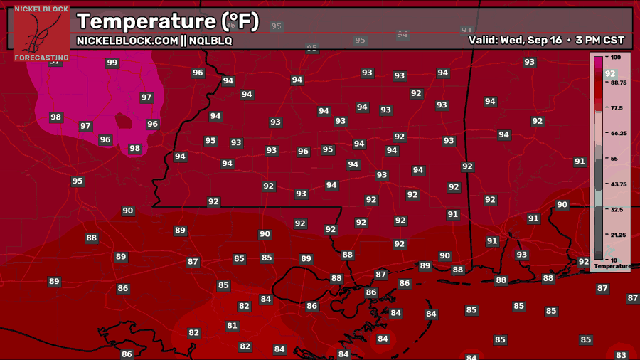
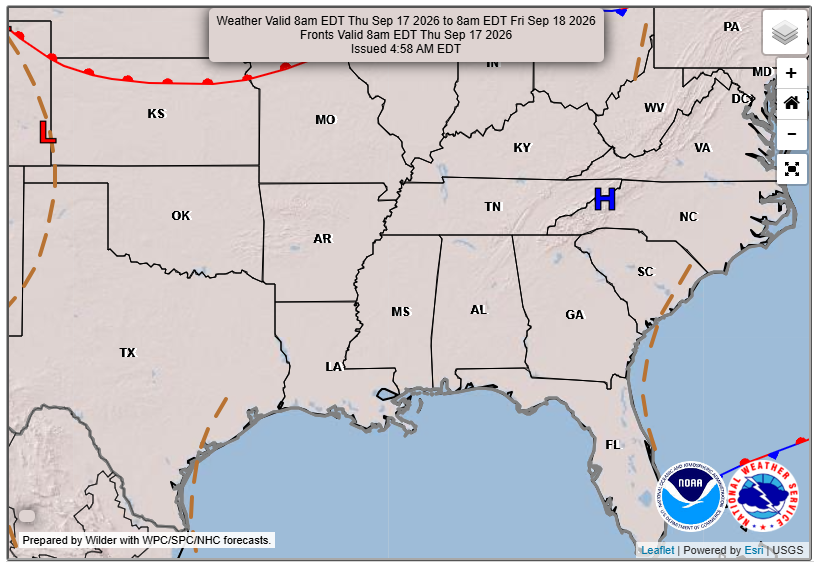
By Thursday, the ridge of high pressure is fully cranked, and a nice dry and sunny day is to be expected. High temperatures could reach even higher than forecasted in the NQLBOT model, so ensure you are staying hydrated if you will be outside on Thursday!
Extended Local Outlook
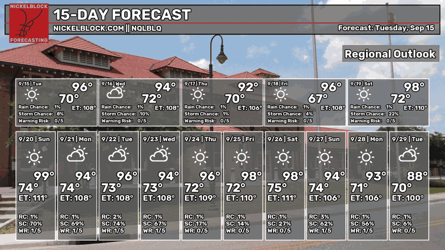
We’ll have a beautiful Friday and Saturday with plenty of sunshine, but very hot temperatures closer to 100. Sunday also looks nice, but as the ridge breaks up and troughing moves in, our daily rain chances return. Next week, storm chances are much more elevated than this week, so ensure to keep an eye out on our forecasts as we get closer.
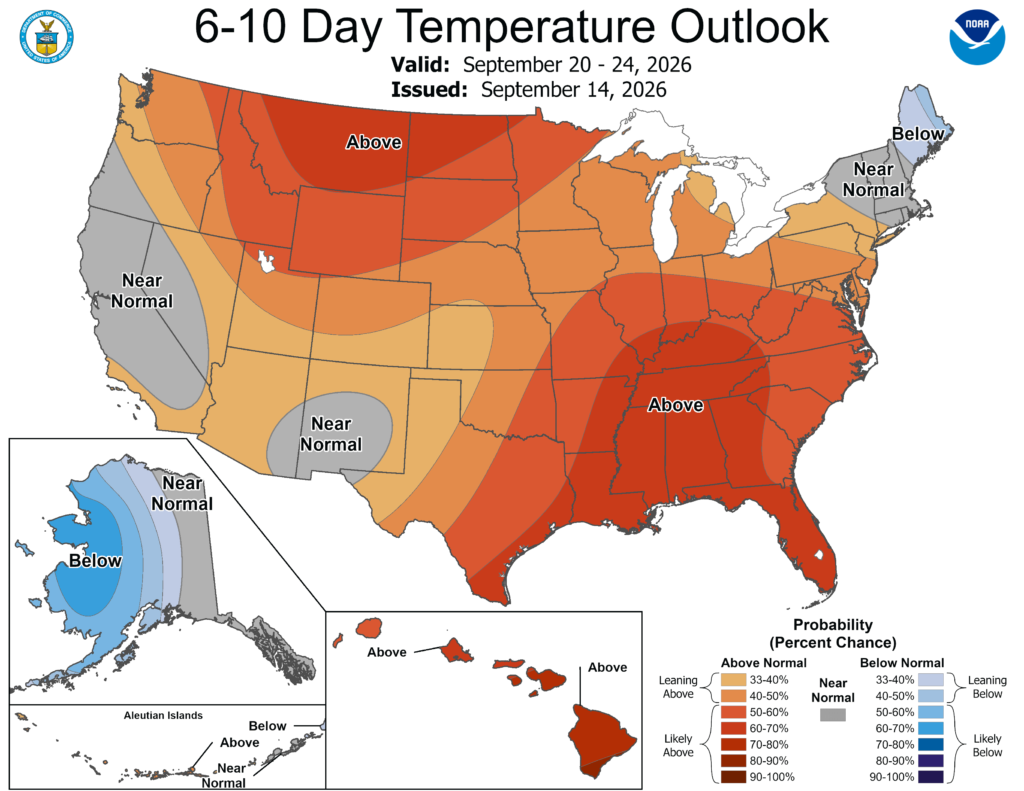
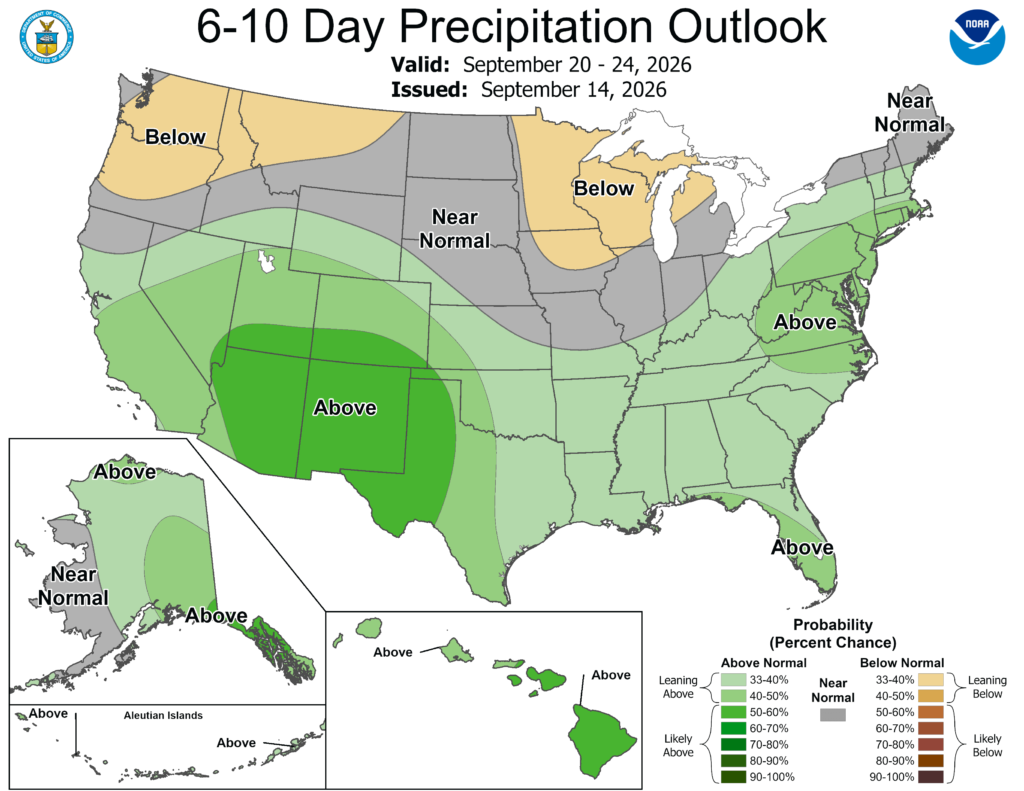
Though troughing will bring the possibility of above-normal rainfall next week, it’s not strong enough to bring our temperatures down. The Climate Prediction Center is confident that we will remain with the above-normal temperatures through the end of the month.
Quick Tropics Update
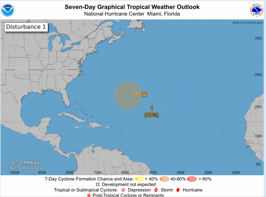
It’s true! For the first time in the modern satellite era, the Atlantic Basin has made it this far into the season without producing a hurricane. Strong El Nino conditions have been a major factor this year, increasing wind shear across much of the tropical Atlantic and making it difficult for storms to organize and strengthen.
There is still plenty of hurricane season left, though, so we’ll be watching closely for any late-season development. Some of the most impactful storms for the U.S. have occurred later in the season, so a quiet start does not necessarily mean a quiet finish!