The Setup
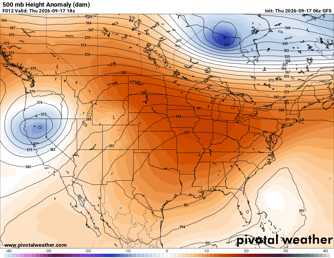
As I mentioned on Tuesday, a strong ridge is sitting over the eastern U.S., bringing dry and hot conditions to those underneath it, including us along the Gulf Coast. The intense heat is not going anywhere just yet, even as the ridge shifts west later this week. Thankfully, the highest dew points remain offshore for now, keeping humidity somewhat lower through Friday before it begins to increase again this weekend.
High pressure is dominating beneath the ridge. Most of the Southeast will remain completely dry today, except for southern Florida, where a nearby frontal system could produce a few showers and thunderstorms.
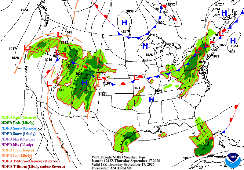

Today’s Forecast: Thursday, September 17th
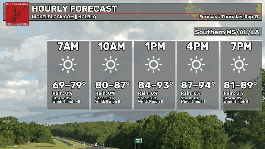
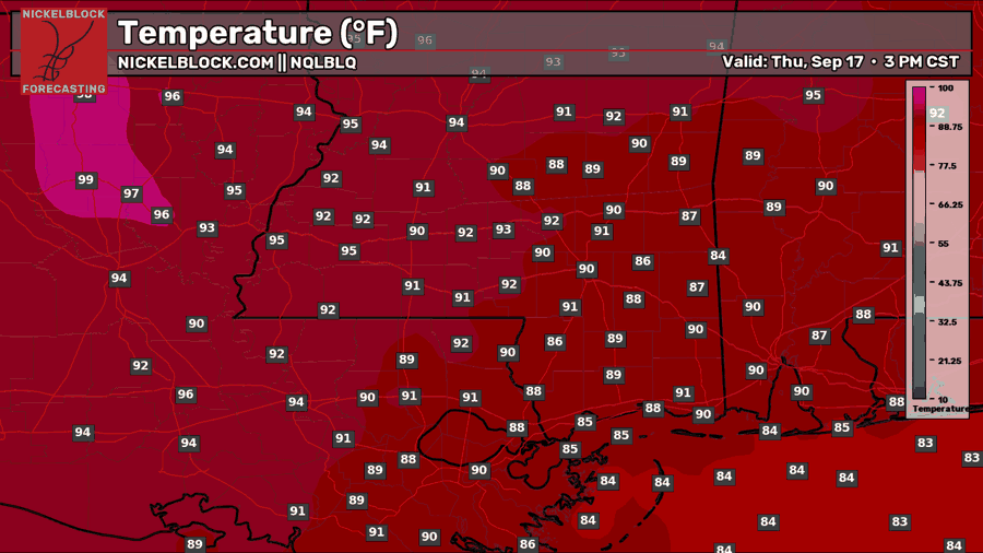
Today, expect plenty of sunshine with only a few clouds passing through at times. Temperatures will reach near 90 degrees for most of us, with mid-80s along the immediate coastline. Humidity should remain manageable as the highest dew points stay offshore, but it will still feel quite hot during the afternoon. There is no rain or storm threat, so any outdoor plans are good to go!

Tomorrow’s Forecast: Friday, September 18th
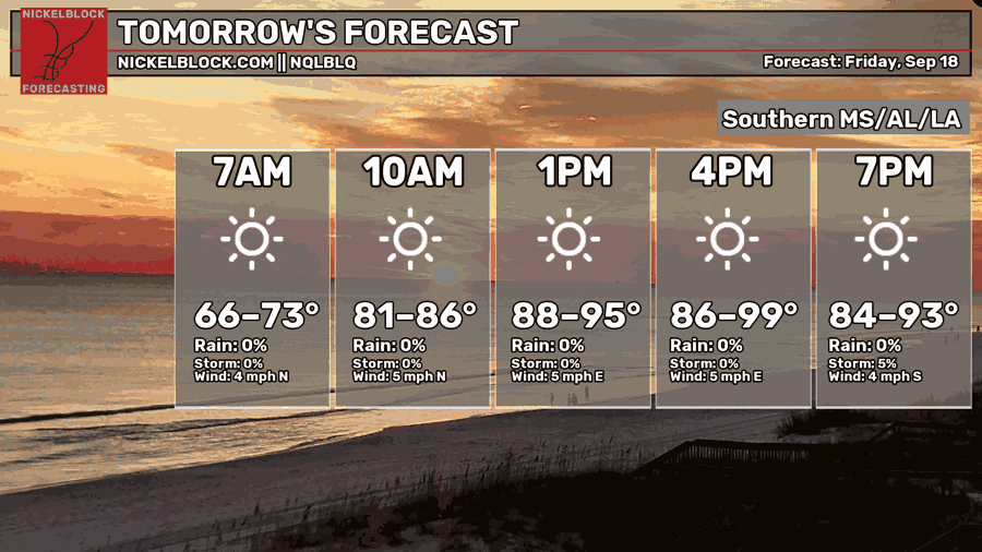
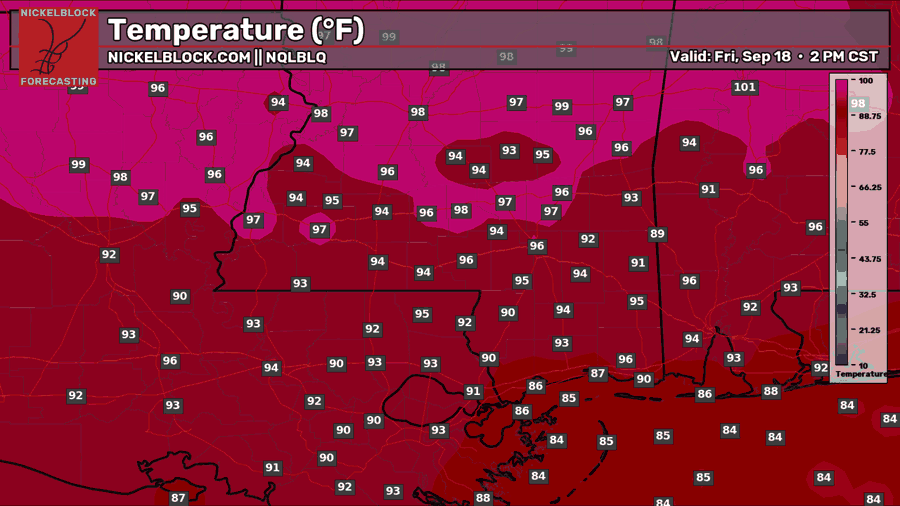
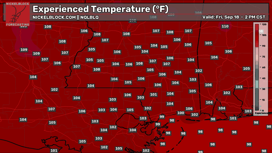
We will repeat a similar day on Friday with abundant sunshine. Temperatures will be hotter, though, reaching 95 degrees or higher farther north. Feels-like temperatures could climb above 105 degrees in the hottest locations, so make sure you stay hydrated. Even though humidity will be slightly lower, there will still be enough moisture in the air to make it feel hotter than the actual temperature.
Saturday’s Forecast: September 19th
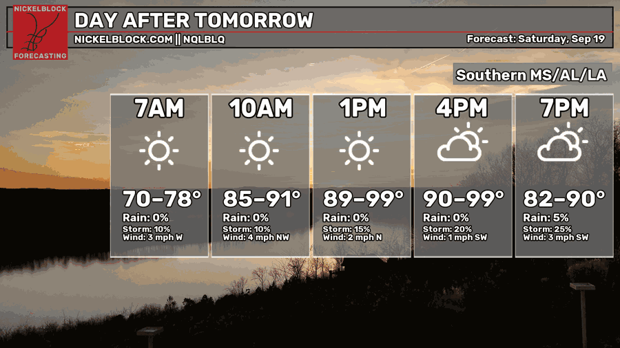
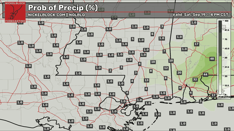
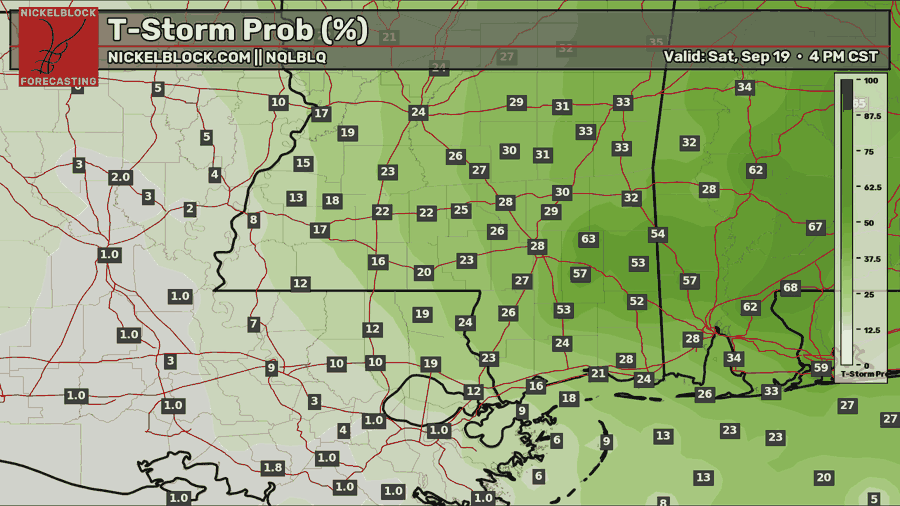
Looking ahead to Saturday, expect more sunshine as very hot temperatures spread across the entire area. Highs will approach 100 degrees in many locations, making it difficult to spend much time outside during the afternoon. As you can see above, the NQLBOT is showing a small chance of thunderstorms by the afternoon as the ridge weakens and a weak disturbance moves in from the northeastern Gulf. Most locations will remain dry, but any shower that develops could produce thunder and lightning. It is not a major threat, but it is something to keep an eye on if you plan to be outside.
Extended Local Outlook
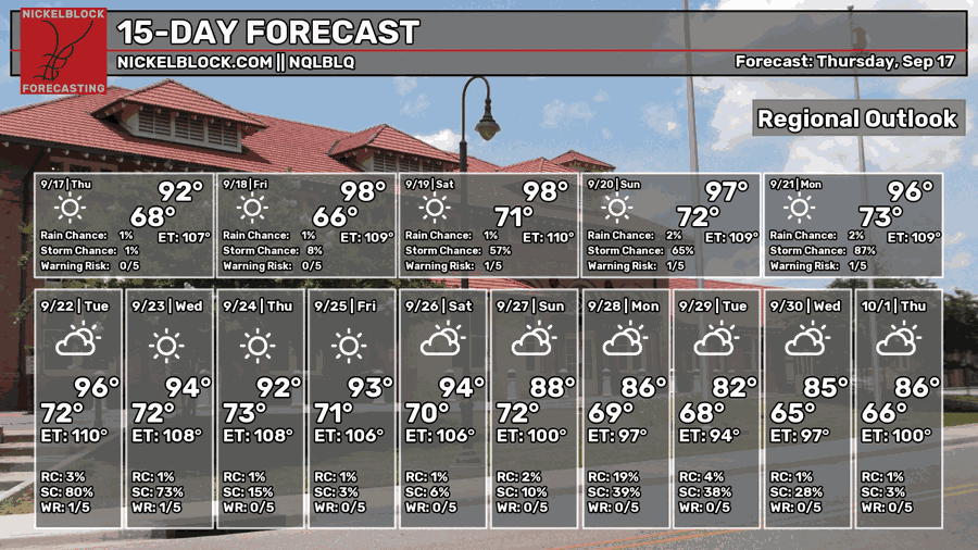
By Sunday and into early next week, a chance of showers and thunderstorms returns each day, especially across areas closer to the weak disturbance. Most of us will not see a complete washout, but occasional afternoon storms could provide some relief from the heat.
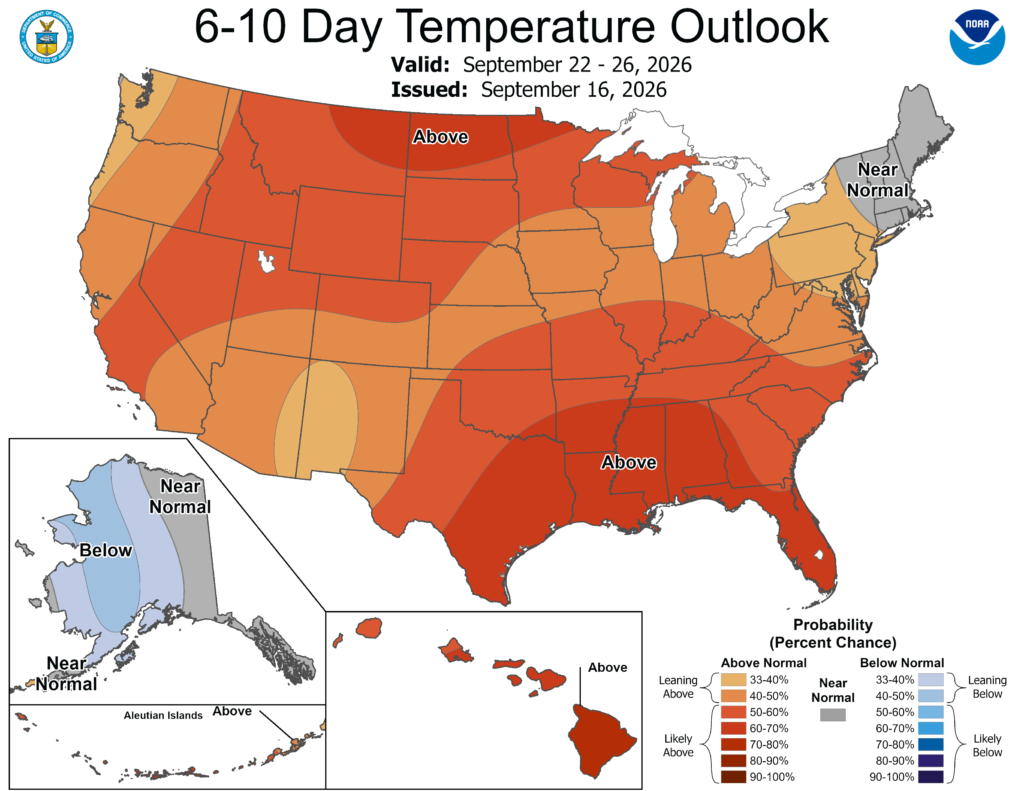

As mentioned, the heat is not going anywhere just yet. Rainfall could also trend above normal during the 6-10 day period as deeper moisture settles across the region.


