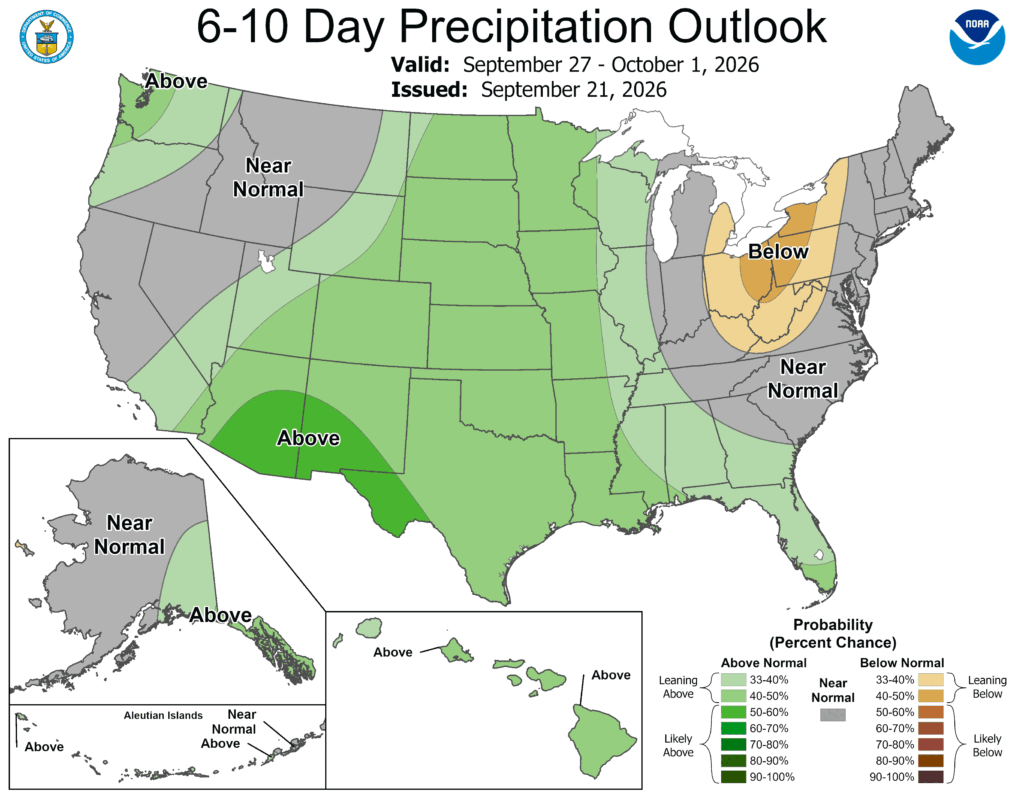
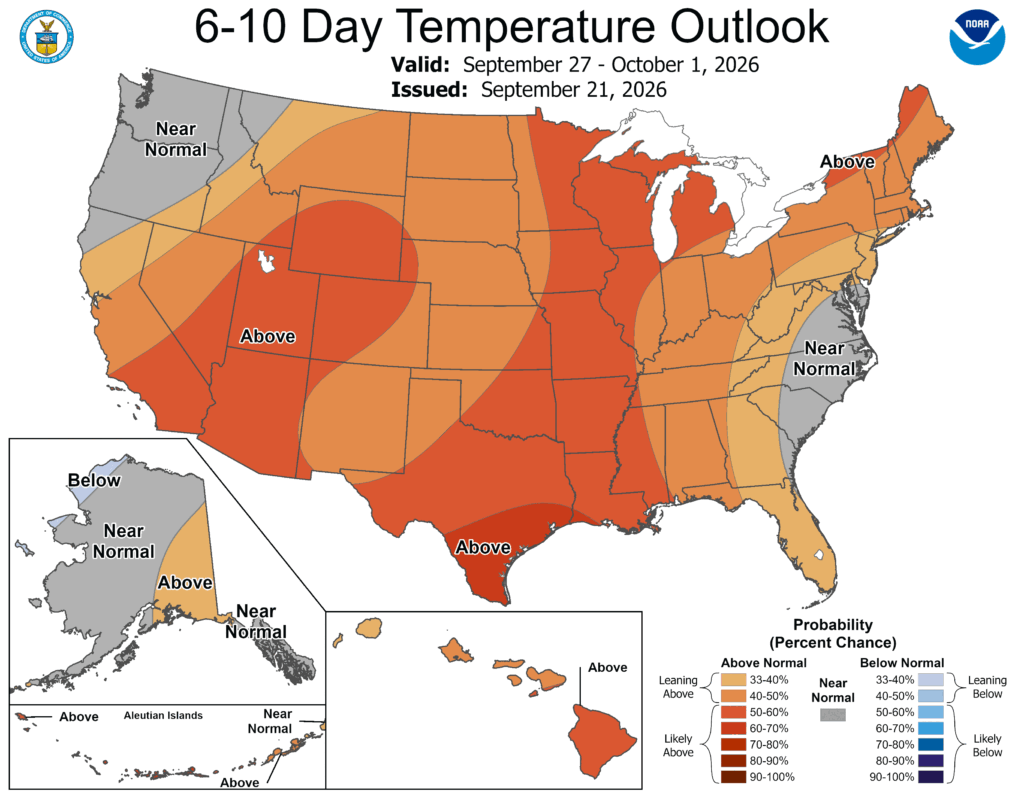
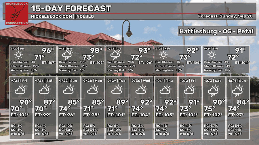
We’re unfortunately back to the more uncomfortable heat for the next couple of days since we’re stuck between a Gulf airmass and a cold front. By midweek, however, it looks like the rain chances will be gone and we’re getting cooler? Kind of! The overall pattern looks to cool a bit as the high temperature average lowers by the end of the week and the heat index hovering around the actual temperature.

Today’s Setup
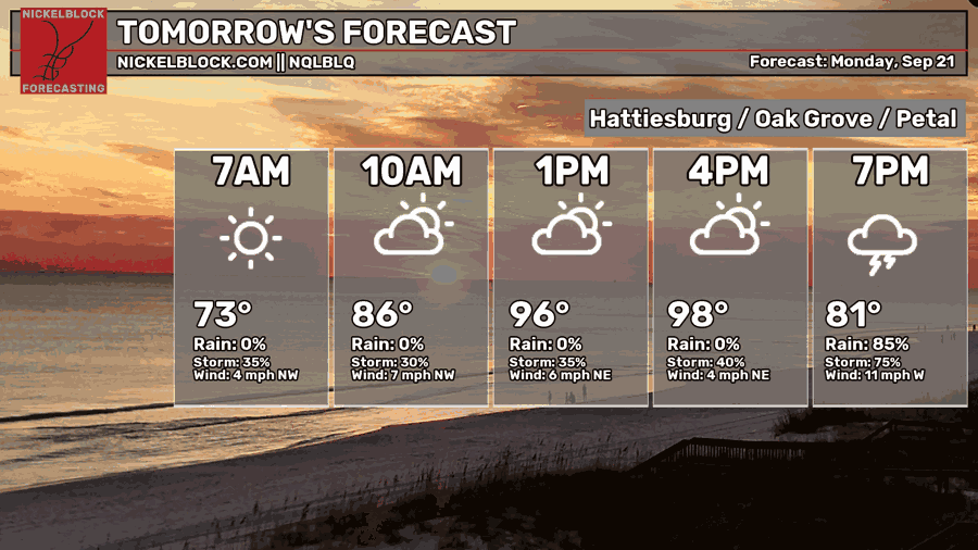
Yep, it’s hot! Nothing else to say here. Actually, there is! Rain is also possible this evening! I mentioned the Bermuda low last week, but that will drive in enough moisture along with that front to bring rain into much of Mississippi and Louisiana this evening. Storms will start developing early in the afternoon for much of northern Mississippi, then develop further south into the late afternoon hours for south Mississippi. Expect thunderstorms, a bit of wind and heavy rain possible. Highs will top out in the mid to upper 90s and lows in the low 70s.
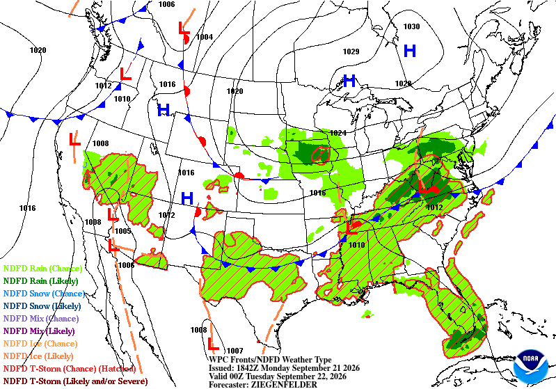
Looking at the surface map above, we can notice that there is a front near the Mason-Dixon line that will eventually move further into the Deep South. For now, it will provide a nice boundary for thunderstorm development today and possibly tomorrow.

Tomorrow
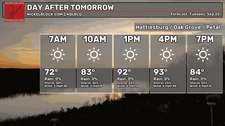
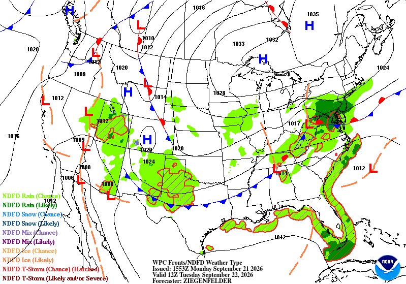
The front is moving further down the latitudes and we’ll have one last good chance of rain for the week tomorrow. Some scattered showers and thunderstorms are possible in the mid-afternoon to evening hours, so be prepared if you’re walking out of work around that time! Temperatures won’t be as hot as today, but they’ll still top out in the low to mid 90s. Mostly clear skies will give way to more mid-level clouds as the thunderstorms begin to pop up. Overnight, we’ll fall into the low 70s again.
Wednesday
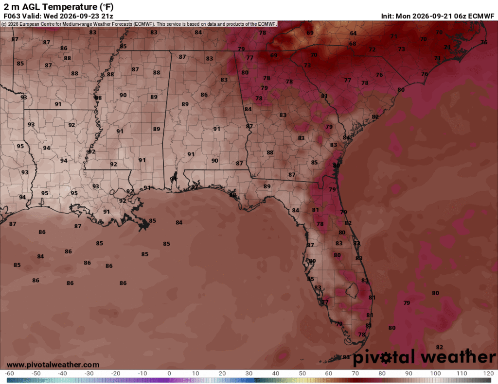
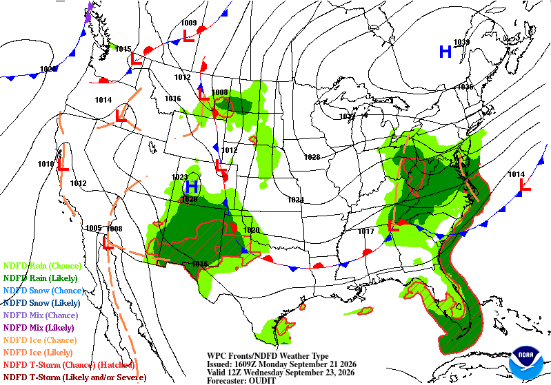
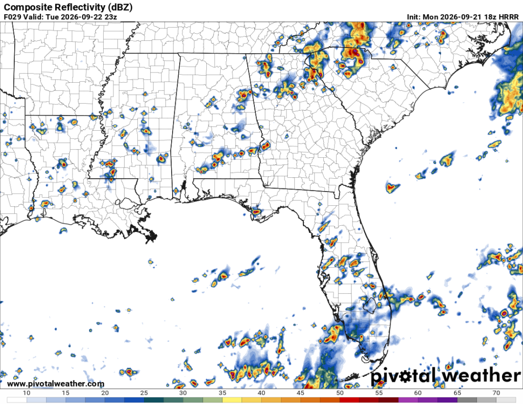
If you look at the ECMWF map to the top left, you’ll notice temperatures are falling over in the Carolinas! This is due to that front moving out to sea and deepening into a more potent low. It will pull stronger northerly winds across the mid-Atlantic driving down temperatures and will even have an effect on us past Wednesday. We’re still dealing with another hot day on Wednesday, though. Highs will be in the low 90s with more northerly winds moving in. Lows will fall around the low 70s.
End of the Week
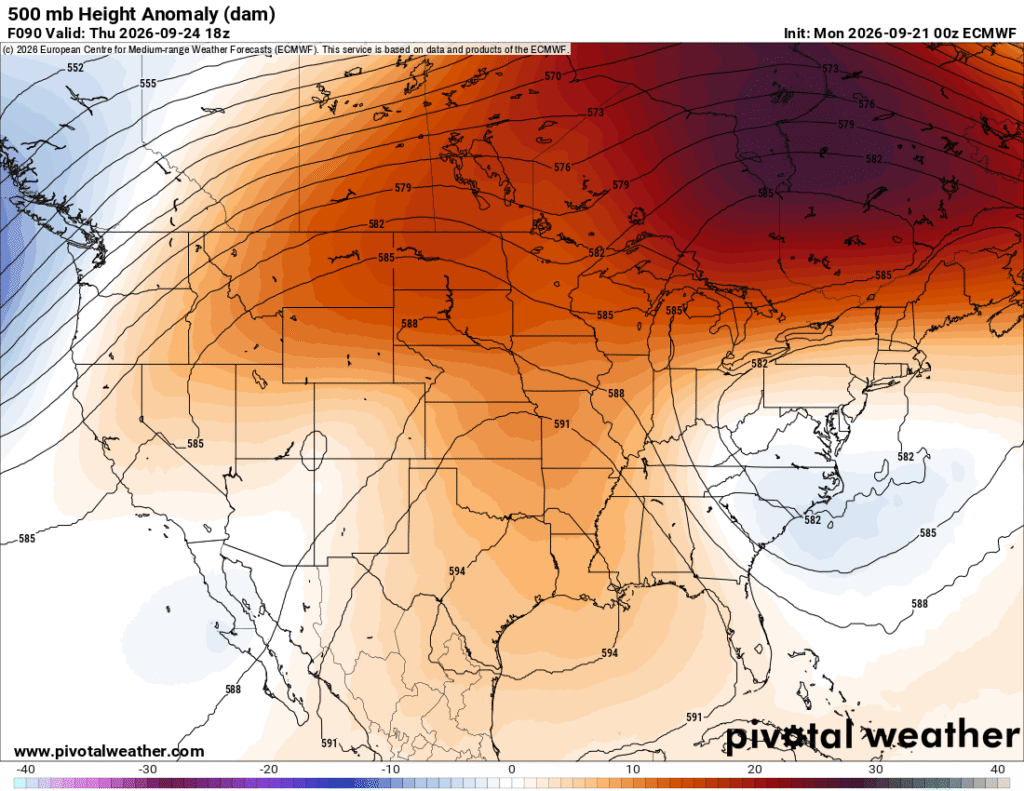
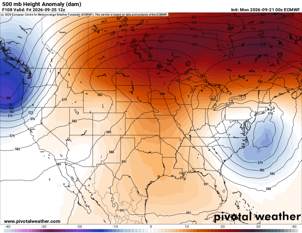
Looking at the upper levels (above), we notice that the Deep South is stuck between a big ridge and a growing trough in the Atlantic. It’s somewhat good news for us since it does contribute to our decreasing temperatures, but also cuts back on the rain chances due to the stronger northerly winds and increased pressure over the northwestern Gulf. Over the weekend, the pattern will shift as well since the low pressure system in the northern Atlantic will move further away from land and allowing more high pressure to grow over the southeastern US.
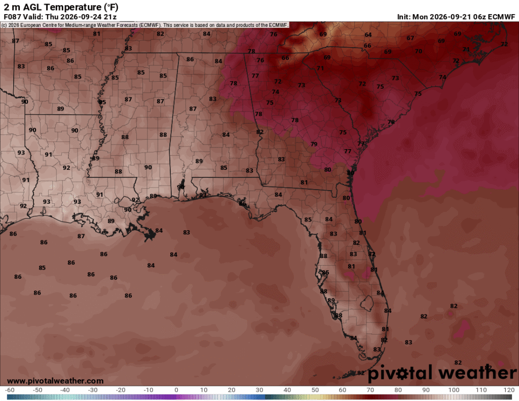
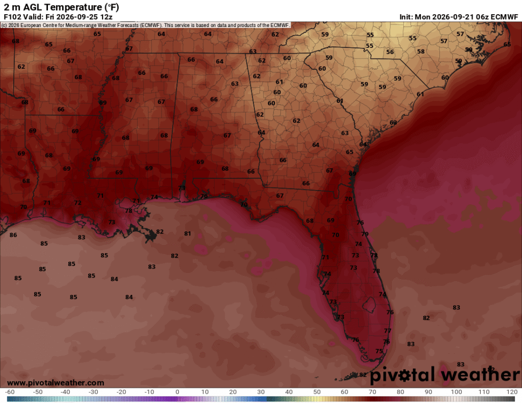
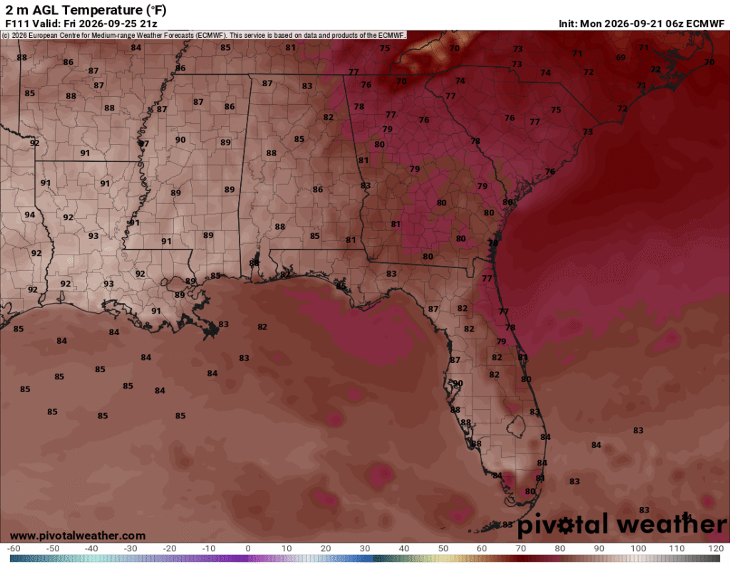
Overall temperatures will decrease over the latter part of the week and into the weekend which is good news for us! Is it going to feel like the Fall that we really want? Eh, not quite yet. Temperatures are on the decline for a little while, but we’ll see a change as another high pressure develops next week bringing more southerly winds and warmer feeling temperatures. Along with that, the Gulf moisture will likely bring more rain by midweek next week as a developing low out of the southwest (possibly a Pacific tropical system!) moves further northeast.