The Setup
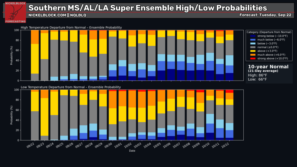
The official astronomical fall season begins tonight at 7:05 PM CDT, though it sure doesn’t feel like it here in the Pine Belt! Our average high for this time of year is around 86 degrees, but we’re quite a bit above that for most areas. We are going to be above normal for at least another week or two, but the beginning of October does look hopeful in terms of a cooldown.
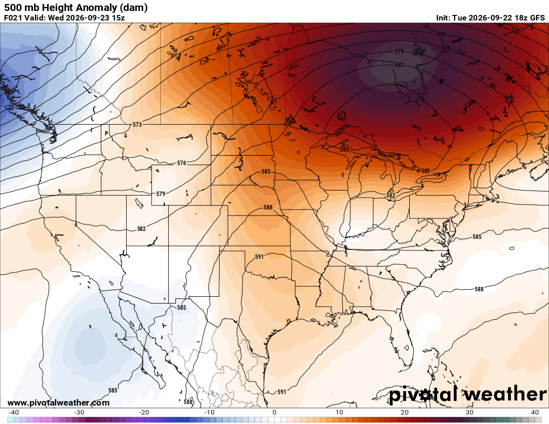
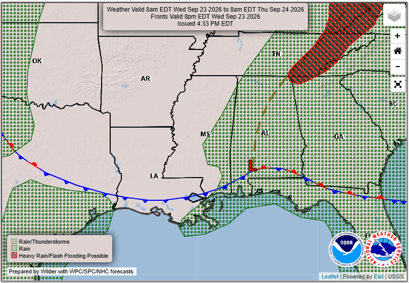
Our overall pattern features broad ridging across the central and eastern U.S., with an area of low pressure over southern Alabama and a stationary front draped across the Gulf Coast states. Note the extremely strong area of high pressure over southeastern Canada! As an upper-level trough develops across the eastern U.S., a coastal low is expected to develop and draw in abundant moisture from the Gulf and Atlantic. The strong Canadian high will help establish persistent northeasterly winds and potentially slow the storm’s progression, setting the stage for a nor’easter in New England later this week. Pretty cool how it all comes together!

Tomorrow’s Forecast: Wednesday, September 23rd
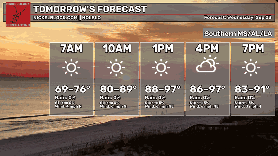
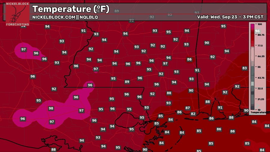
Tomorrow is looking like another hot and mostly sunny day across the region, with highs reaching the mid to upper 90s inland and mid 80s along the coast, not really feeling like fall. Even though we have an area of low pressure and a frontal boundary nearby, upper-level ridging and some drier air will help keep most of the rain away. There is a small chance of an isolated shower or thunderstorm after 3-4 PM, but most of us should stay dry throughout the day!

Thursday’s Forecast: September 24th
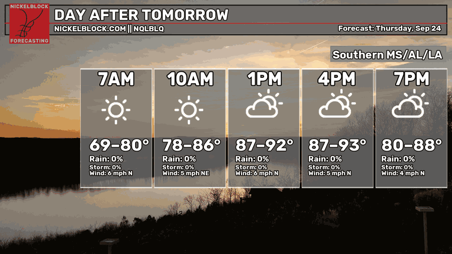
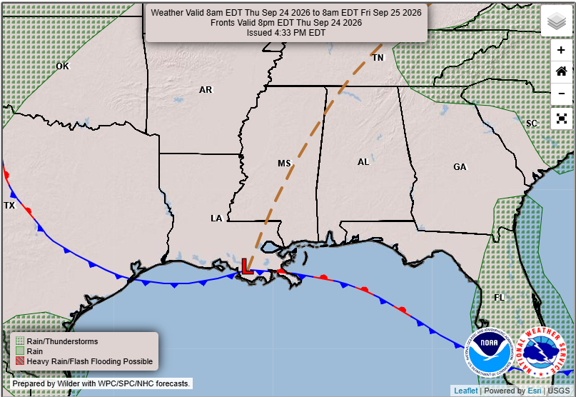
Thursday is looking like another mostly sunny and dry day across the region, with highs reaching the lower 90s for most areas. The cold front will have moved through by this point, bringing in northerly winds and noticeably lower humidity. While temperatures will still be hot, the drier air should make it feel a little more comfortable outside compared to the past few days. Upper-level ridging will also help keep rain chances near zero throughout the day!
Extended Local Outlook
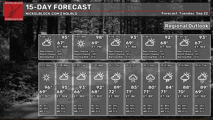
Looking ahead, the hot and mostly dry weather will continue through the weekend and into early next week, with highs generally in the lower to mid 90s. By the middle of next week, we could finally see a change in our pattern as rain chances begin to increase and temperatures gradually cool down. Some of the latest guidance suggests a wetter stretch of weather heading into the first weekend of October, with highs potentially dropping into the 80s. There is still some uncertainty this far out, but it looks like we may finally get a break from the persistent heat!