The Setup
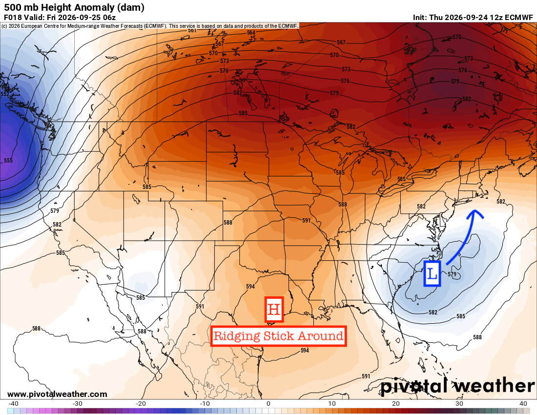
Ridging is still overhead across the Gulf Coast, and that will keep the weather mostly dry through the weekend. Winds turning out of the north and northeast are bringing in some drier air, with dewpoints dropping into the 60s. It’ll still be warm, with highs in the upper 80s and lower 90s, but the humidity won’t be quite as noticeable. A stray shower is possible near the coast late tonight into early Friday, though most of us will stay dry.
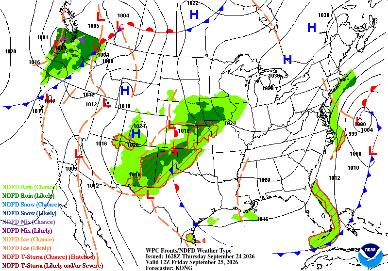
You can see the ridge on the map above, while the surface chart shows a weak trough across parts of southern Louisiana and Mississippi. Despite that trough, there isn’t much support for rain with the ridge still in place. Temperatures climb back into the low to mid 90s by Sunday and stay there early next week.

Tomorrow’s Forecast: Friday, September 25th
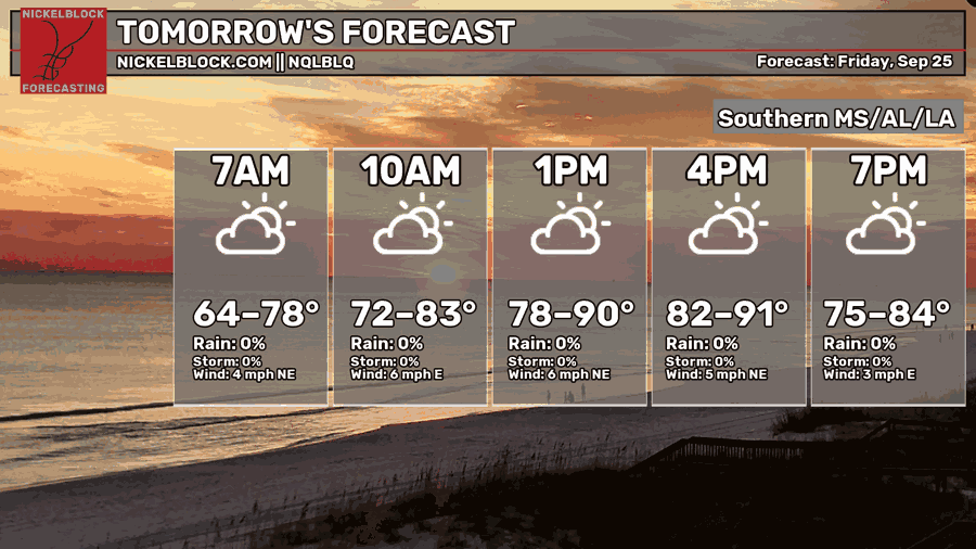
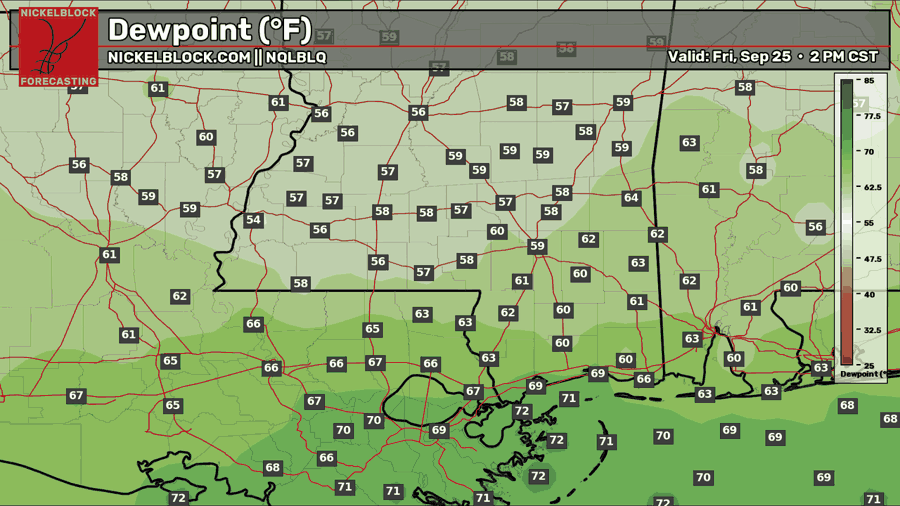
Friday is looking like a pretty nice day across southern MS/AL/LA. We’ll start in the 60s in many inland spots, with 70s closer to the coast. Expect a mix of sun and clouds through the day, with temperatures climbing into the upper 80s to lower 90s by the afternoon. Most of us will stay dry, though a stray shower can’t be ruled out near the coast early in the morning.
The northeasterly wind will help bring in some drier air, which you can see on the dewpoint map. Inland dewpoints drop into the upper 50s and 60s Friday afternoon, while it stays a bit more humid near the coast. So it’ll still be warm, but it should feel a little more comfortable than it has lately!

Saturday’s Forecast: September 26th
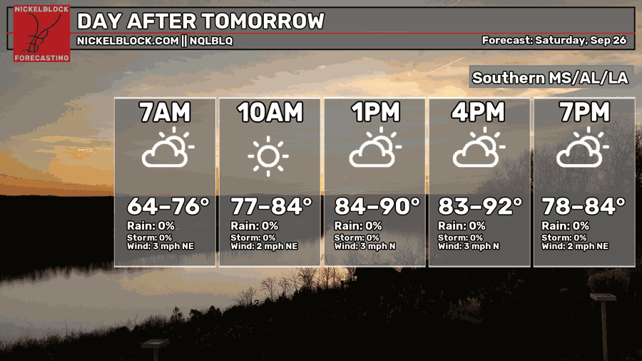
Saturday looks like another dry day across southern MS/AL/LA, with a mix of sun and clouds and plenty of sunshine by late morning. The day starts in the mid 60s for some inland spots, while areas closer to the coast stay in the 70s. By the afternoon, temperatures climb into the upper 80s to lower 90s.
There’s no rain showing up in the forecast, so if you have plans outside, the weather should cooperate. We’ll have a light north to northeast wind, and that slightly drier air should stick around for one more day.
Extended Local Outlook
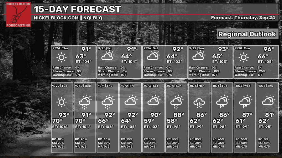
Sunday looks like one more dry day, but the heat starts to creep back up. Highs reach the low to mid 90s, with plenty of sun through the afternoon.
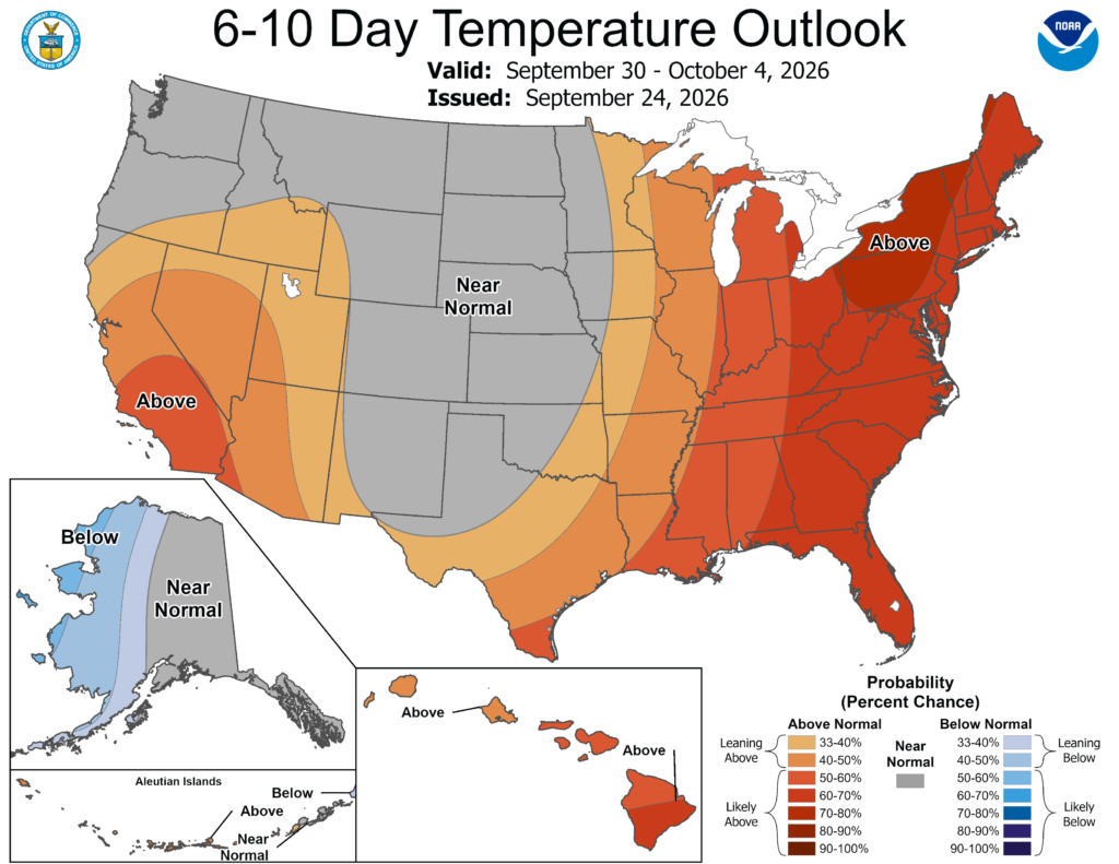
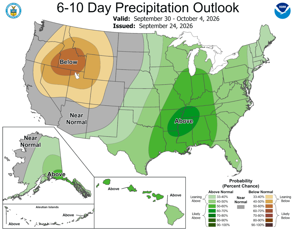
That warmth sticks around to start next week, with Monday and Tuesday looking to stay in the 90s. Winds turn more southeasterly later Monday, bringing moisture back into the area. By the middle to latter part of next week, we may finally have a shot at our first real front of the season. The models still disagree on how it plays out, so I wouldn’t count on a cool down just yet. For now, expect rain chances to increase later in the week as that boundary gets closer.