The Setup
Hey everyone! I am covering Noah’s forecasts while he is enjoying his honeymoon with his wife! Nick may throw a few forecasts out during his time off as well, so it’s just us two for now! For this week, we’re mainly dry for the beginning and middle of the week, as we’re under mostly dry, northwest flow with no big rainmakers nearby. As the week ends and into the weekend, remnant moisture along with a trough from the Southwest will bring the threat of very heavy rain. It’s a complex setup, so I’ll be sure to update you all each day. I’ll also have some more info further down in this post.
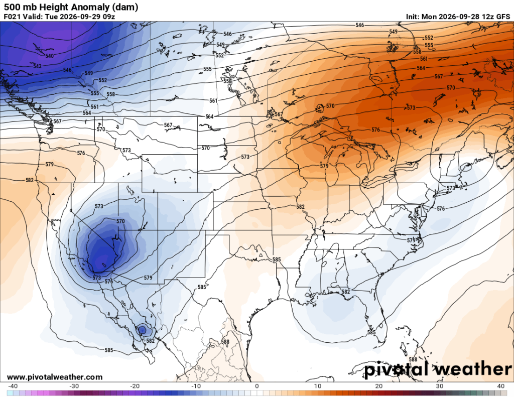
As for tomorrow’s setup, we’re under a weak trough, with a ridge of high pressure just to our west. A weak warm front will settle right overhead, which won’t bring any rain to our area, but will bring a humidity gradient to different sections of our viewing area.

Tomorrow’s Forecast: Tuesday, September 29th
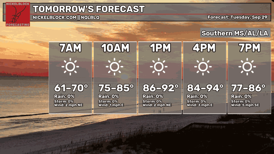
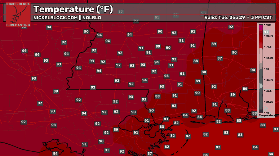
We’ll see abundant sunshine tomorrow with relatively calm winds. High temperatures are still in summer mode, in the lower 90s for most on the mainland, and 80s for those right on the coast. Relative humidity and overall moisture is fairly low tomorrow, so there isn’t much of a chance of any rain throughout the day.
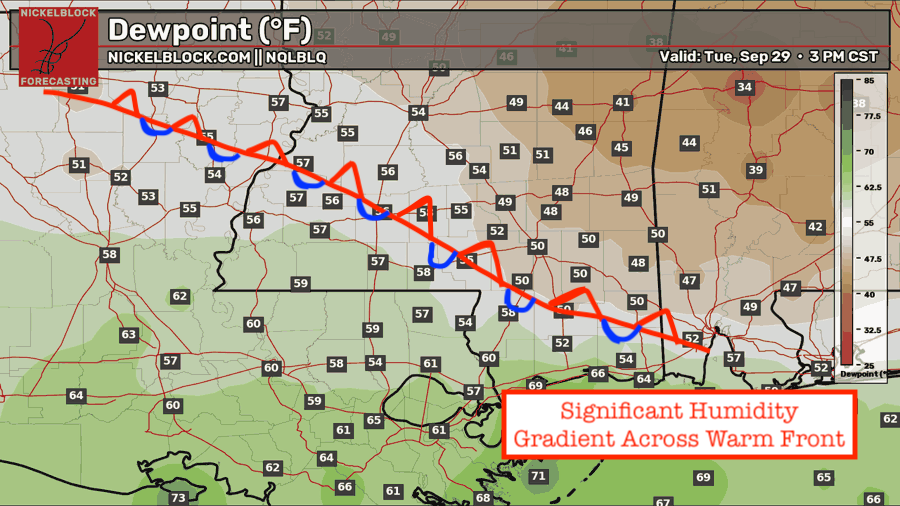
Something cool to look at for tomorrow is the dewpoint map. You can see that we will have more humidity and higher dewpoints below the warm/stationary front and less humidity and lower dewpoints above the front. The reason is that there are two airmasses that are running into eachother, the dry continental air from the north trying to move south, and the moist tropical air from the south trying to move north. So, some areas will be more humid than others tomorrow.

Wednesday’s Forecast: September 30th
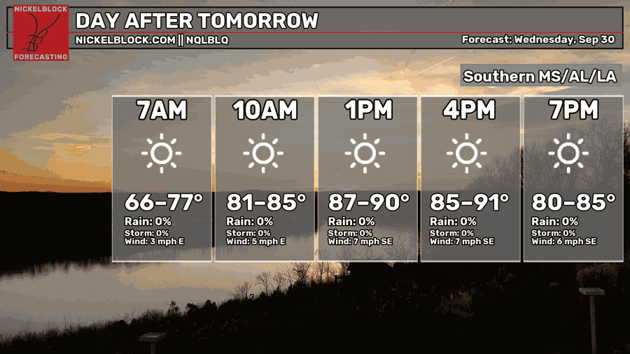
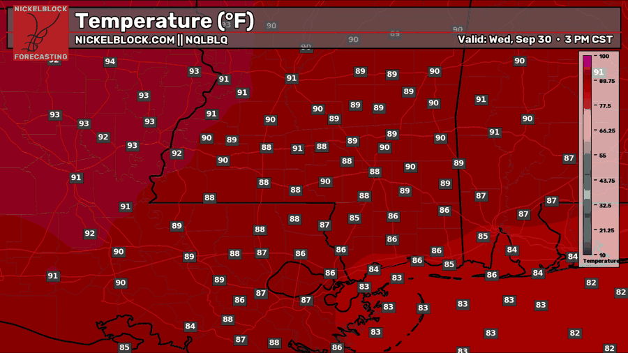
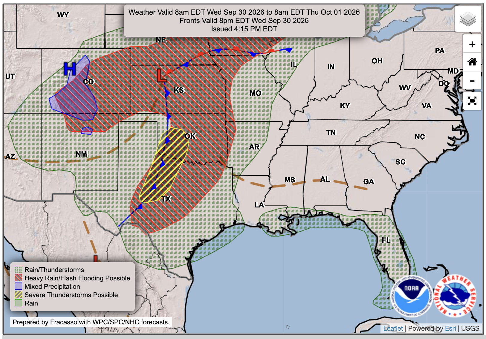
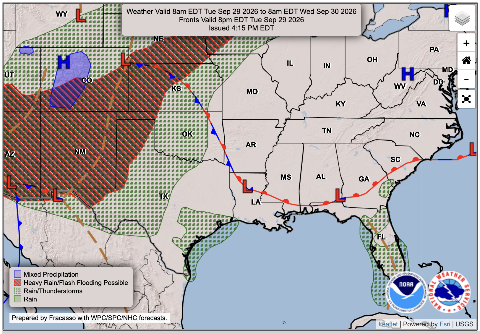
Wednesday is a very similar to Tuesday with lots of sunshine. The only difference is that the front will move northward, bringing in the more humid airmass from the Gulf and making it feel more humid for everyone this time. Good news is that high temperatures look a few degrees lower than Tuesday, sitting in the upper 80s or near 90. As the WPC shows, there is a chance of some isolated rain or thunderstorms near the coast and in southeastern Louisiana, as that moisture moves in, but it’s a mostly dry day even for that area.
Extended Local Outlook
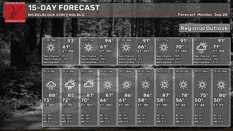
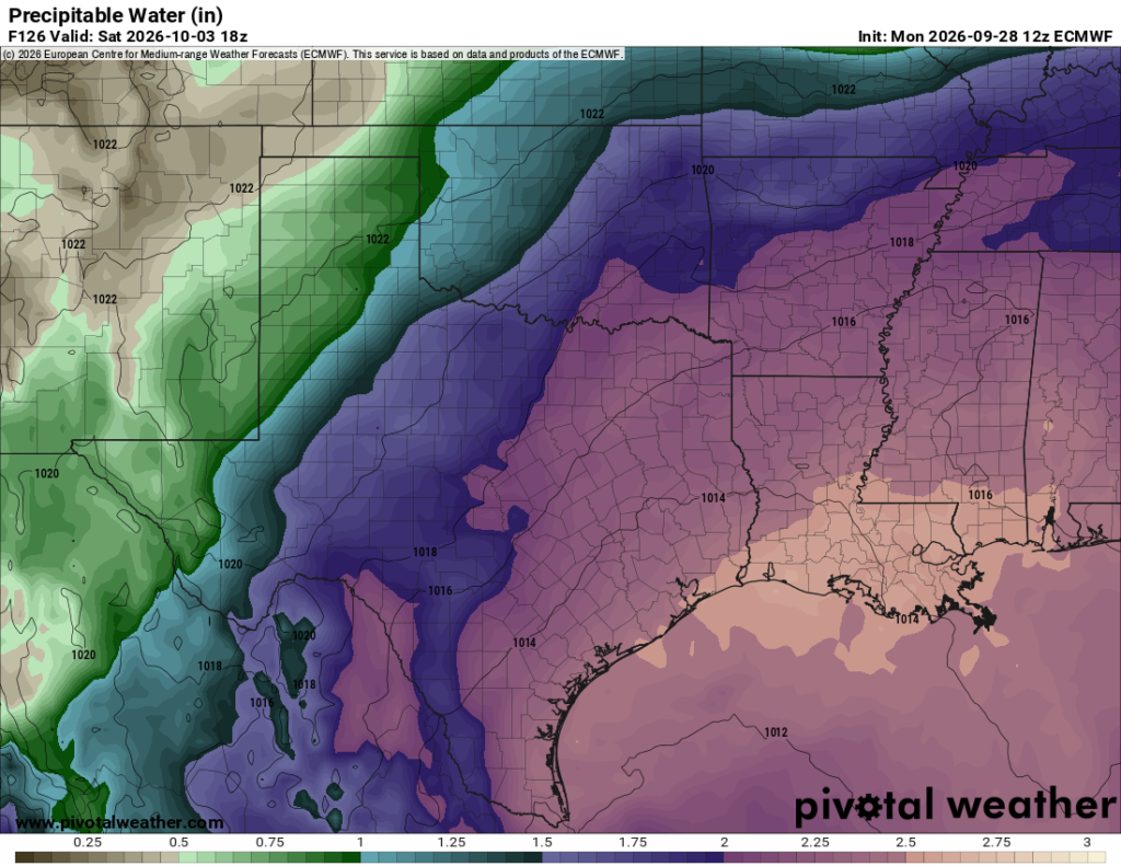
Thursday is our last day of dry weather before the weekend rain arrives. Rain chances increase for Friday, and Saturday and Sunday look to be washouts, as of right now. The WPC is already is showing at least 2-4 inches of rain for the area and some flash flood potential. Just look at those precipitable water amounts shown by the Euro for Saturday afternoon (2.5 + inches). Note that this doesn’t show the amount of rainfall, it shows the amount of water in the atmosphere ready to be let go/precipitated.