The Setup
Hey everyone! I hope you all enjoyed your Tuesday! The forecast remains pretty much the same compared to last night’s. I thought I’d show the 500mb temperature, height, and wind map for tomorrow to show the current setup. There is an area of troughing and low pressure over the Four Corners region, causing a significant flood threat for the central and southwest portions of the country. Our area is under an area of high pressure and ridging, which is directing the mid-level airflow to come from the north, northeast, allowing for mostly dry air to filter in.
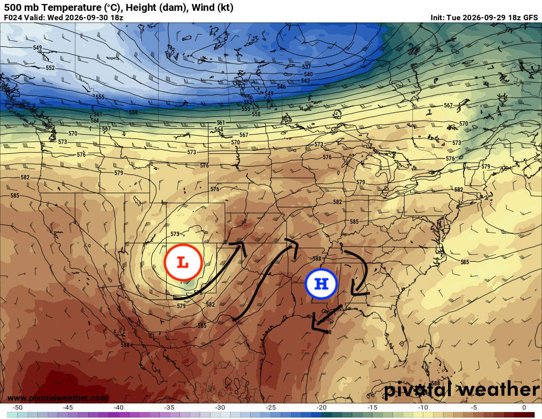
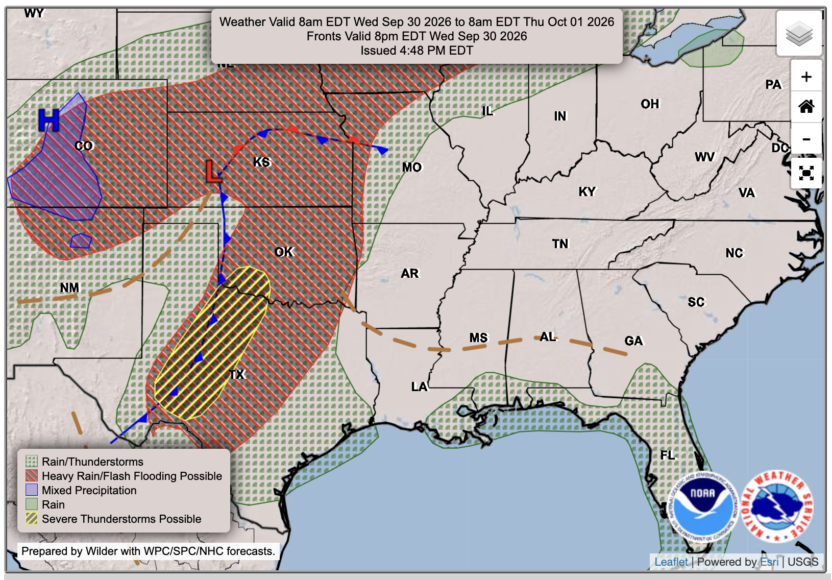
Look at that big mess over to our west… There’s a classic low pressure and frontal system setup taking place, bringing a huge flash flood threat, due to the remnant moisture from Huricane Polo moving into the U.S.. Some severe thunderstorms are possible from central Texas to southern Oklahoma, and even some mixed precipitation or snow is possible in the mountains in Colorado! This system will move eastward by the weekend, moving the ridge to our east, allowing for a return of moist, southerly flow by the end of the week.

Tomorrow’s Forecast: Wednesday, September 30th
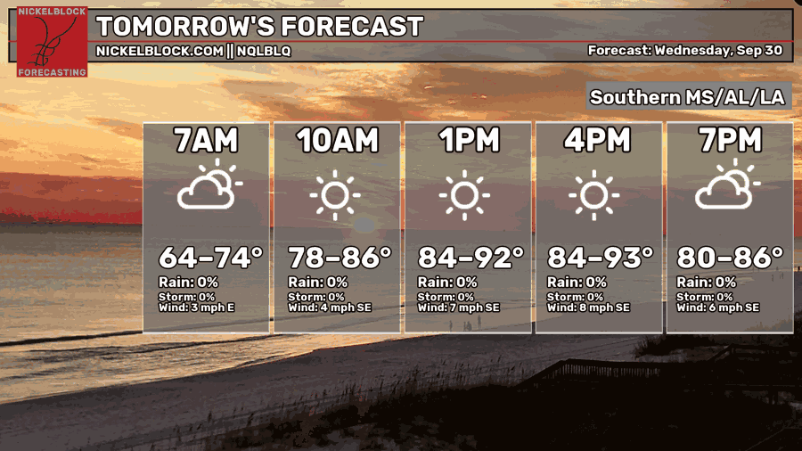
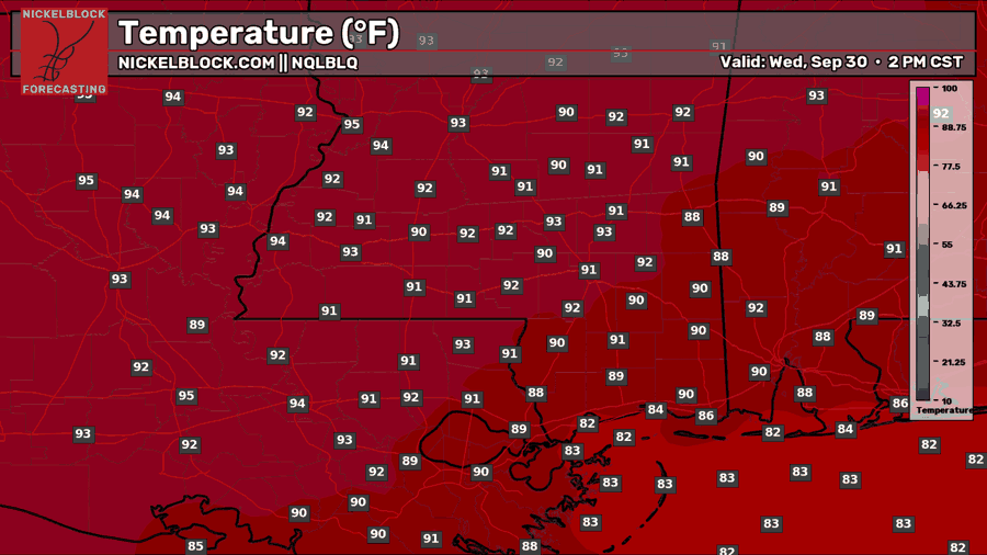
A mostly sunny and dry day is in the forecast for tomorrow, Wednesday. Highs will reach the lower 90s and 80s for those along the coast. As some Gulf moisture tries to come onshore, a few isolated popup showers or storms are possible along some of our most southern points, but most will stay dry for most of the day.

Thursday’s Forecast: October 1st 🎃
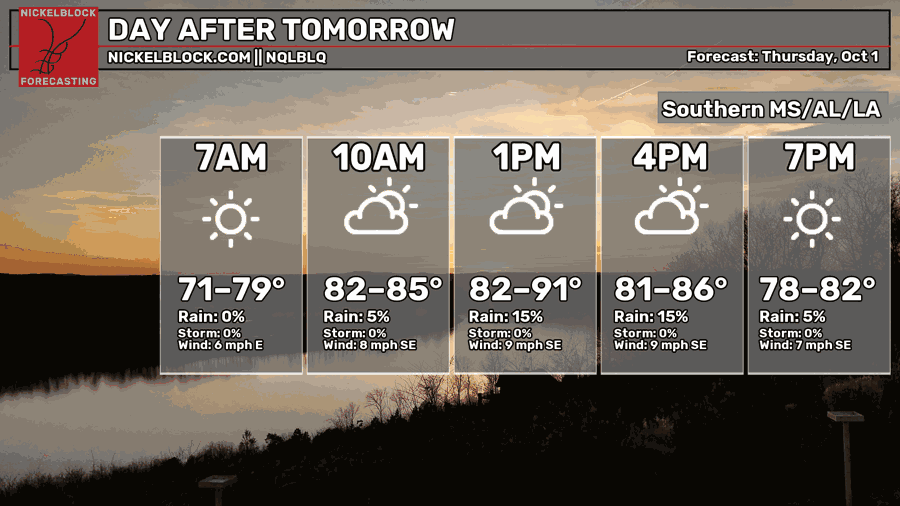
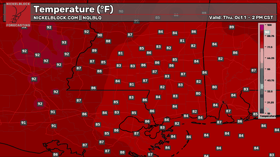
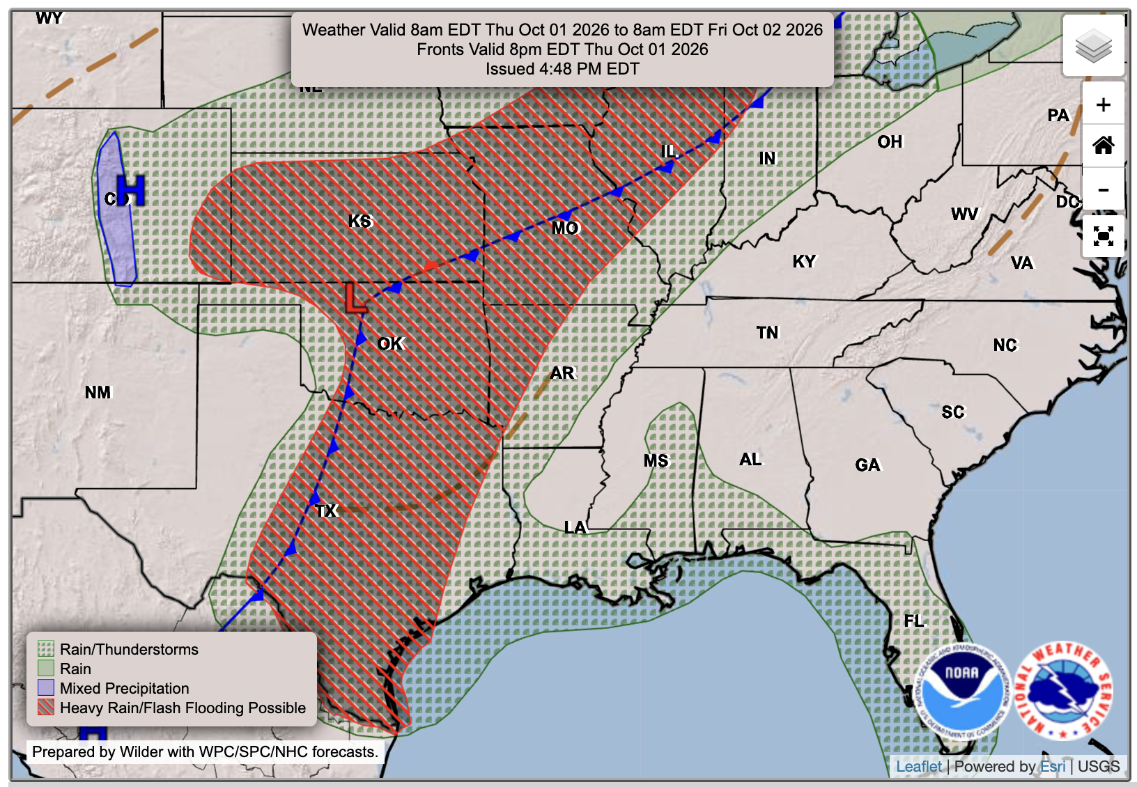
Spooky season officially starts on Thursday, as it will be the first day of October! While temperatures might be down a few degrees than previous days, it will still feel very hot, as humidity will be on the rise as our flow becomes even more southerly. There will be some scattered showers throughout the day in the area, though no thunderstorms are currently expected.
Extended Local Outlook
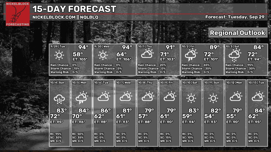
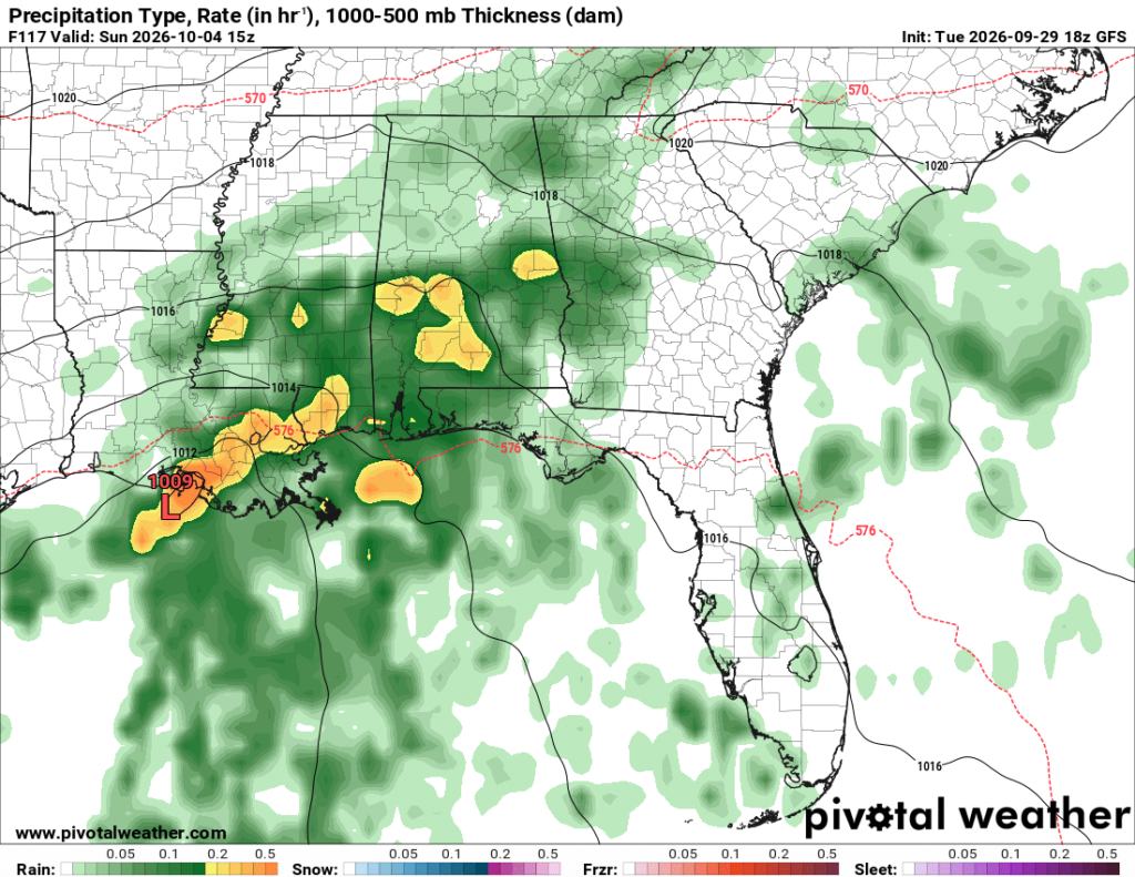
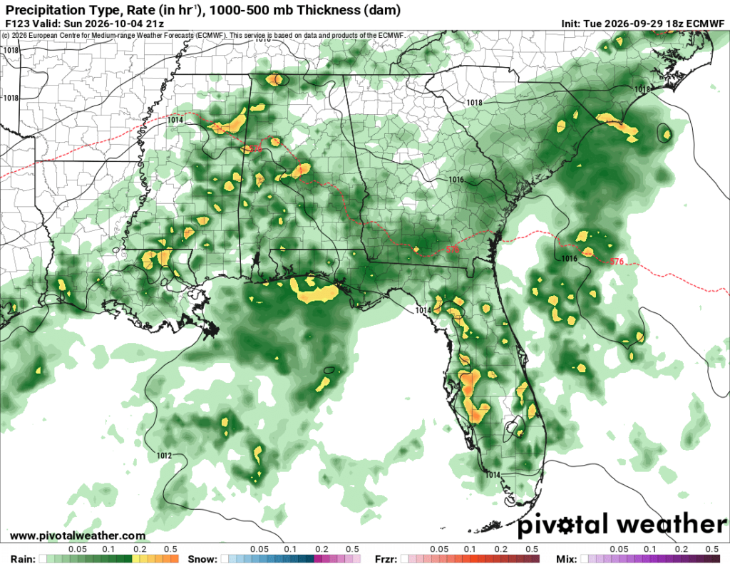
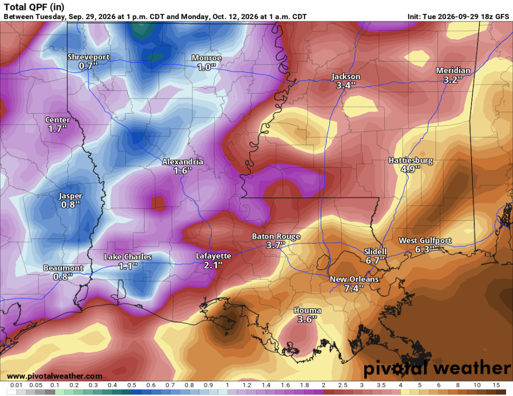
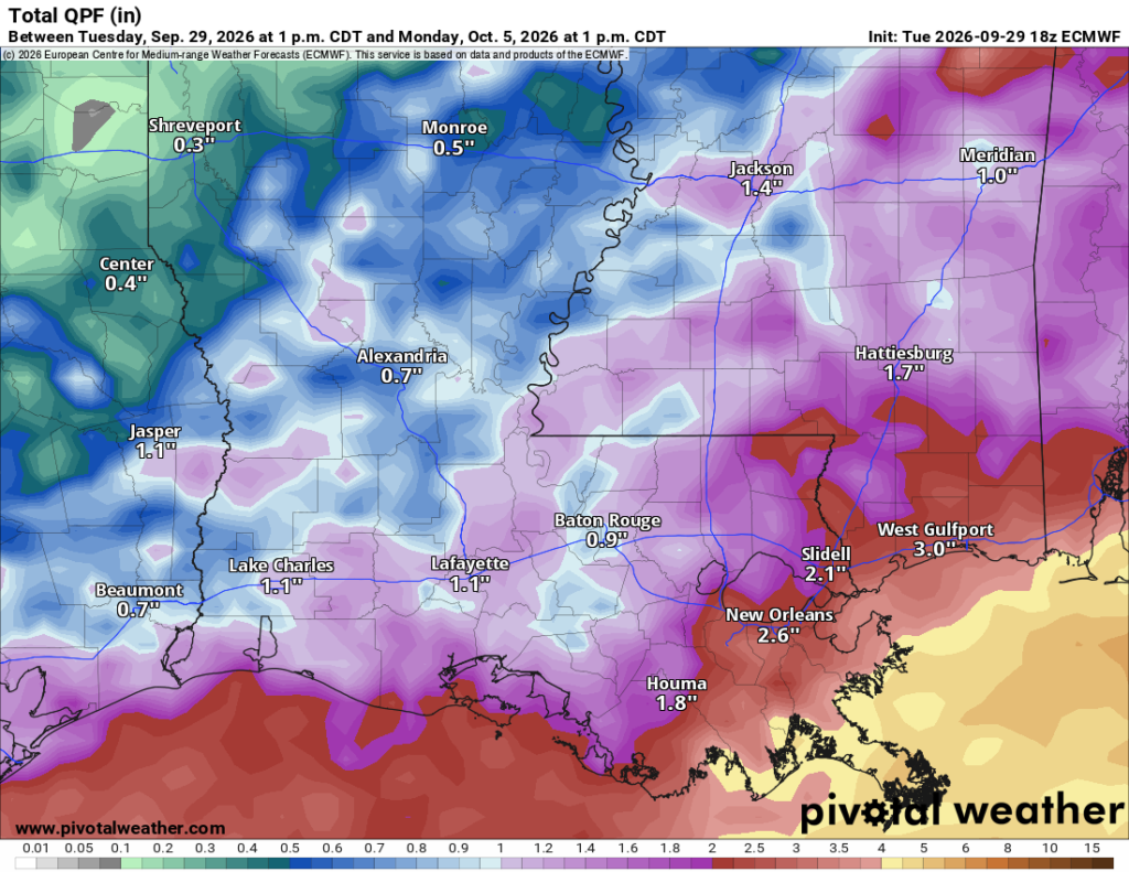
Rain chances increase on Friday, with a higher chance of more numerous rain showers and storms throughout the day. The most widespread rain and storms still looks to be on Saturday and Sunday, with several inches of rain and flash flooding possible. The GFS and Euro both are in agreement that we will see a decent amount of rain, but they disagree on the totals, which is to be expected 4-5 days away. I will keep you all updated as we get closer, but expect a rainy weekend with cooler temperatures.


You need to make your images where they can be enlarged.