Current Conditions
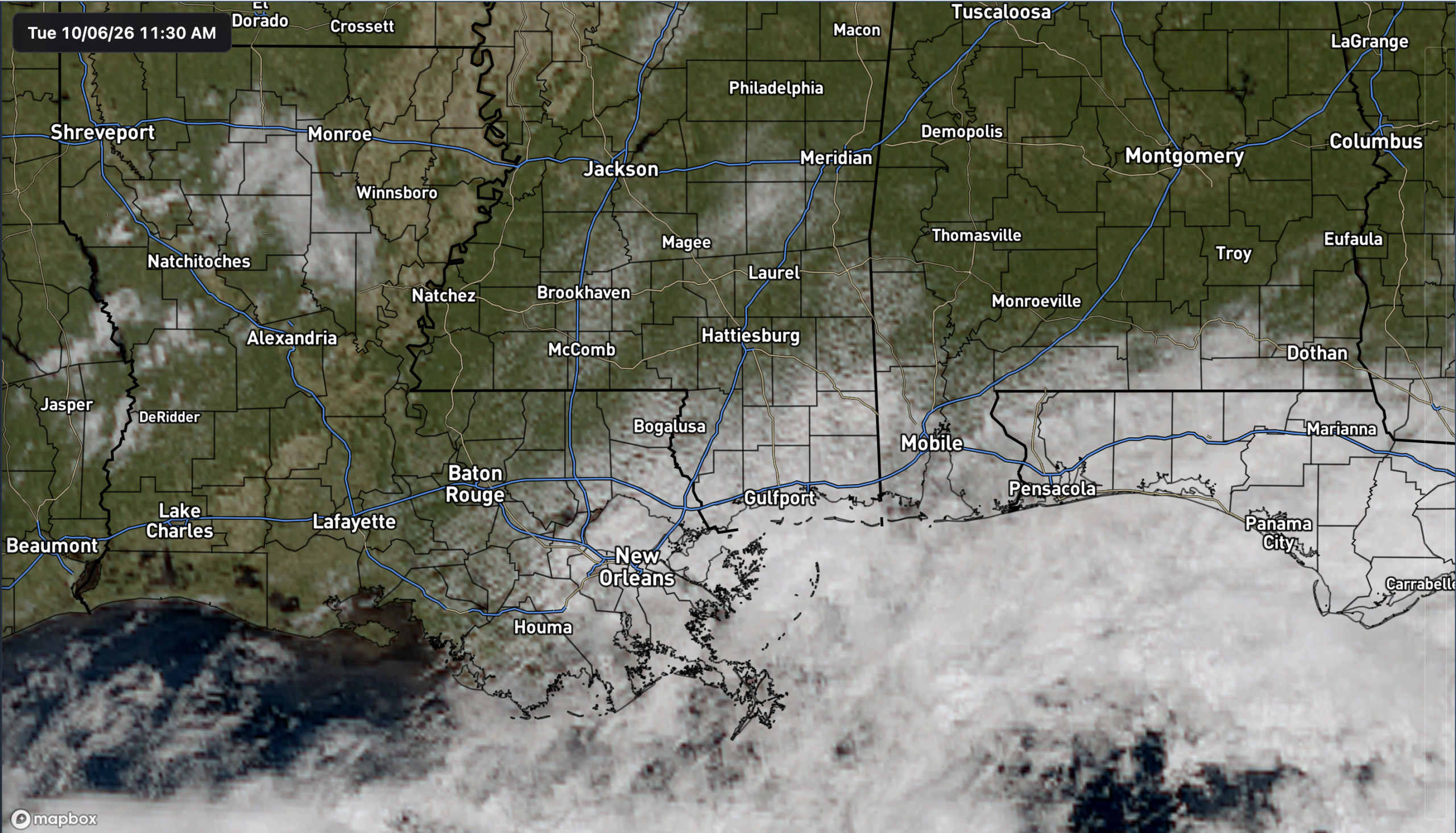
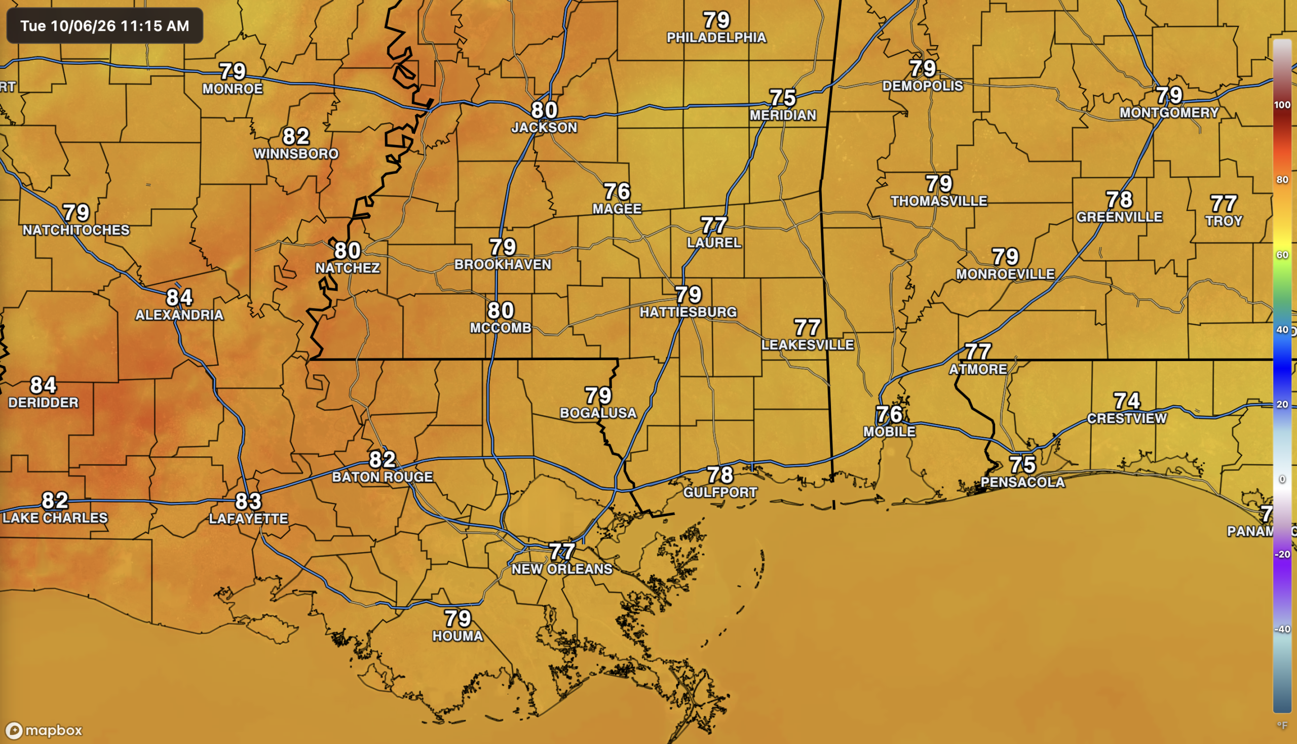
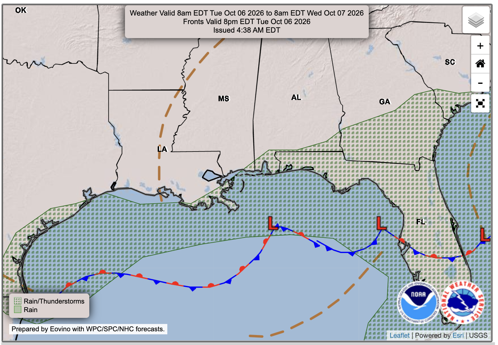
We’re mostly dry across the area this afternoon, with showers mainly staying over the northern Gulf. A few could make it onshore today, but most places should stay dry. Cloud cover is greatest closer to the coast, with more breaks in the clouds farther inland. Temperatures are currently in the mid to upper 70s and lower 80s.
The Setup
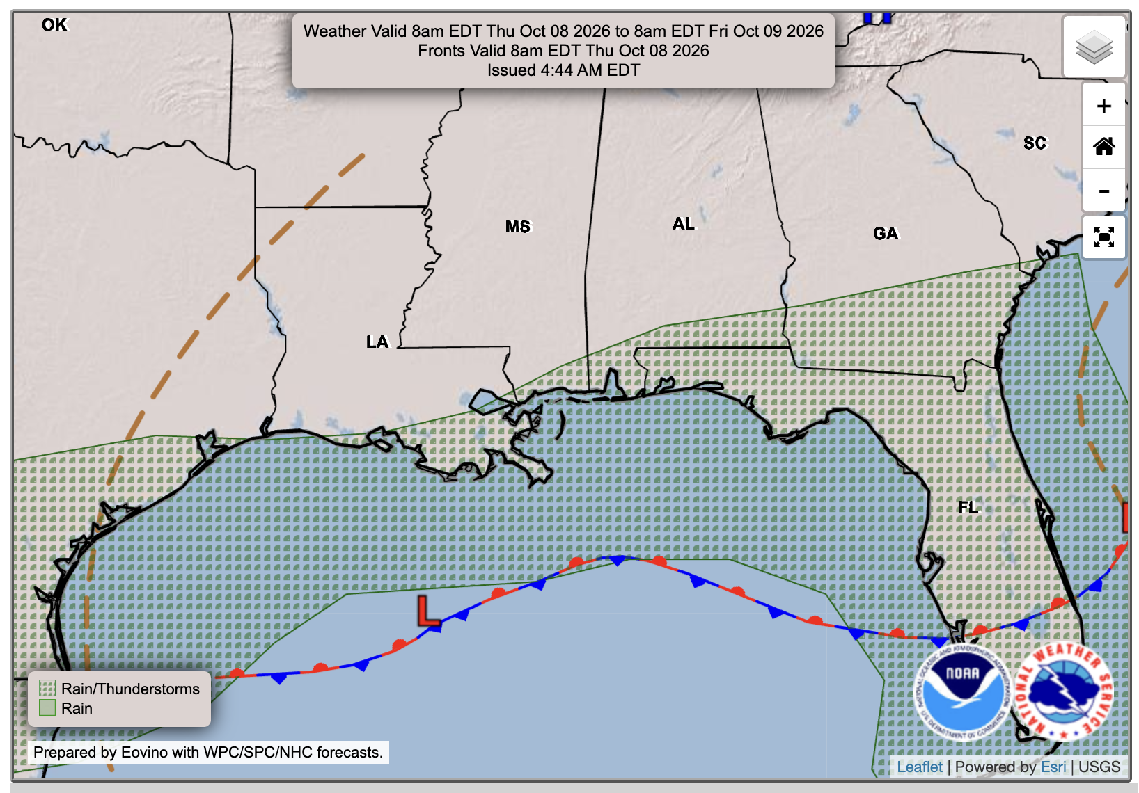
A stalled front over the northern Gulf is keeping most of the showers near the coast and offshore. Northeasterly winds should keep much of the area dry over the next few days, with more sunshine returning. Meanwhile, conditions in the southern Gulf are becoming favorable for tropical development, so our attention will turn there as we head later into the week. I’ll have more on this down at the bottom of the post.

Today’s Forecast: Tuesday, October 6th
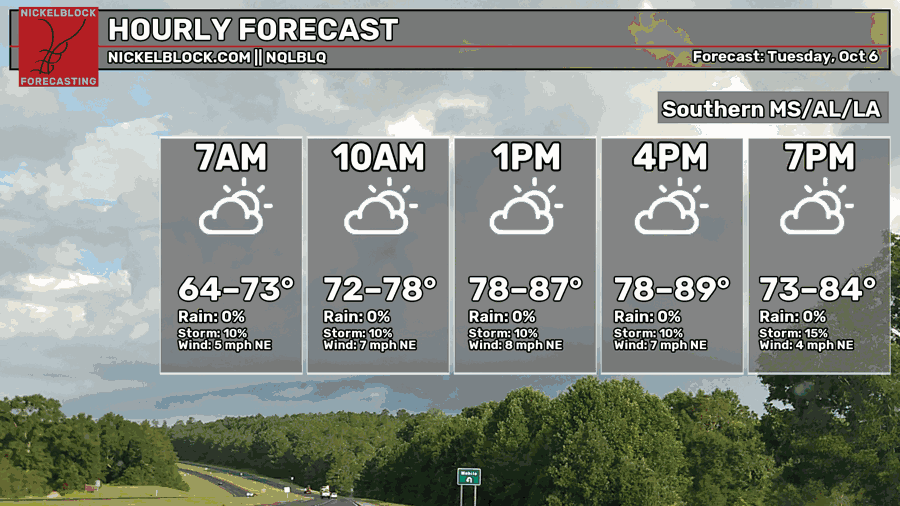
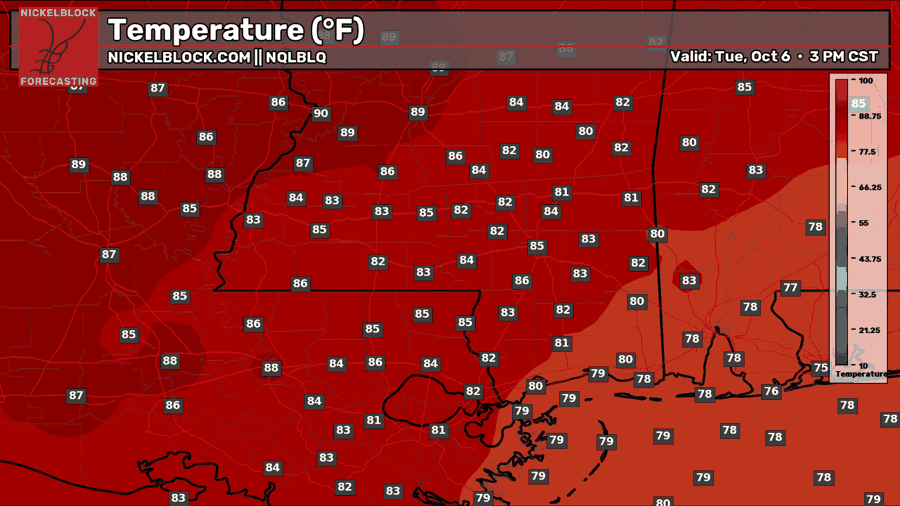
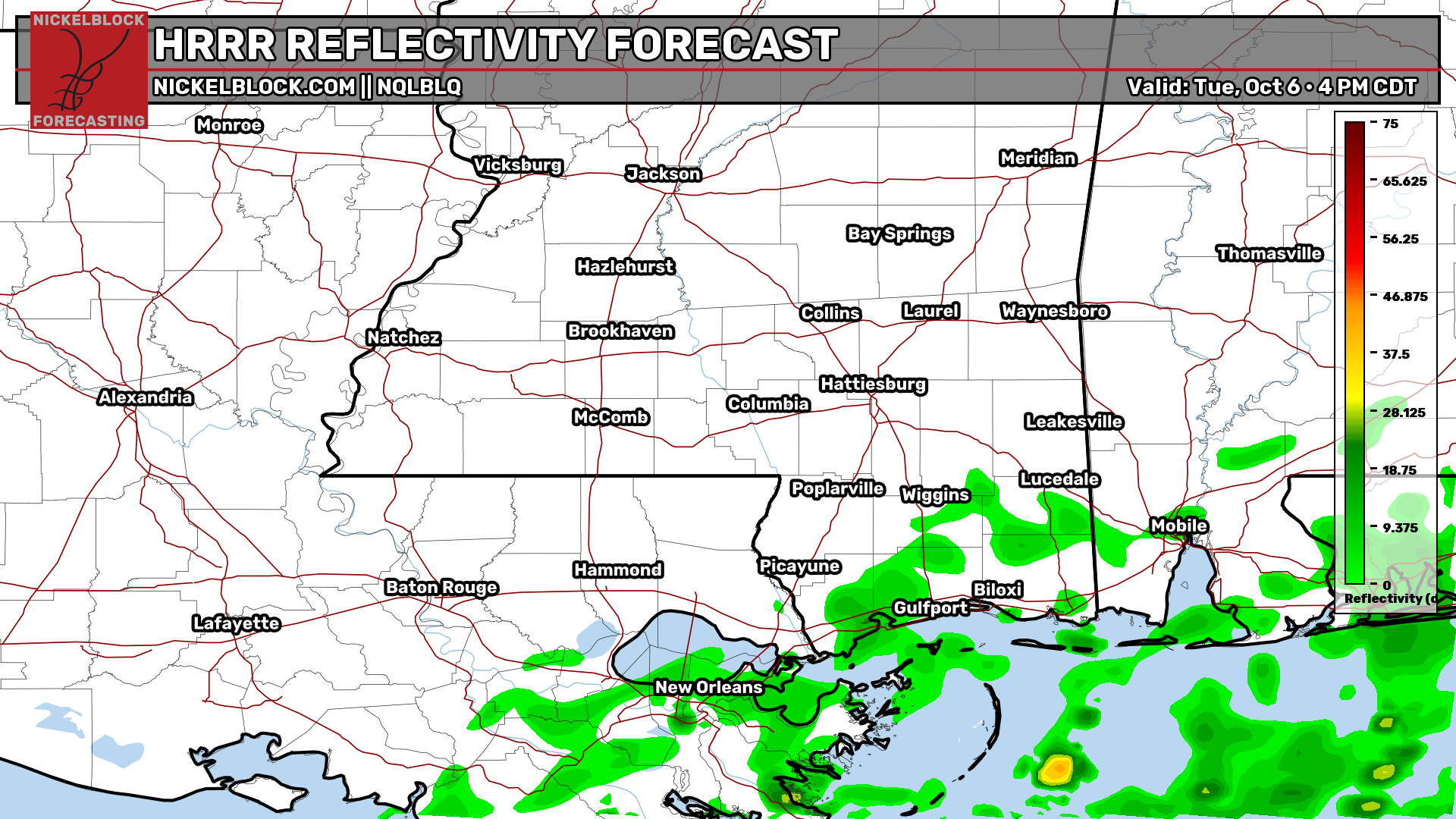
For the rest of today, expect a mix of sun and clouds, with temperatures topping out in the mid to upper 80s inland and upper 70s to lower 80s closer to the coast. A few showers could move onshore this afternoon, mainly around New Orleans, the Mississippi Coast, and Mobile, but most inland areas should stay dry. Winds will remain out of the northeast around 5-10 mph.

Tomorrow’s Forecast: October 7th
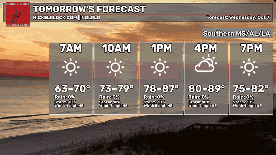
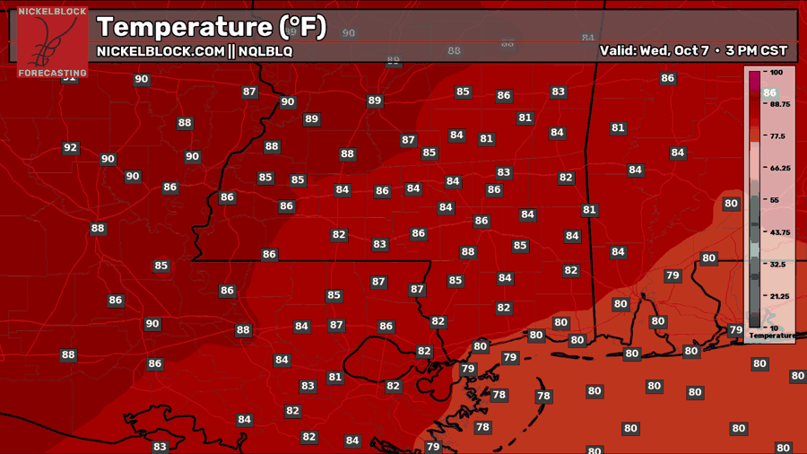
Tomorrow looks mostly sunny and dry for much of the area, with the stalled front keeping most showers over the Gulf. A stray shower is still possible right along the coast, yet again. Morning temperatures will start in the 60s to around 70 before warming into the mid to upper 80s inland and around 80 near the coast. Northeast winds will stay around 5–10 mph, keeping it a little less humid than if it were southerly winds.
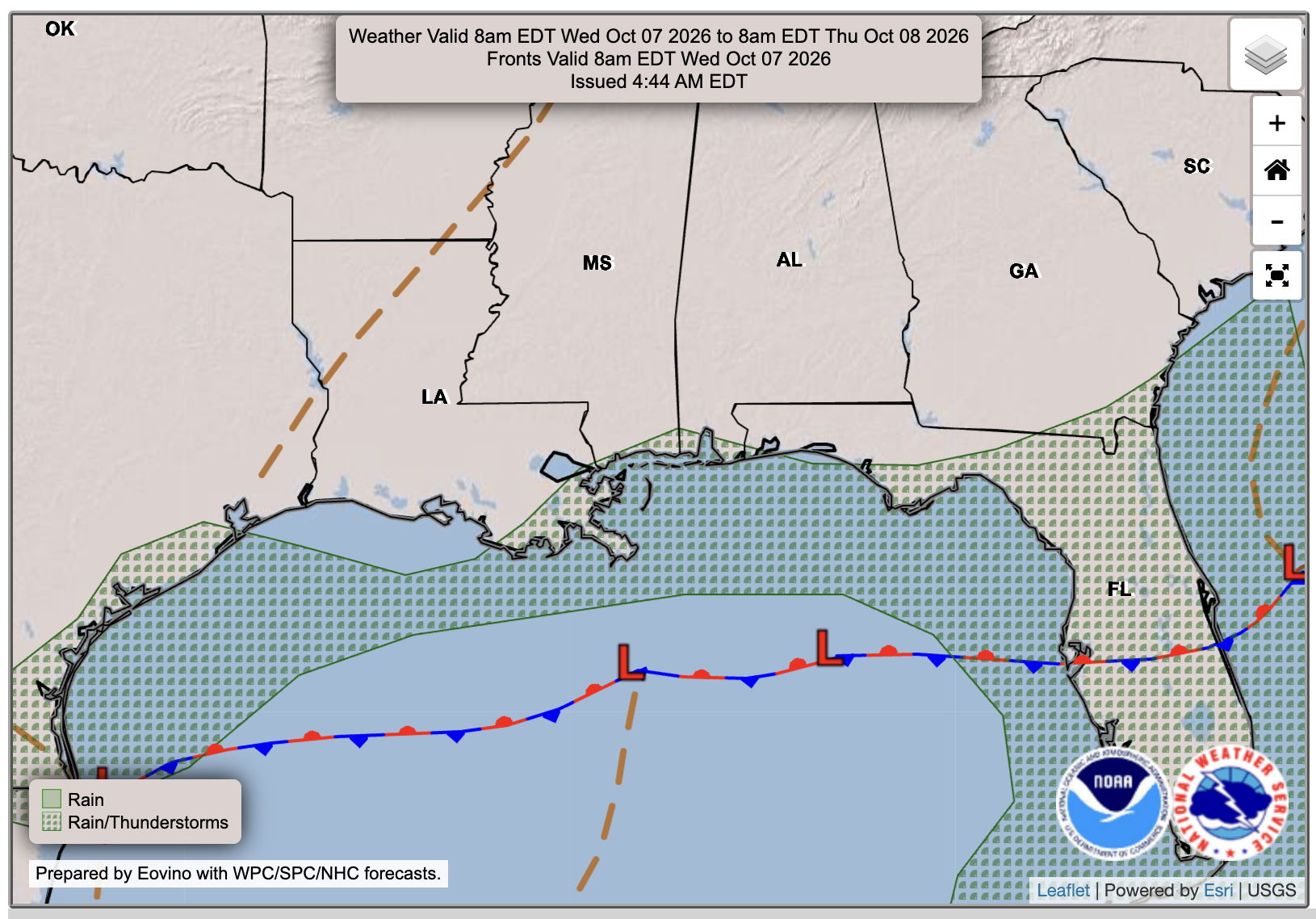
Thursday’s Forecast: October 8th
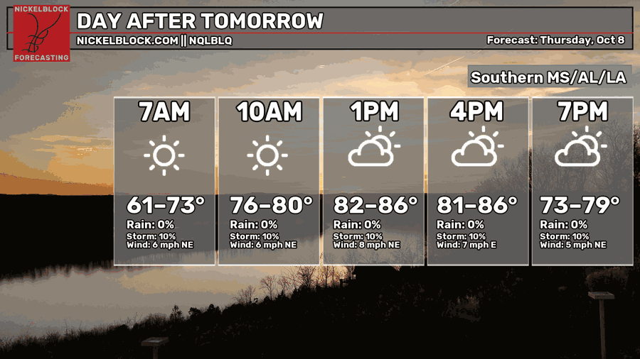
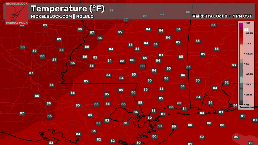
Thursday looks mostly dry inland, with sunshine early and a few more clouds during the afternoon. Highs will reach the mid to upper 80s, with lower 80s near the coast and less humidity farther inland. A stray coastal shower is possible, but most rain should stay offshore.
Extended Local & Tropical Outlook
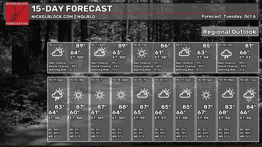
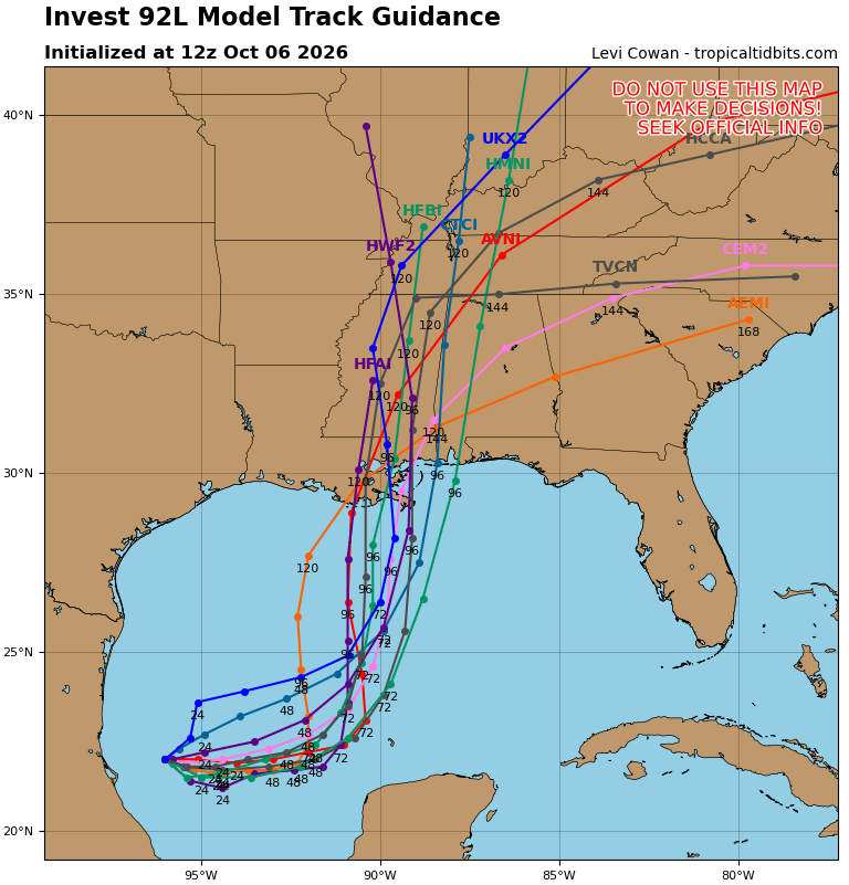
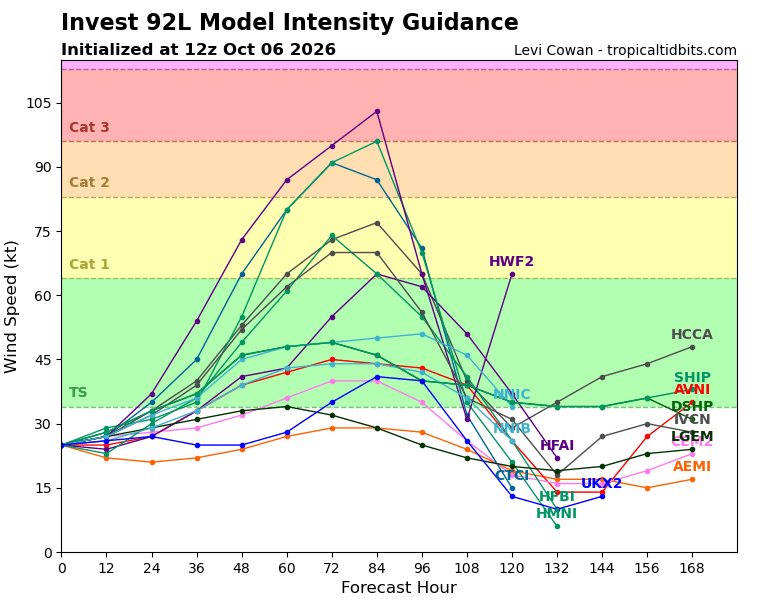
A quick update on Invest 92L: The system is showing signs of organization, and the NHC says a tropical depression is expected to form within the next day or so. It should turn north toward the northern Gulf Coast later this week.
What does this mean for us? Well, there’s still a lot of uncertainty, especially with how strong it gets. Wind shear could limit strengthening near the coast, but we can’t count on that just yet. Heavy rain and other tropical impacts are possible heading into the weekend.
If you’re in southern LA/MS/AL, now is a good time to check your supplies and review your storm plan. Stay prepared, and we’ll keep you updated as we get closer!