Current Conditions
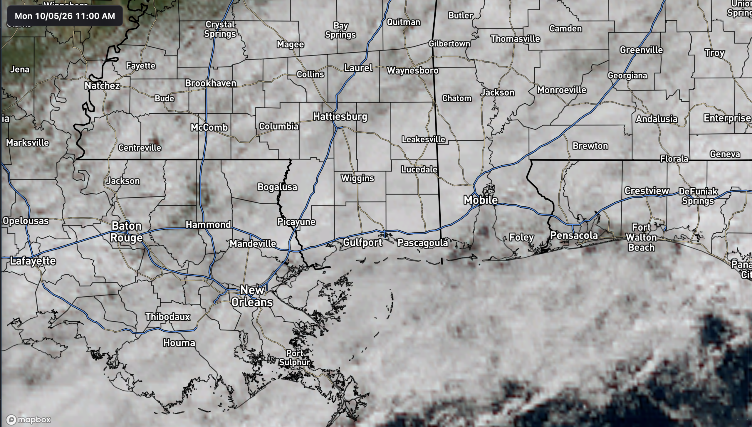
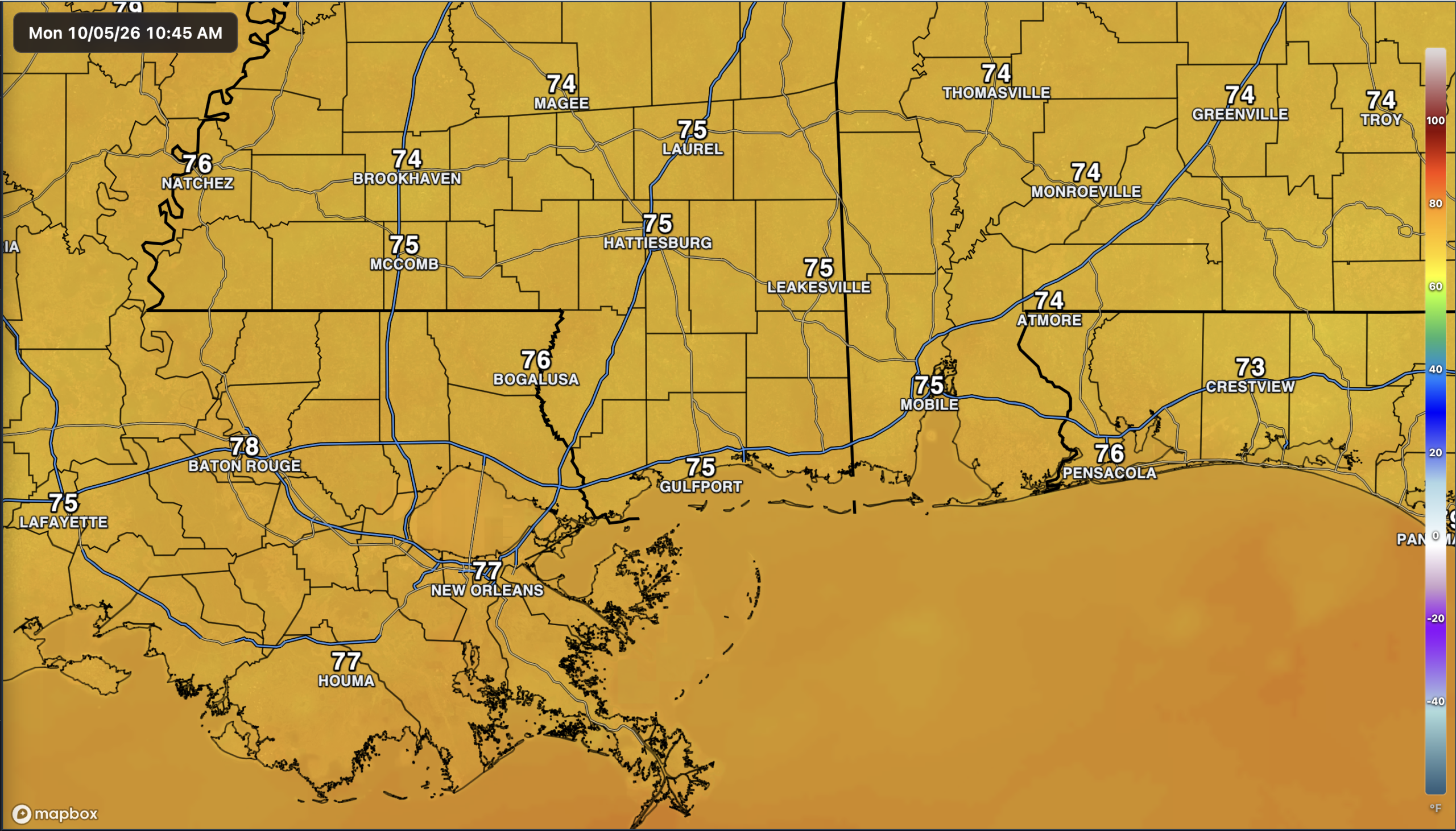
A few showers are out and about this morning in the area and there’s lots of cloud cover overhead. Temperatures are sitting in the mid-70s, warming up through the afternoon, but not by as much as recently.
The Setup
We’re past our rainy weekend finally, with areas seeing generally anywhere from 1-5 inches, as expected. We still have another day out ahead of a cold front, so we can see some scattered rain today as the front pushes through. By tomorrow, it should be out of our sights, though still fairly humid.
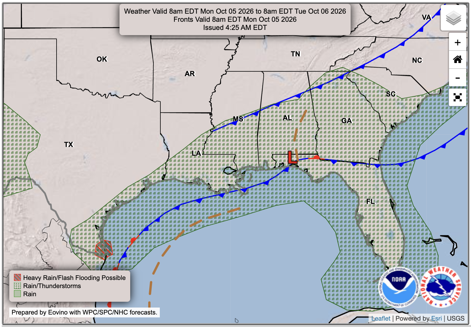

Today’s Forecast: Monday, October 5th
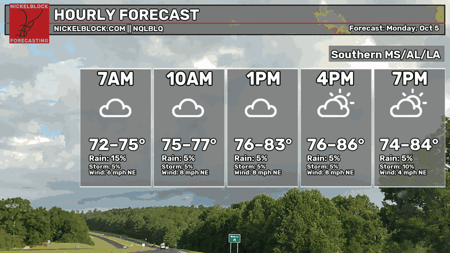
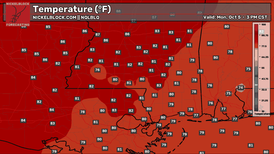
Today is a cloudy one, with not much sunshine heating up the ground. Temperatures will only reach the lower 80s for a change, bringing some much needed relief from the heat. As mentioned, there will be a few scattered showers around through the day. Dew points are still sitting in the 70s, so it’s still very humid out there. Winds could also gust as high as 20 mph today. Overall, a gloomy and damp day for the deep south.

Tomorrow’s Forecast: October 6th
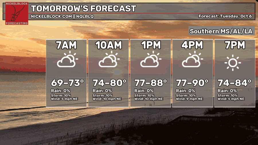
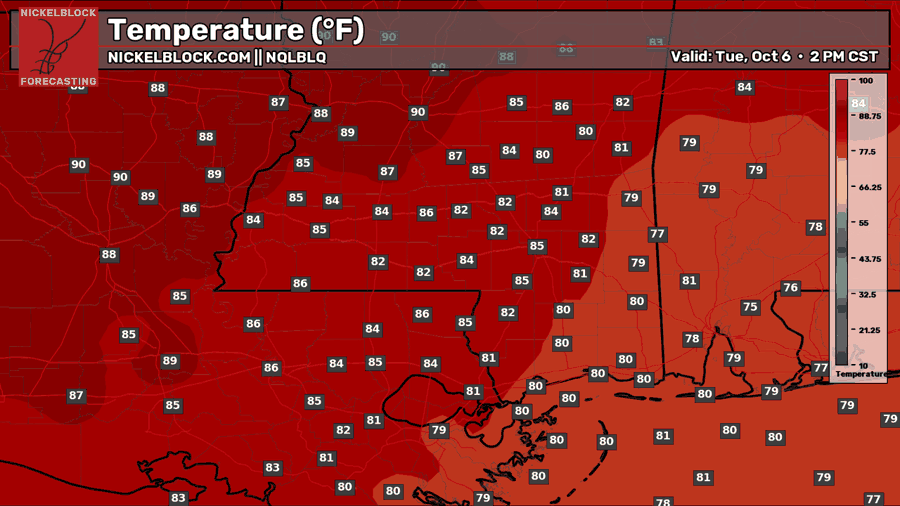
By tomorrow, the front pushes further south off the coast and we are replaced with northeasterly flow. The sun will finally come out, heating up temperatures back to the mid-80s. The closer northwest you go, the less clouds you will have, and the higher your temperature will be.
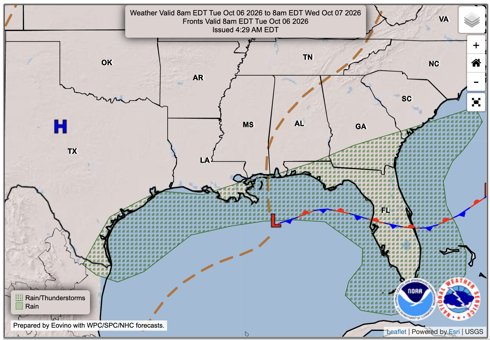
Some showers are still possible tomorrow, though its more focused towards the coast and in the open waters of the Gulf as the low pressure and trough is meandering there. Dew points will drop slightly into the 60s for much of the mainland, making it feel a little less humid tomorrow. Those towards the coast won’t feel the relief though, since dewpoints will stay in the 70s with the marine influence.
Wednesday’s Forecast: October 7th
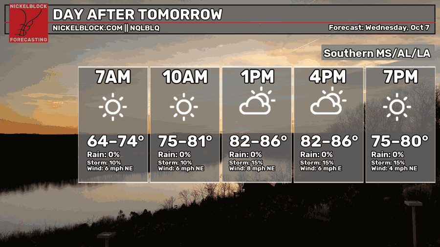
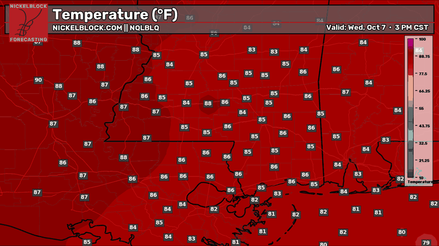
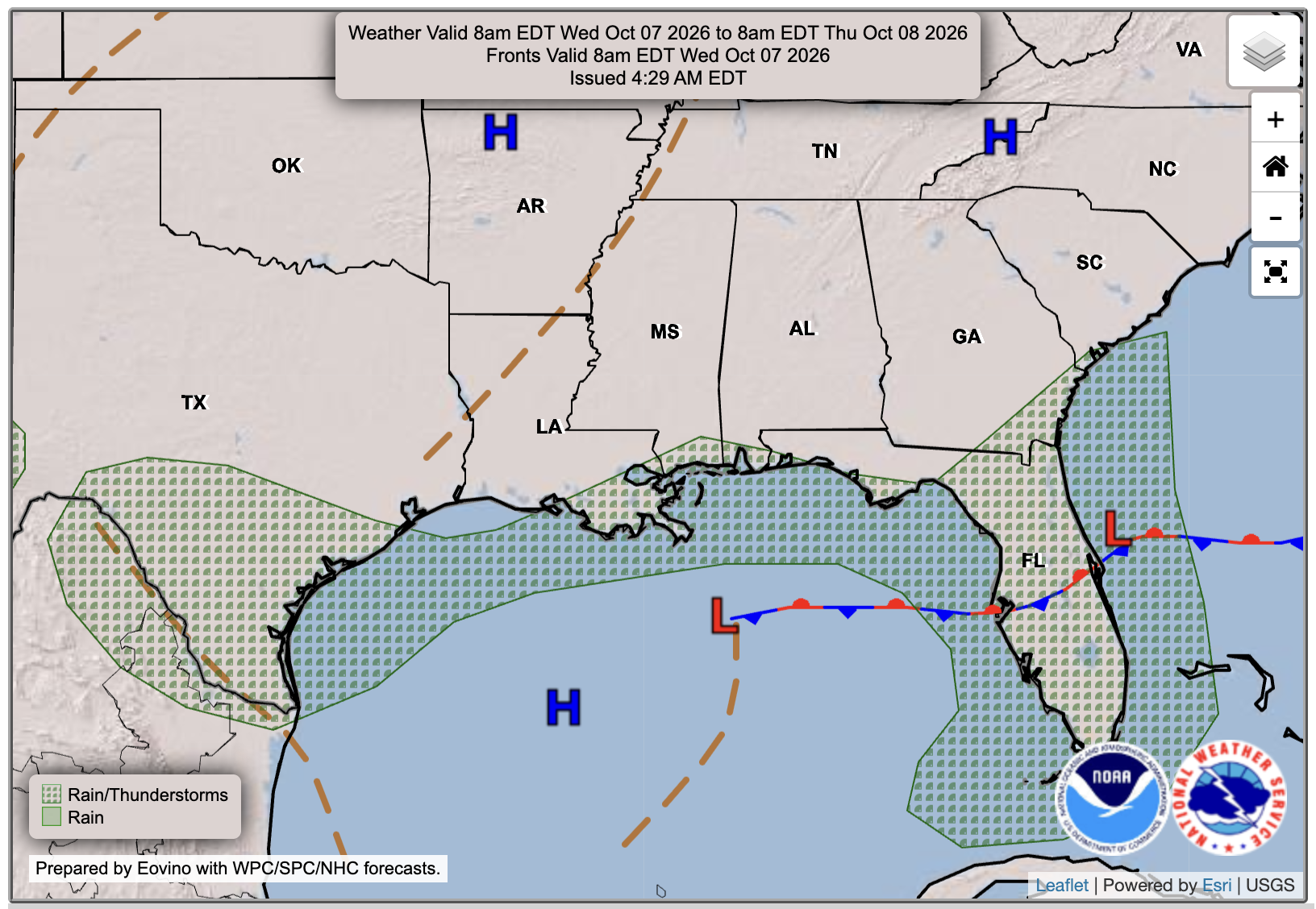
By Wedesday, the Gulf low and trough are still chilling out in the northeast Gulf, bringing a nice amount of rain to Florida. Our area will stay mostly dry with a mix of sun and clouds, but a stray shower is again possible close to the coast at anytime. Dew points and humidity will decrease even more on this day.
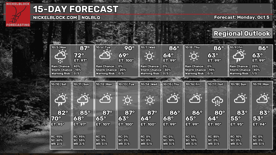
Extended Local & Tropical Outlook
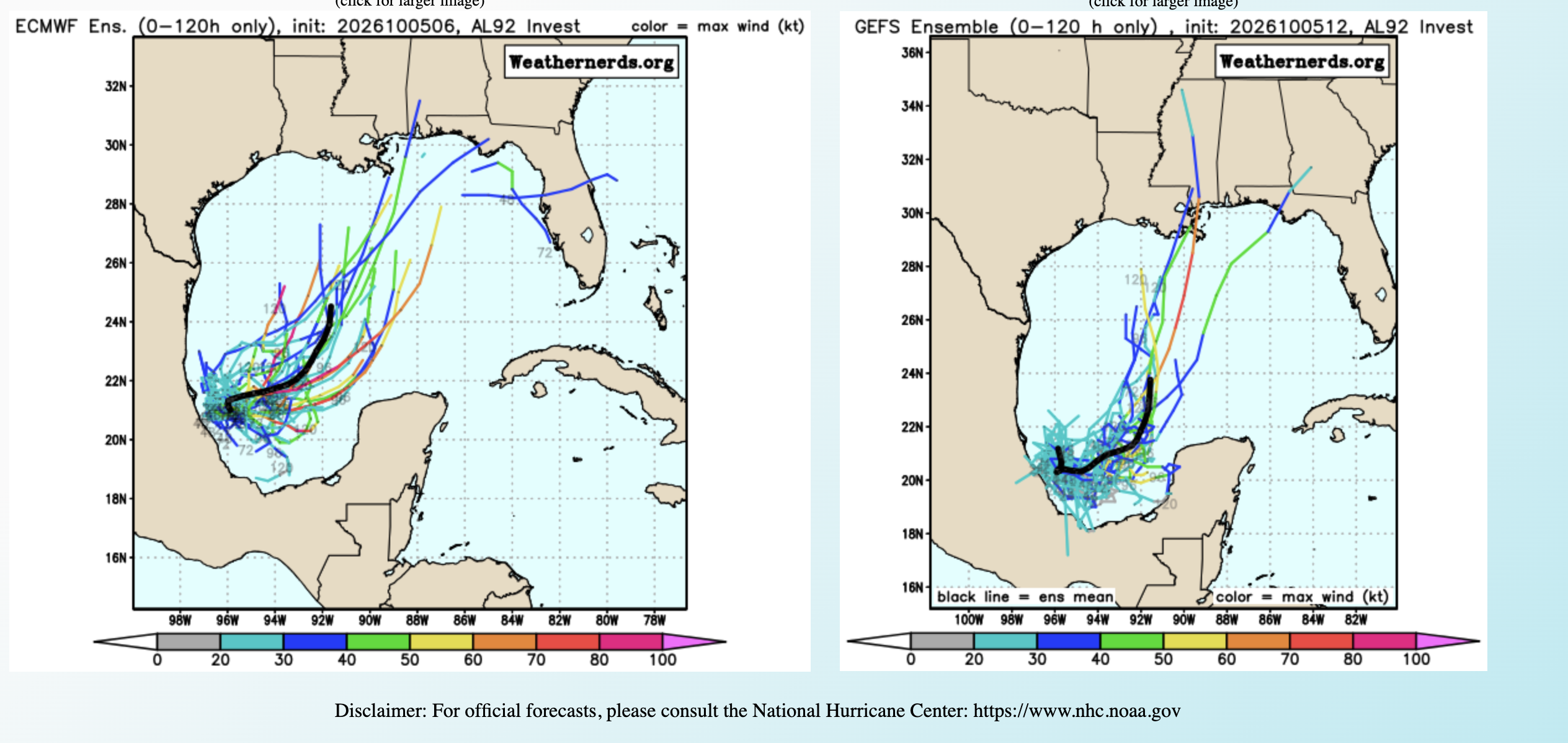
Now onto what everyone has seen in the news recently. The National Hurricane Center has issued an Area to Watch over the southwestern Gulf, with a high 70 percent chance of tropical formation in 7 days.
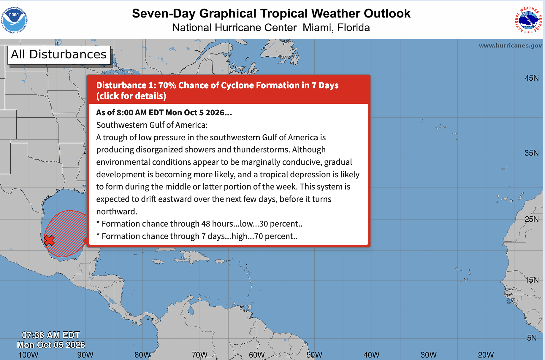
What does this mean for us? Well, we’re not entirely sure yet. A very broad area of low pressure is currently meandering in the southwestern Gulf. While there is a high chance for tropical development, conditions could limit strengthening to a tropical depression or tropical storm, for a few reasons.
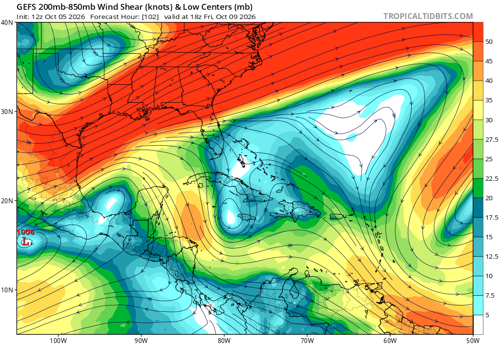
- There is a ton of wind shear in the northwestern Gulf, so as the storm tries to move northward, any organization could be ripped apart because of the hostile upper-level winds.
- The low-pressure system is still broad and disorganized, so it would need time to develop a tighter circulation before it could strengthen much. If it moves into stronger wind shear before that happens, it could struggle to organize further.
We’ll probably see another wet weekend ahead, though we are still 5-6 days out. Even though there is uncertainty, the chance of a hurricane or tropical storm moving towards the northern Gulf coast is looking more possible, so ensure you check back with us and the NHC for updates throughout the week.