Current Conditions
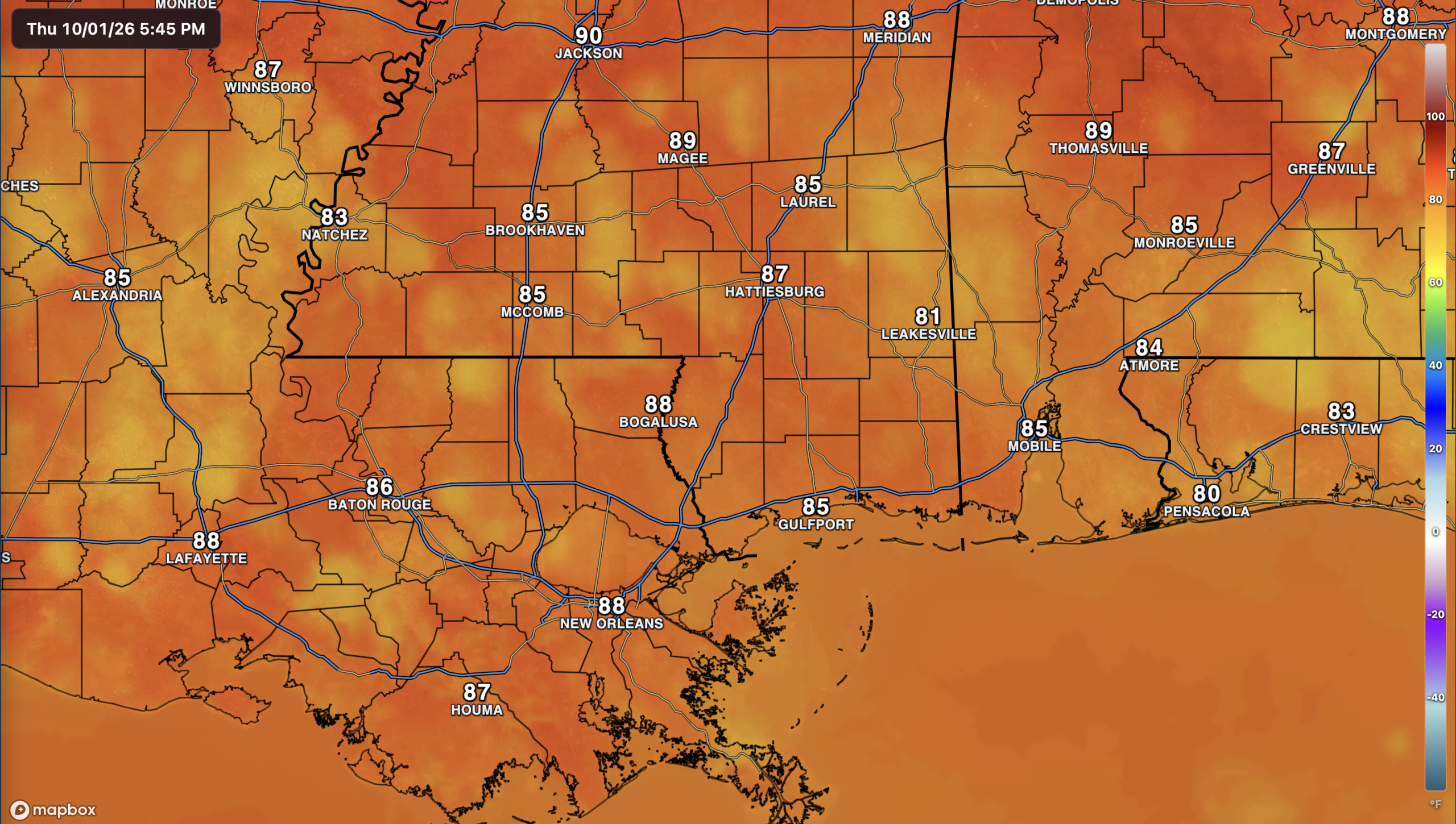
Hey everyone! We’re seeing some scattered rain showers throughout the area, hitting some and missing others. I’m sure it feels humid out there with dewpoints sitting in the 70s. Current temperatures as of this post (5 PM CDT) are in the upper 80s.
The Setup
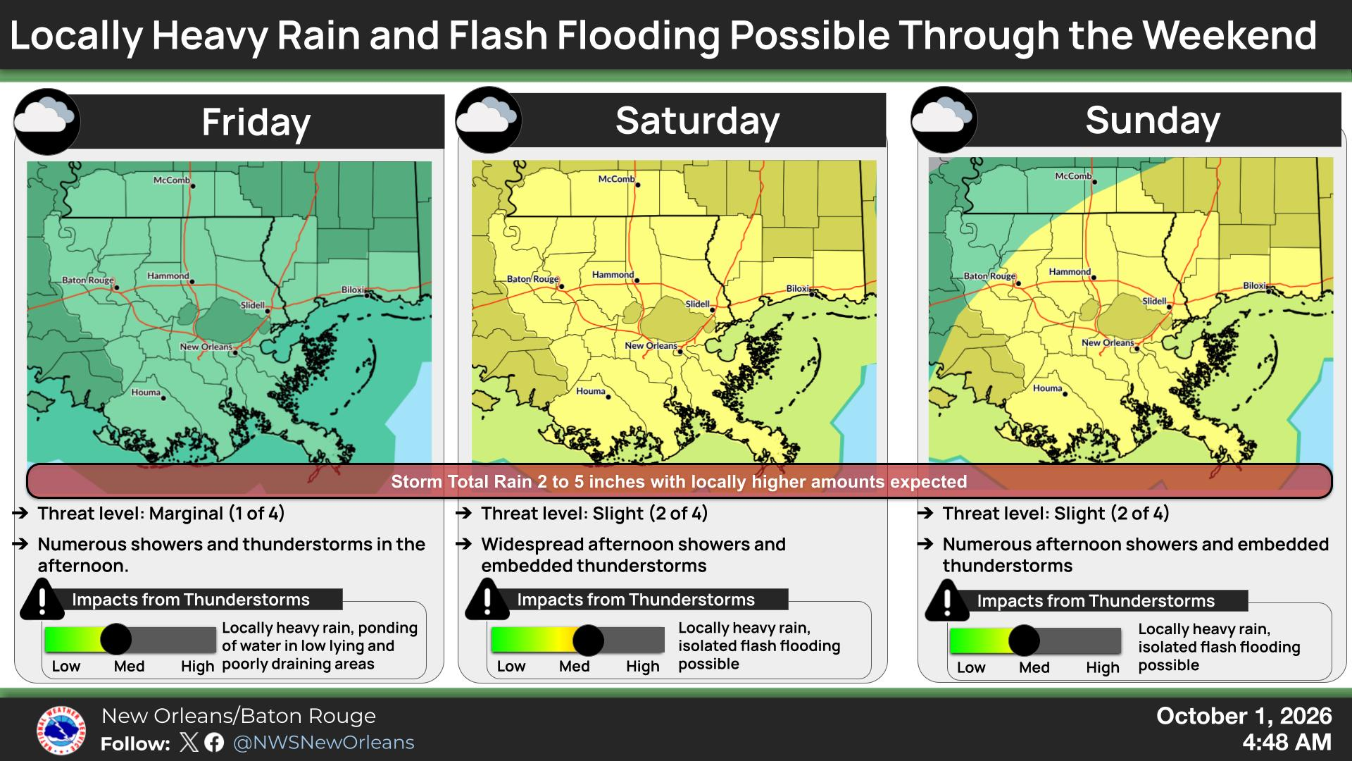
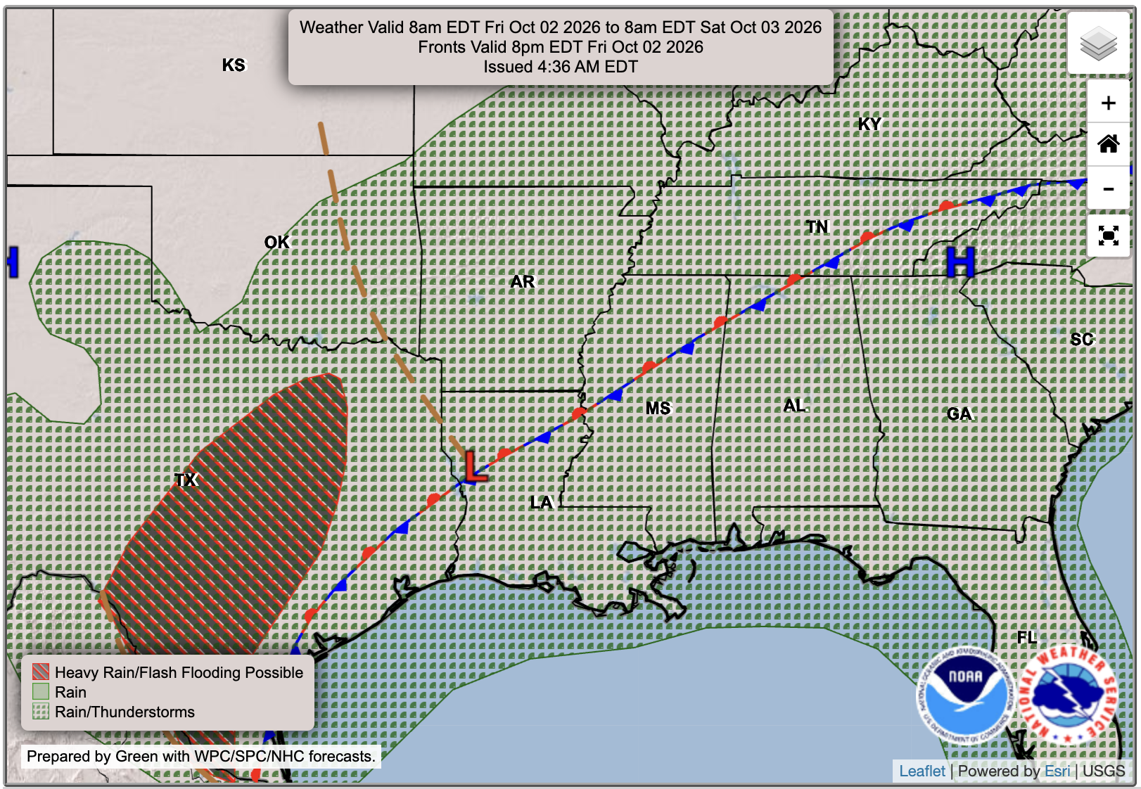
We’re approaching the end of the work week with the threat of rain increasing each day until Monday, as the low pressure system and associated fronts push in from the south-central U.S. The WPC has issued a level 1 out of 4 threat of flash flooding for our area for Friday, as numerous showers and thunderstorms could bring some locally heavy rain and ponding of water in low lying and poorly draining areas. The threat increases on Saturday and Sunday, where we will be under a level 2 out of 4 threat of flash flooding, as widespread showers and some thunderstorms are to be expected.

Tomorrow’s Forecast: Friday, October 2nd
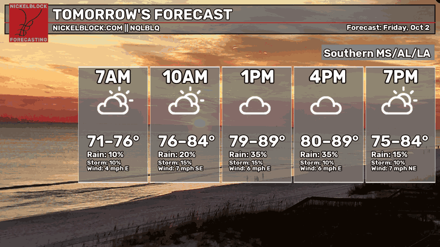
Mostly cloudy conditions with scattered to numerous showers with some thunderstorms are in the forecast for Friday. High temperatures will reach the upper 80s. As you can see from the HRRR model above, the rain threat is definetly there, so be prepared for some wet weather in the afternoon and evening around the area!

Saturday’s Forecast: October 3rd
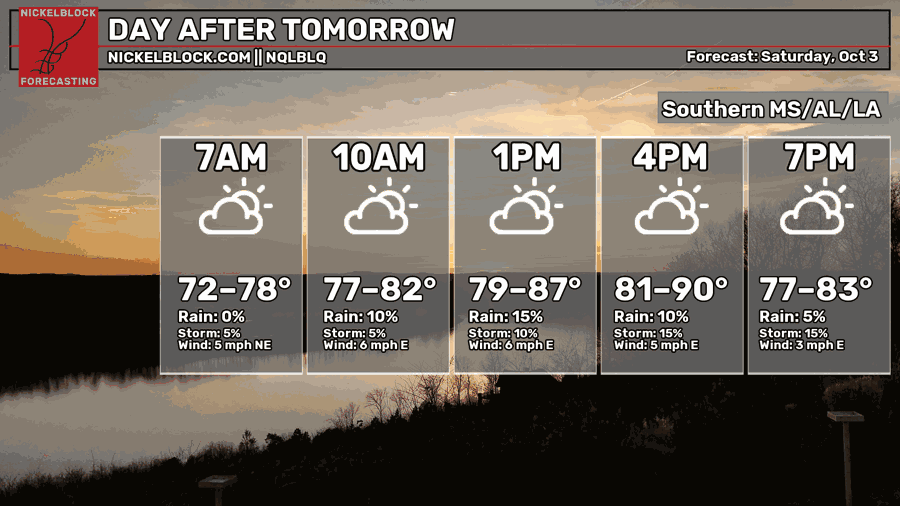
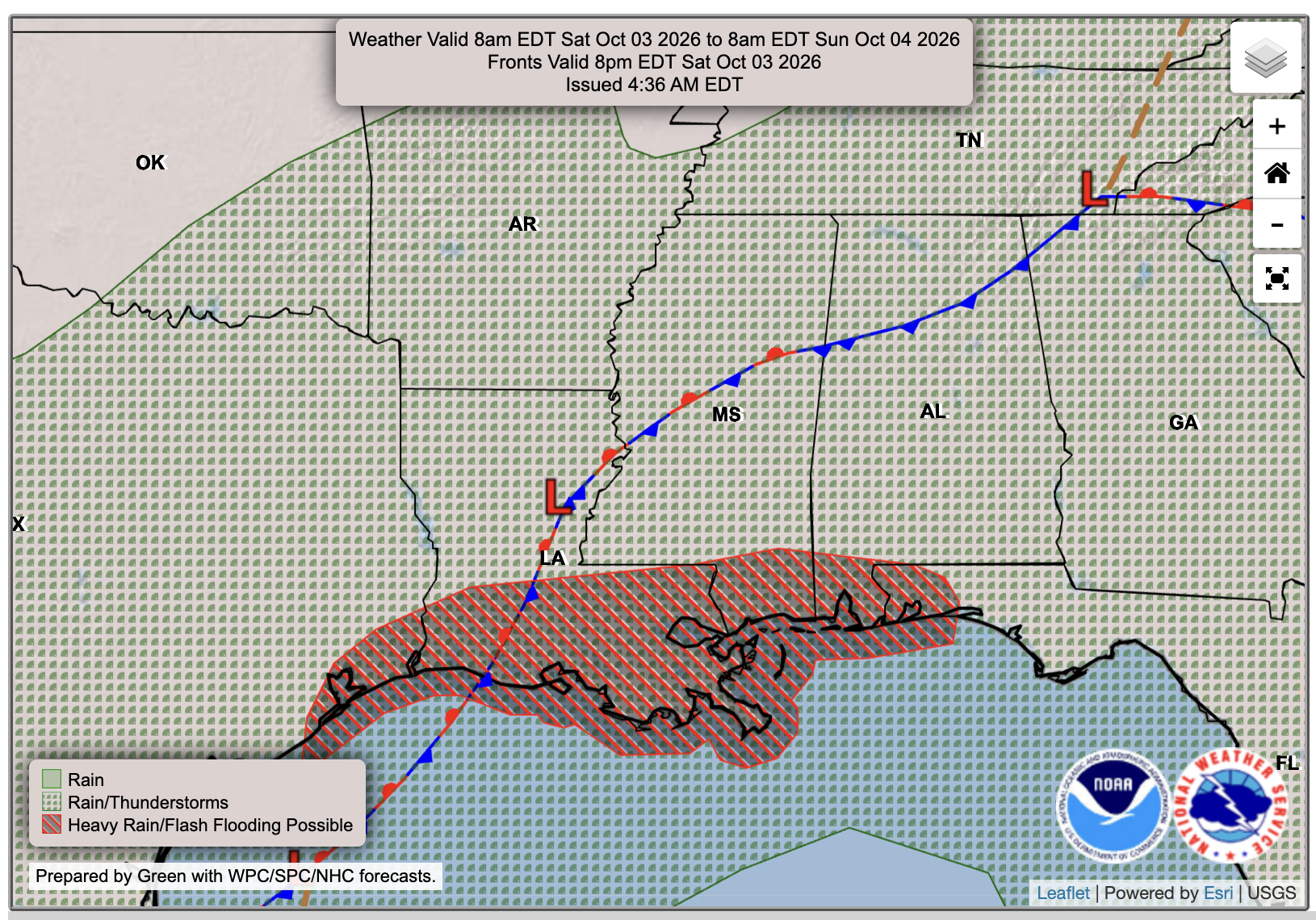
I do think that the NQLBOT rain chances in the hourly forecast above are way too low for Saturday. Saturday is still looking like a day with widespread showers in the area, and maybe some thunder and lightning embedded in some stronger cells. While I do expect there to be some lulls in rain, I think that there will be more wet weather than dry, especially after noon and into the evening hours.
Extended Local Outlook
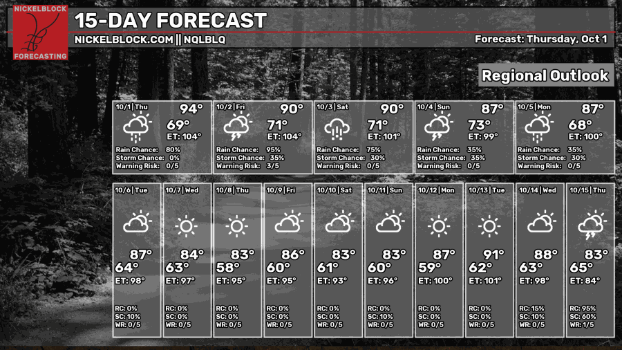
We’ll continue our weekend rain on Sunday, with a total anywhere from 1-3 inches in most areas, with locally higher amounts of 4-6 + inches possible closer to the coast.
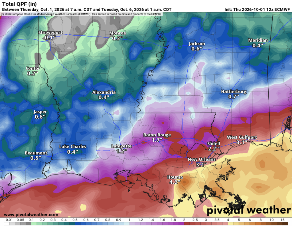
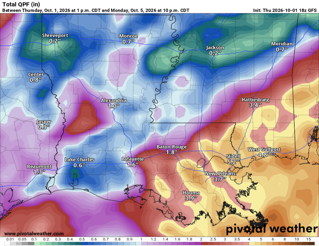
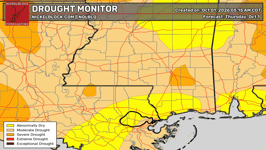
Flash flooding could become a concern if heavy rain repeatedly moves over the same areas. With the ground so dry across the region, intense rainfall could run off before it has a chance to soak in.