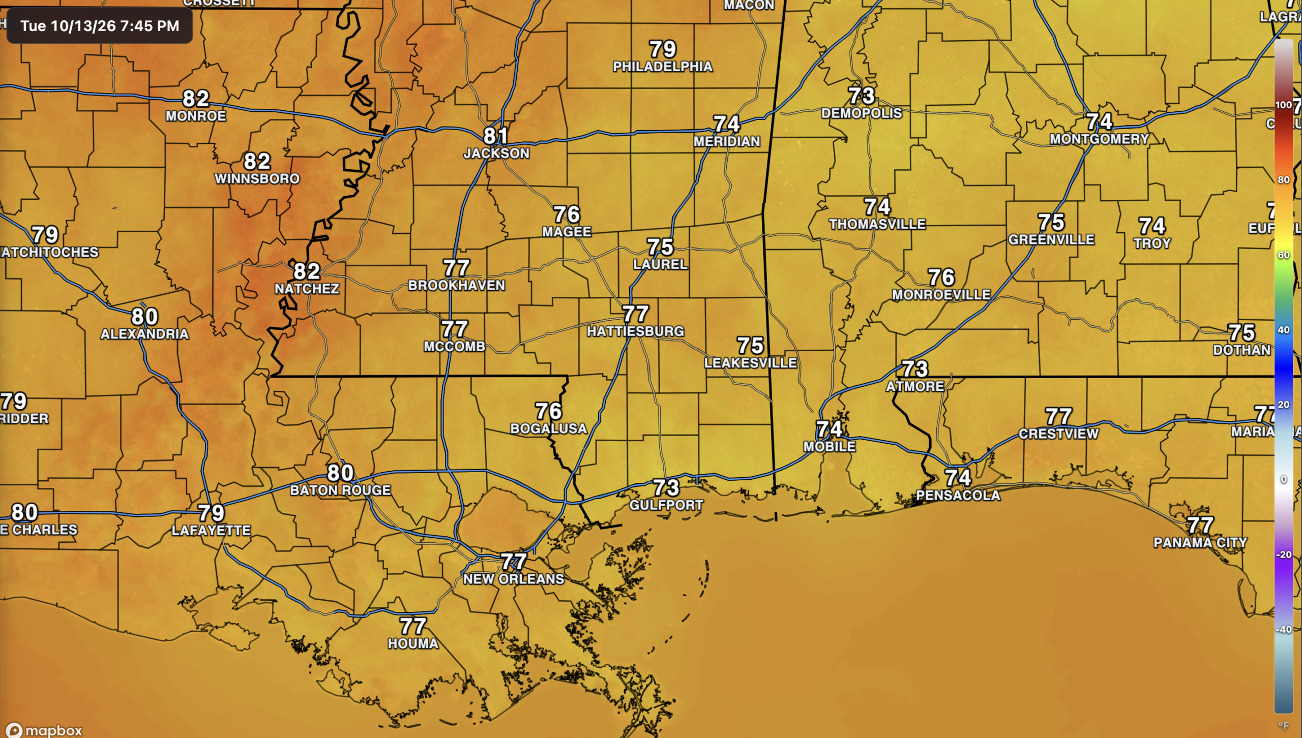
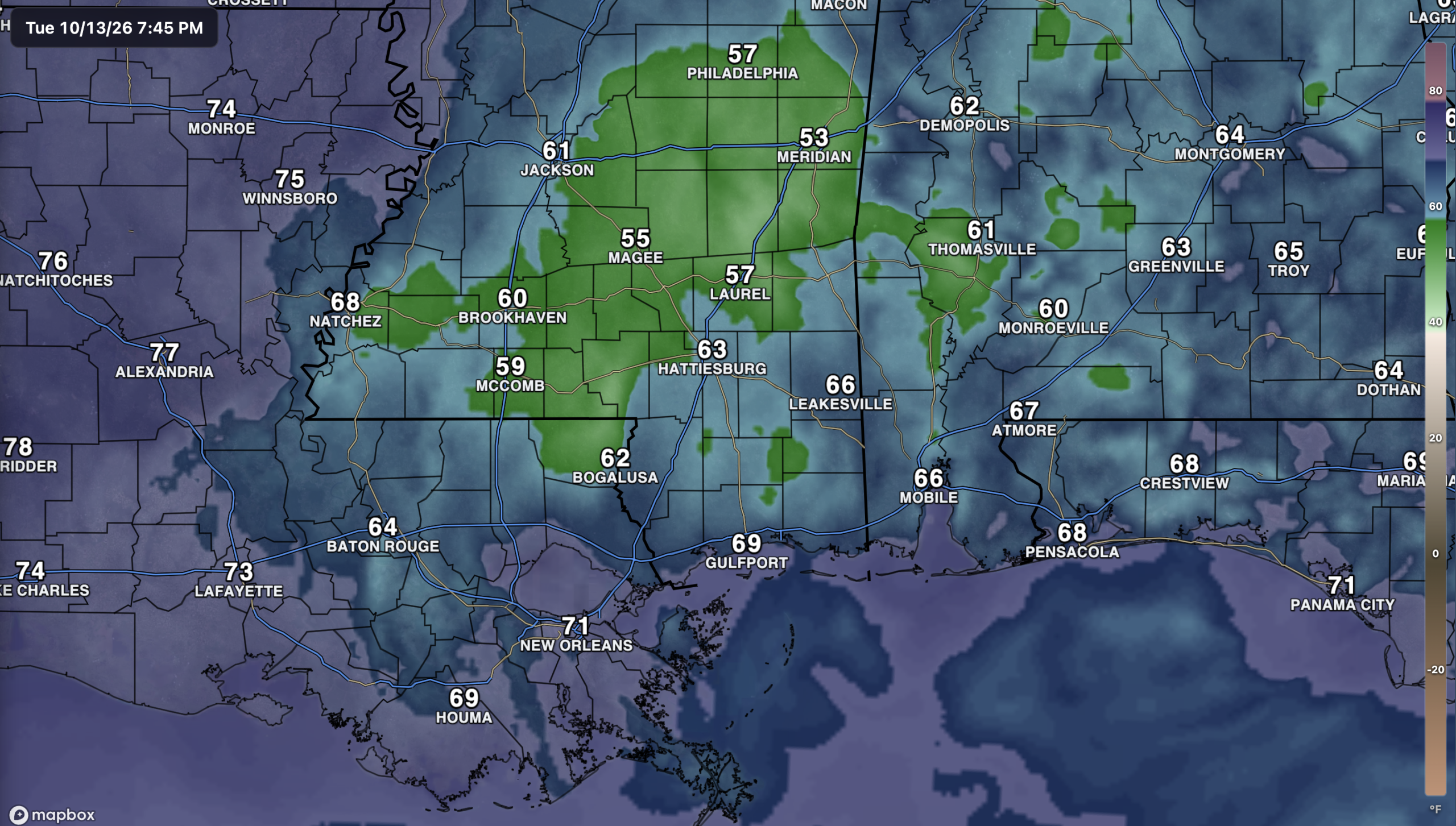
Current Conditions
The Setup
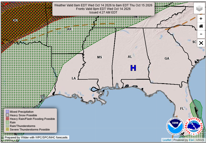
High pressure over Alabama will help keep things mostly dry across our area on Wednesday. Most of the showers and storms will stay to our west and north, leaving us with a fairly quiet day.
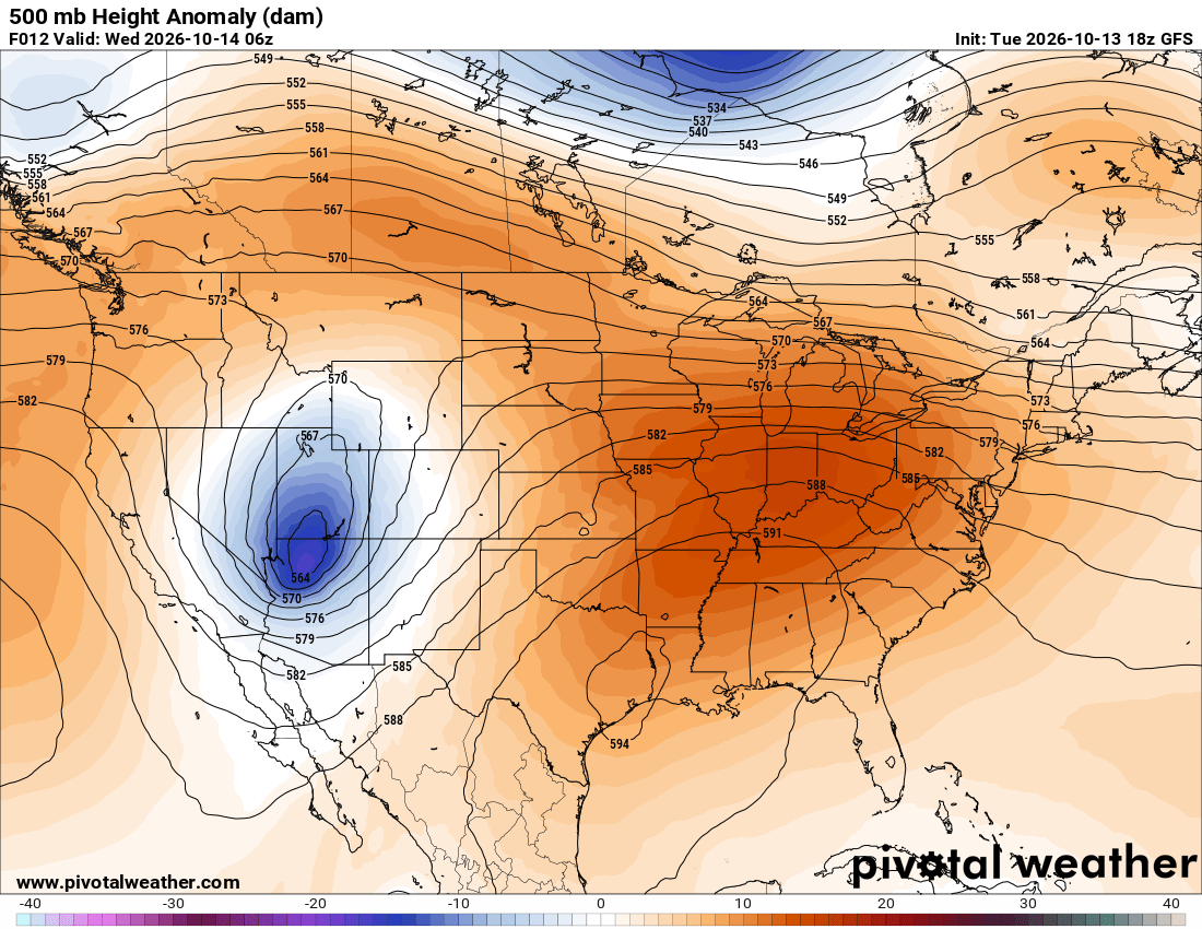
Looking upstairs, a ridge extends across much of the eastern U.S., while an upper-level low sits over the Southwest. That ridge will help limit rain chances locally and favor warmer weather. We’ll take a closer look at temperatures and what comes next below.

Tomorrow’s Forecast: Wednesday, October 14th
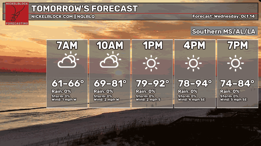
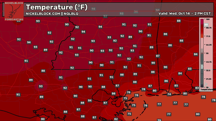
Wednesday will start off comfortable, with temperatures in the low to mid-60s and a few clouds around. But that fall feel won’t last through the afternoon. With plenty of sunshine, temperatures will climb into the upper 80s to low 90s across much of the area, with a few inland spots reaching the mid-90s. Coastal areas will stay a bit cooler.
Rain isn’t expected, and winds will stay light, becoming southerly to southeasterly during the afternoon. If you’re heading out early, you may want a light layer, but you probably won’t need it for long!

Thursday’s Forecast: October 15th
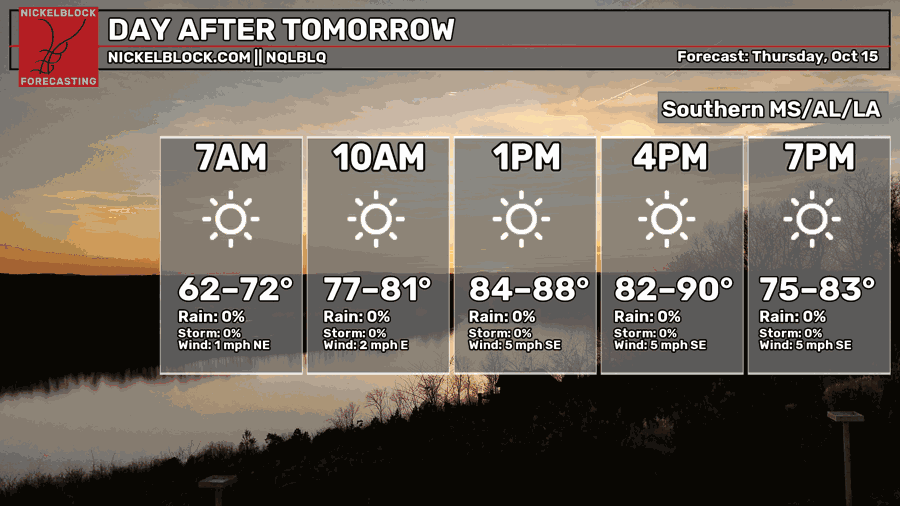
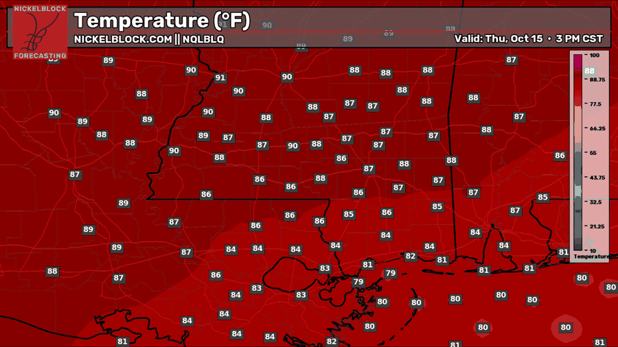
Thursday brings another sunny and dry day, though afternoon temperatures will be a few degrees lower than Wednesday. Most inland locations will reach the mid to upper 80s, with a few spots near 90, while coastal areas stay closer to the low 80s. Morning temperatures will range from the low 60s to low 70s, so some of us will get a comfortable start before things warm up again. Winds will stay light, becoming southeasterly around 5 mph during the afternoon.
Extended Local Outlook
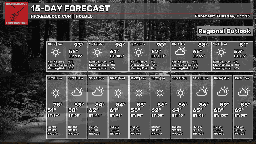
A little more fall weather is on the way for the weekend! A dry cold front should move through Friday night or early Saturday, bringing cooler temperatures and much drier air. Highs will drop from the upper 80s Friday to around 80 Saturday and the upper 70s Sunday. Overnight lows could reach the low 50s in some inland spots, while areas closer to the coast will stay milder. Northeasterly winds will also pick up behind the front, with gusty conditions possible.
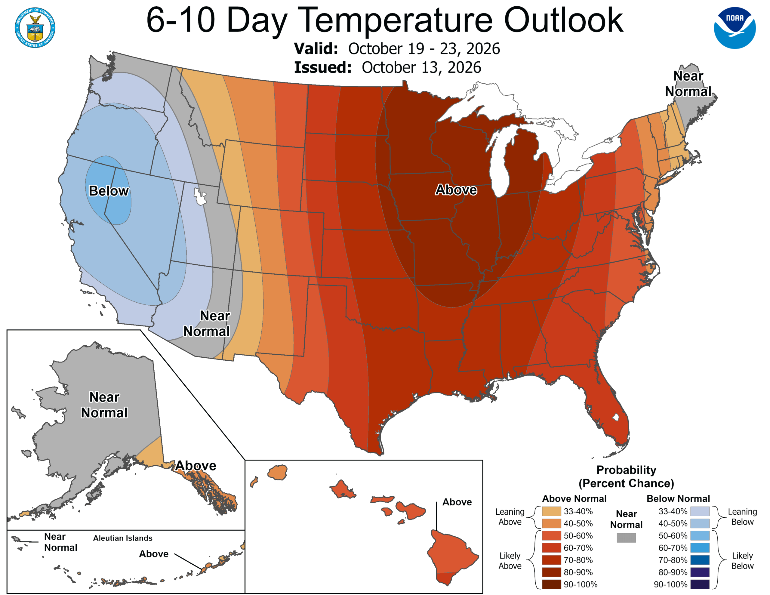
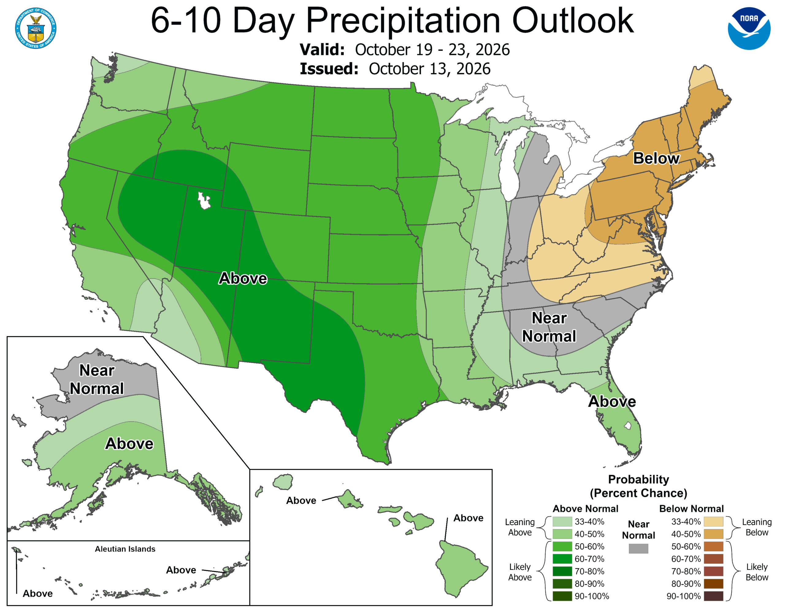
The cooler weather won’t stick around for long, though. As the ridge begins building back in from the west, highs should return to the low to mid-80s early next week. The CPC outlook for October 19-23 supports that warmer trend, favoring above-normal temperatures across the region. Rainfall has a slight lean toward above normal across Louisiana and southern Mississippi, but our local forecast still looks mostly dry for now. We’ll keep an eye on whether rain chances increase as we get closer.


