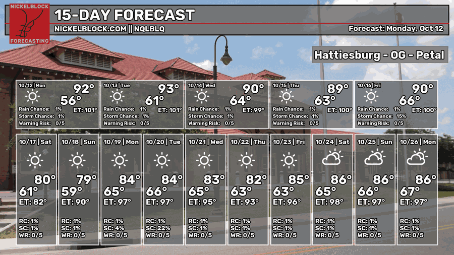
After Isaias’s departure this weekend, we’re left literally high and dry for the rest of the week! A high pressure system takes its place and there will be nothing but dry conditions even with a large front moving in by Friday. Our high will choke out a lot of the moisture that would normally move in and leave us with cooler but dry conditions into the weekend.
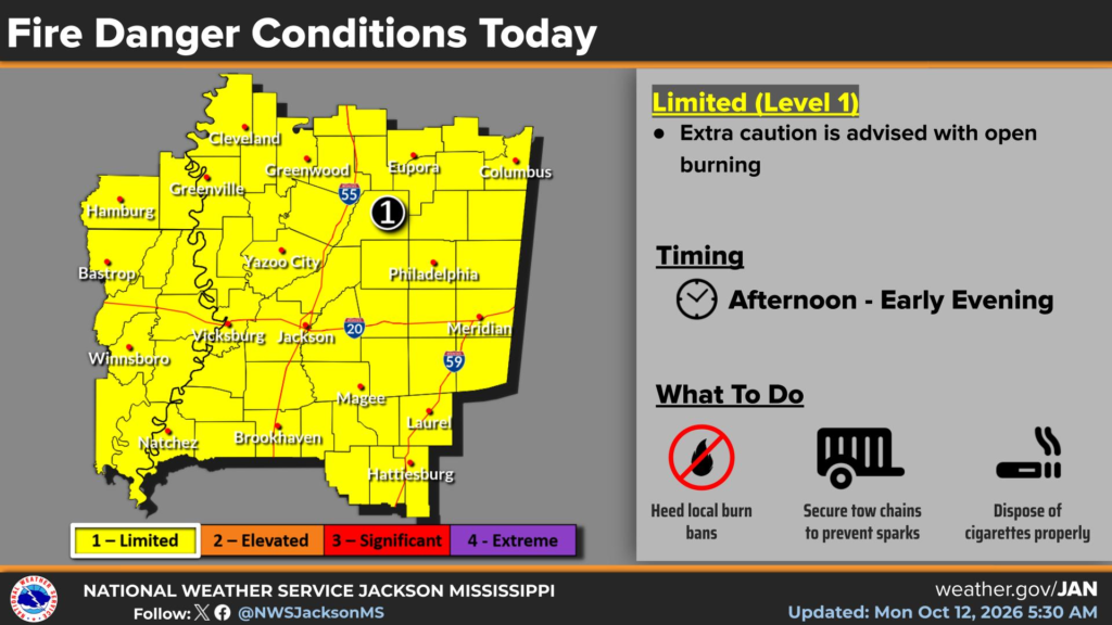
One thing we’ll have to contend with is the possible fire weather this week. With very little rain even with what Isaias brought us, we’re prone to fires sparking off fairly easily. If there is a local burn ban, don’t burn. Don’t throw your cigarettes in the grass or out of your car, and don’t burn where there is hanging vegetation.

Today
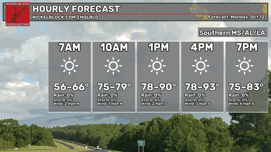
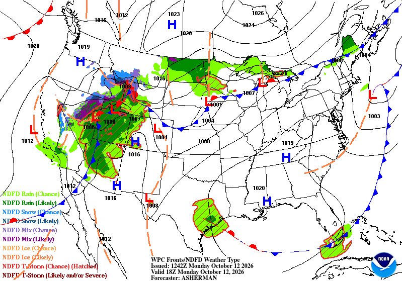
Looking at the WPC map above, it looks like the atmosphere is a little stuck, mainly in the southeastern US. We’re stuck with a large high pressure system, and a large stationary front has encompassed the northern Great Plains and the Great Lakes states. For us, that means that areas east of the Ouachita River are going to be dry. With light and variable winds, we won’t see much moisture or dry air moving about. Just hot, and dry.
Areas closer to the coast will see cooler temperatures, but for the rest of us, we’ll be in the upper 80s to low 90s today. Heat indices will top out around the same as the actual temperature. Overnight, we’ll drop back into the low 60s.
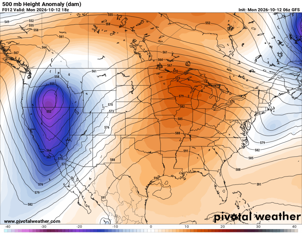
Looking at the 500mb map above, there is a building closed ridge in the western Gulf and the ridge encompasses most of the eastern US. An exiting trough in the Atlantic and a strong trough in the Pacific Northwest will begin to move further east during the rest of the week.

Tomorrow
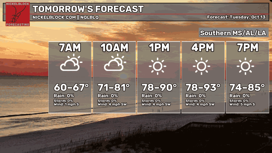
We’ll have more of the same tomorrow as temperatures top out in the low 90s for most of us further inland. A few upper level clouds will move in during the morning hours from the Gulf, however they won’t stick around for long. It’ll be another hot, but not too humid day with winds out of the southwest. Overnight, temperatures will fall back into the low to mid 60s.
Wednesday
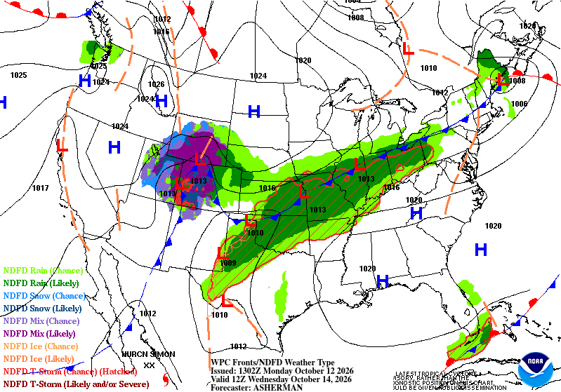
A stream of Gulf moisture is being pulled to our west as that front I mentioned earlier is moving further south. The high is creating a pretty stout boundary of moisture that will be funneled into that system in the Heartland to the lower Plains. Anywhere south of it, however will remain pretty dry.
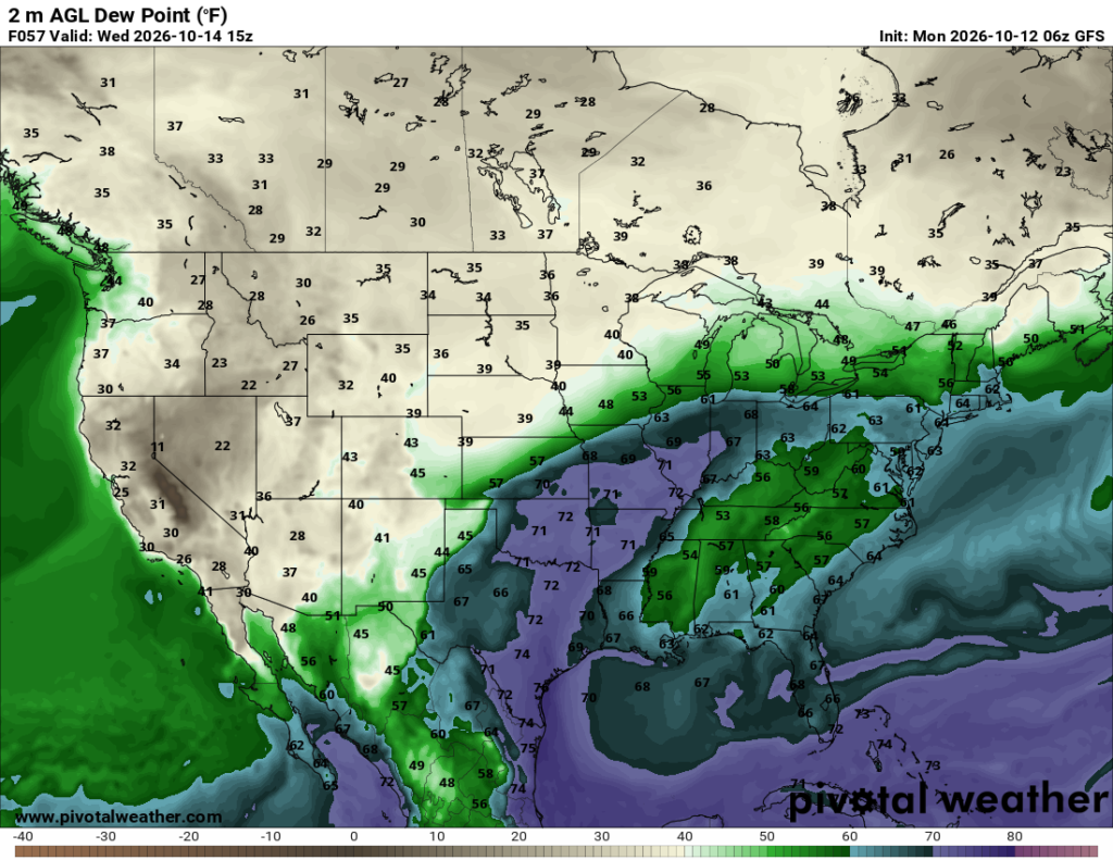
You can look at the map above and see where all the moisture is going. That high pressure system we’ve dealt with the past few days is the barrier to us seeing any of that later in the week. For those in the path of the front, they could see anywhere from 1-7 inches of rain! Not for us, though!
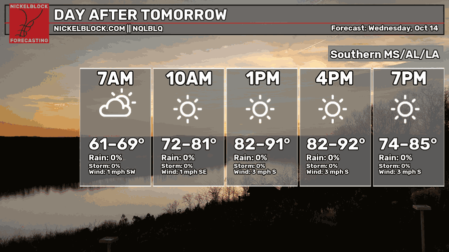
Another dry day is ahead for us as temperatures reach the low 90s again. Few clouds will be in the sky in the morning hours, but otherwise, hot and sunny. Overnight, we’ll fall back into the low to mid 60s.
Towards the Weekend
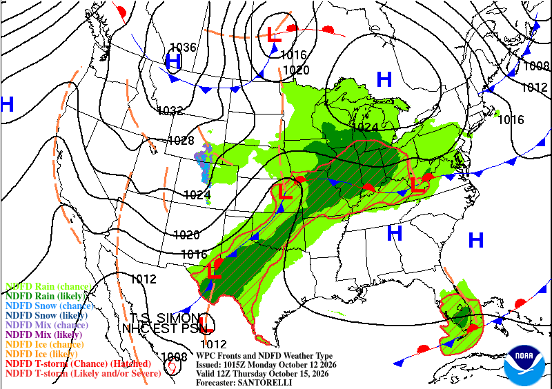
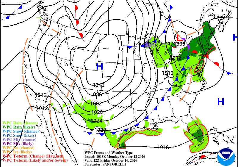
Looking at the two WPC maps above, we can see how much the rain chances dry out over a period of 24 hours. We get absolutely none of that rain and that’s thanks to the combined efforts of the lower and upper atmosphere.
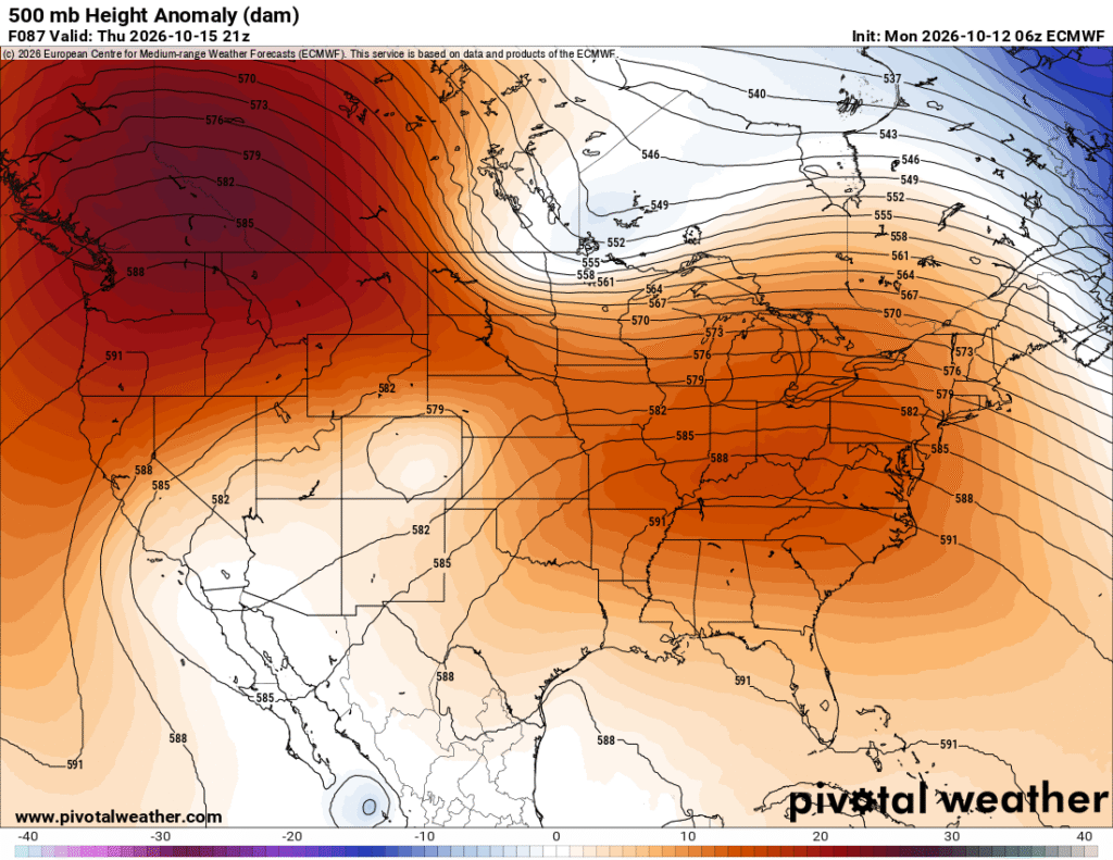
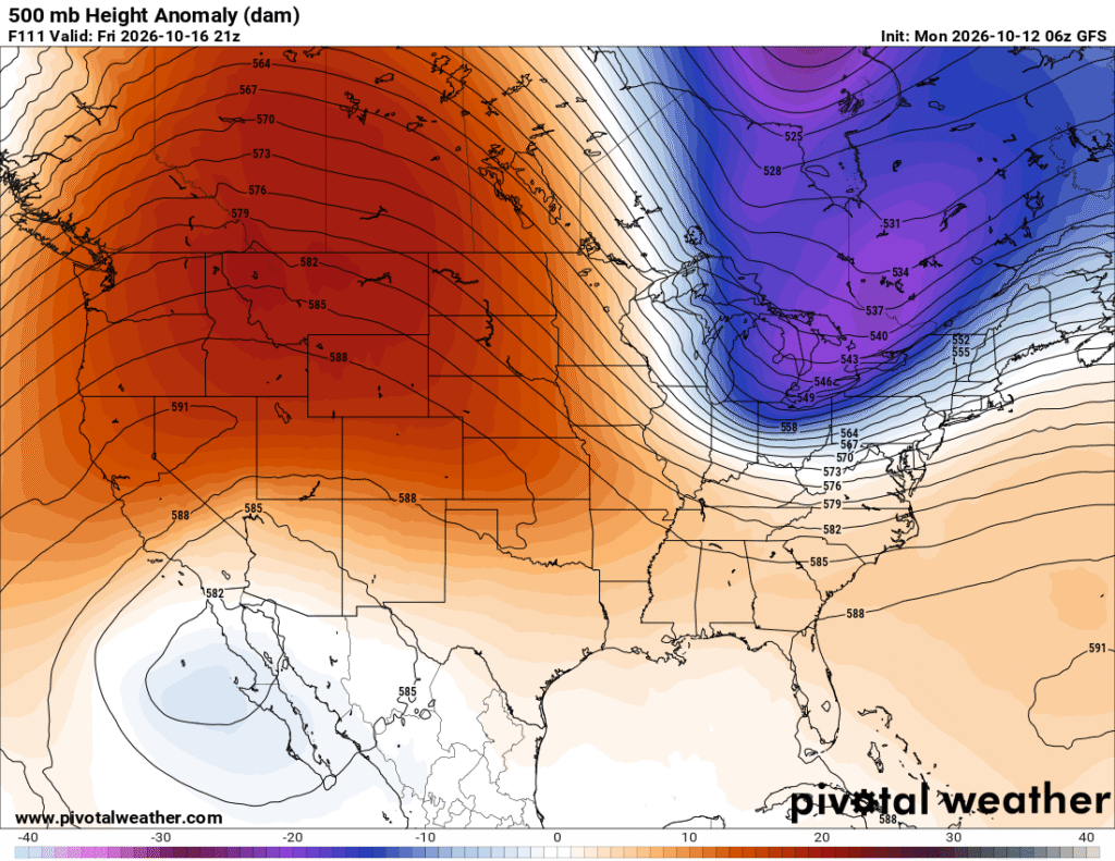
The 500mb maps above show that the trough in the Pacific Northwest is eventually choked out and absorbed by a larger trough in the eastern Canadian Plains. Hurricane Simon will eventually take its place in Baja as it becomes extratropical when it moves further north from the Gulf of California.
Now what this means for us is there will be a huge drop in humidity as this front passes through on Friday. I’m not saying that for clicks, I do mean it. We drop from dew points in the 50s/60s to the 30s/40s, and that’s a big difference in feel. Not only that, but temperatures will take a slight dive as well. By the weekend, temperatures will be in the upper 70s during the day and low 50s at night, so it feels like Fall! Expect a gusty day on Friday as well since the front will bring in a decent wedge of cooler-feeling air. We’ll slowly inch back to the low to mid 80s by next week but with overall dry conditions.