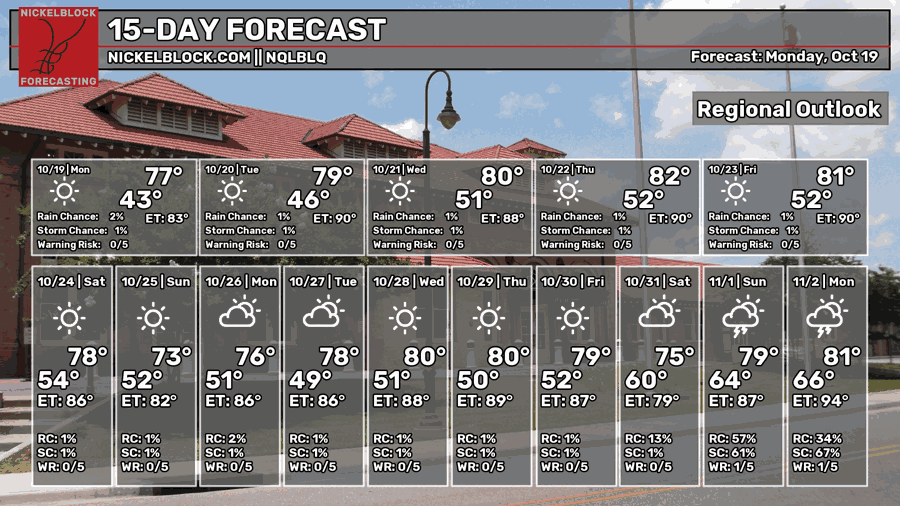
As we’re further into the Halloween season, we are in the self-fulfilling prophecy of dry October. Typically, this is the driest month of the year as the mid-latitudes begin to ramp up again and Gulf moisture is more dependent on incoming fronts. For now, we’re stuck in a dry pattern due to a large upper ridge that isn’t budging for a while. Temperatures will begin to warm up as we go further into the week and top out by Saturday in the mid 80s.

Today
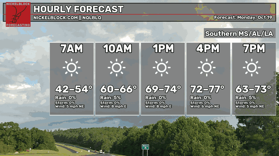
Nothing but sun today! Winds have been steady around 5 mph today and highs have topped out in the mid 70s. Probably the best day we’ve had of the season so far! Overnight, the temperature will reach the upper 40s to around 50, so a cool morning to start things off tomorrow.

Tomorrow
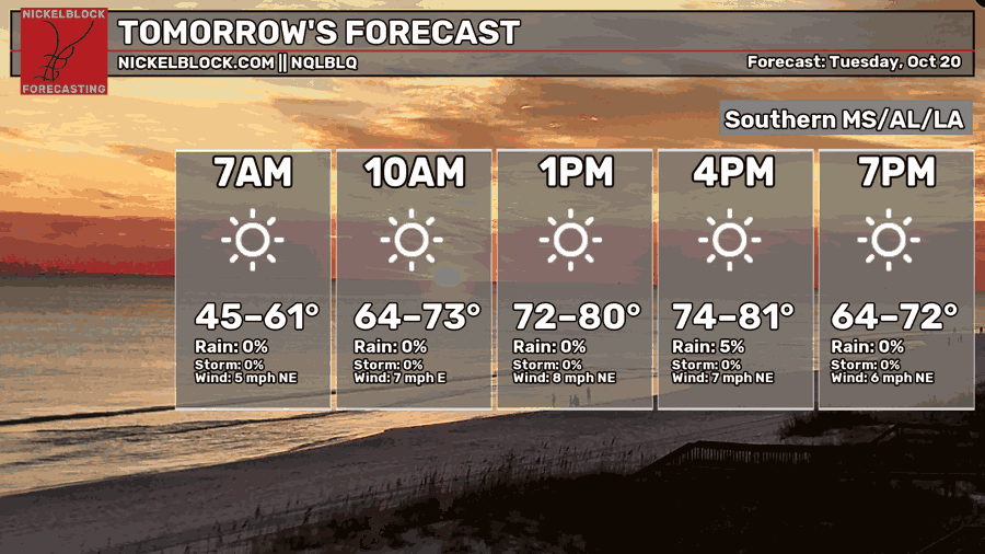
Temperatures top out around 80 tomorrow with sunny skies and northeast winds. Honestly, it’s just going to be another beautiful Fall day! We are on the upward trend with temperatures, however most areas won’t get past the mid 80s and heat indices will not reach much further than the actual temperature. Overnight, temperatures will be in the upper 40s to low 50s.
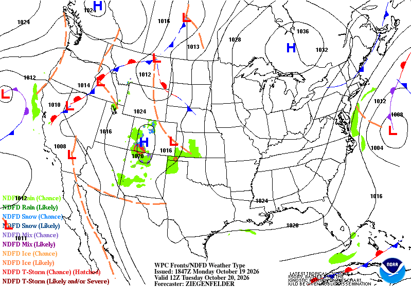
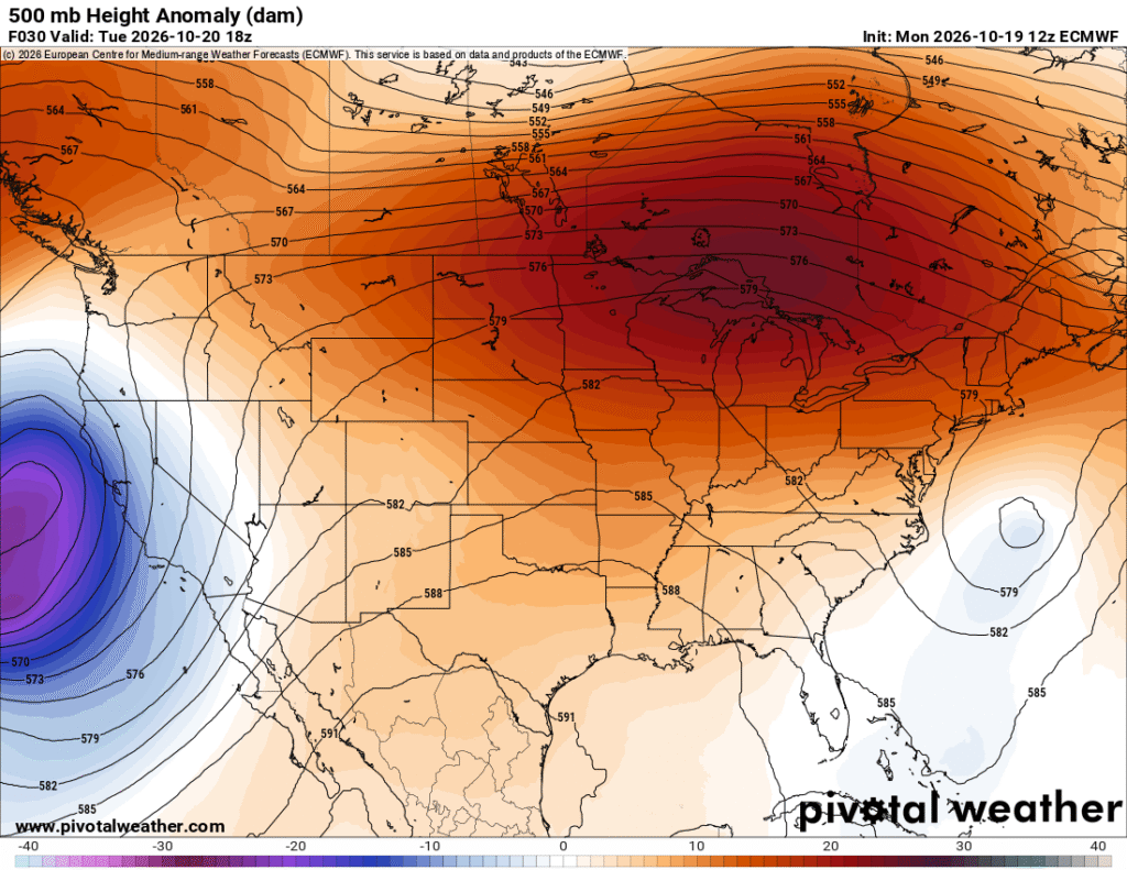
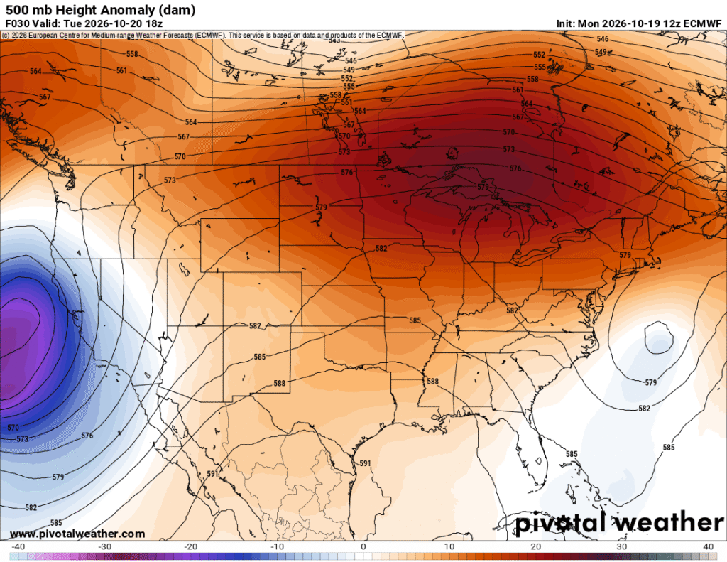
Looking at the surface and upper level maps, respectively, there is an almost wedging pattern forming. The high pressure at the surface in Ontario is currently blocking much of the convective development any further than the Rockies. In the upper levels, an undulating ridge out of the western Pacific will grow and move further towards the mid-latitudes and create a blocking pattern over us. The low pressure system in the north Atlantic has storm warnings issued as it begins to intensify.
Wednesday
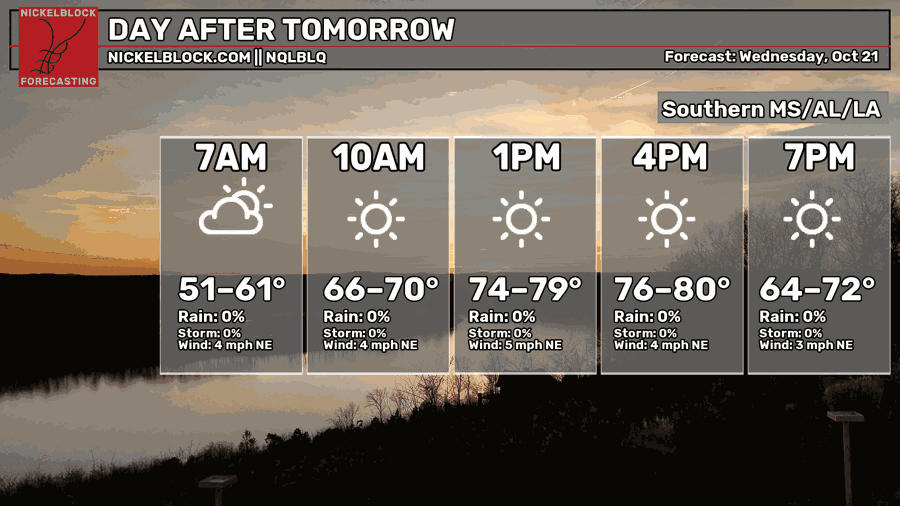
A few low clouds are possible in the morning hours Wednesday morning before we go back to clear skies again. Winds will shift towards the northeast more, and we’ll top out in the upper 70s to just around 80. Nothing but good weather! Overnight, temperatures will fall back into the low 50s, so a nice night ahead!
Fire Weather
I’m just repeating it at this point, but it really does bear repeating. Don’t burn in this dry spell. While the winds have died down for the most part, the grass, bushes, and trees are dry. It won’t take much to set them on fire with the lack of rain we’ve had the past couple of weeks. Burn bans are likely.
Week’s End
As we go towards the weekend, there won’t be a big change in weather. It’ll still be dry and warm with cooler nights. Enjoy it! It’ll feel like Fall at least in the morning and evening hours. The pattern won’t change over the weekend either as the cold front that’s moving past the Rockies will dry out due to the large area of high pressure over the eastern US.
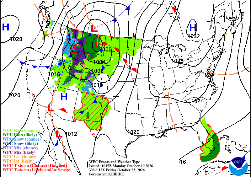
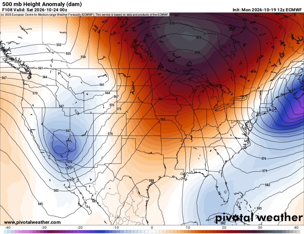
Looking at the lower and upper levels again, a wedge has been placed between the western and eastern US which will cause the trough to eject towards Canada. The high pressure system will bend and morph a bit, but won’t allow much to pass it over the weekend.