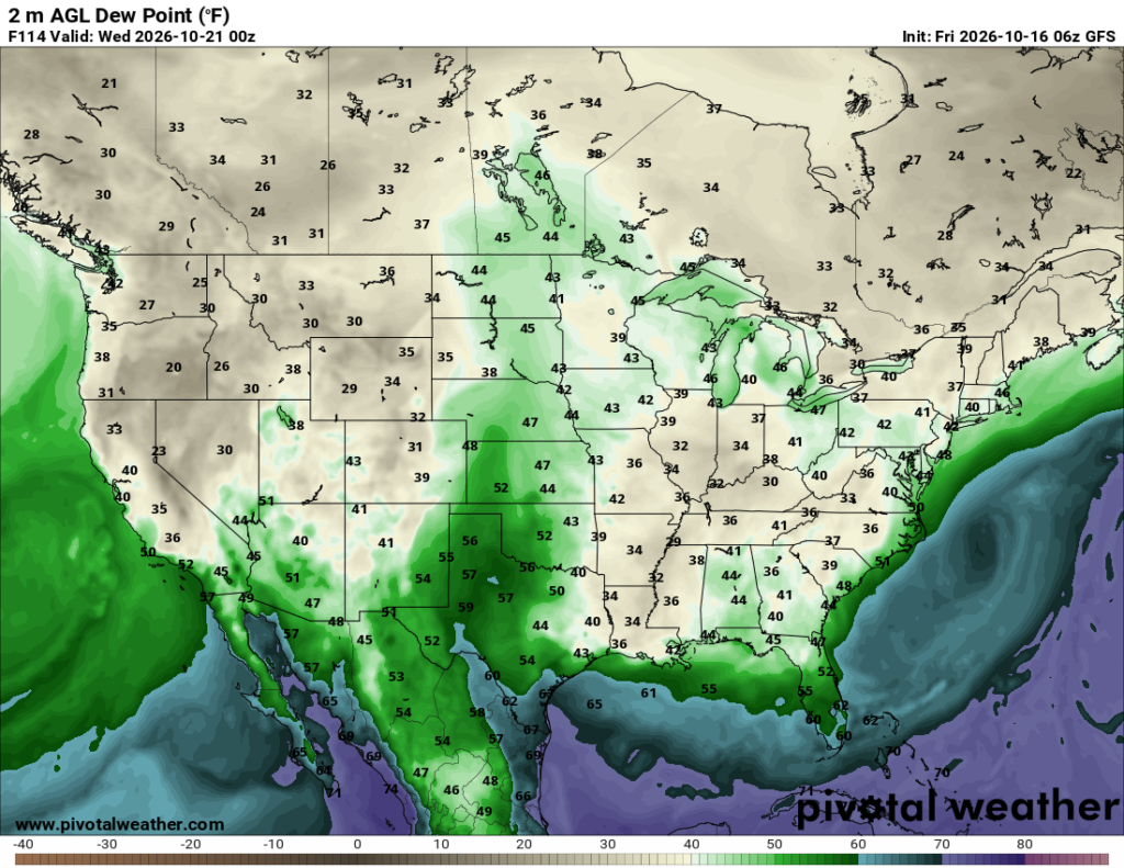
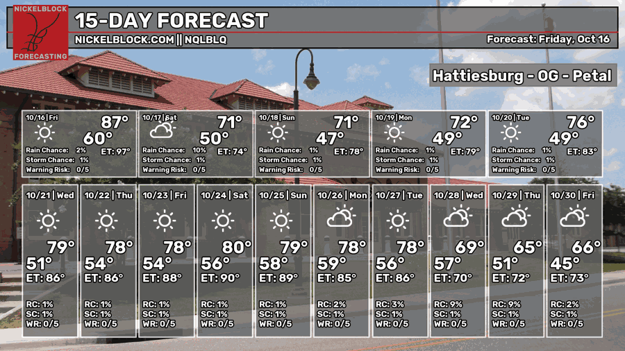
The cold front is currently making its way towards the Pine Belt and we’ll soon get a much windier and cooler day ahead! Say goodbye to the higher humidity as that’s all about to blow into the Gulf soon. We’ll have a brief taste of Fall this weekend before we move into a warmer than average week next week.
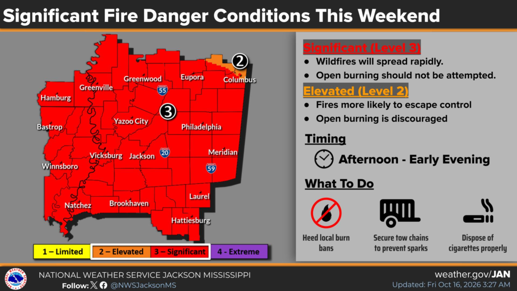
Red Flag warnings have been issued across many states in the Southeast. I’ll just go ahead and say it, do not burn! Under any circumstances this weekend and next week, do not burn anything as vegetation will be dry and easy fuel to burn.

Today
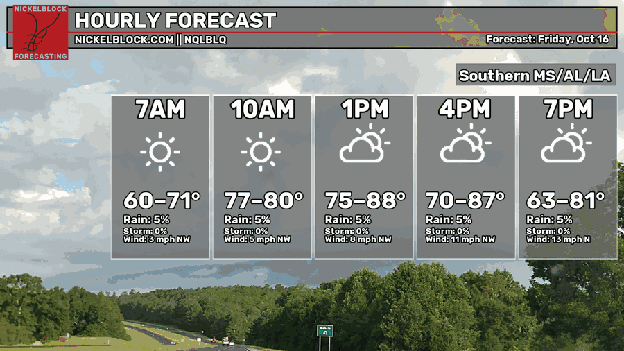
The winds will pick up by the early afternoon as the cold front passes through bringing even drier conditions. It’s going to heat up quick and eventually cool down fairly quickly. Bring your jacket if you’re going outside as it’s going to be blustery! The cloud will begin to roll in during the afternoon as well. Highs will reach the 80s today and lows will fall into the 50s overnight. Winds will be out of the northwest around 5-15mph with wind gusts in the 20s-30s.

Tomorrow
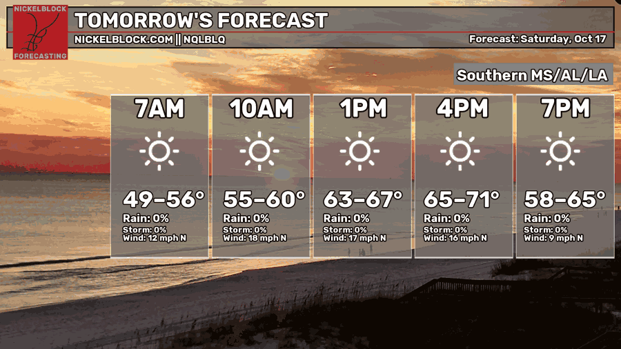
High winds and clear skies are the story for tomorrow. Winds will be around 15-20 mph with wind gusts in the 30s, so don’t get blown around too much! Highs will just reach around 70, but most of us will feel it in the 60s! The wind chill won’t be a huge factor, but it’ll already be much cooler than we’re used to tomorrow, so take that into account if you’re outdoors. Lows will be in the upper 40s, so some of us might have to turn the heat on for the first time of the season.
Sunday
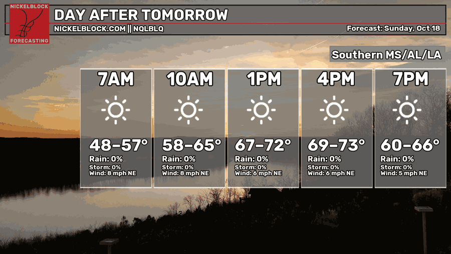
Another cooler day is ahead on Sunday, so put some jackets on the kids if they’re going to church that morning. It’ll be a less blustery day tomorrow as the front moves further away and winds begin to shift with the high pressure zone. Winds will consistently blow around 5-10 mph from the northeast during the day with 15-20mph wind gusts possible. Skies will be clear and conditions will be quite good to be outside!
Next Week
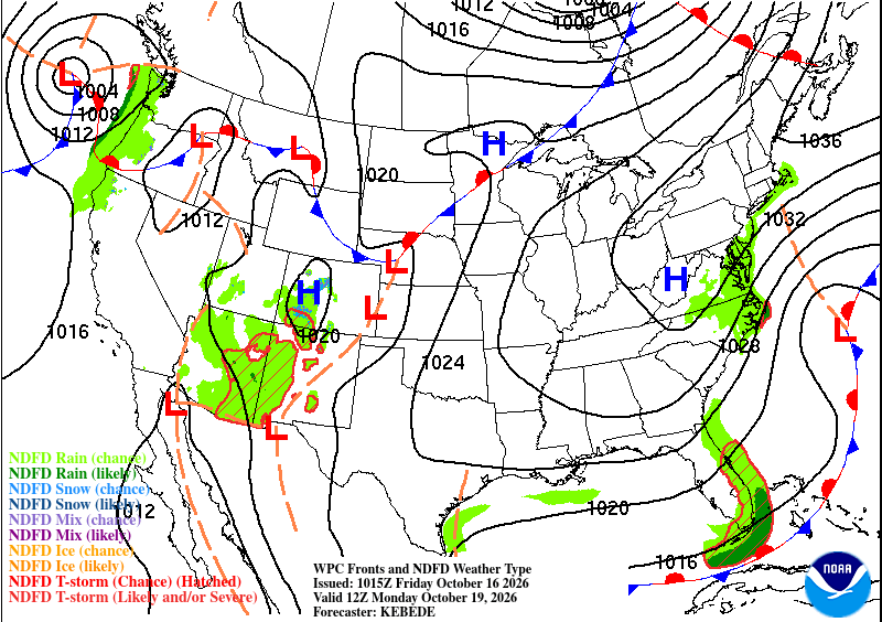
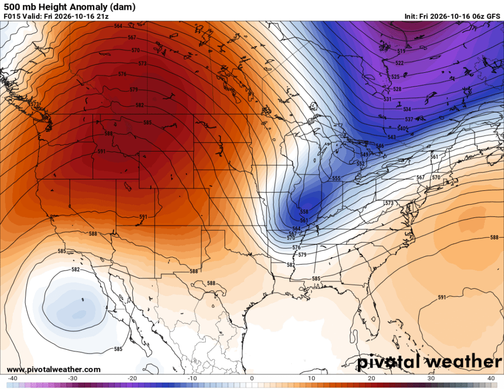
Little rain is expected for the foreseeable future and that’s thanks to a stacked atmosphere keeping moisture from entering our neck of the woods. At the surface, a high pressure system is moving further west from Labrador and meandering around incoming fronts from the Rockies. At the upper levels (below), a ridge is building and effectively blocking incoming troughs from moving further east into the Gulf states. This creates a very dry setup for us, and a possible flooding setup for the eastern Plains states later on.
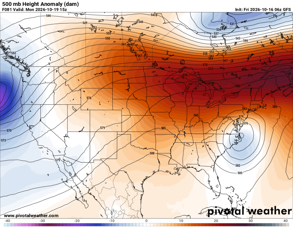
The other aspect that we have to deal with is the warmer than average temperatures next week. Since the high pressure system will take over and leave us with little movement in the atmosphere, we’ll also be left with more heat. This is relatively speaking as dew points will be much lower than we’ve had, so it’ll feel much more like 84 when the temperature says 84. The good news is that it won’t last forever, but it will take a while for us to reach those real “Fall-like” temperatures we’ve been wanting. Some other good news is that the lows will also cooler on average! We’ll start our mornings off in the upper 40s to low 50s during the first part of the week and the mid 50s by the end of the week.