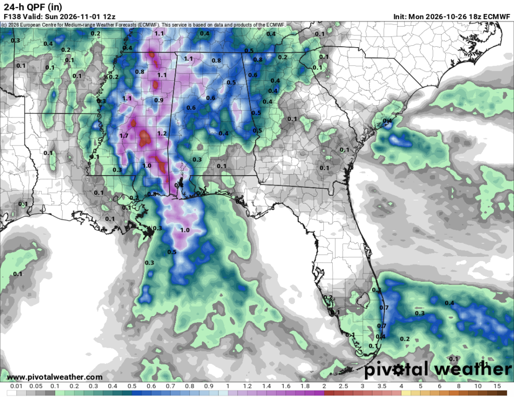
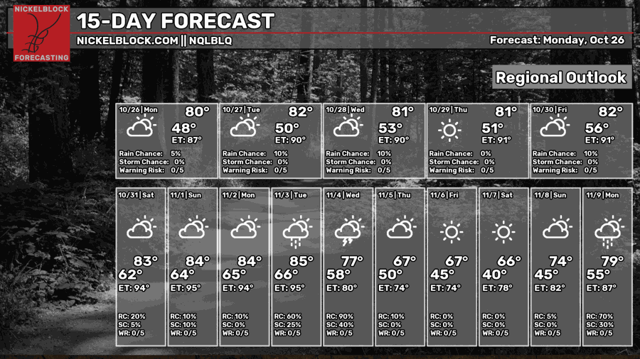
We have the rest of the week before we get our chance of rain on Saturday! And on Halloween of all days, it had to rain! The European and GFS models have both been in agreement about the possibility, and while it doesn’t look like there’s much severe weather, it does look more like a washout.

Tonight and Tomorrow
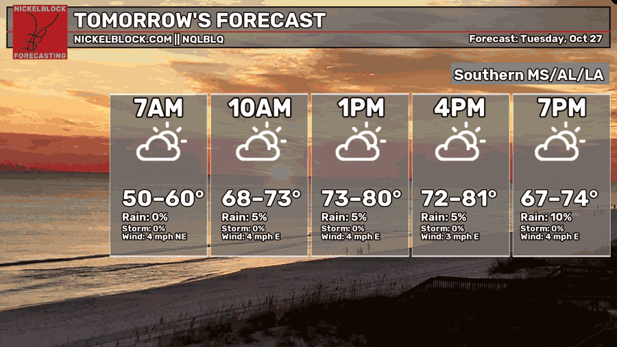
Some overnight clouds will keep rolling in tonight and might even give the moon a bit of a halo effect! The low will fall to the low 50s for most of us in the early morning. By tomorrow, we’ll have a cool morning with more upper level clouds hindering some of the sunlight. Afternoon highs will be in the upper 70s to low 80s with light winds out of the east. The clouds will hang around again with lows in the low 50s.

Wednesday
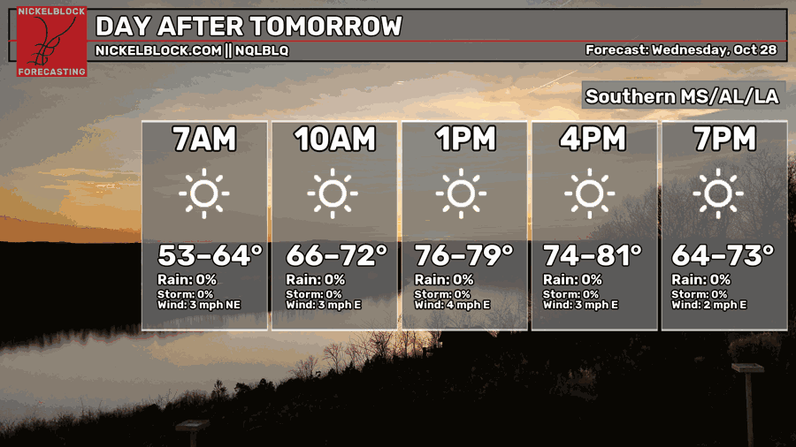
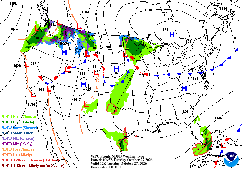
We’ve got a clear day ahead for our hump day. Temperatures will reach the upper 70s to low 80s again with winds out of the east less than 5mph. Not a bad day considering how many of the good, warm ones we’ve had already. Overnight, temperatures will reach the low 50s again.
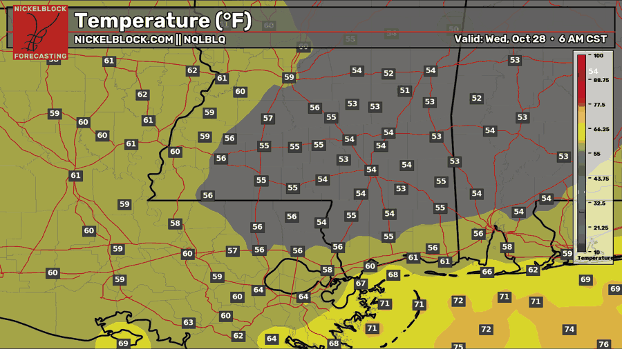
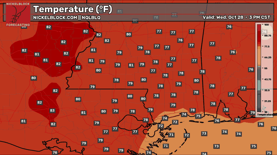
Thursday into the weekend
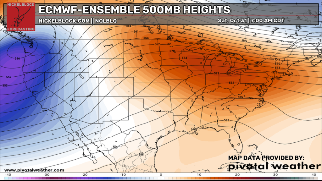
We won’t really see a lot of change leading into the weekend in terms of temperatures. The humidity factor will increase a bit as the Gulf moisture begins to move in by Friday. While we won’t expect much rain by Friday, model guidance is showing a decent chance for rain on Saturday with the incoming front. The moisture flow will be the main flow to our storm direction as the convection moves in from the southwest and eventually moves east as the front passes later in the day.
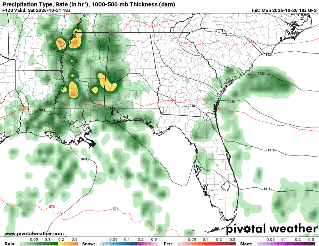
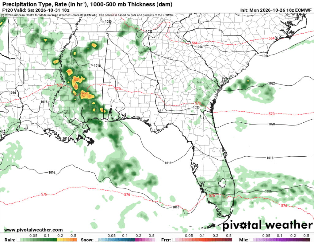
Both the ECMWF and GFS models show the main part of the rain moving in by midday on Halloween. For those of you with Halloween plans, you may want to move them indoors this time around. It’s a perfect excuse to watch a few of your favorite Fall/scary movies, though! The other bright side is the much needed rain since we’ve been in a drought for so long. An inch and a half or less isn’t going to be a drought buster, but it’s at least going in the right direction as long as we get some consistent wet cold fronts moving in over the next few weeks. Otherwise, Sunday is going to be a damp start before we dry out by the afternoon.