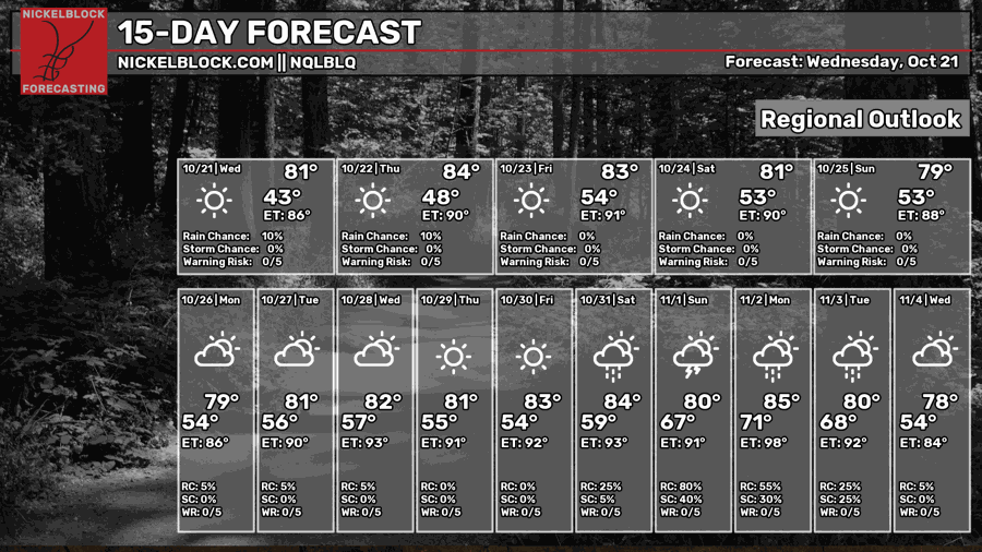
Similar to the late southern summer pattern we all know and loathe, we’re stuck in a dry pattern that budges for no one. Eventually, it will have to make way for incoming weather, and we’re almost there. For now, we’re stuck with dry and warmer than average weather for this time of year. It’s not very different from what we’ve already been feeling in the past few days, so not a bad week!
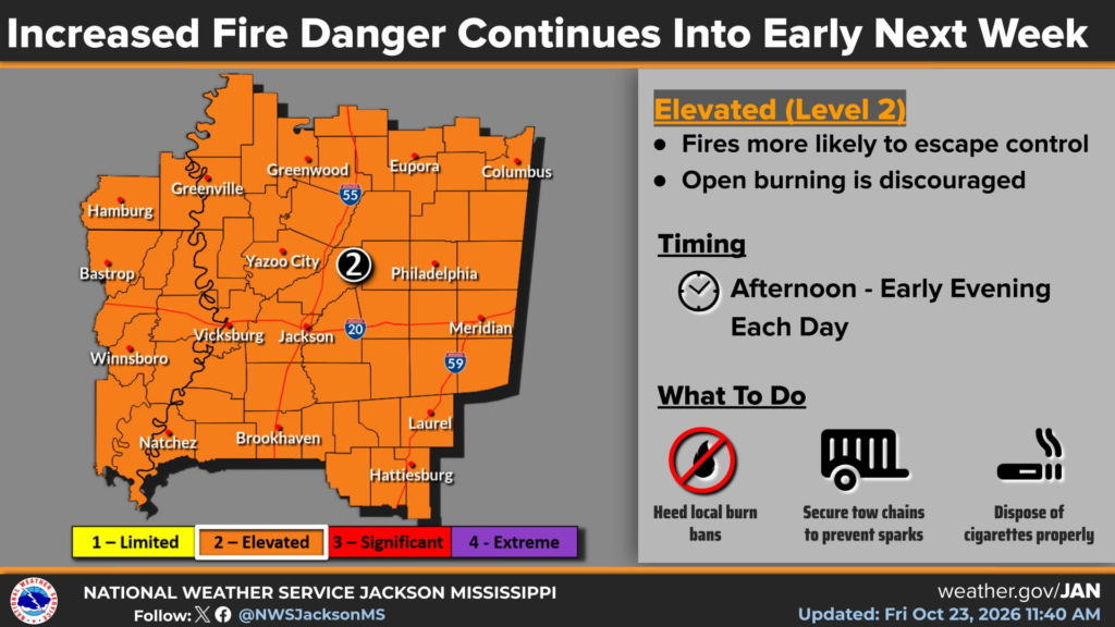
The other obvious problem that we have is easy burning vegetation. The grass and leaves are crunchy which means that anything catching fire will spread. Don’t burn anything! I know most of Mississippi’s counties have burn bans in place and that’s not going to change for the next week, at least.

Today
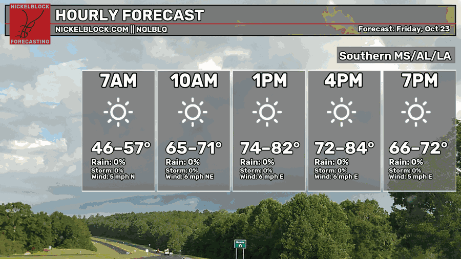
It’s been a fairly warm day for most of us with highs topping out in the low 80s. Winds have been variable from the east and northeast today with not a cloud in the sky. That’ll continue into the evening hours with a cool night ahead. If you can, go outside for a while and enjoy it! I know I’m going to! Overnight, temperatures will fall into the upper 40s to low 50s.

Tomorrow
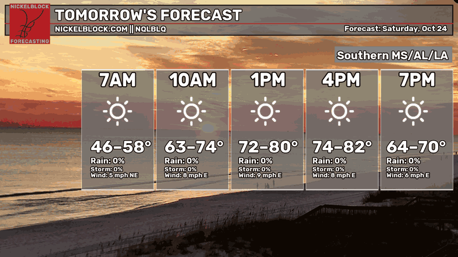
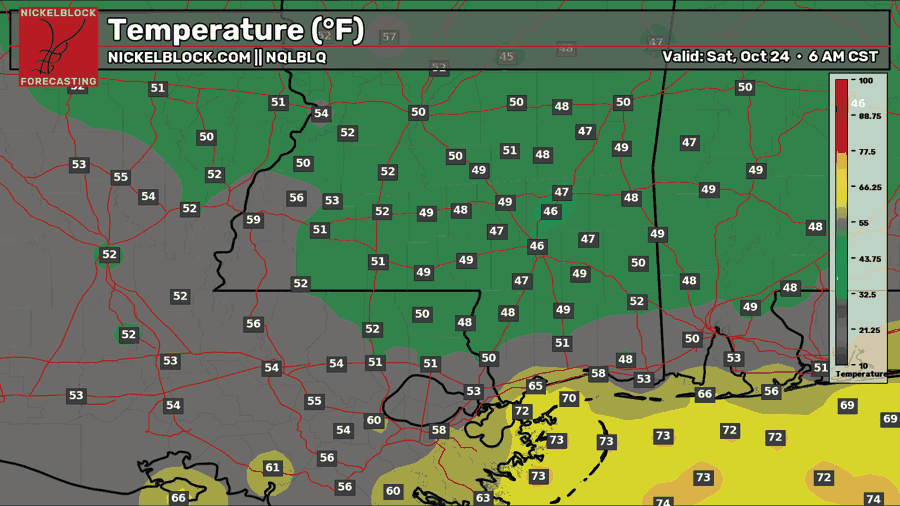
Saturday is almost a carbon copy of today’s forecast, if not a couple of degrees cooler. We’ll start off with a cool morning and eventually heat up to the upper 70s to low 80s during the day. Winds will be out of the east for most of the day and no clouds. If you’re going to the game or tailgating, it’ll get a bit cooler by sunset, so bring a light jacket or sweater with you. Overnight, temperatures will reach around the 50 mark.
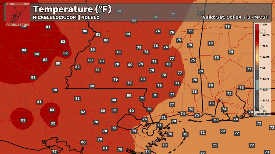
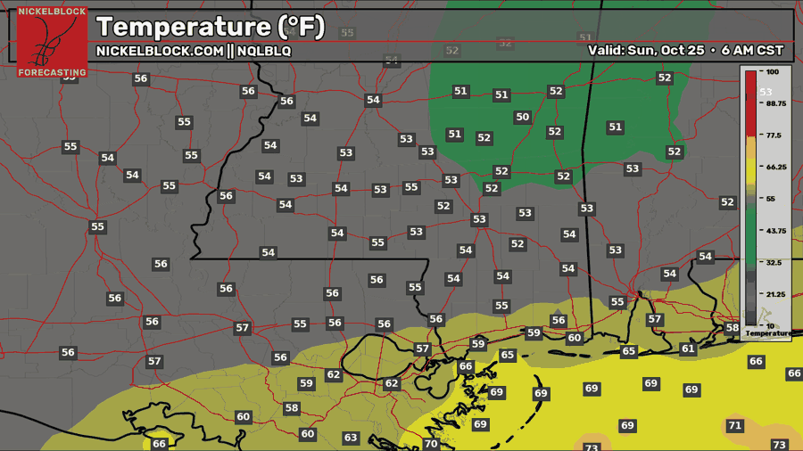
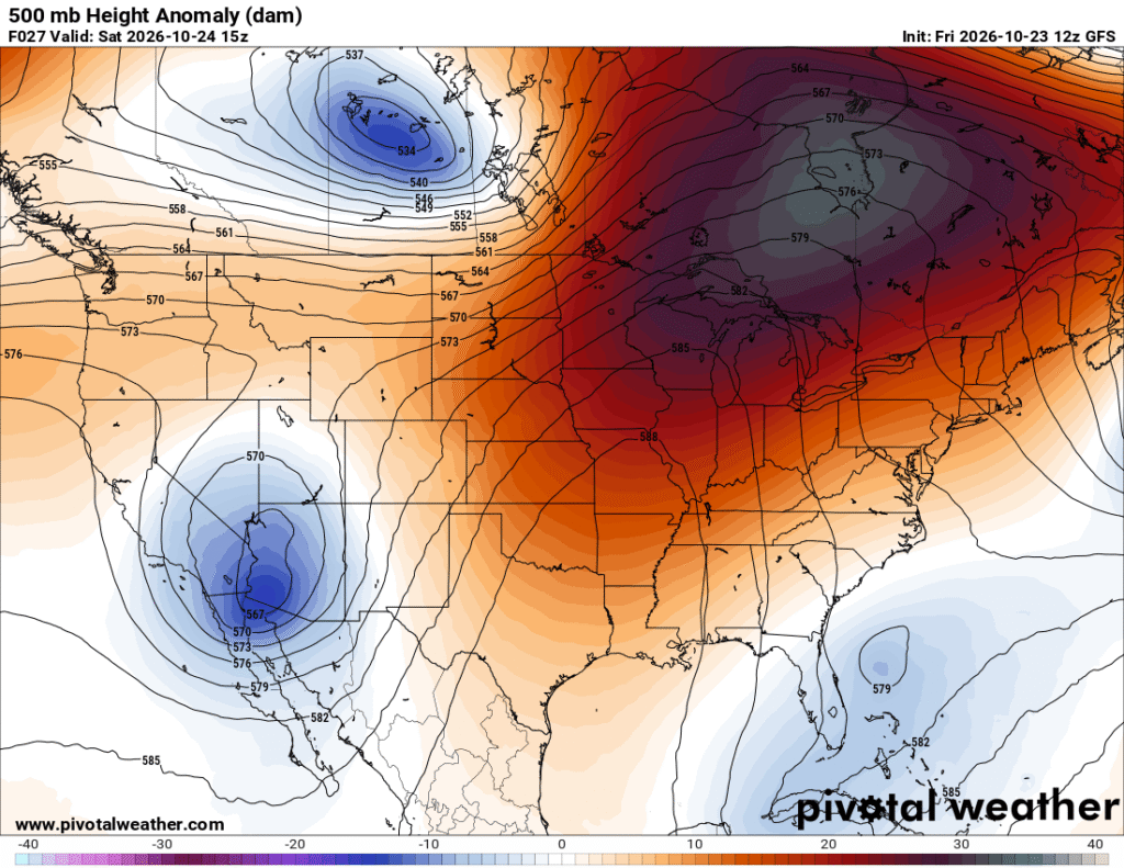
Looking at the upper atmosphere, there is no doubt that there is a blocking ridge from Mexico keeping both troughs in California and the Florida Atlantic from even going near us. This is a big reason why we’re so dry right now.
Sunday
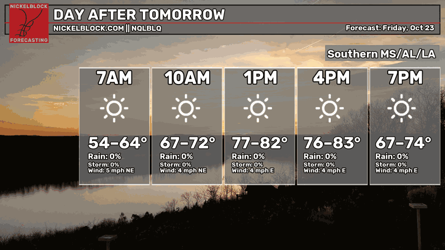
Rinse and repeat is what the NWS in Jackson is saying! And they’re right! It’s almost like Groundhog Day but at least we’re moving forward in time. Temperatures reaching the low 80s during the day, east winds, and lows in the low 50s. Not a cloud in the sky, we know the drill.
So When’s the Rain Coming?
I get asked this quite a bit, but I make no guarantees! Model guidance is only guidance, but it will help as we get closer to next weekend. Are we getting rain next weekend? Maybe.
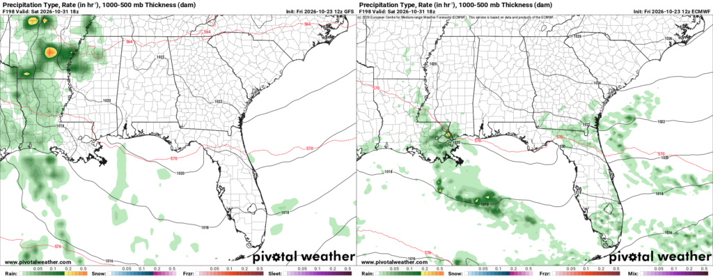
Also shout-out to Pivotal Weather! Being able to do a side by side on model guidance now is awesome!
As you can see, there’s mixed results. The low pressure system is stretching itself thin as it ejects out to Canada leaving us with not a lot. Where the rain will fall is also in question. There is quite a bit of moisture flowing towards us as this system moves in, so rain is not out of the question, but whether it’s able to push out the high pressure system far enough to circumvent that lack of convection is another story. However, by the end of the weekend into next week, things look a little more hopeful.
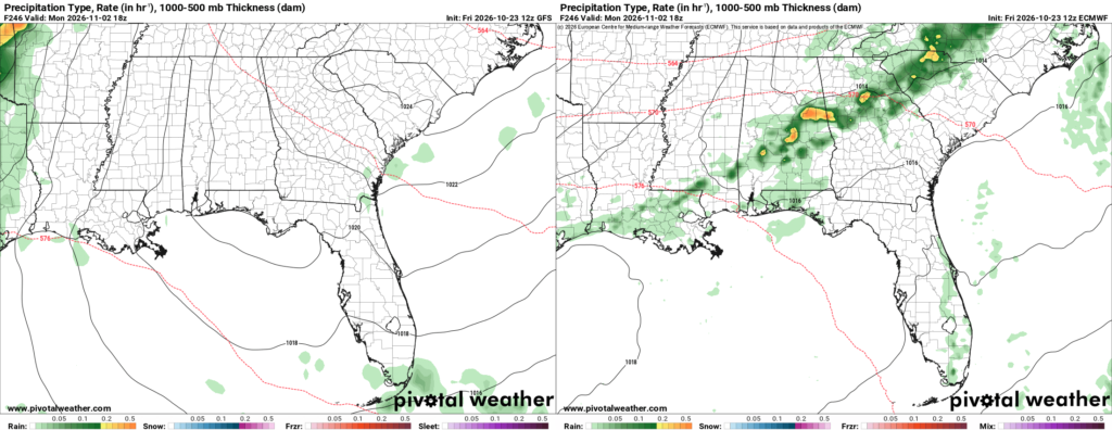
While the timing is off on the arrival, it looks like there’s a better chance of this storm system moving through as the high breaks down on Monday. The upper atmosphere is also giving way and allowing for more movement, albeit it may be short lived as it builds and breaks down fairly frequently afterwards, so it’s going to be a rocky couple of weeks with model guidance.
All this to say, the atmosphere will slowly become more favorable for rain by the week after next. There’s no guarantees of rain just yet, but we’re inching towards conditions that will allow for more rain in the near future.
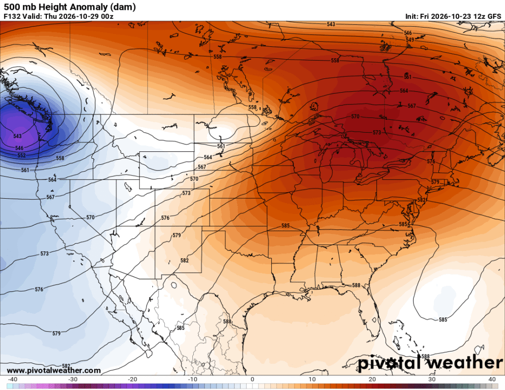
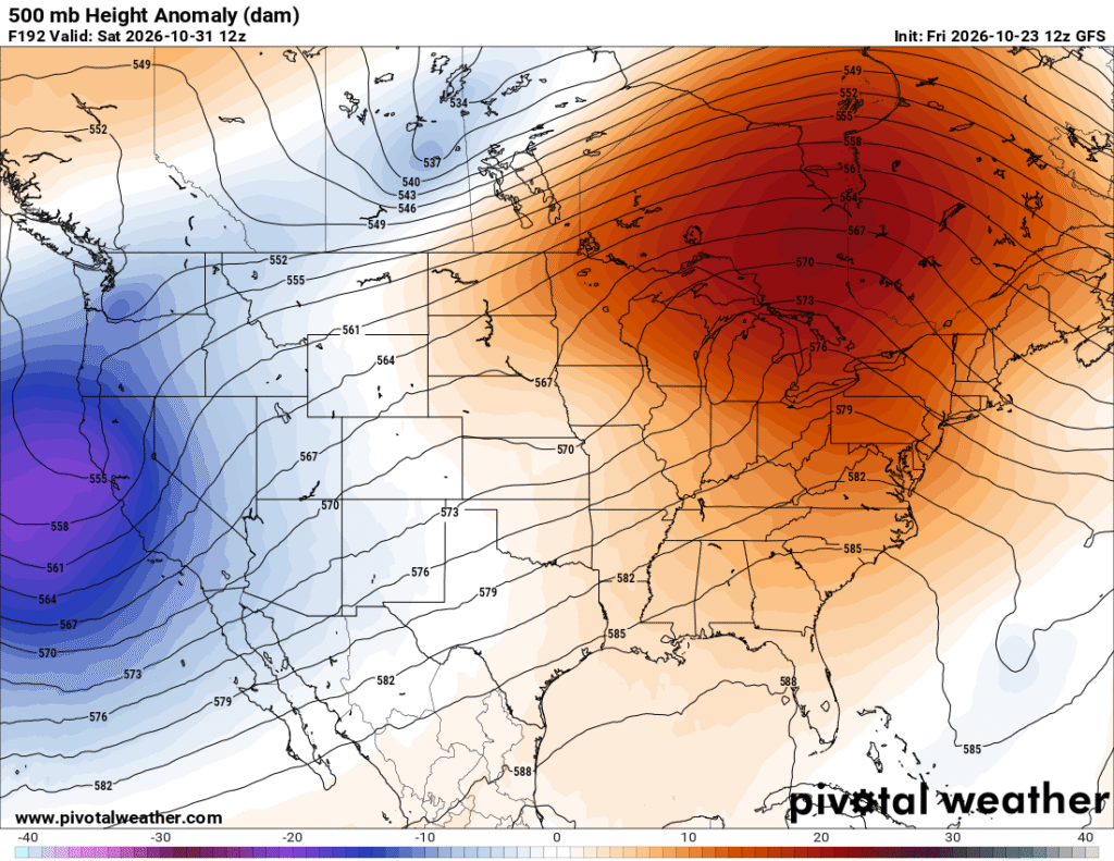
Looking at the 500mb maps above, you’ll notice a big change from a large blocking trough to a more linear one by the end of next week.
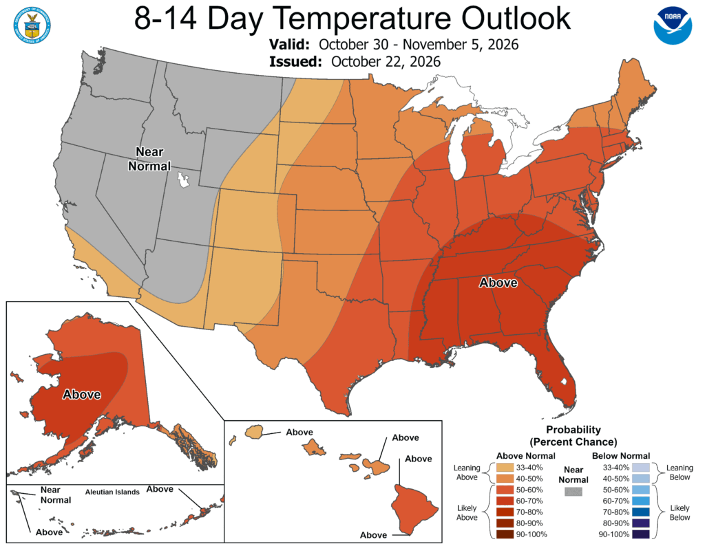
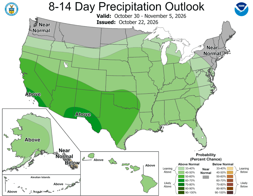
The extended outlook does emphasize warmer temperatures overall, and rain chances are shifting towards the east, slowly.


