Current Conditions
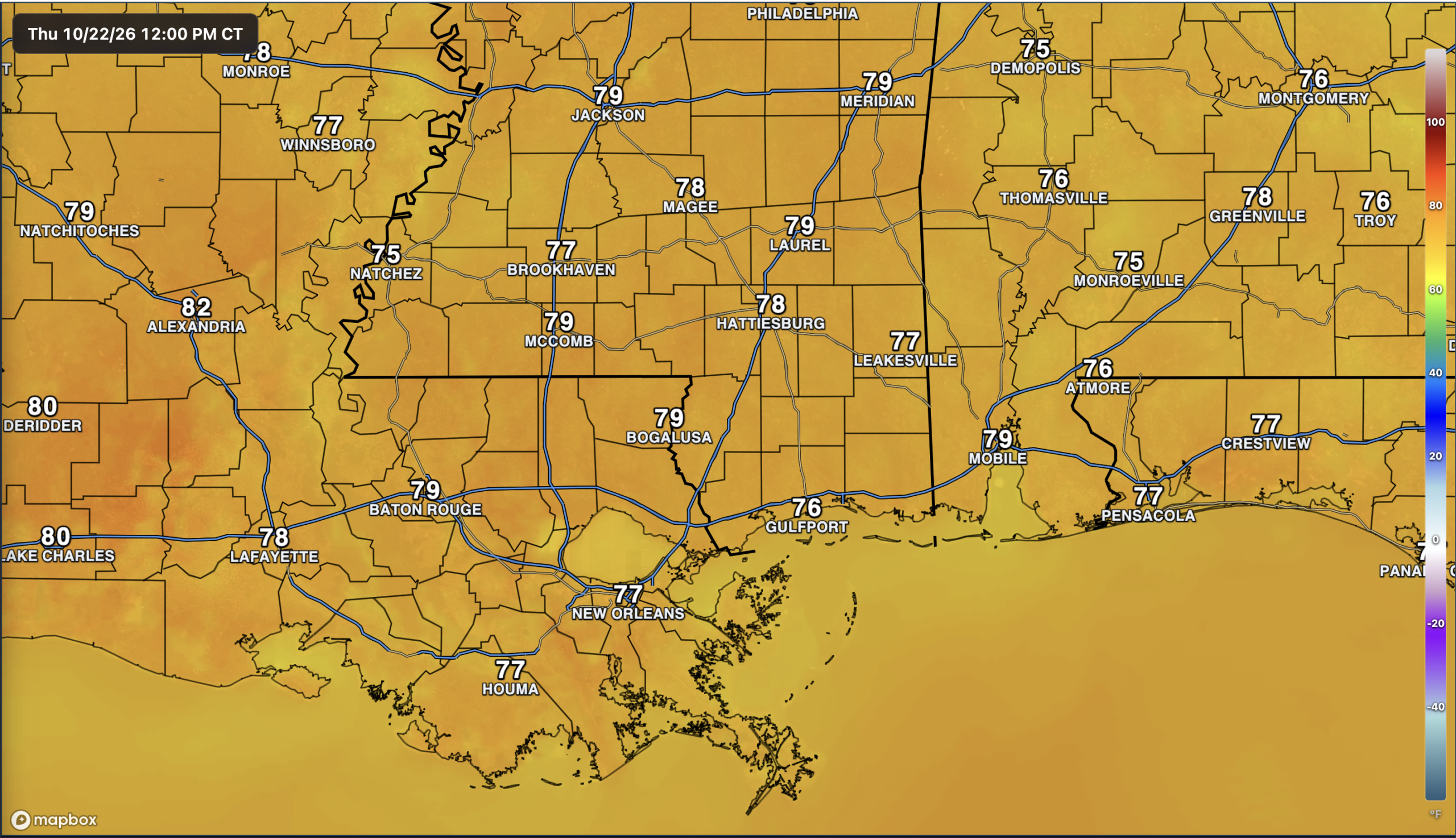
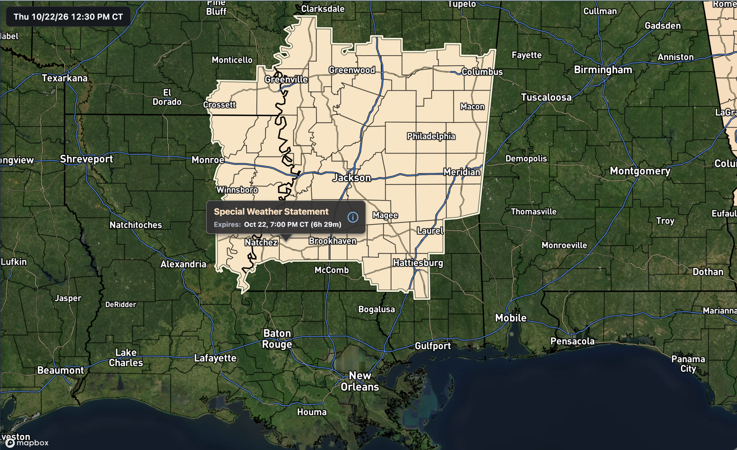
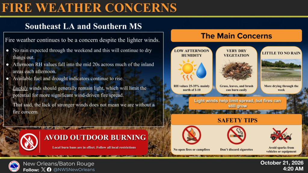
Most of the country is quiet this afternoon, though the Southwest is dealing with showers and storms, some of which have been severe. Here in the NickelBlock region, the dry stretch continues with a clear radar and temperatures in the mid to upper 70s around noon. Fire danger remains a concern, with a Special Weather Statement in effect for much of Mississippi through this evening, so hold off on any outdoor burning, as we’ve been mentioning a lot recently!
The Setup
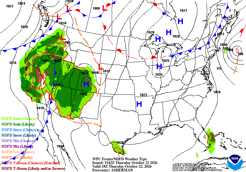
High pressure is keeping much of the U.S., including our area, quiet and dry today. The Southwest is the main exception, with widespread rain and thunderstorms, while Subtropical Storm Josephine sits offshore of New England.

Today’s Forecast: October 22nd
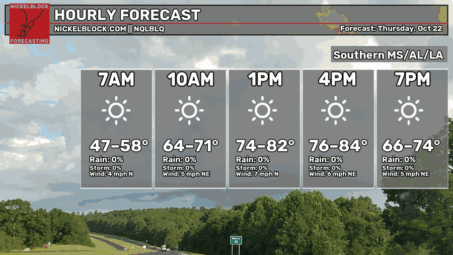
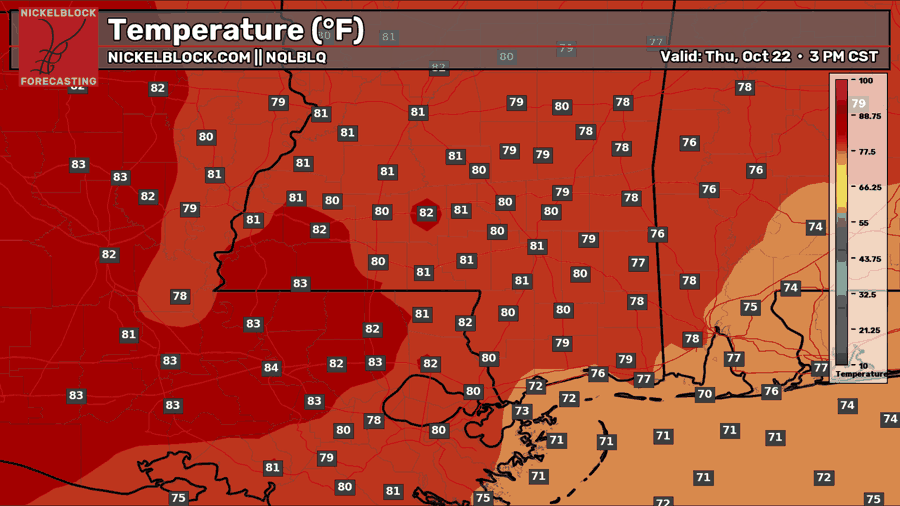
More sunshine is on tap for the rest of today, with highs reaching the upper 70s to lower 80s across most of the area. A few spots in Louisiana could reach the mid-80s, while coastal areas stay a little cooler. North to northeast winds will remain light at around 5-7 mph, and temperatures will fall back into the 60s and lower 70s this evening. No rain to talk about today!
Tomorrow’s Forecast: Friday, October 23rd
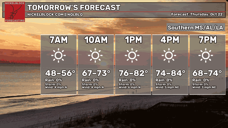
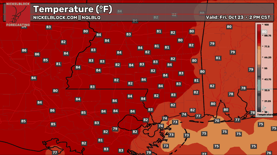
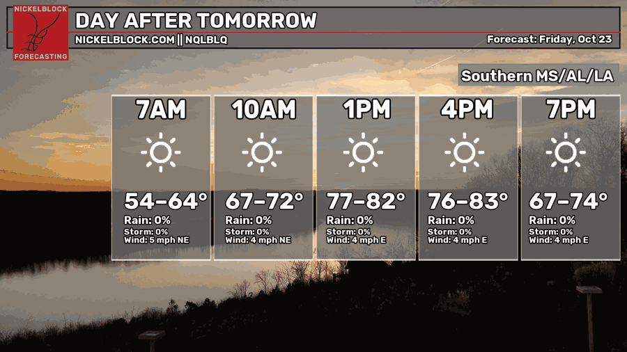
Friday looks like another sunny and dry day, just a little warmer! Temperatures will start in the upper 40s to mid 50s before climbing into the lower to mid 80s for most inland areas, with upper 70s closer to the coast. Winds will stay light out of the north to northeast, and temperatures will drop into the upper 60s to mid 70s by 7 PM. Looking good for any Friday evening plans!

Saturday’s Forecast: October 24th
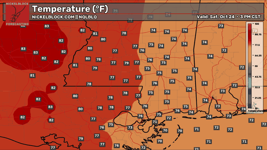
Saturday brings more of the same sunshine and dry weather, so outdoor plans are looking good! Morning temperatures will start in the mid 50s to mid 60s, with afternoon temperatures ranging from the lower to mid 70s across southern Alabama and eastern Mississippi to the lower 80s farther west in Louisiana. Winds will stay light out of the east to northeast, with temperatures settling into the upper 60s to mid 70s by the evening.
Extended Local Outlook
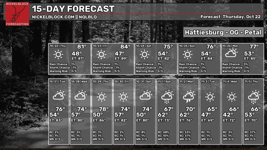
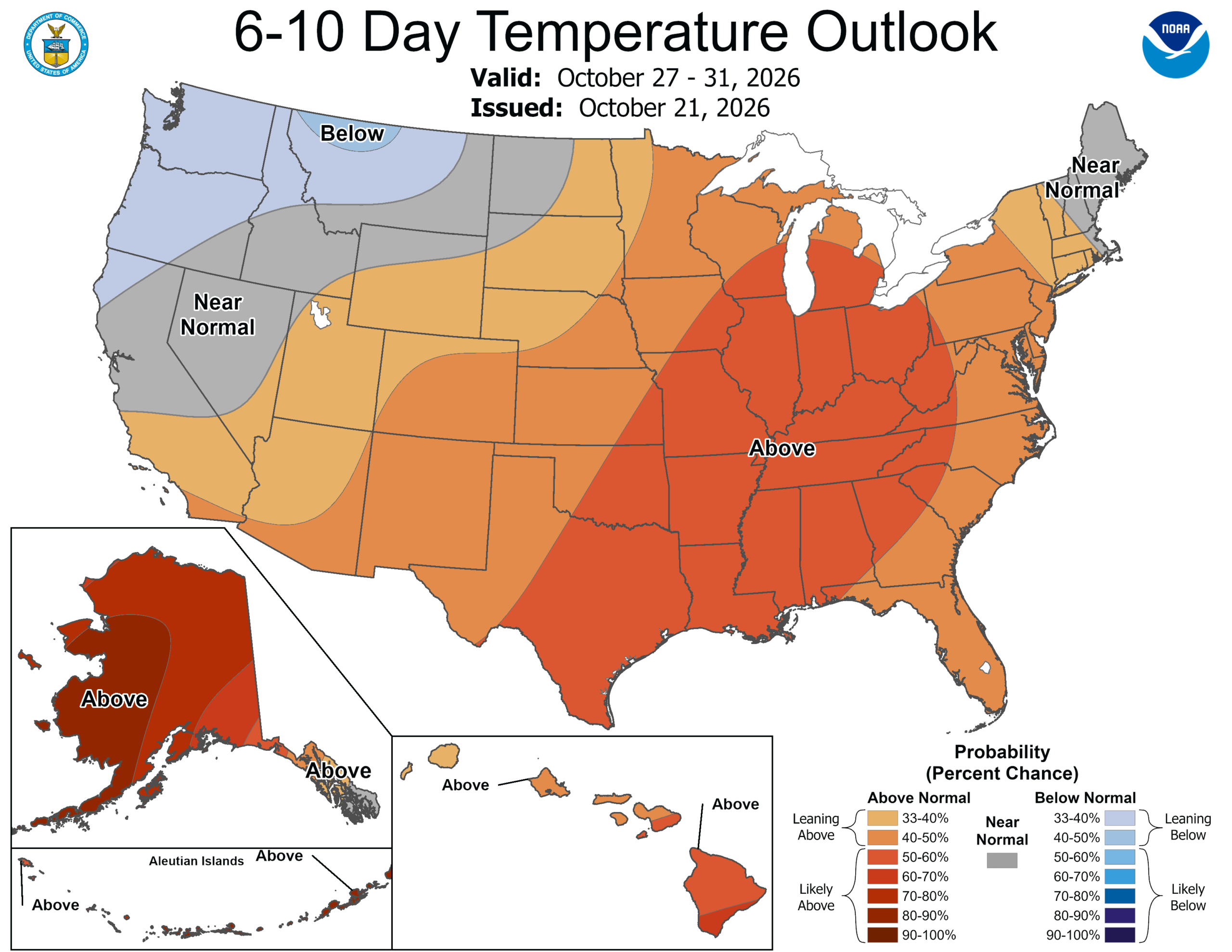
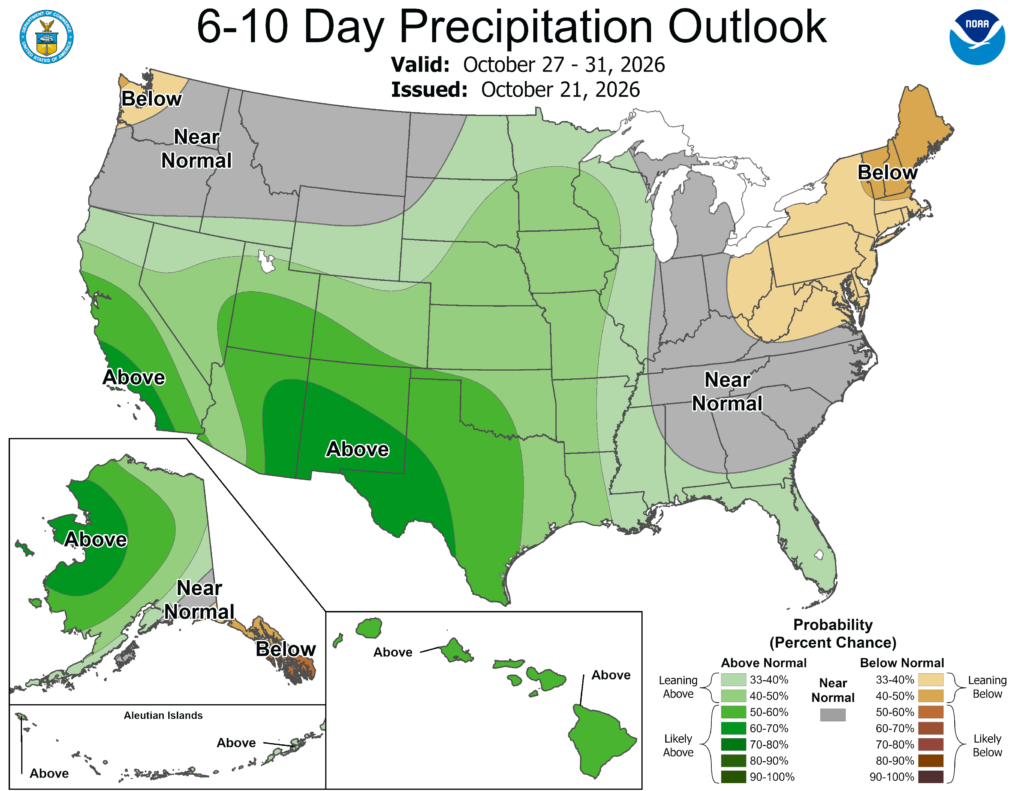
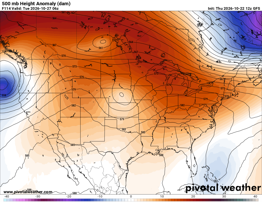
I know I’m starting to sound like a broken record, but the dry weather looks to stick around through much of next week! Highs will generally stay in the 70s with overnight lows in the 50s. Ridging overhead will help keep things quiet, and the Climate Prediction Center favors above-normal temperatures heading toward Halloween. There are hints of rain returning around the start of November, followed by cooler temperatures, but that’s still far enough out that the timing will likely change.