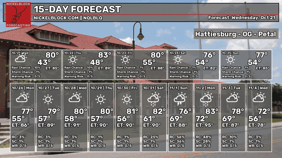
It’s been another beautiful day today with highs just reaching 80! The wind has been fairly light, but otherwise, it feels like Fall! It’ll continue to be that way for several days as well. Let’s take a look at the rest of our week!

Today
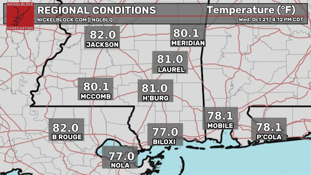
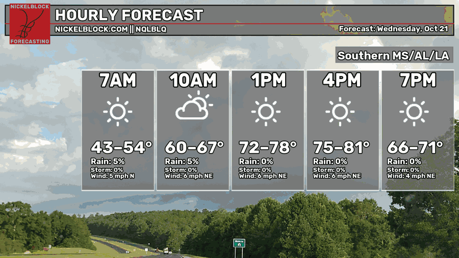
We’ve had a few upper level clouds in the sky today, but otherwise, clear skies! Temperatures have topped out just around 80 for most of us with northeast winds moving through most of Mississippi. Overnight, temperatures will fall into the upper 40s to low 50s with clear skies.

Tomorrow
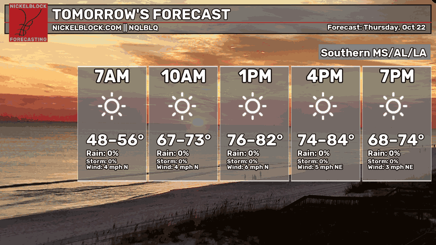
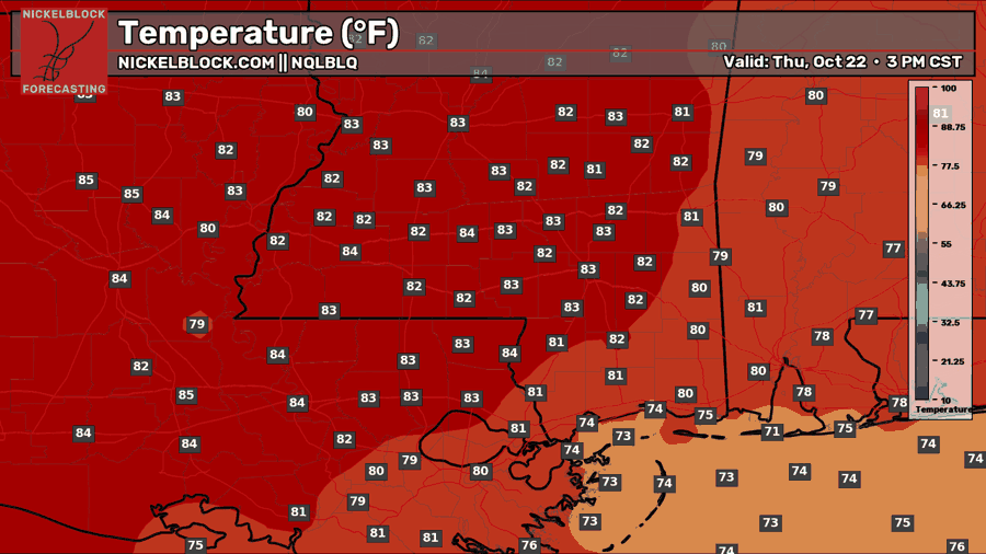
As we roll into Friday-eve, temperatures will be a little bit warmer than today by a few degrees. Thankfully, the humidity won’t change much, but low temperatures will also fall a little further towards the low to mid 50s.
Friday
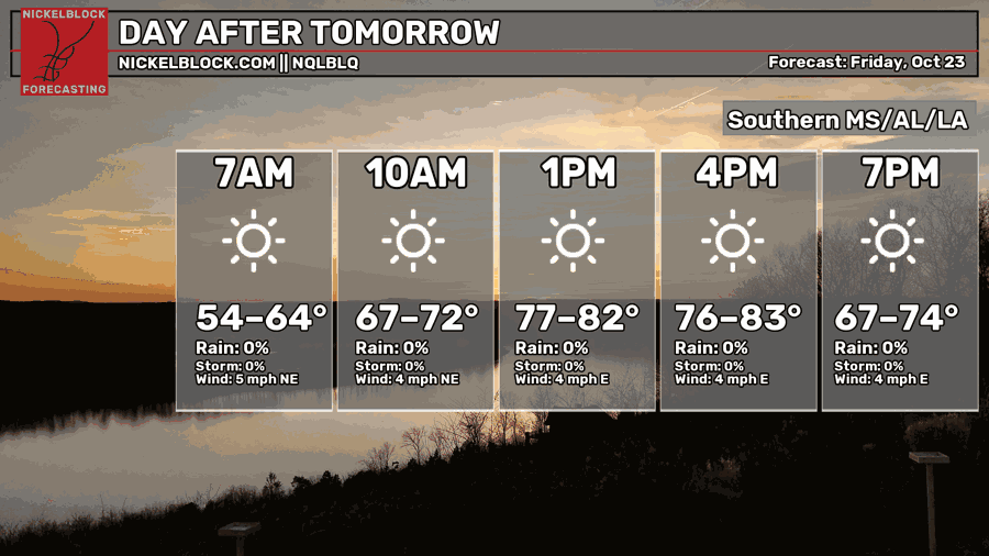
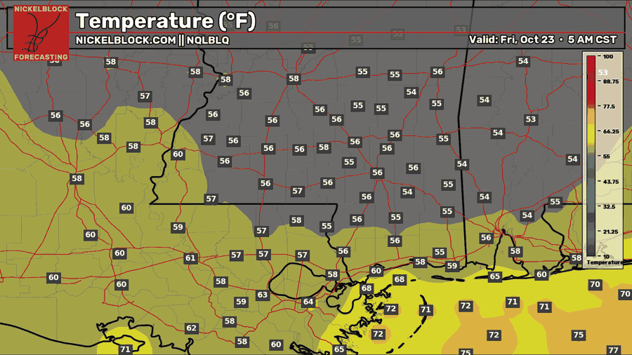
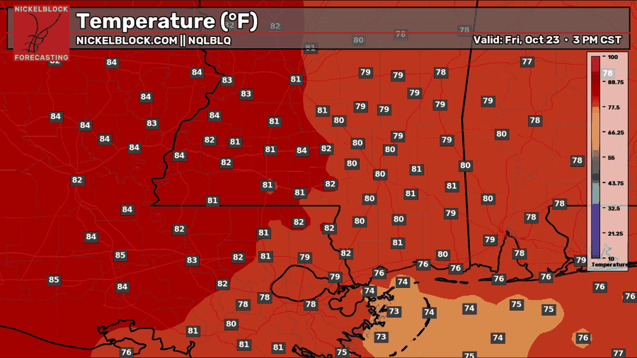
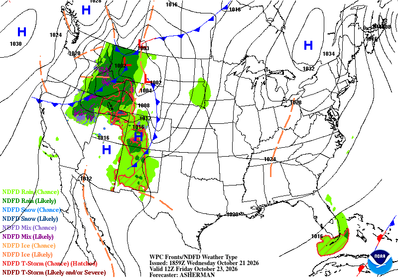
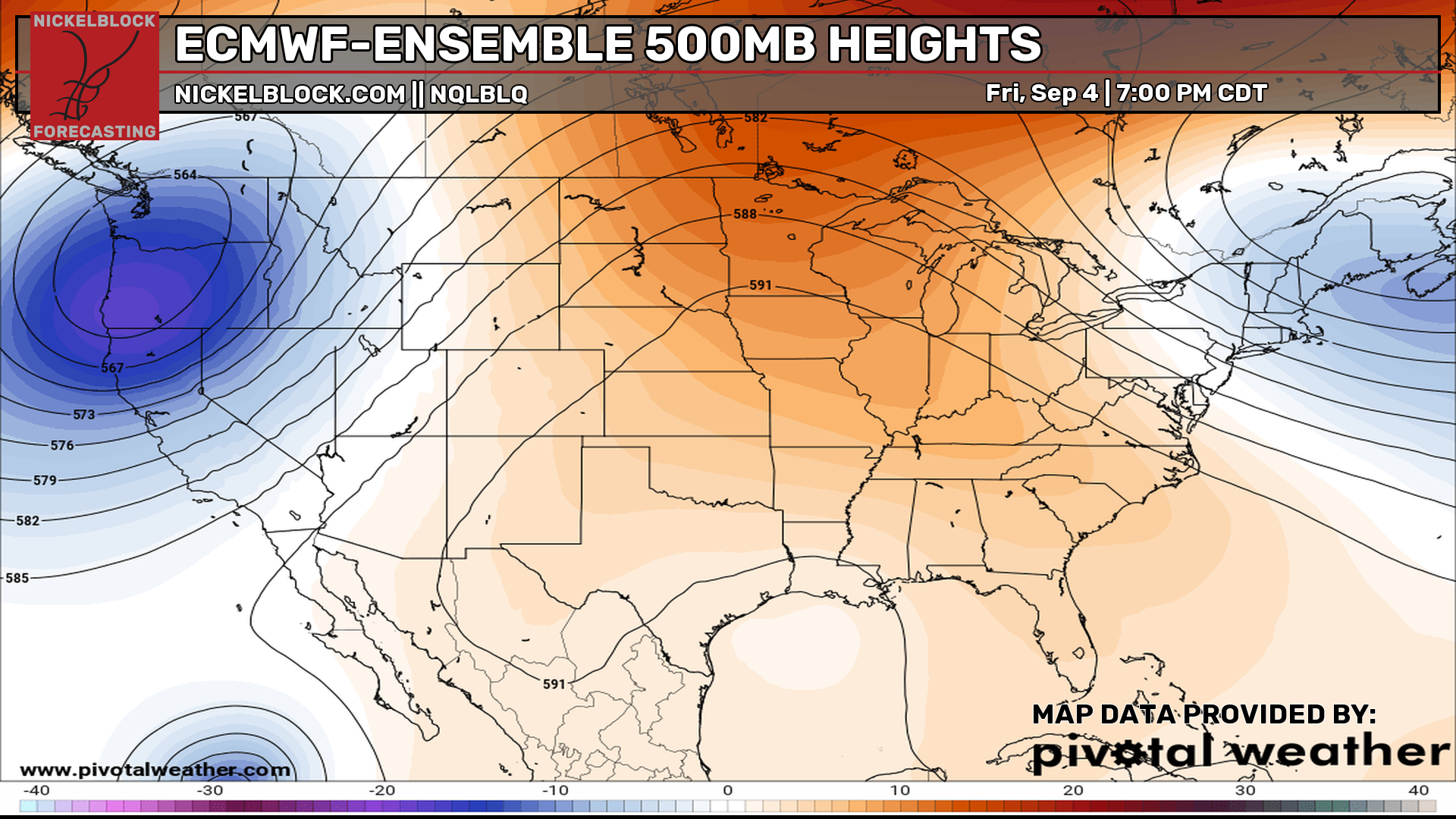
Despite the warmer morning, temperatures will be slightly cooler by the afternoon compared to Thursday. Temperatures will hover around 80 with clear skies. Barely a cloud in sight! Looking at the upper and lower levels, the high pressure system still reigns supreme. The upper levels compound on this with no low pressure systems able to push through.
The Weekend
Ladies and gentlemen, the Weekend.
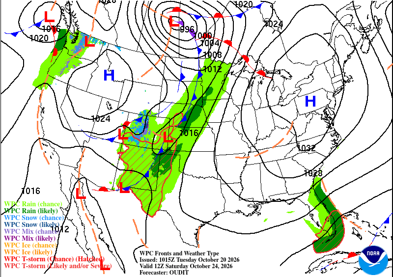
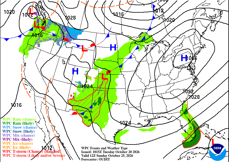
There isn’t a lot of movement in the atmosphere for anyone in the eastern side of the US. The high pressure system is creating a blocking and drying out any systems that move towards it, hence what we see in the high plains to Ontario. The high will morph around the low and eject it to the Hudson Bay.
For us, not much will change. The humidity will increase a bit, however, due to the influx of moisture to our west. Expect temperatures in the upper 70s to low 80s during the day and lows in the low to mid 50s. Despite the slight rain chances in the middle of the Gulf, we won’t see any of it for a while longer.
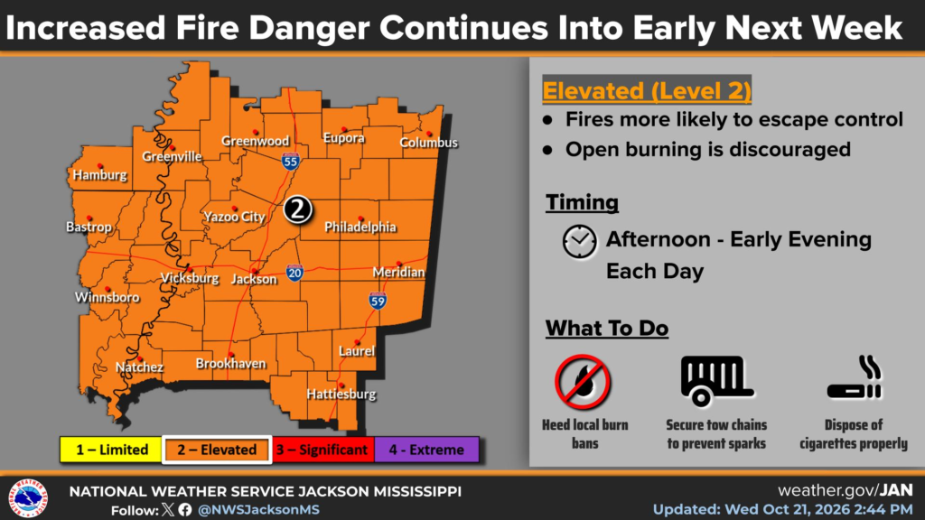
I’ve said it twice in the past week, but I’ll say it again. DON’T BURN. It’s dry, there’s burn bans everywhere, and wildfires will spread.