On the heels of the catastrophic flooding last night in Pearl River Cpounty and Washington & St. Tammany Parishes, we do have more rain on the horizon.
But the truth is there there might not be much.
In fact, as we head through the next two weeks there will be a few rounds of potential rain, but nothing is sticking out as a “sure thing” for our area in particular. While each next system will glide by, we may be in a bit of a weird “lull zone” where we see rain to the west and then rain to the east, but for us… not much.
And, when you look at the maps, there is plenty of activity coming.
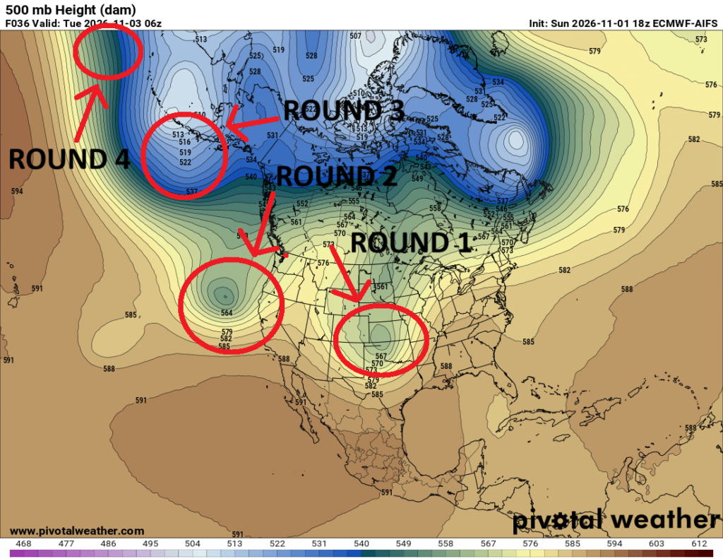
Multiple rounds of storm systems set to push through the United STates between no and the middle of next week. In fact, I could argue that there is a “Round 5″ and Round 6” to go with the systems highlighted above, too!
But, so far, it looks like with the first two, we may see some rain but certainly not as much as some folks would hope for. And not as much as we would “normally” see with passing systems in November.
The three maps below show how much rain we will get during 5-day periods during the next 15 days. The ECMWF-Ensemble guidnace shows between 0.5″ -1.0″ of rain in teh first window, up to 0.5″ in teh second window and a little more than 0.5″ in the third window.
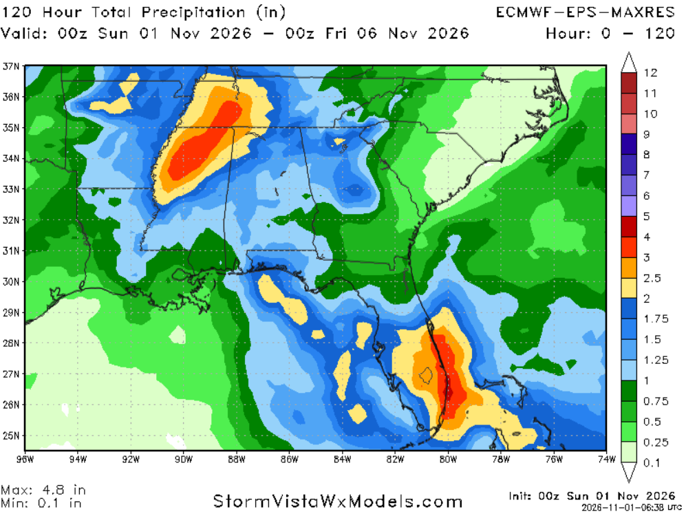
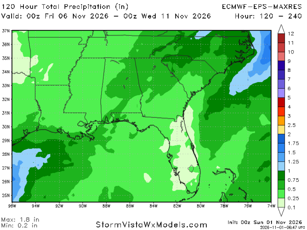
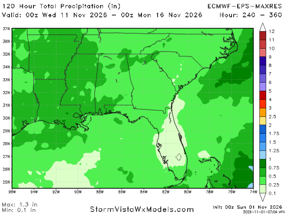
Compared to normal? About 75% of normal.
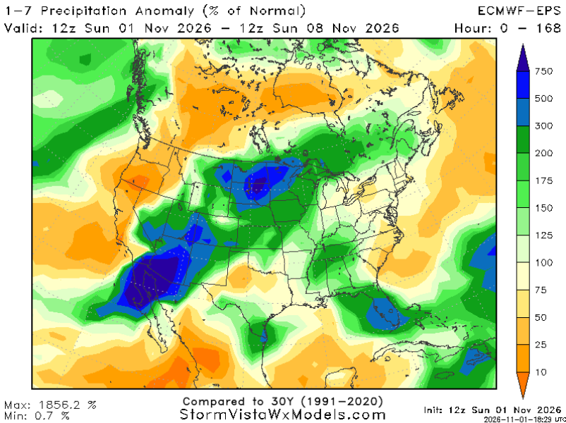
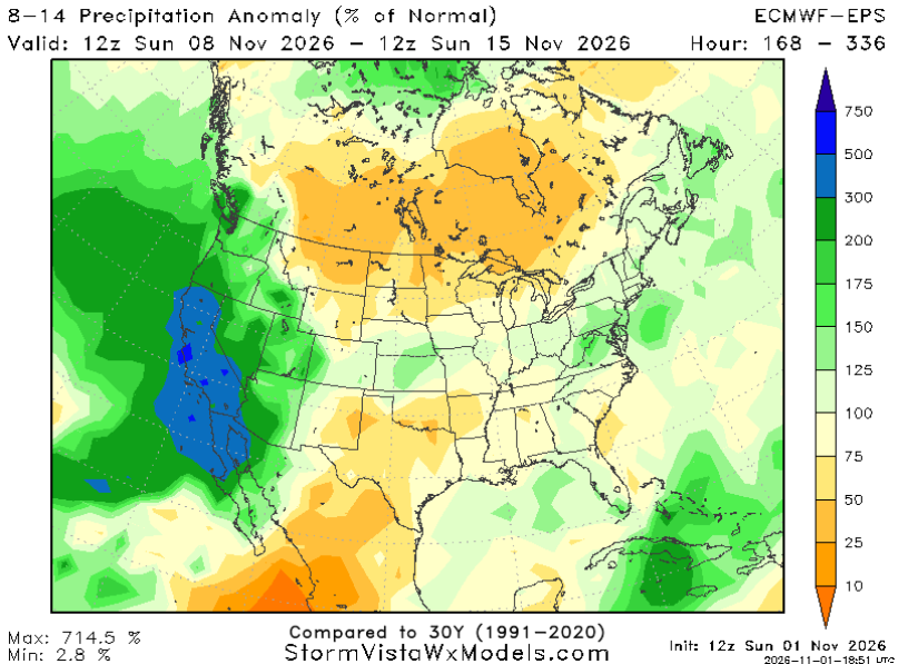
And that is during a pretty active pattern! You would normally think 75% of normal would happen in a slower pattern or under a ridge of high pressure.
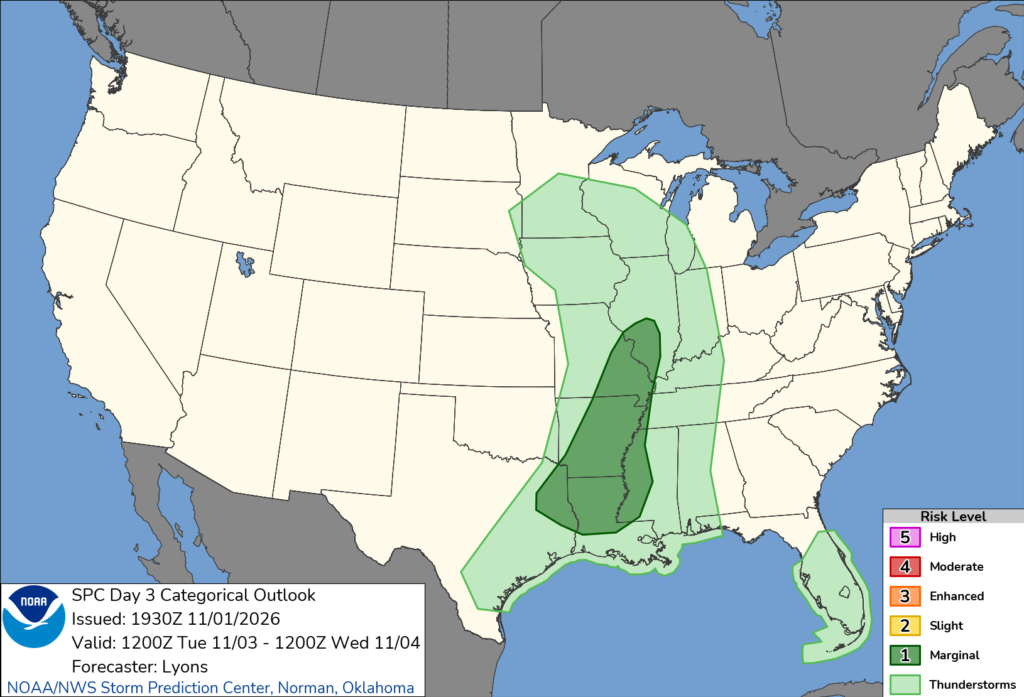
So while there is a Marginal Risk for severe weather to our west on Tuesday (it clips a handful of our counties, too, I suppose), I don’t know that it automatically means our entire area will see a Marginal Risk (or Slight Risk) on Wednesday.
This also means that while the forecast shows a lot of “rain” on the icons used for the forecasts… do know that things may be more spotty than normal.
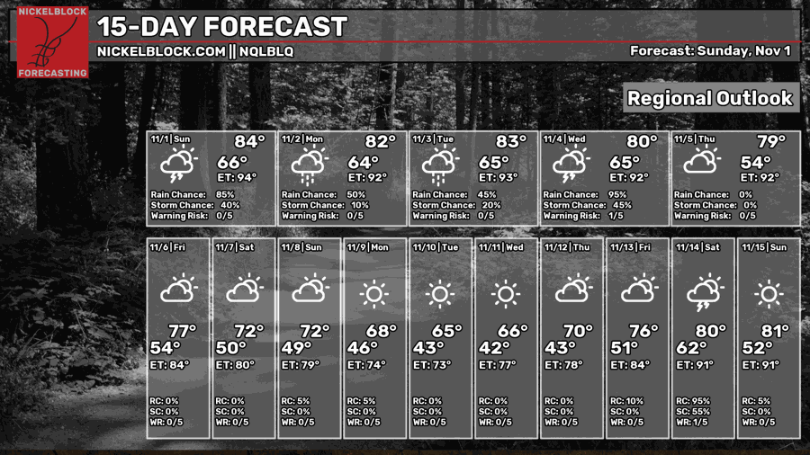
It also means the “95% chance for rain” you see on the “Regional Outlook” here is still correct. There is a really good chance that a lot of people see -some- rainfall. It just may not be much at all. And there may be a lot of here-and-there to the rain.
Another good example of this is on our rarely-used-but-still-pretty-cool Contour Maps
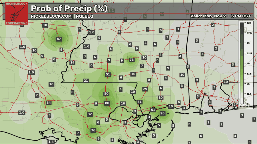
Looking at tomorrow night, the raw data supports a lot of places with a 3% to 10% chance for rain with only a few select locations with a much higher shot for rain.
And at the same time, how much rain are we talking about? Oh, you know, about 0.10″ of rain.
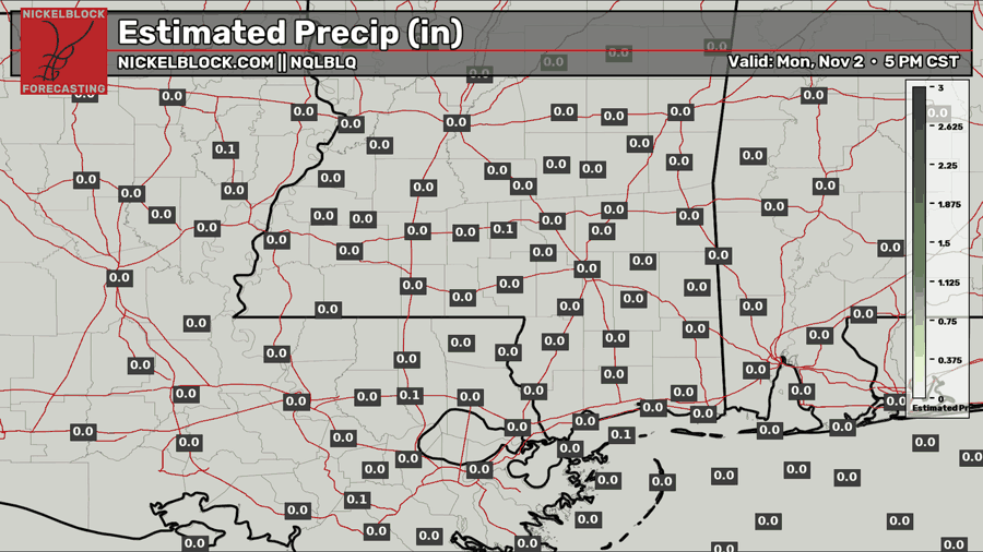
Not. A lot.
So! Despite the active pattern, it may not be active with copiou samounts of rain. It might just be active with fronts, clouds, and spottier-than-normal showers.


