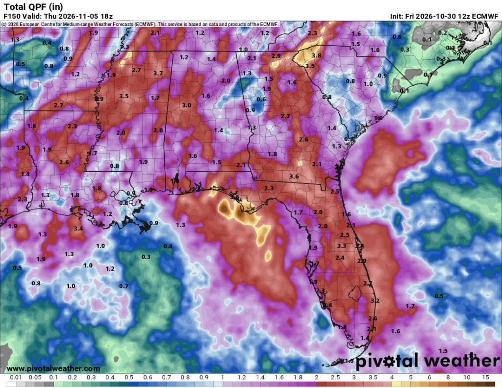
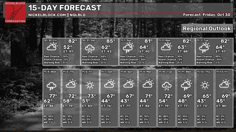
Well, after so much waiting and a lot of drought, the rain is here to see us! Sadly, that also means it’s on Halloween. Get your kids a poncho if you’re going out trick-or-treating! The rain hangs around during the evening hours as well into November, so keep that in mind if you’re going to church in the morning.


Today
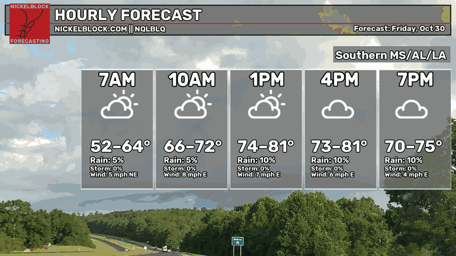
A few clouds have rolled in during the day leaving us somewhat warm. Highs will top out around 80 with winds out of the east. No rain so far! If you’re out and about tonight, it’ll be nice, if a little humid by the evening hours. Overnight, we’ll have a warmer night ahead with lows in the mid 50s to low 60s. A sign of what’s to come!

Halloweee-ee-een! Halloween!
(I sang that in my best Danzig voice)
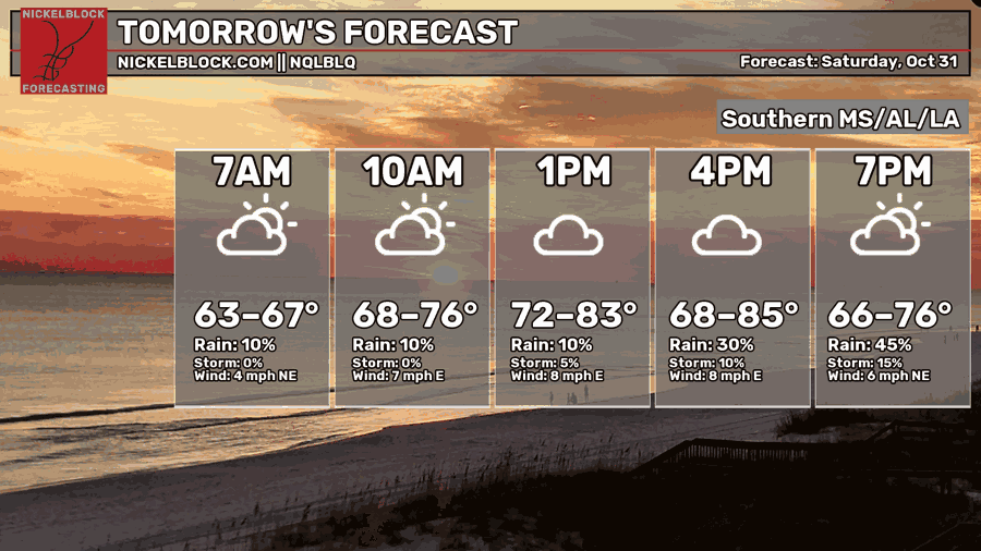
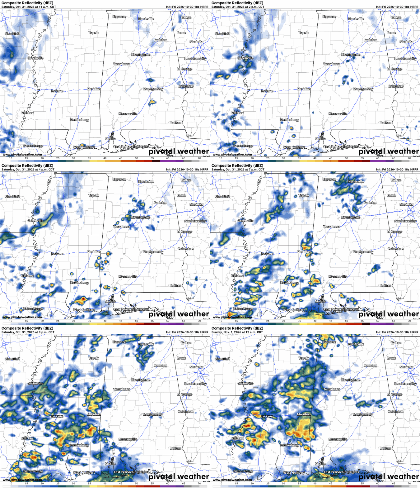
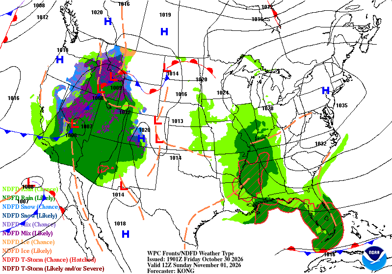
We start off Halloween with a somewhat warmer than average morning indicating the humidity we’re feeling. A few storms will pop up during the midday hours, moving north over the afternoon into the evening hours. Scattered storms are likely and the storms will be more present across the Gulf South in the evening. So if you go trick-or-treating with your kids, make sure to go early. Temperatures will average around the upper 70s by the afternoon dropping depending on where the storms hit. Overnight, the showers and storms will keep coming over much of the Pine Belt and slowly move east with the front.
Dia de los Muertos (Sunday)
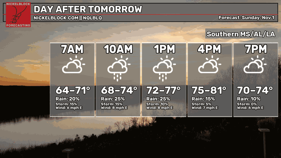
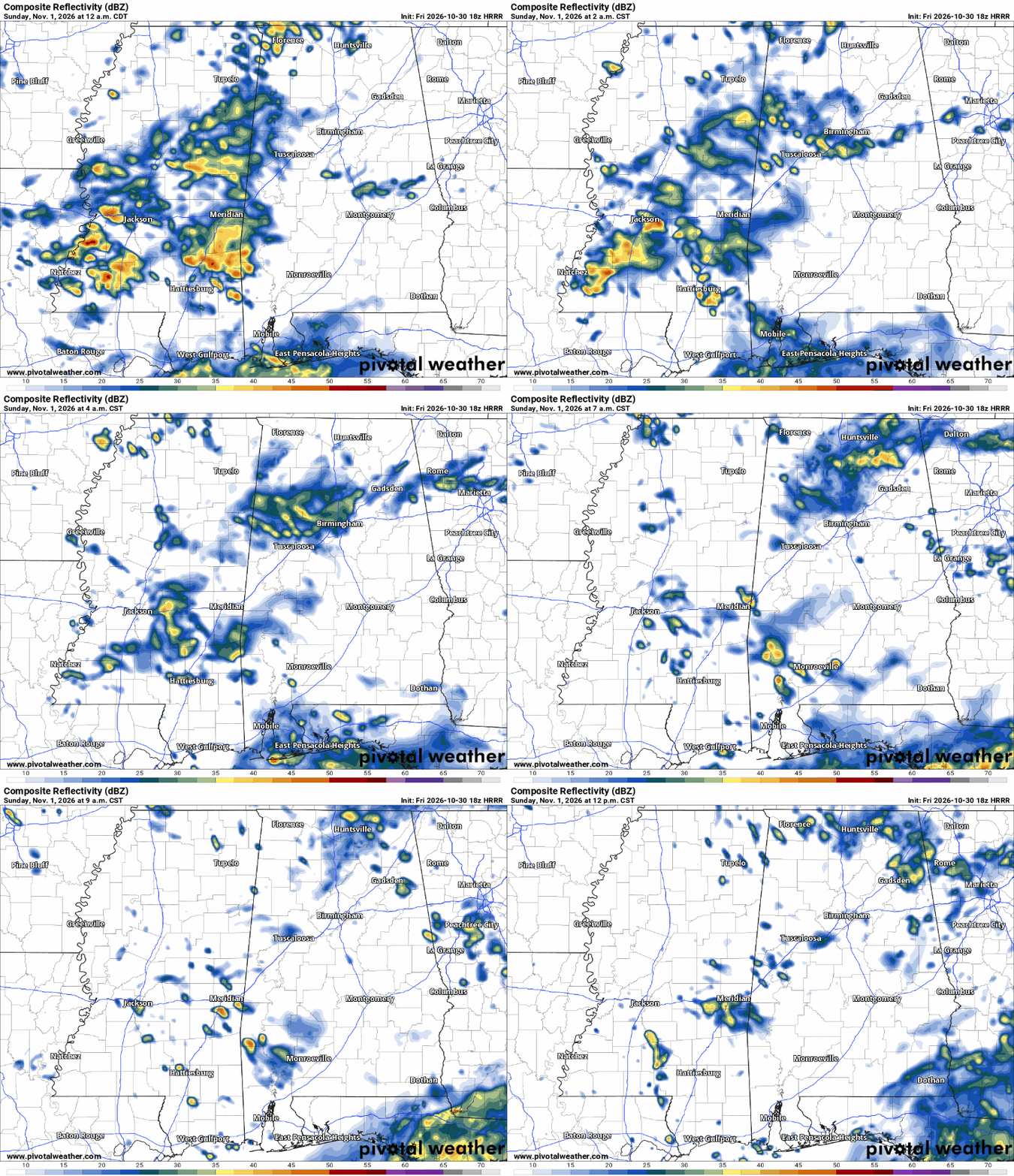
We’ll start off with a soggy morning as the storms rain themselves out by the early afternoon. Most of the storms will have moved off into Alabama at this point. Afterwards, we’ll have a partly to mostly cloudy day ahead as temperatures reach the mid 70s. Overnight, temperatures will reach the low 60s.
Next Week
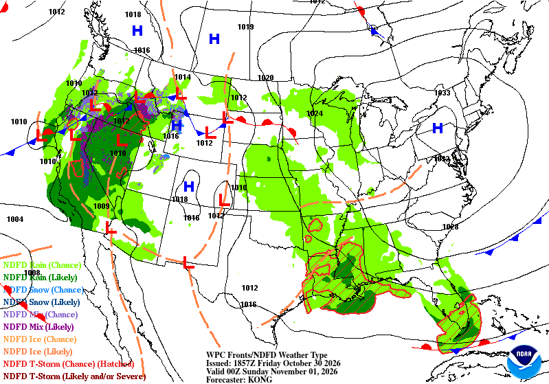
We start off November a little more humid and warm than we’d like, however that’s due to another incoming system on Tuesday and Wednesday. This system so far doesn’t look too impressive and that’s due to a couple of reasons. The first one is that the low pressure system is stretched fairly thin due to it’s location. It starts out in the upper Rockies and takes a semi-lateral path towards Minnesota. Despite that, another system develops in its wake towards Arkansas/Missouri. Even so, the WPC map shows this system occluding fairly early, essentially cutting off a lot of the severe potential. The warm front can’t stretch out enough to create discrete cells ahead of the system and the cold front is just behind it, leaving us with more of a marginal risk for severe thunderstorms.
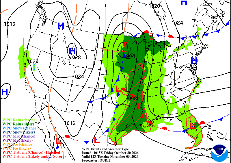
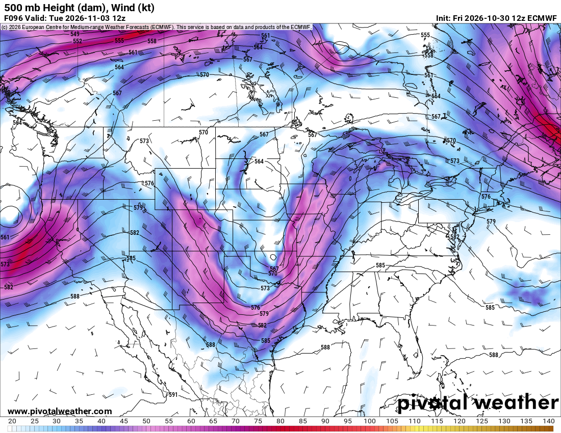
That being said, we still have a little bit of severe weather potential. This can change in the next few days, but looking at the Skew-T’s and weather maps, so far it doesn’t look too impressive. I believe that there could be some severe weather especially to our west before it reaches us. The upper atmosphere (right) also does something interesting on Tuesday, creating it’s own closed low and dipping further south towards us. You can see where both systems lie on the surface map (left) because of it!
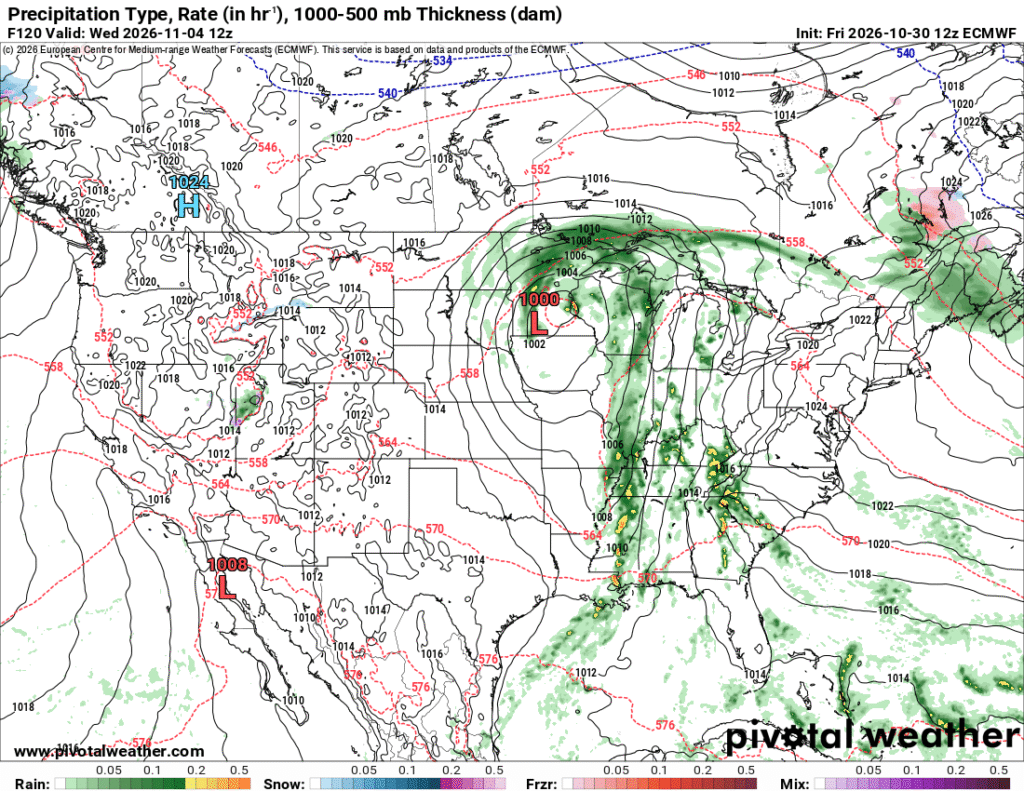
Either way, we’ll see a good chance of rain by Tuesday evening into Wednesday morning. A few thunderstorms, wind, and some lightning. While it won’t be a ton of rain, I think our totals over a few days’ worth will hopefully be a good sign for us to receive some more over the next few weeks. Afterwards, we’re stuck in some doldrums as temperatures begin to even out during the days and nights. Overall temperatures hover around the mid 70s with lows in the low 50s. This will likely drop by the week after next too!