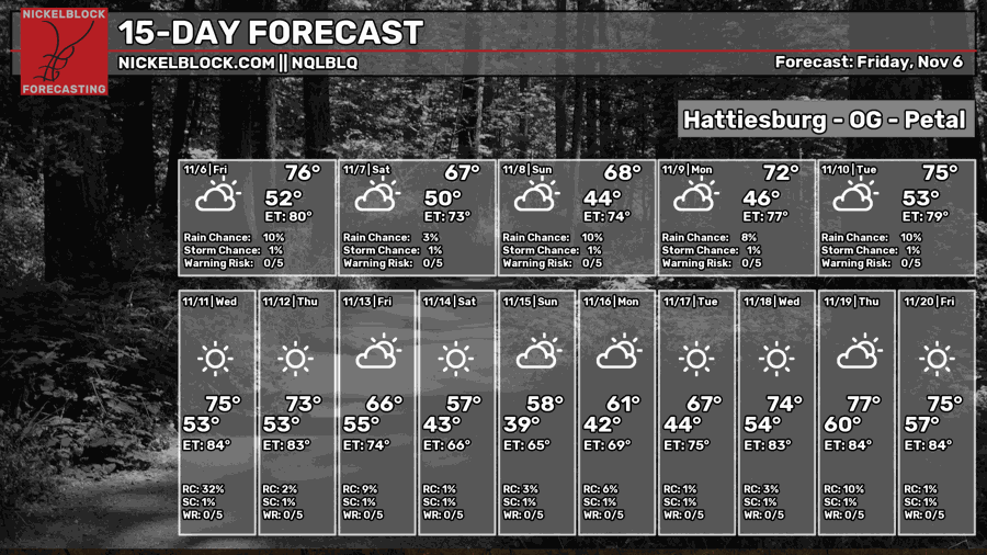
It’s been a warm one out there so far, but we’ll soon get a cool wind coming in bringing the fall temperatures to start off the weekend! We’ll fall back into the upper 60s to low 70s across the area and lows will fall into the upper 30s to low 40s. As next week approaches, rain chances are looking pretty slim with a blip of rain possible for the Pine Belt around mid-week.

Today
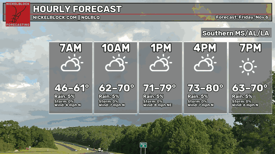
Highs have been topping out in the upper 70s across most of the Pine Belt and around 80 in Louisiana. We’ll begin to feel the incoming cold front towards the evening hours as the winds shift towards the north. The overall low will be in the upper 40s to around 50 with some intermittent clouds.

Tomorrow
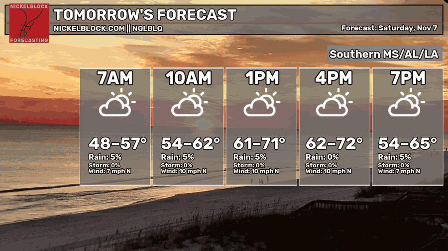
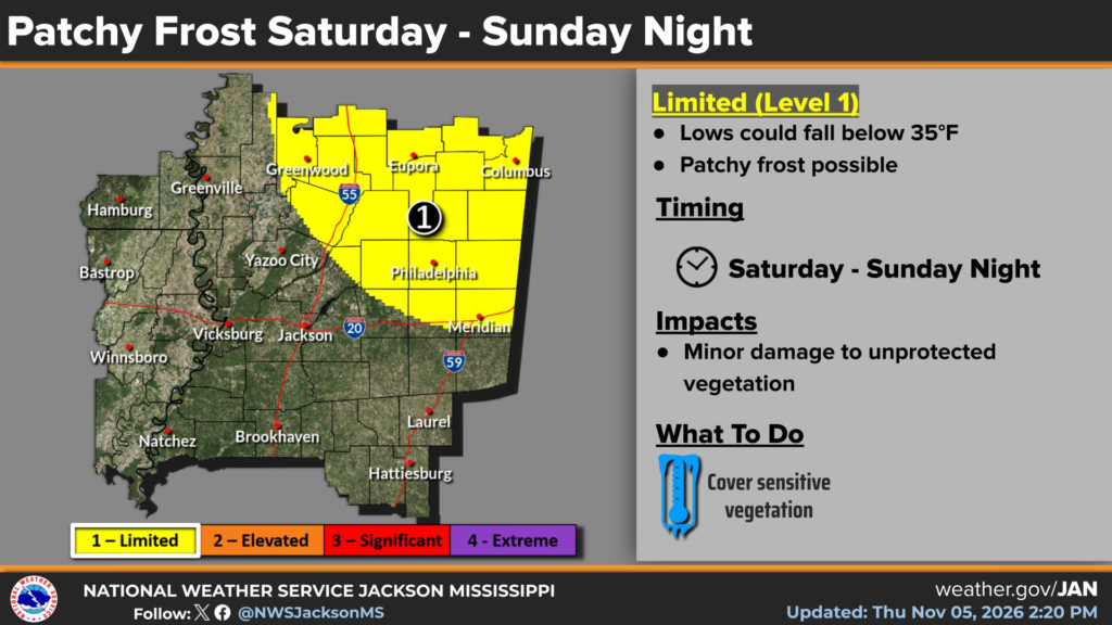
We can see the lower threshold of temperatures on the NQLBLQ model with highs only topping out in the upper 60s to around 70. There might be a bit of a chill in the air as the gales of November are moving in! Okay, maybe not gales but at least a 5-10mph wind. Overnight, temperatures will fall into the low 40s and even the upper 30s for many near I-20. The NWS in Jackson has already issued a frost advisory for many north of Meridian.
Sunday
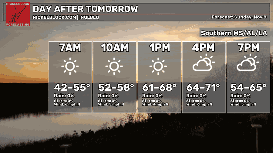
Sunday’s temperatures will feel just as cool as Saturday’s but without as much of the wind gusts. It’ll be a mostly sunny day ahead with a high in the upper 60s and winds out of the north. Overnight, lows will be in the 40s for much of the Pine Belt.
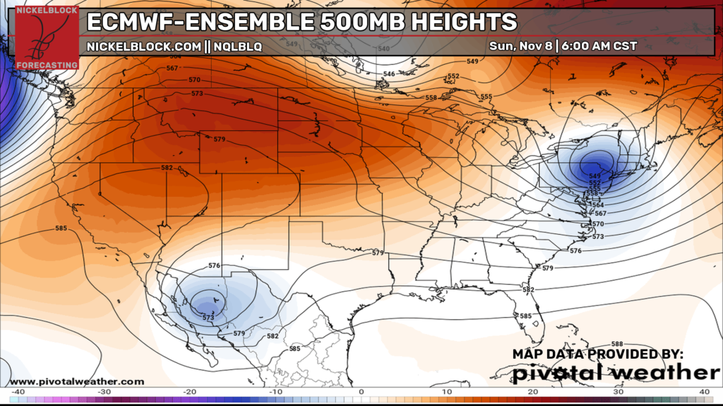
Looking at the upper levels, a deepening trough in northwestern Mexico seeks to dig further, however it will quickly run out of steam. It will have a possible effect on our weather next week though.
Next Week
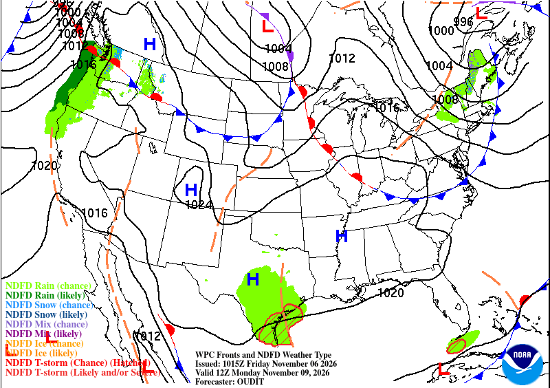
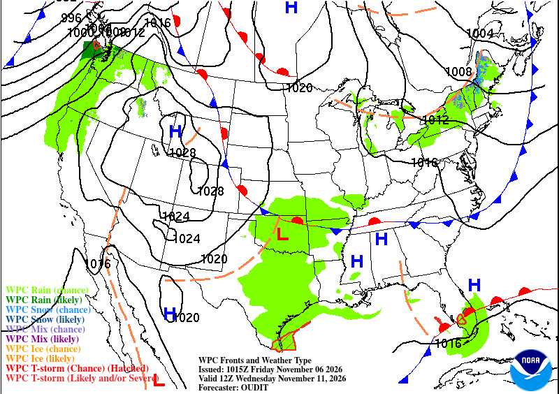
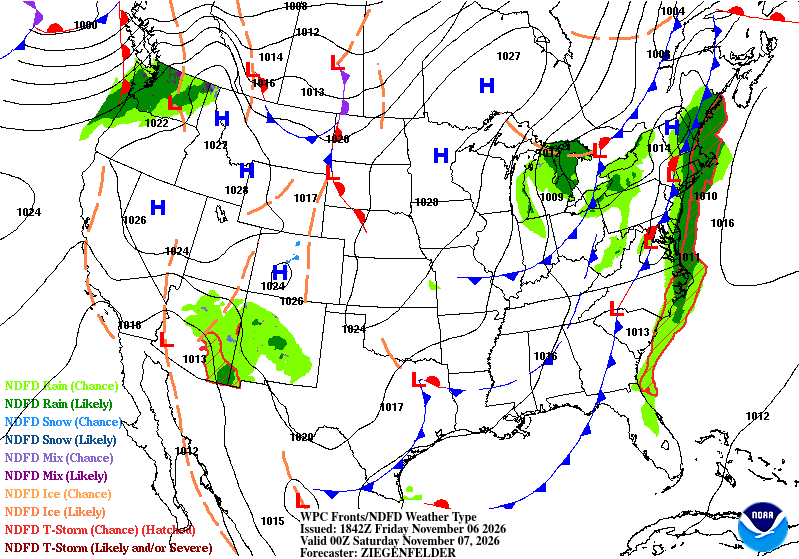
Temperatures will be back to seasonal norms as conditions begin to even out from a large high pressure system across the entire US. The average temperature will be in the low to mid 70s across much of the Deep South as there isn’t a lot of movement in the atmosphere.
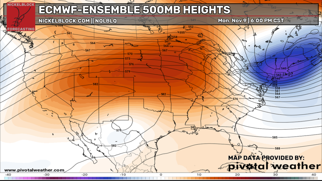
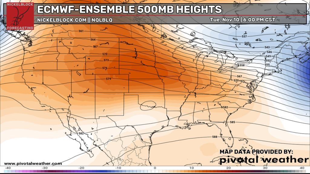
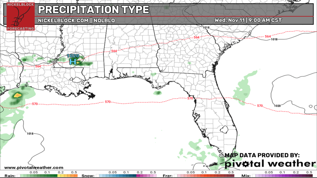
That little blip of rain I mentioned earlier is right here on Wednesday. A subtropical system is being suppressed by the large high pressure system across the US and Gulf South. However, a small cluster of showers may be possible on Wednesday as it sneaks in from the west. Looking at the two 500mb maps above, we can see the trough weaken significantly which won’t allow much movement of moisture to create a storm system above the Gulf.
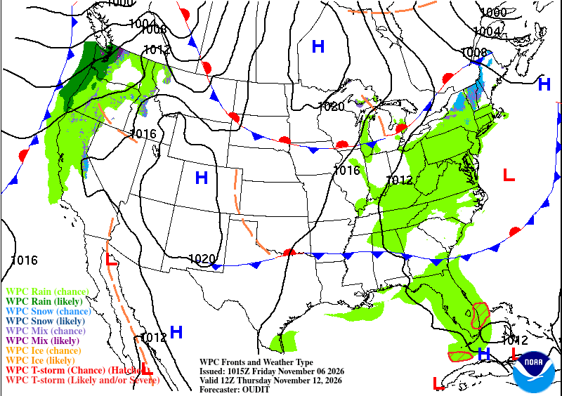
This doesn’t really stop another large front from moving in, though. I wouldn’t call it a polar blast, but a large high pressure system out of Nunavut will move in allowing for a cooler mass of air by the end of the week. It’s fairly slow moving, so it likely won’t be here until the weekend and may not last very long.