Current Conditions
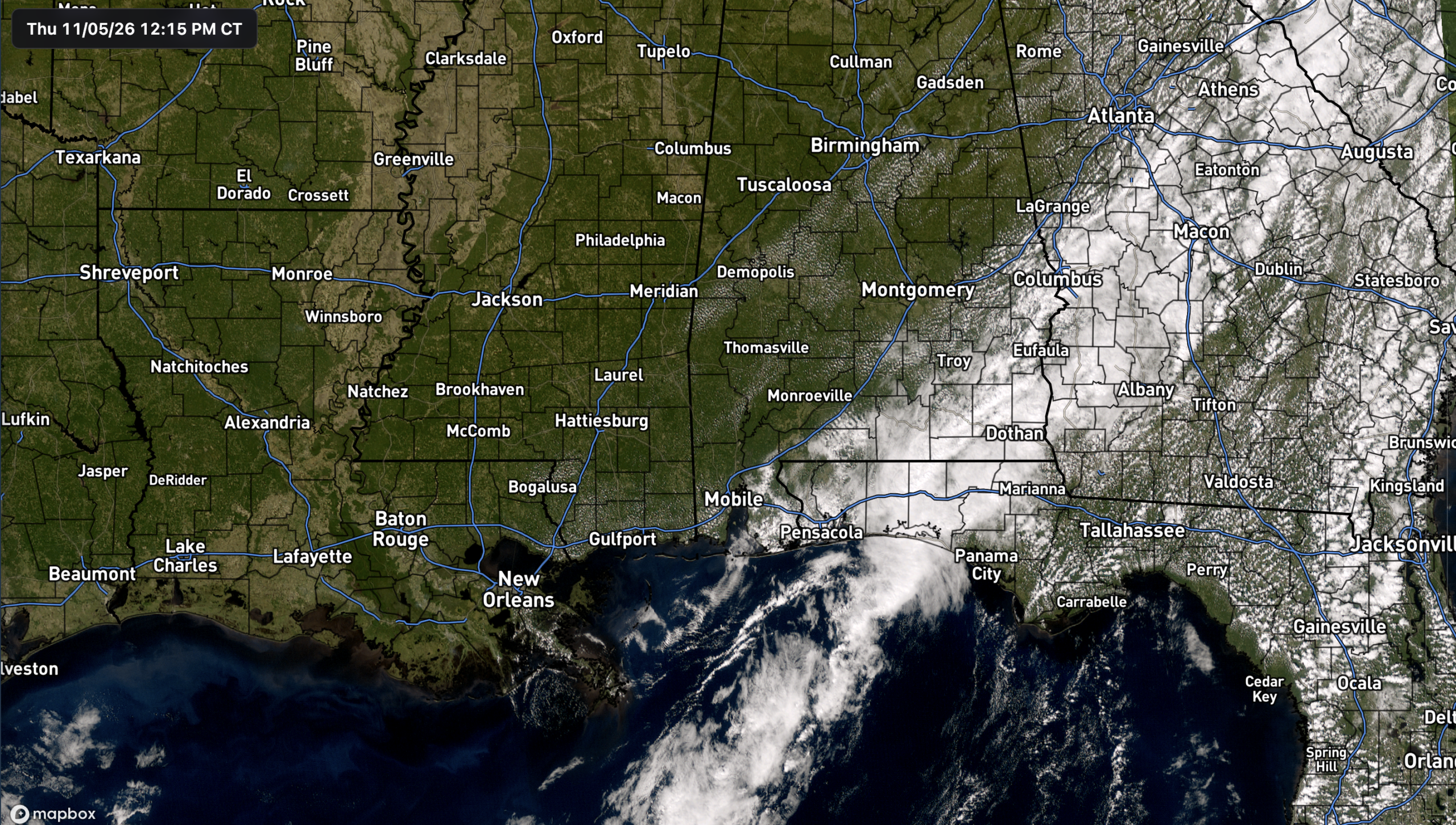
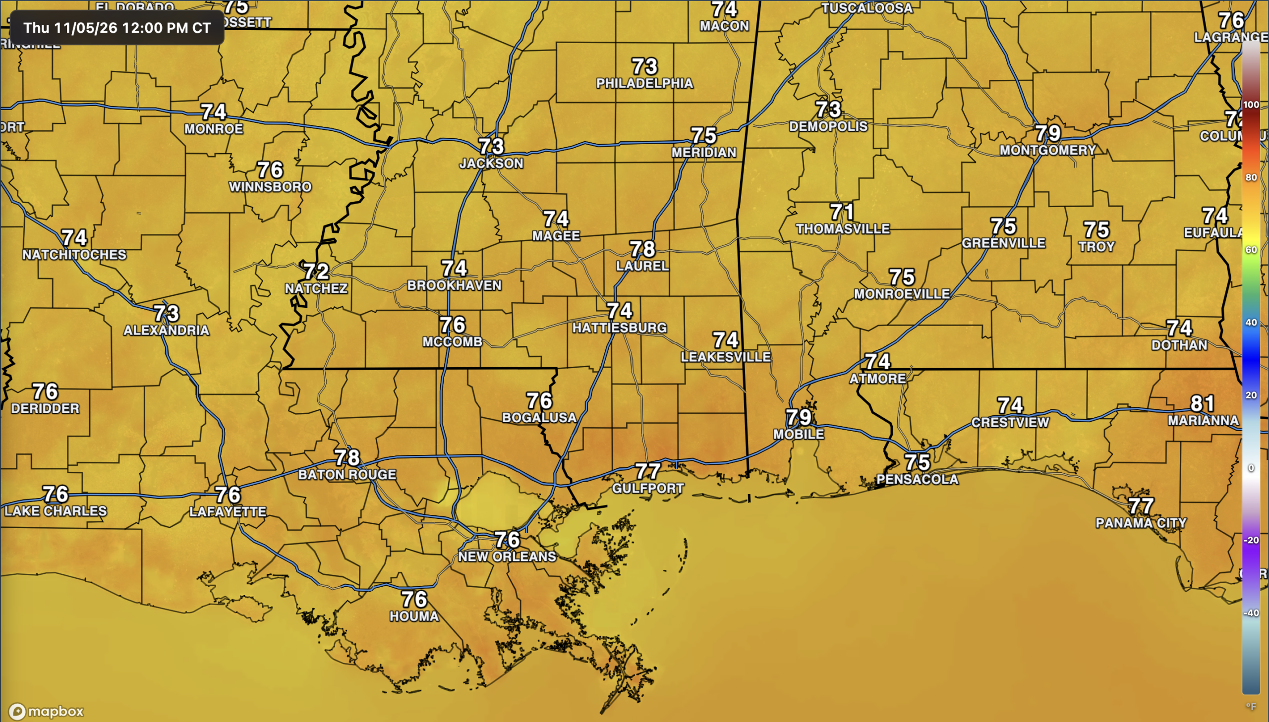
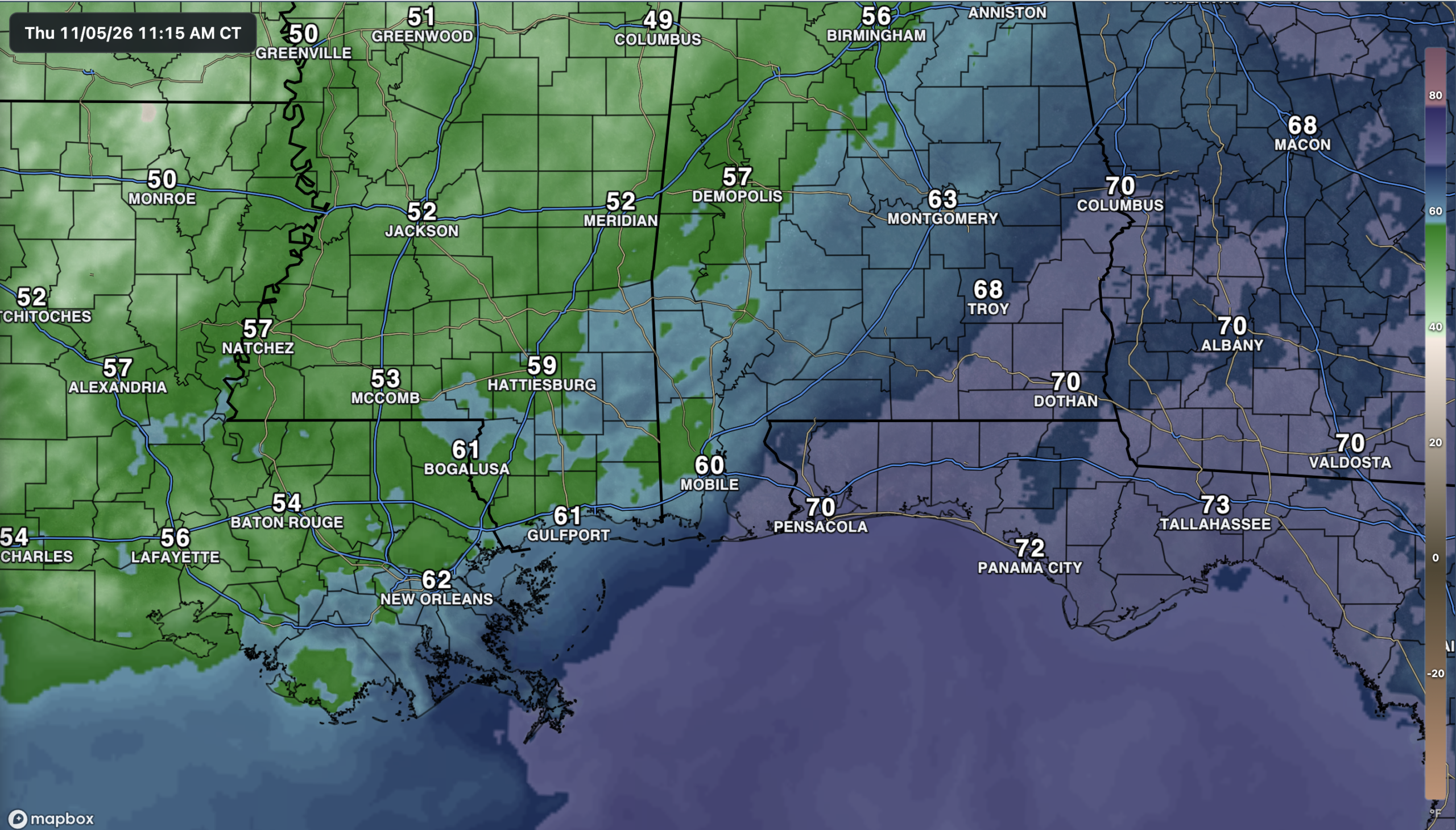
It’s a pretty nice afternoon across the region, with plenty of sunshine over southern Mississippi and Louisiana and temperatures already in the lower to mid 70s. You can pick out where the front is sitting by looking at the clouds across Alabama and the Florida Panhandle, along with the dew point gradient. Dew points are in the 50s across much of Mississippi, while around 70 farther east near Pensacola. Another front will move through tonight into Friday, bringing in more dry air without any rain. The cooler air will follow, making it feel more like fall again heading into the weekend!
The Setup
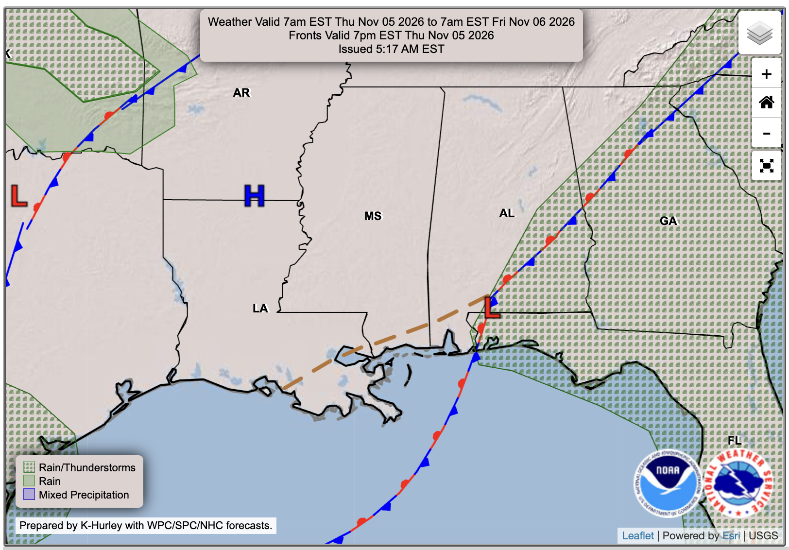
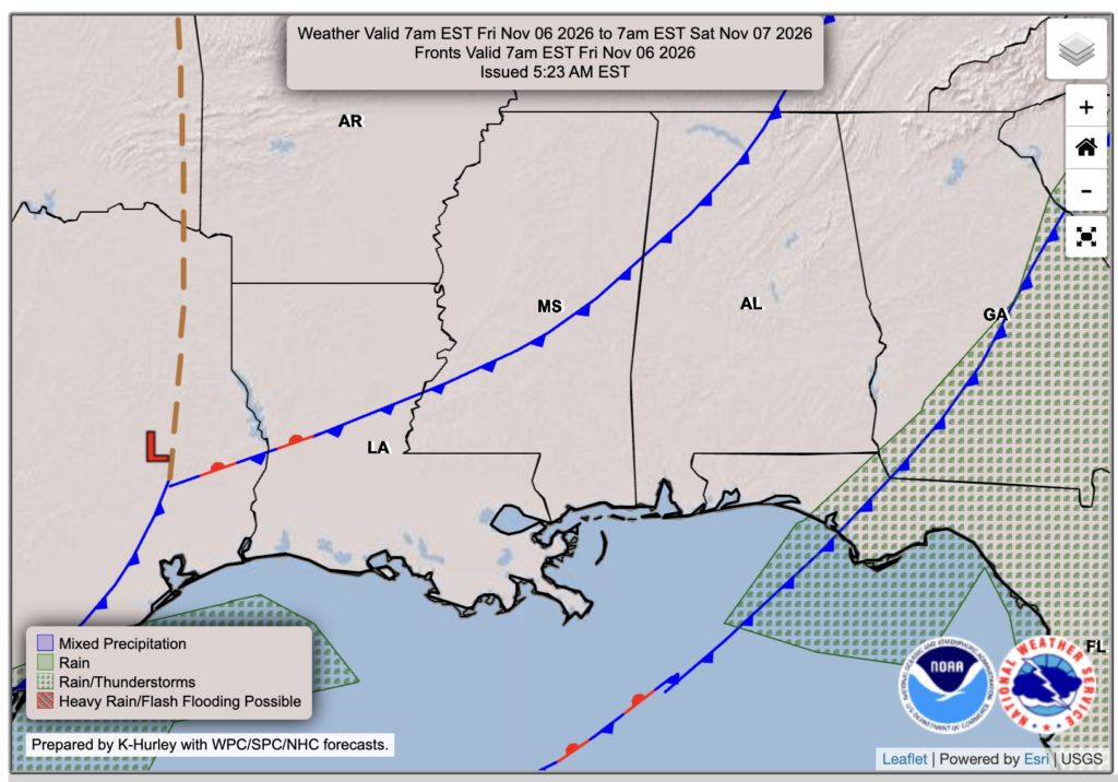
Looking at the surface maps, our first front will continue working away from the area today, keeping the rain chances off to our east. Another front will follow tonight into Friday, but with little moisture left to work with, we won’t get any rain out of it. We’ll mainly notice a wind shift and another push of drier air at first, with temperatures Friday still pretty similar to today. The cooler air starts settling in late Friday and Friday night, setting us up for a nice fall weekend.

Today’s Forecast: Thursday, November 5th
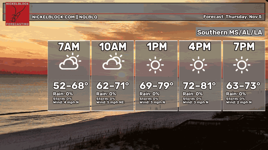
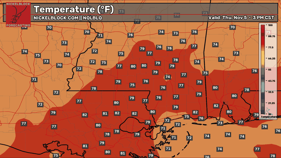
Plenty of sunshine is on the way this afternoon, with highs in the mid-to-upper 70s and a few spots reaching the lower 80s. Winds will stay light out of the north around 5 mph or less, so a good day to get outside if you have the chance! Tonight, we’ll stay mostly clear as temperatures fall into the lower to mid 50s inland, with upper 50s to lower 60s closer to the coast. Watch out for some patchy fog if you are northwest of Jackson.
Tomorrow’s Forecast: Friday, November 6th
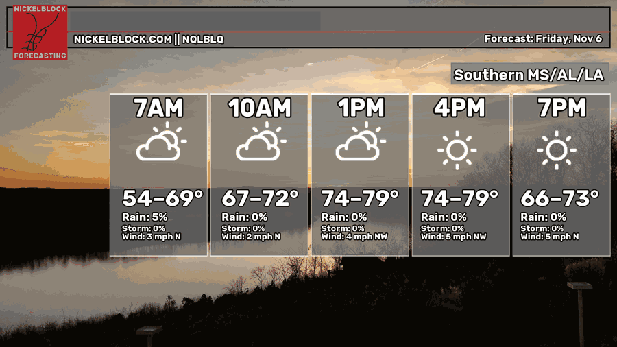
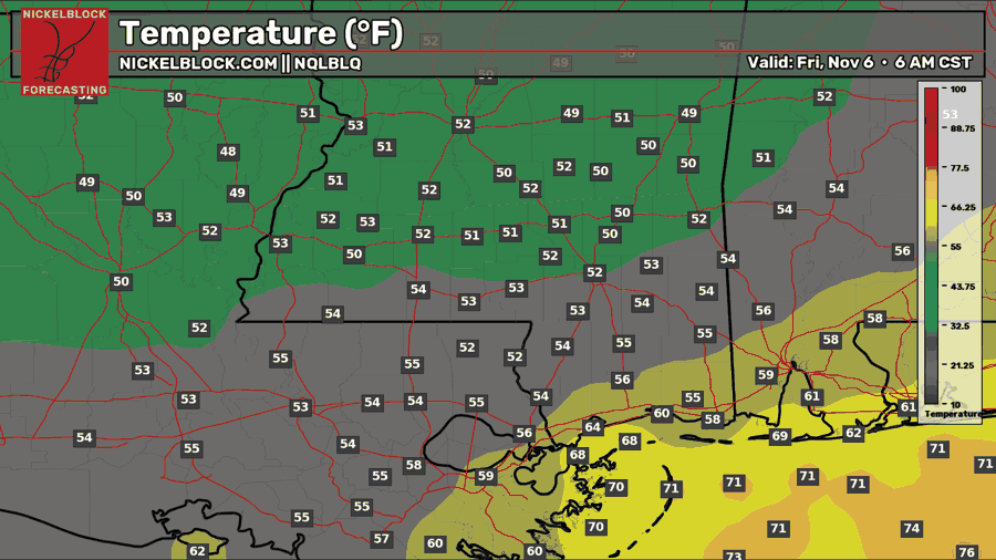
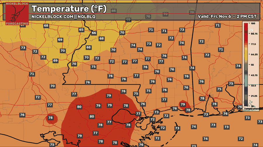
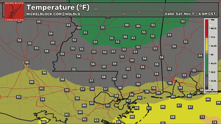
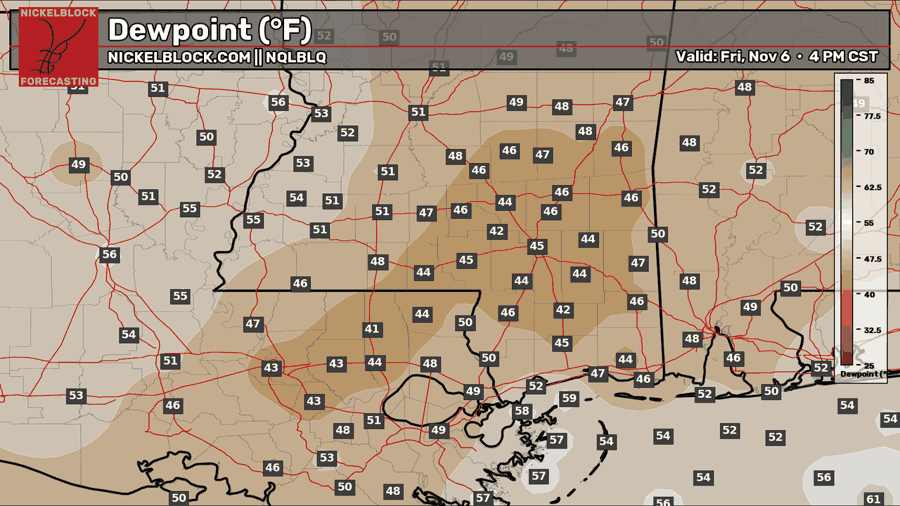
Friday will start off with a few clouds before we see more sunshine during the afternoon. Highs will reach the mid-to-upper 70s for most, with a few spots in Louisiana touching the lower 80s. The bigger thing to notice is the dry air moving in behind the front. Look at those dew points dropping into the 40s across much of the region down below! Winds will stay out of the north to northwest around 5 mph, making for a comfortable afternoon. If you’re heading out Friday night, temperatures will fall through the 60s during the evening before reaching the lower to mid 50s inland and upper 50s to lower 60s closer to the coast by Saturday morning.

Saturday’s Forecast: November 7th
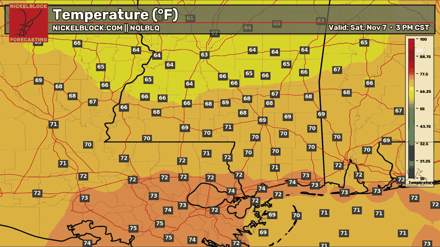
Saturday is looking like a good day for any outdoor plans, with mostly sunny skies and low humidity sticking around. We’ll definitely feel the cooler air a bit more, with highs around 70 inland and in the lower to mid 70s farther south. Temperatures will drop off Saturday night under mostly clear skies, with lows in the 40s inland and lower 50s closer to the coast. You may want a jacket if you’re heading out late or getting an early start Sunday!
Extended Local Outlook
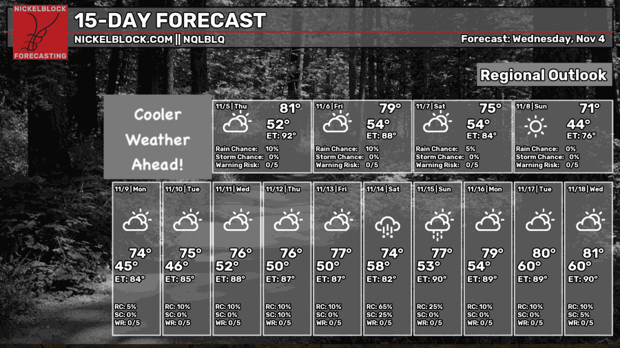
Sunday will bring more sunshine, with highs around 70 and a chilly start to the morning. We’ll gradually warm back into the mid 70s early next week, but there’s another system to keep an eye on out west. A low is expected to cut off from the main flow near northern Mexico and Texas, and these can be tricky to time. Depending on when it moves east, a few showers could return late Monday into Tuesday. For now, rain chances look low. There’s also a signal for more rain the following weekend, but we have plenty of time to watch how that develops.


