The rain has moved out, and we’re left with a humid overcast day. Doesn’t quite feel like Fall yet, eh? Not to worry! The stationary front will move out soon and make way for some cooler weather by the weekend! It’ll finally feel like Fall after so long.

Tonight
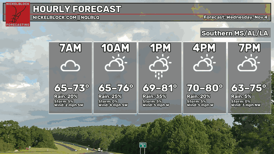
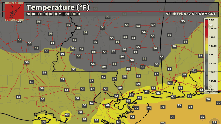
The rain has officially passed in the late morning hours. It wasn’t a storm, but it at least got the soil damp. Unfortunately, what we got is about it for the next week or so. The clouds remain and we’ll have a humid night ahead. Temperatures will fall into the mid 50s to low 60s. Due to the lack of wind tonight, expect some patchy fog across much of the Pine Belt.
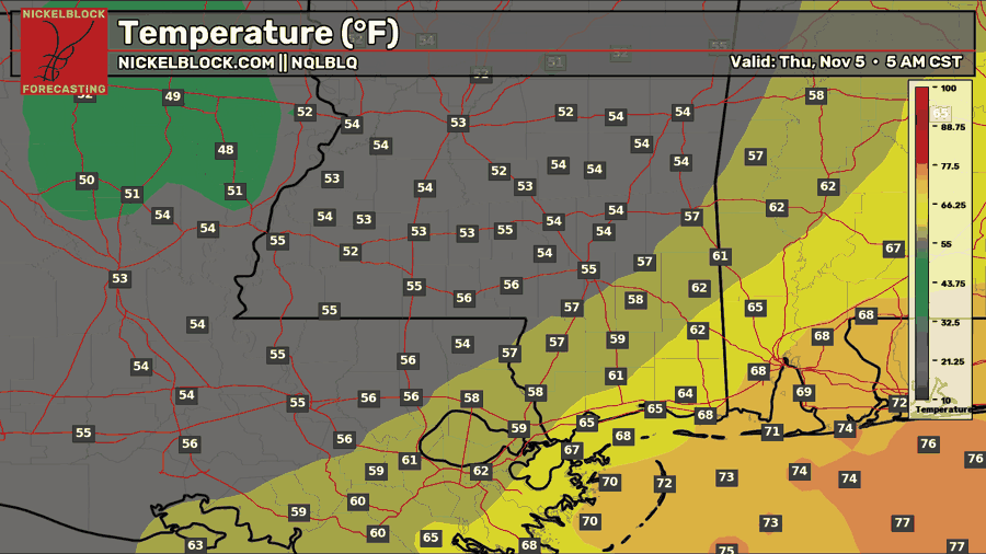

Tomorrow
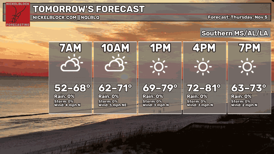
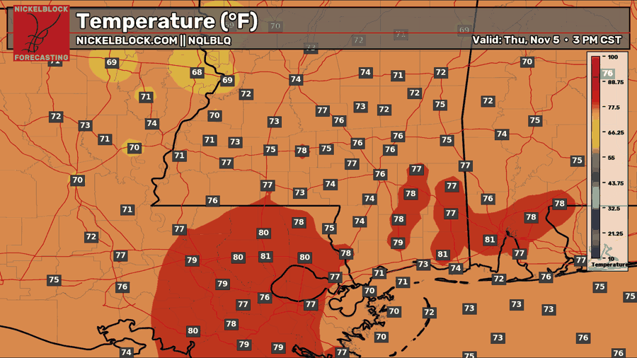
Winds will be moving in from the north tomorrow signifying the incoming front. However, the cold front stalls around the MS/AL border leaving many to the west slightly cooler and to the east, warmer and more humid. For most of us in Mississippi, it’s going to be fairly warmer with a high in the mid 70s. The clouds will clear out during the day, and lows will reach the mid 50s to low 60s.
Friday
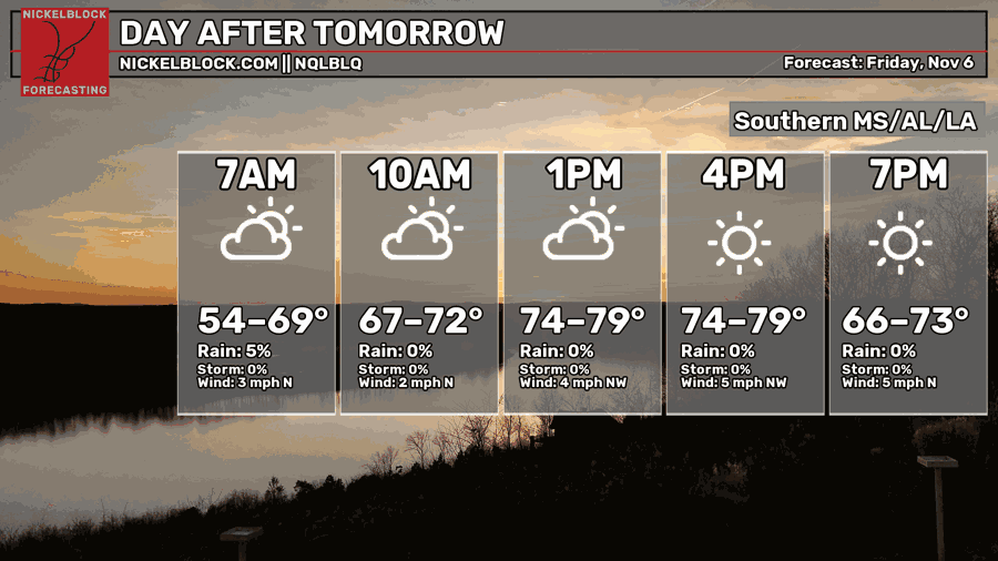
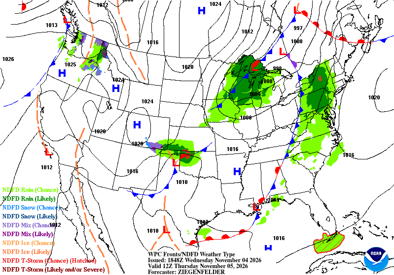
Our front moves further east towards Florida and the mid-Atlantic leaving us with somewhat drier conditions. We’ll still have some warm temperatures ahead as there’s not a lot of movement in the atmosphere. However, as we move further towards the evening, another front will move in bring a large high pressure system and a cooler mass of air. Low temperatures may fall back into the low to mid 40s!
Cooler Weekend Ahead
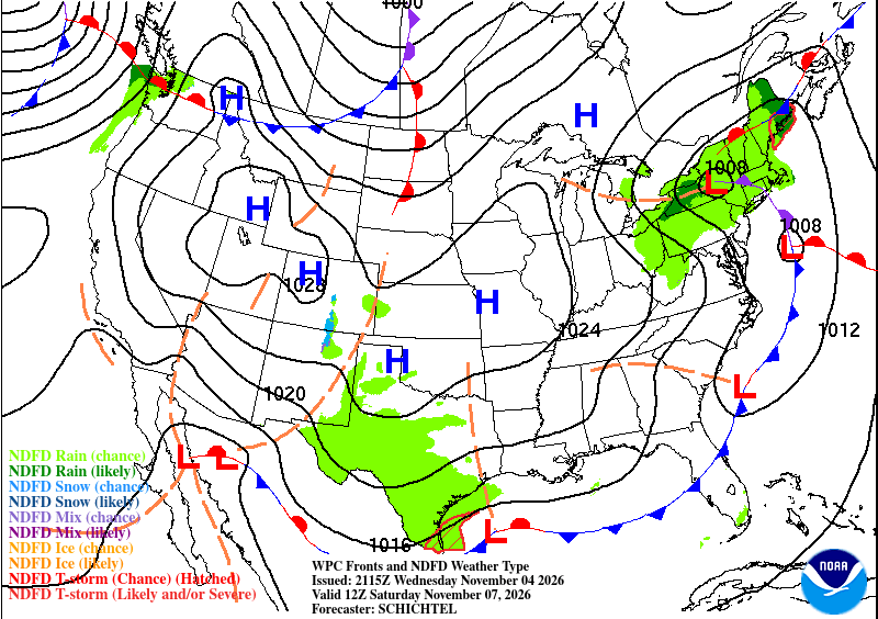
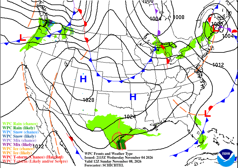
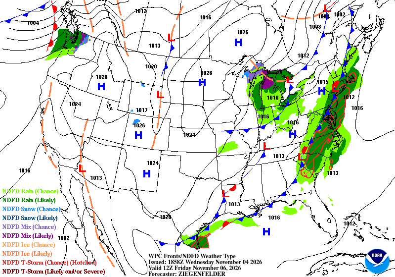
As we can see from the Weather Prediction Center maps above, a large system of high pressure spanning across most of the continental US is moving in. This is a predecessor to the active weather systems we may see later in the month, but for now it’s a sign that we’re moving more into Fall-mode. The bad news is that it keeps most of the rain away for anyone north of the 30th parallel.
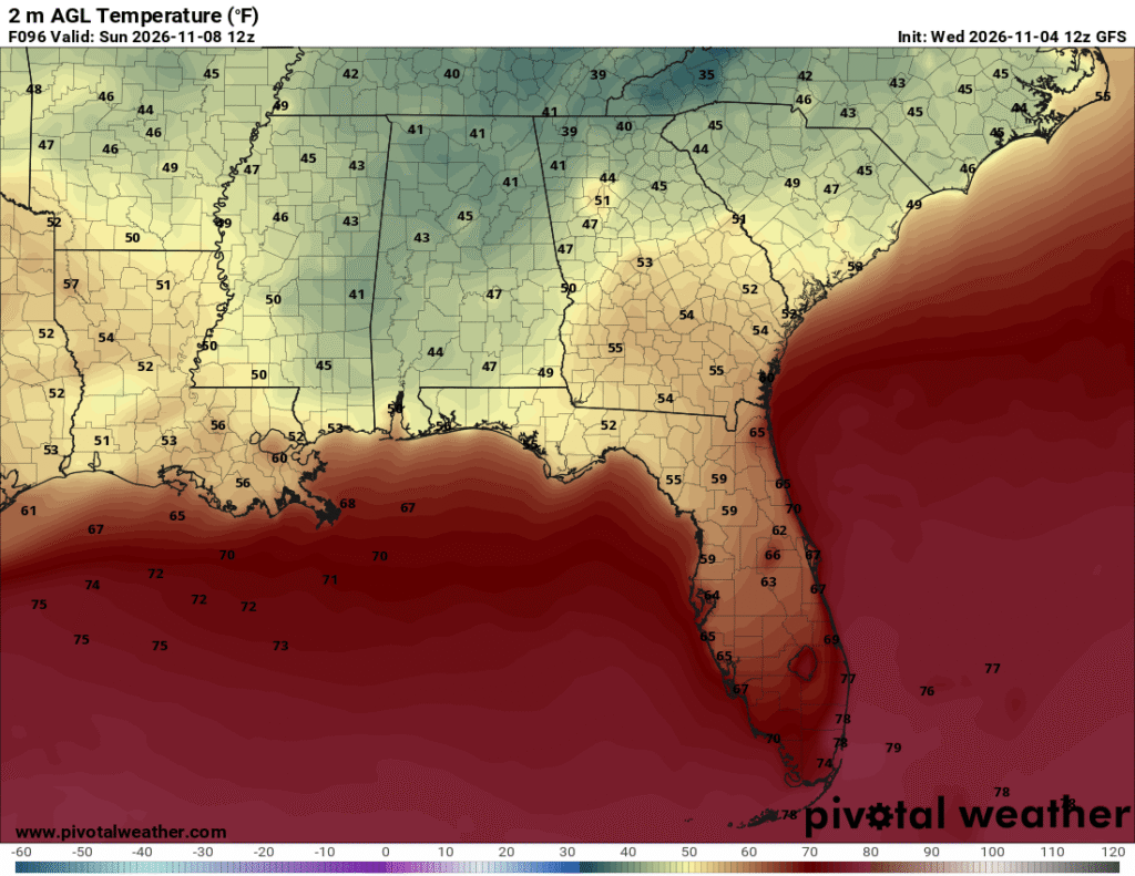
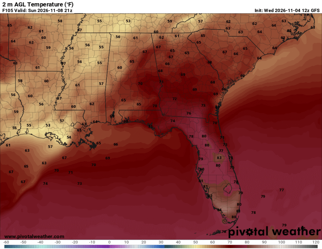
The good news is that temperatures will be relatively lower than we’ve felt! Expect highs to be in the upper 60s to low 70s. Winds won’t be super gusty but we’ll have a northerly breeze moving in bringing a more fall-like crispness into the air.
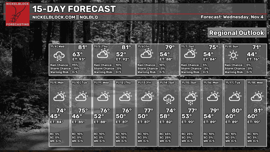
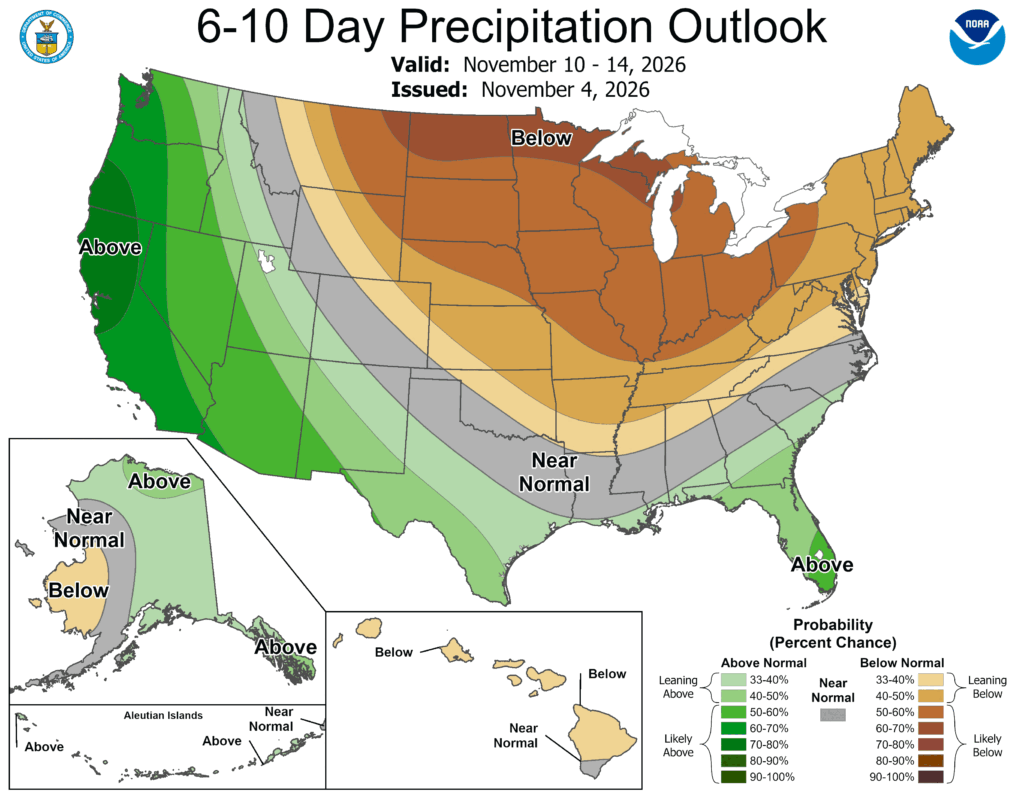
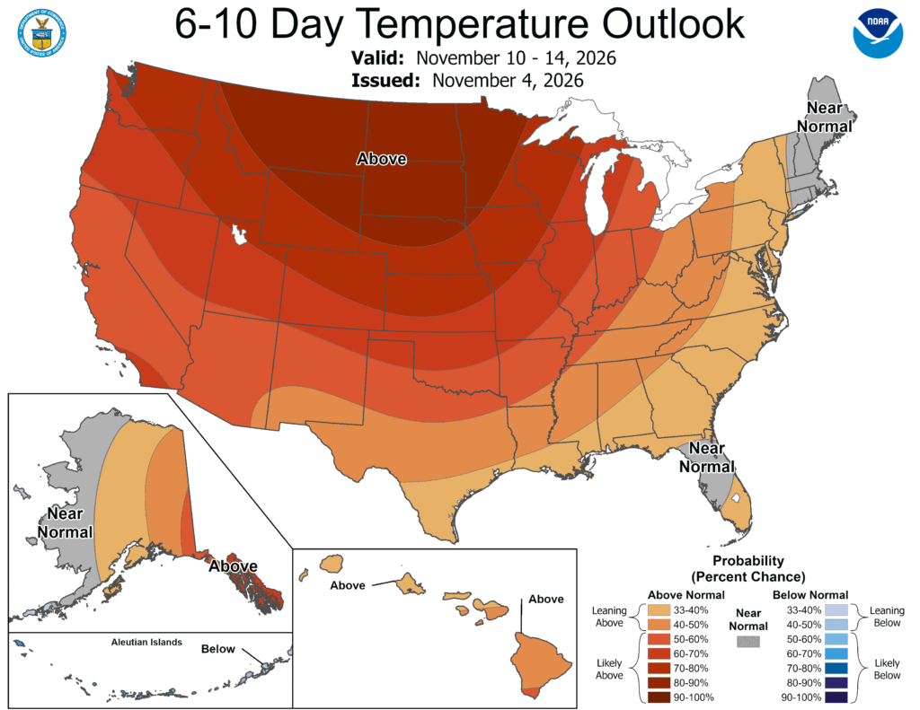
Looking at the extended outlook, we see a large area of above average temperatures and below average precipitation coinciding with each other largely due to the high pressure in Canada/the Rockies stalling any frontal movement. The above average rainfall in the Pacific Northwest is due to an incoming front that will battle with the high pressure system. Temperatures will be slightly above average in the southeast as a subtropical low pressure system attempts to move closer to the Gulf coast around mid-week.


