Current Conditions
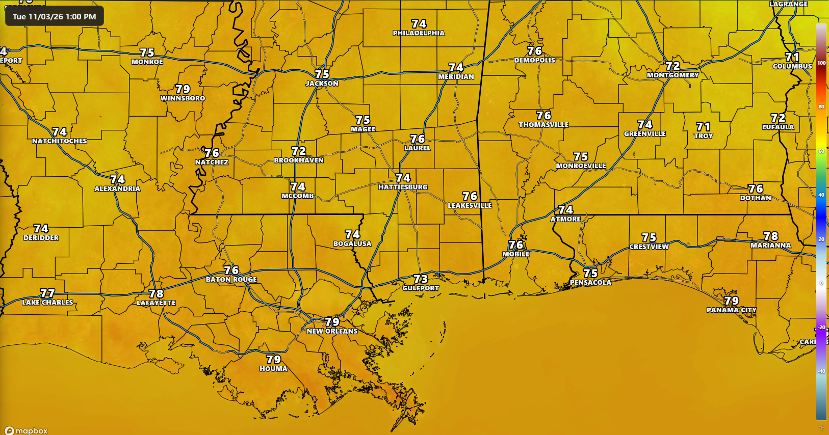
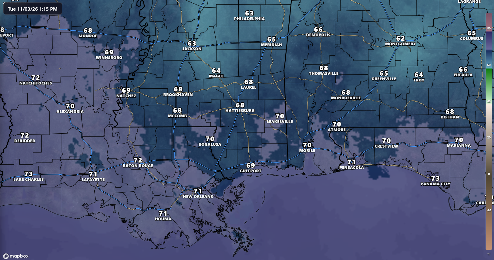
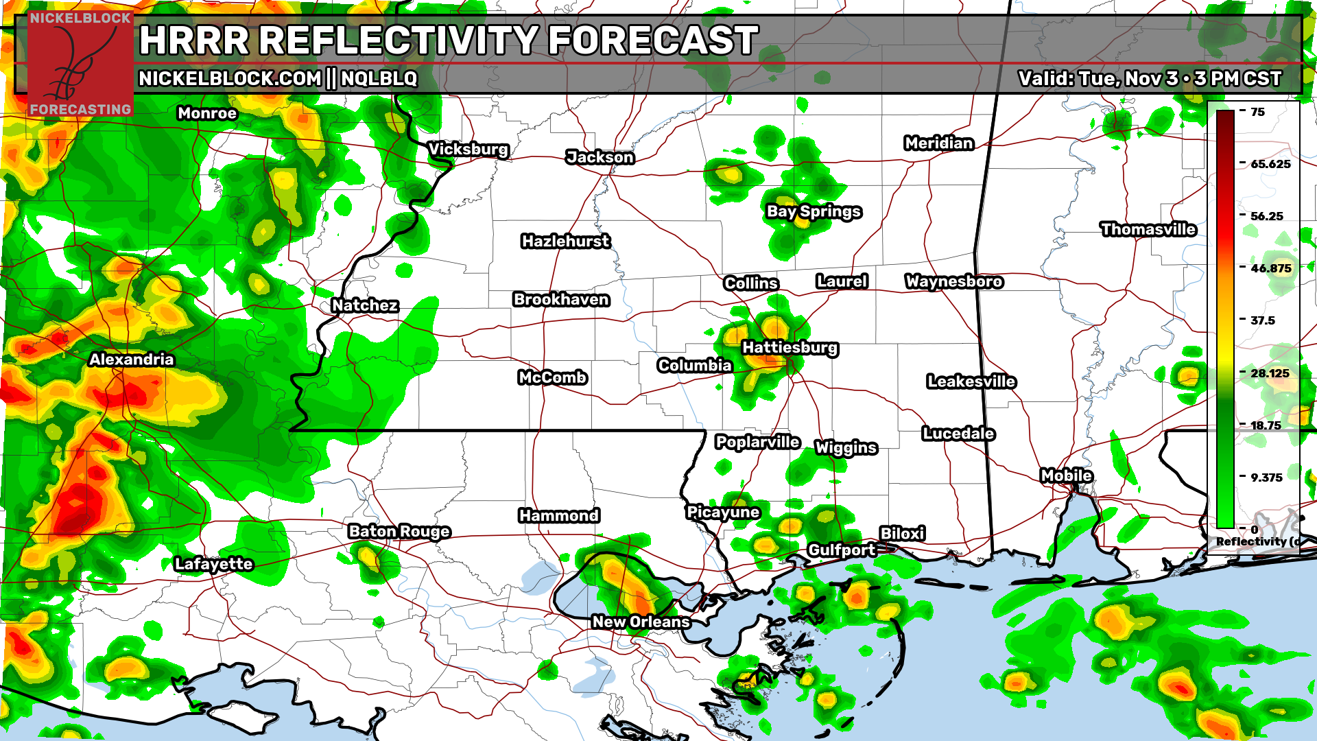
It’s a warm and muggy Tuesday afternoon across our area, with temperatures generally in the 70s and dew points in the 60s to near 70 degrees. Those high dew points is making it feel much muggier than it has in recent weeks. Most of our region remains dry for now, but a line of showers and thunderstorms is moving through western Louisiana and eastern Texas ahead of an approaching cold front. This activity will continue pushing east through the afternoon and evening, although it is expected to weaken as it gets closer to our area.
The Setup
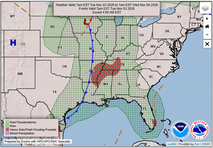
A cold front is making its way east across the Mississippi Valley today, bringing showers and thunderstorms ahead of it. As the system moves closer to our region later this evening and overnight, we’ll see increasing rain chances across southern Louisiana and Mississippi. However, the line of storms is expected to gradually weaken as it pushes east, with the better upper-level support remaining well to our north and west.
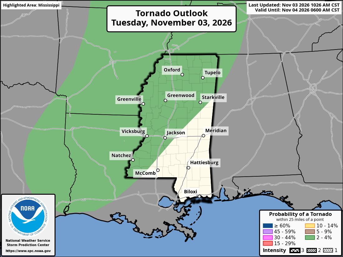
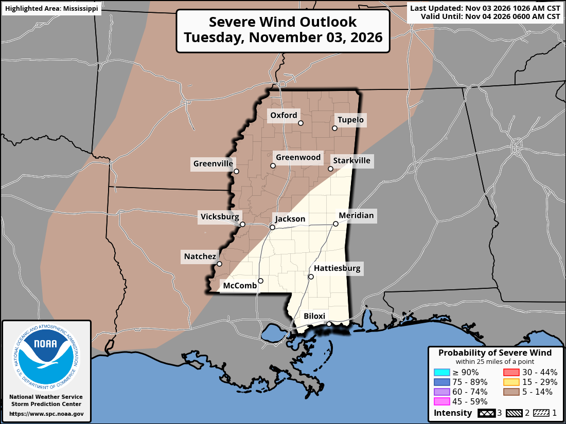
The Storm Prediction Center has outlined a Marginal Risk (Level 1 of 5) for severe weather across portions of Louisiana and western Mississippi today. A few storms farther west could produce isolated damaging wind gusts or even a brief tornado, but the greater severe weather threat will remain west and north of most of our region.
For southern Mississippi, Alabama, and Louisiana, we’re mainly looking at showers and a few thunderstorms tonight, with a low risk for severe weather with any storms. Some gusty winds are the main concern, but as we know, a tornado is always possible with a nearby threat, so it’s not completely off the table in the non-tornado shaded areas on the map.

Today’s Forecast: Tuesday, November 3rd
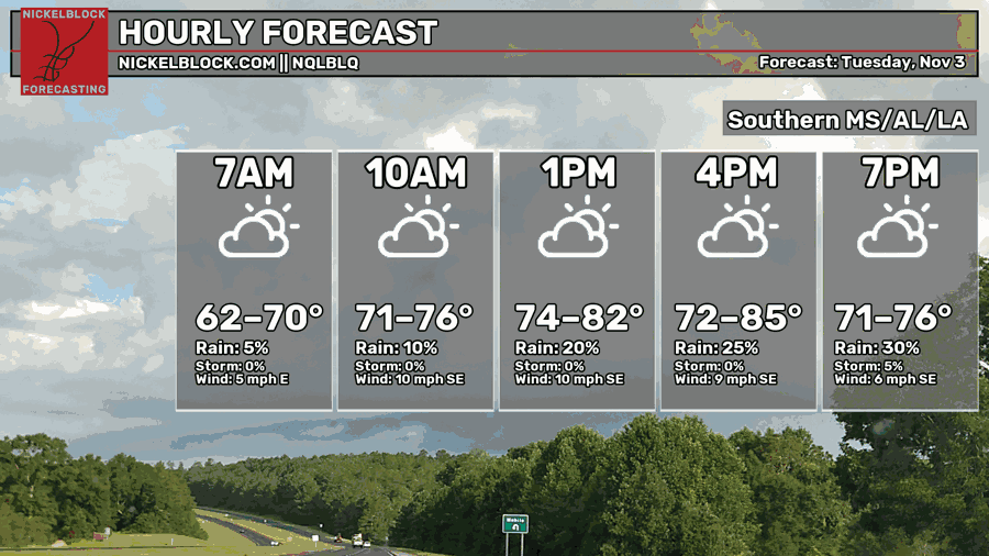
We’re looking at a warm afternoon with a mix of sun and clouds and highs climbing into the upper 70s and lower to mid 80s. Most locations will stay dry through the afternoon, with southeast winds around 5 to 10 mph. Clouds will gradually increase later today as the front approaches from the west. Tonight, temperatures will remain mild, with lows generally in the 60s to near 70 degrees.
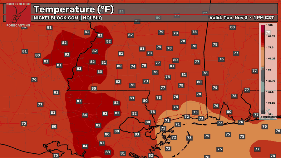
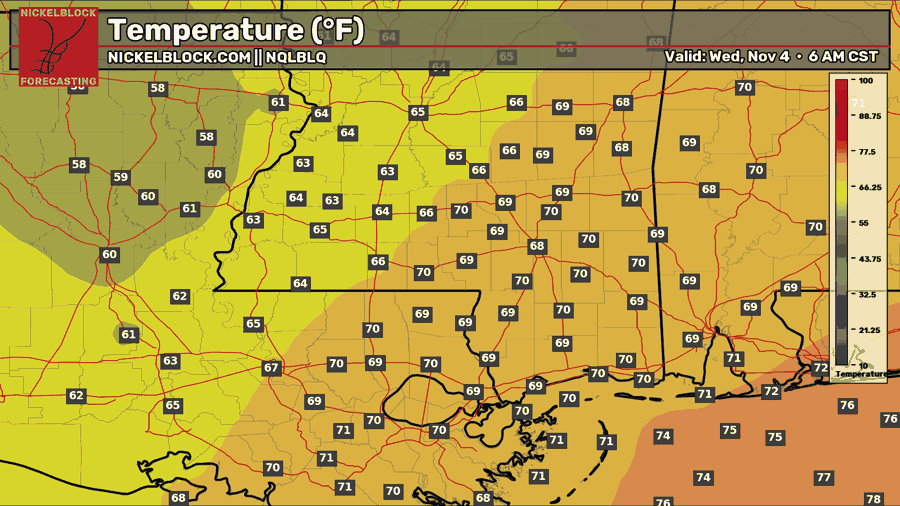
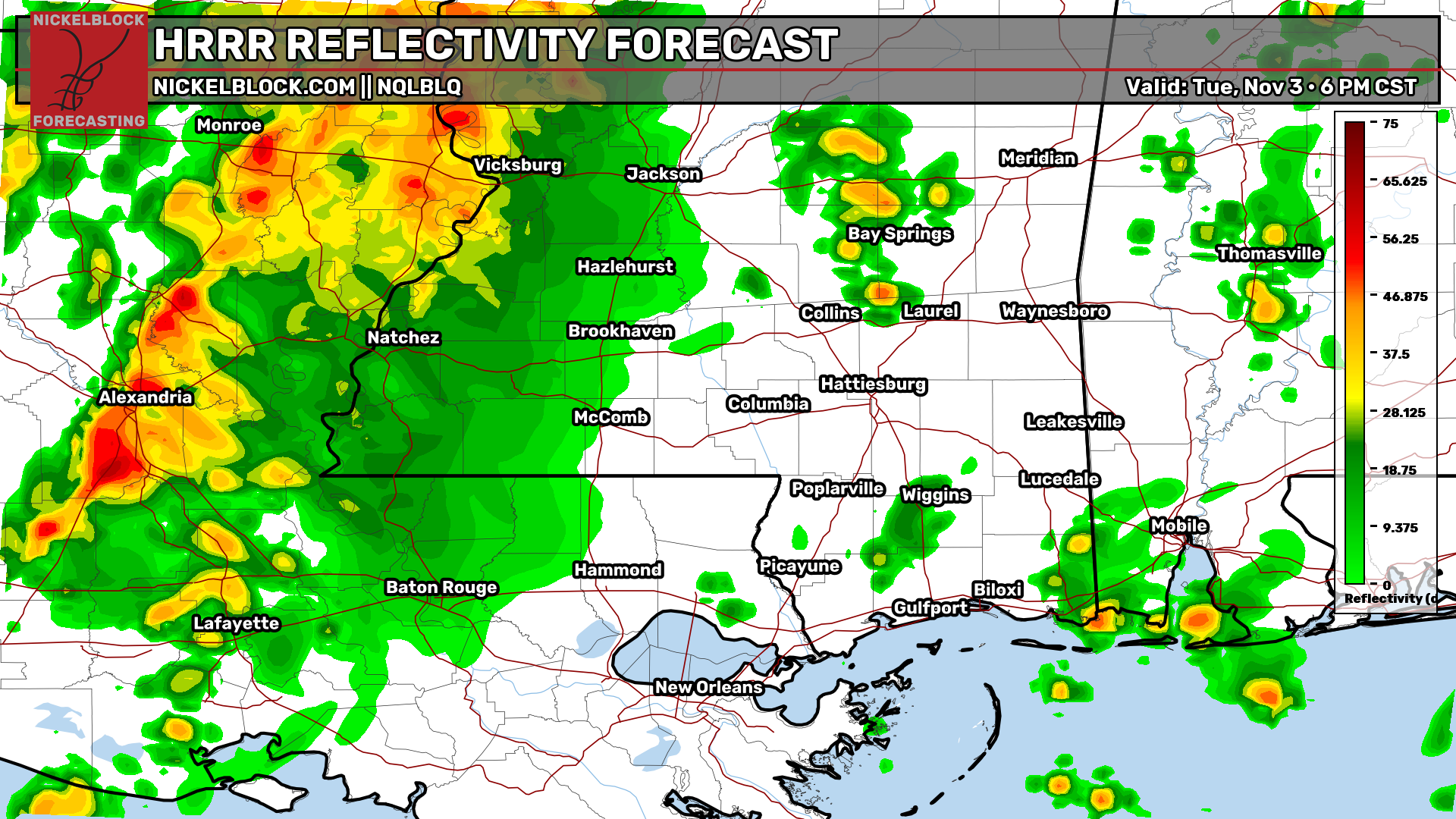
As we head through the rest of the afternoon and into this evening, showers and thunderstorms will continue moving east across Louisiana ahead of an approaching cold front. Some scattered showers and thunderstorms will move northward through the afternoon before the main line arrives. The latest HRRR guidance shows the frontal activity gradually weakening as it approaches us. Rain chances will increase from west to east later tonight. Not everyone will see rain, and for those who do, much of it should remain on the lighter side, unless you’re under any isolated stronger storms.
Tomorrow’s Forecast: Wednesday, November 4th
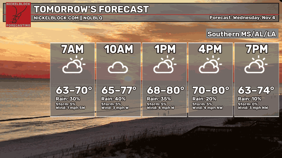
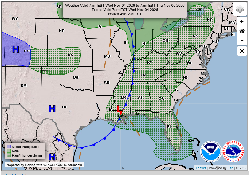
Wednesday will start off mostly cloudy, with scattered showers possible as the cold front continues moving through the region. Rain chances will gradually decrease through the afternoon, with some breaks in the clouds possible later in the day. Temperatures will remain warm, with highs in the 70s to near 80 degrees. By Wednesday night, drier and slightly cooler air will begin moving in, with lows falling into the 50s inland and 60s closer to the coast.
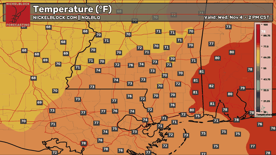
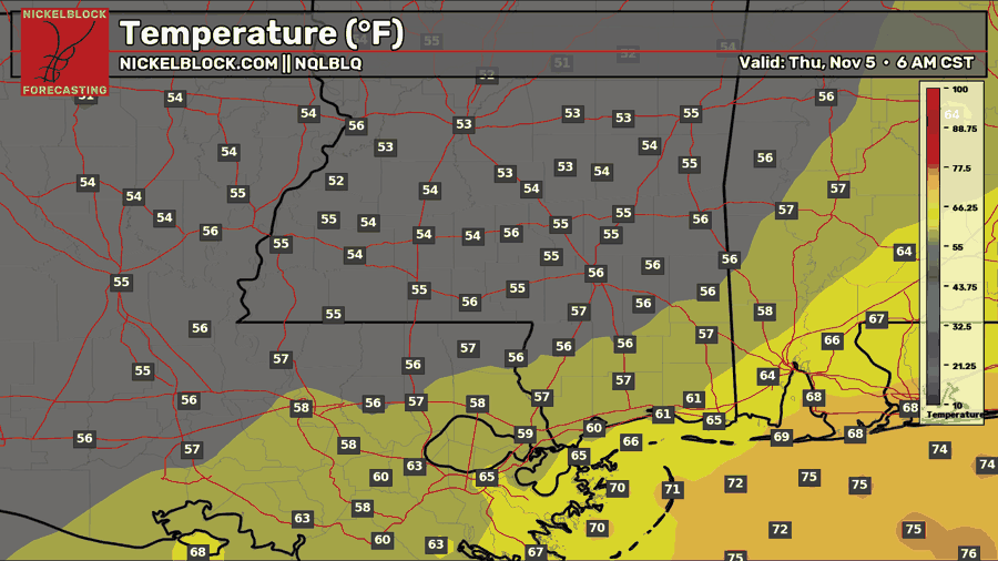
The cold front will continue pushing east through the Gulf Coast region on Wednesday, eventually allowing high pressure and drier air to move in behind it. This should set us up for a quieter Thursday, with more sunshine and comfortable conditions across much of the area.

Thursday’s Forecast: November 5th
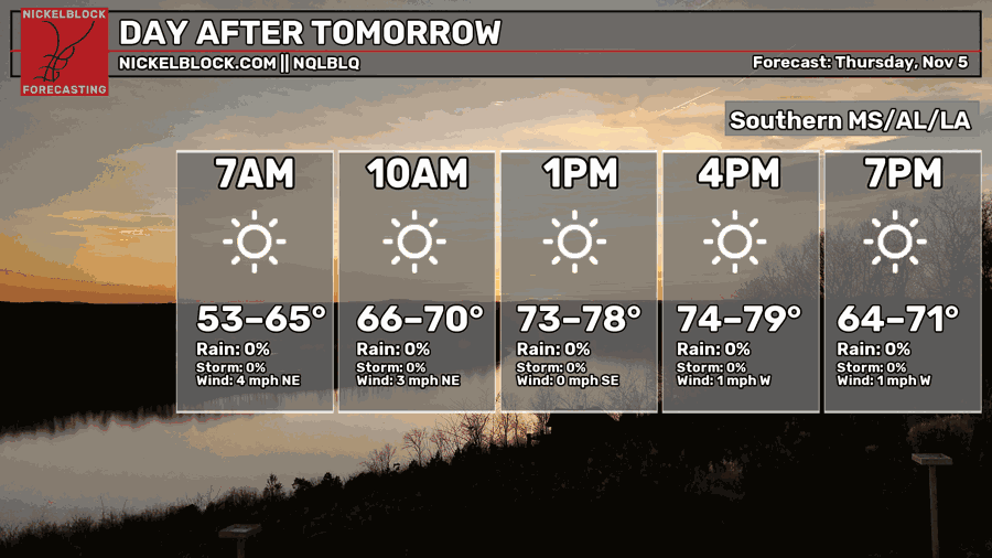
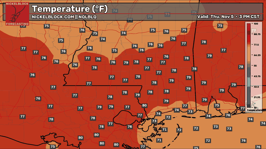
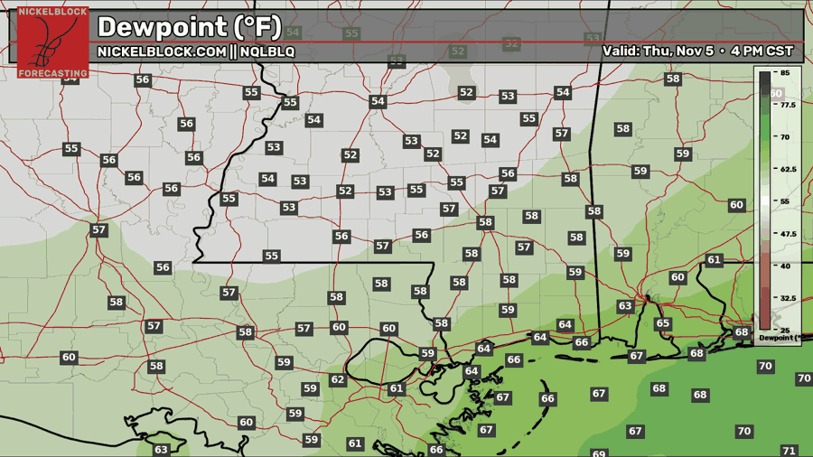
Thursday is shaping up to be a beautiful day! Behind Wednesday’s cold front, we’ll see plenty of sunshine and some drier air moving into the region. Temperatures will start off in the 50s and 60s before warming into the mid to upper 70s by the afternoon. Dew points will fall into the 50s for many inland locations, making it feel much more comfortable outside, although some humidity will stick around closer to the coast. Winds will remain light, so overall, not a bad way to end the workweek!
Extended Local Outlook
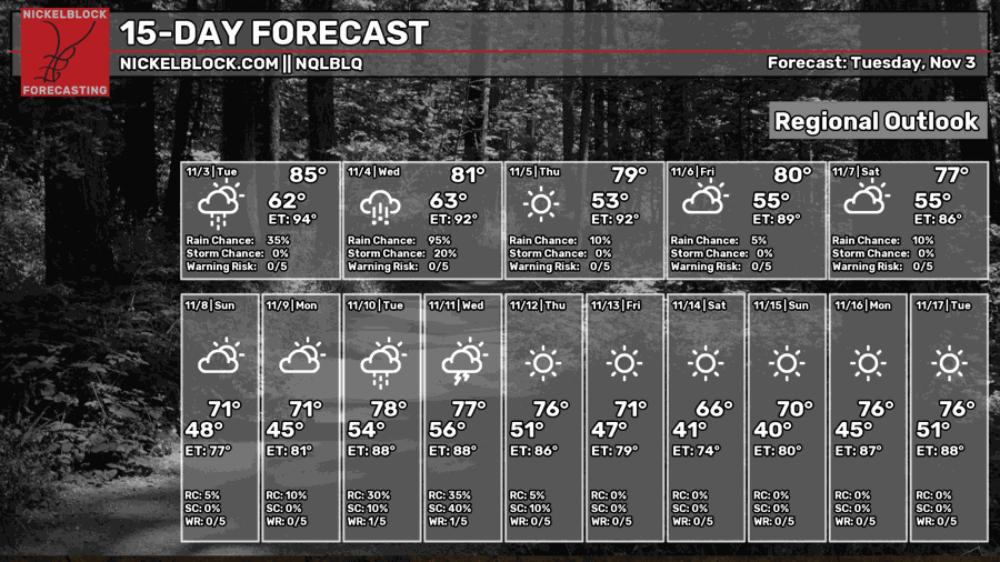
Looking ahead to Friday, we could see a few more showers across the region, especially closer to the coast, but it won’t be a washout by any means. The weekend is looking pretty good overall, with plenty of dry time and highs in the 70s. Another cold front will move through, bringing some cooler temperatures by Sunday and Monday, with lows dipping into the 40s and 50s. We may see another chance for rain around the middle of next week, but there’s still some uncertainty with that system this far out.
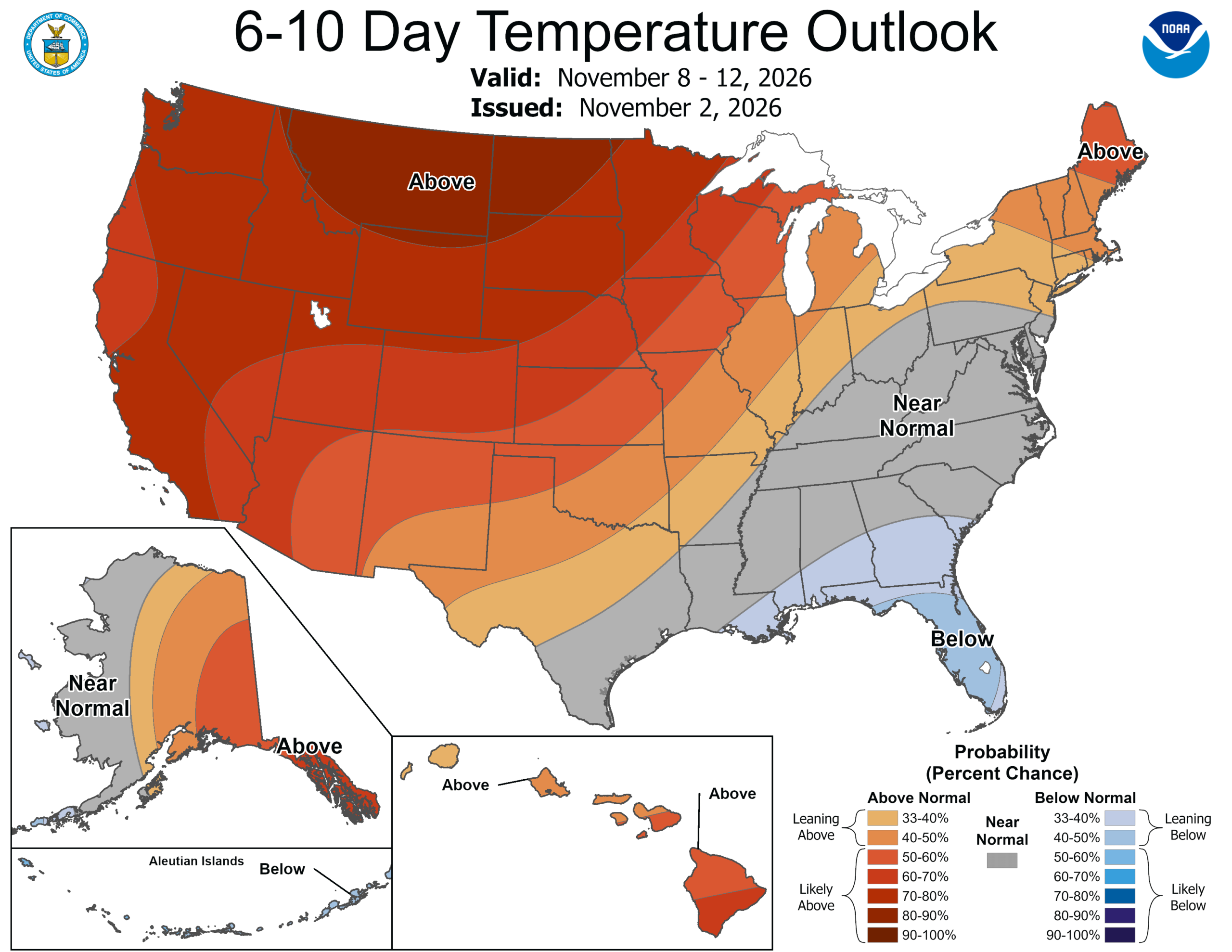
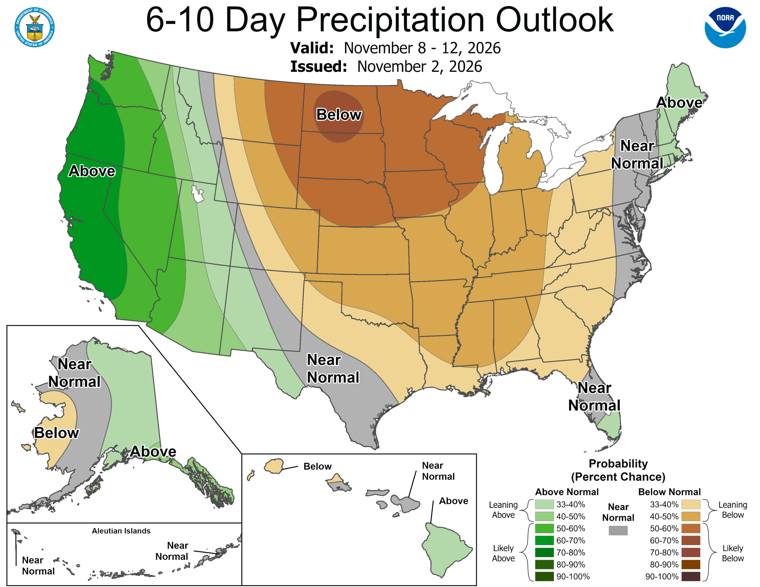
Looking a little further out, the CPC is favoring temperatures around average or slightly below average for the 6-10 day outlook. Rainfall is expected to lean below average during this stretch, so aside from a few chances for showers, things look fairly quiet heading into next week.


