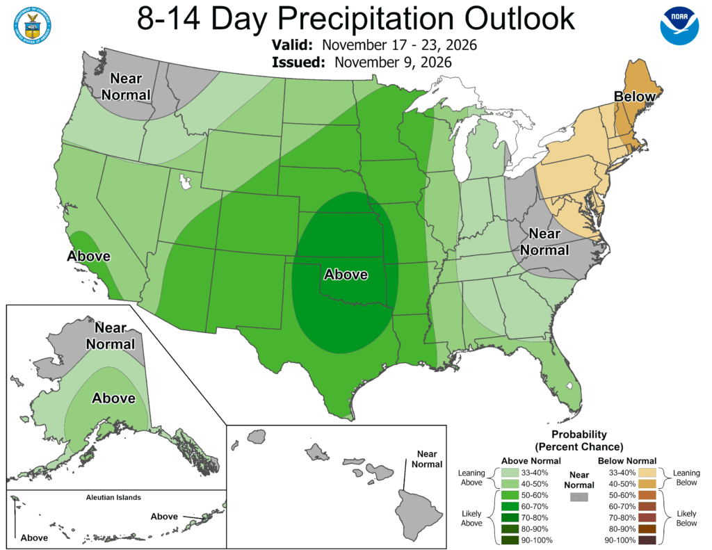
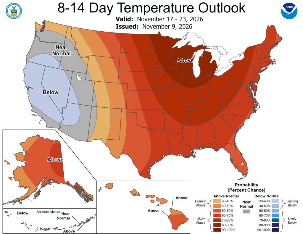
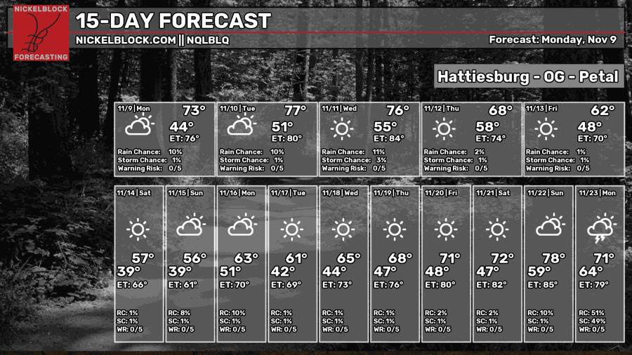
After a crisp weekend full of cool winds and cool temperatures, we’re back to just above seasonal norms for this time of Fall with our average temperature in the 70s for the rest of the week. Lows will also fall into the 50s again and the weather, in a sense, will just be “there.” A very small chance for rain is possible Tuesday night into Wednesday, and a couple of cold fronts will move in eventually moving cooler air. Not an arctic blast, just cooler.


Today
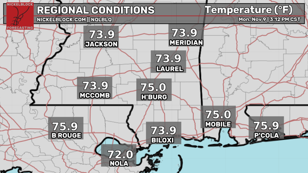
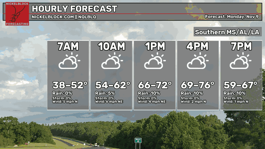
It’s been quite a pretty day today! Winds are just barely blowing out of the north and northeast as the temperatures reach the mid 70s across most of the Pine Belt. I don’t see any rain on radar or on the models, so I’m not sure what the 10% chance is about. Overnight, we’ll have a nice night ahead with temperatures in the upper 50s to low 50s.

Tomorrow
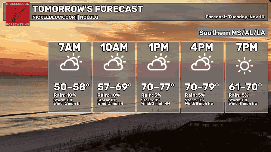
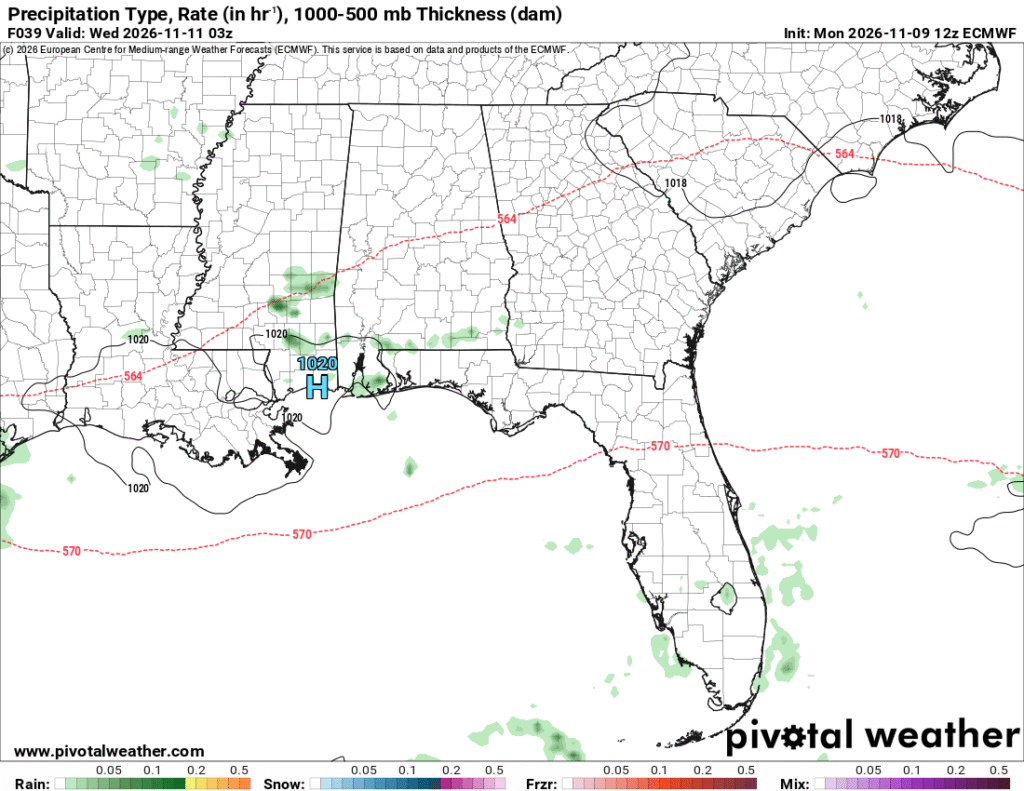
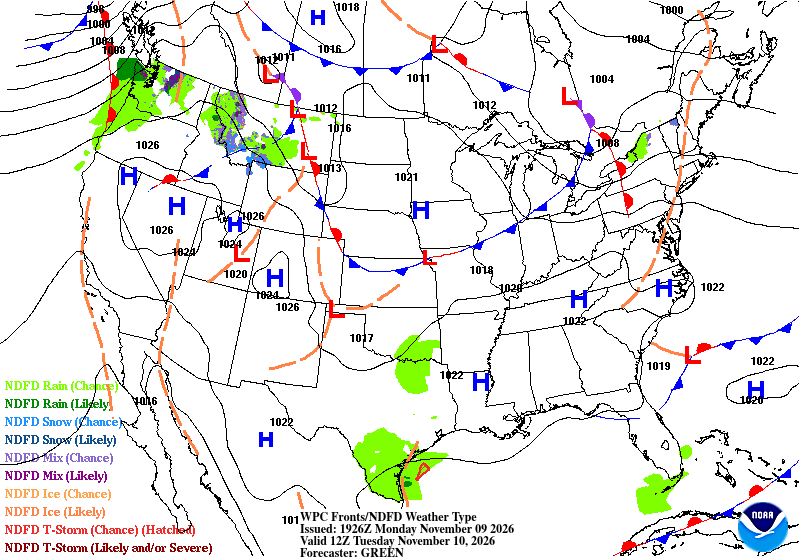
It’ll be a similar story tomorrow but with some mid and upper level clouds moving in during the day. In the evening, a few small cells of rain may move in, however don’t expect a lot of rain out of them! These are passing through from the west with a little bit of Gulf moisture influence. Overnight, temperatures will be back in the low 50s again.
Wednesday – Veterans’ Day
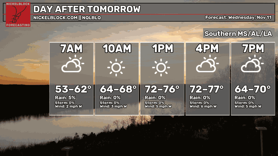
A few leftover showers will move in through Wednesday. If you’re out and about, be sure to attend a Veterans Day event and remember those who fought for our country. Otherwise, it’s going to be a mix of clouds and sun with highs in the low to mid 70s across the Gulf South. Winds will be out of the west and lows will fall back into the low to mid 50s.
Blustery End of the Week
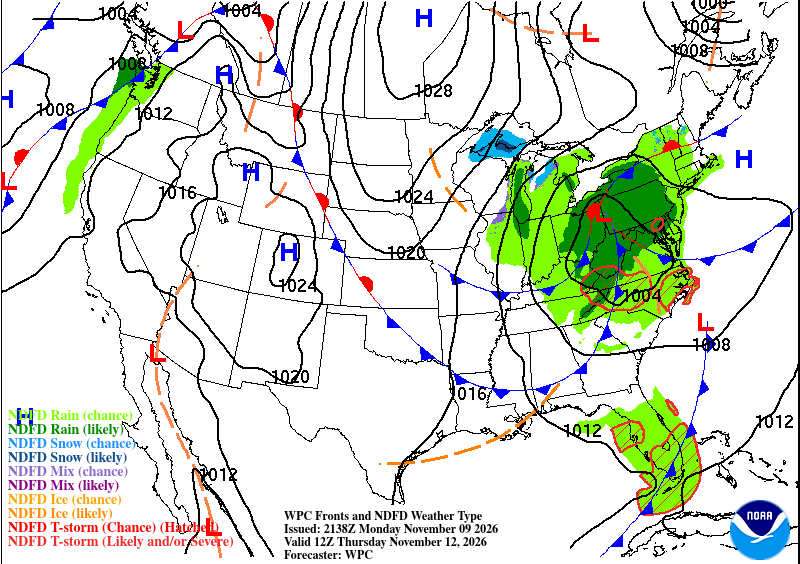
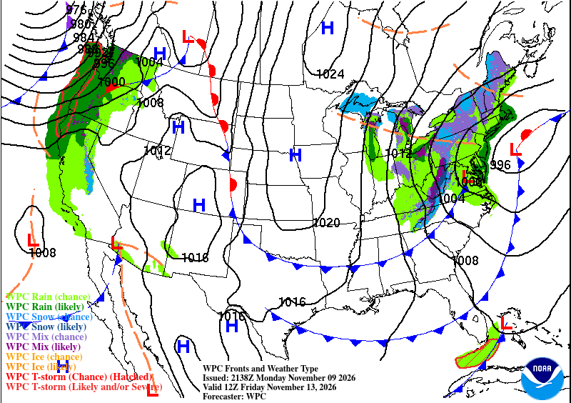
With cold fronts comes cooler weather (usually), and we’ll feel a little cooler with the winds pulling from the north again! The National Weather Service in Jackson is calling for a much cooler week’s end! I don’t see us getting freezing temperatures here, but I don’t doubt we’ll dip into the upper 30s! With a double cold front moving through Thursday and Friday, we’ll feel somewhat normal on Thursday with highs in the 70s, but quickly cool down by the evening with a low in the 40s. Highs will struggle to get out of the 60s and they’ll stay there for a few days into the weekend. Lows may reach the mid to upper 30s for many of us by Saturday, so be ready for the chill!
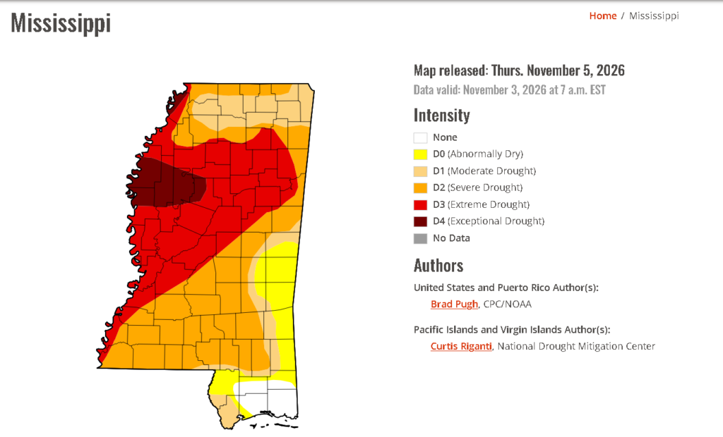
With no rain in sight for a while, drought conditions persist to a severe drought. We’re stuck with more high pressure systems blocking off the rain and won’t have any movement at least for another week. The way that our first system will bring rain is likely through another subtropical system in the Gulf.