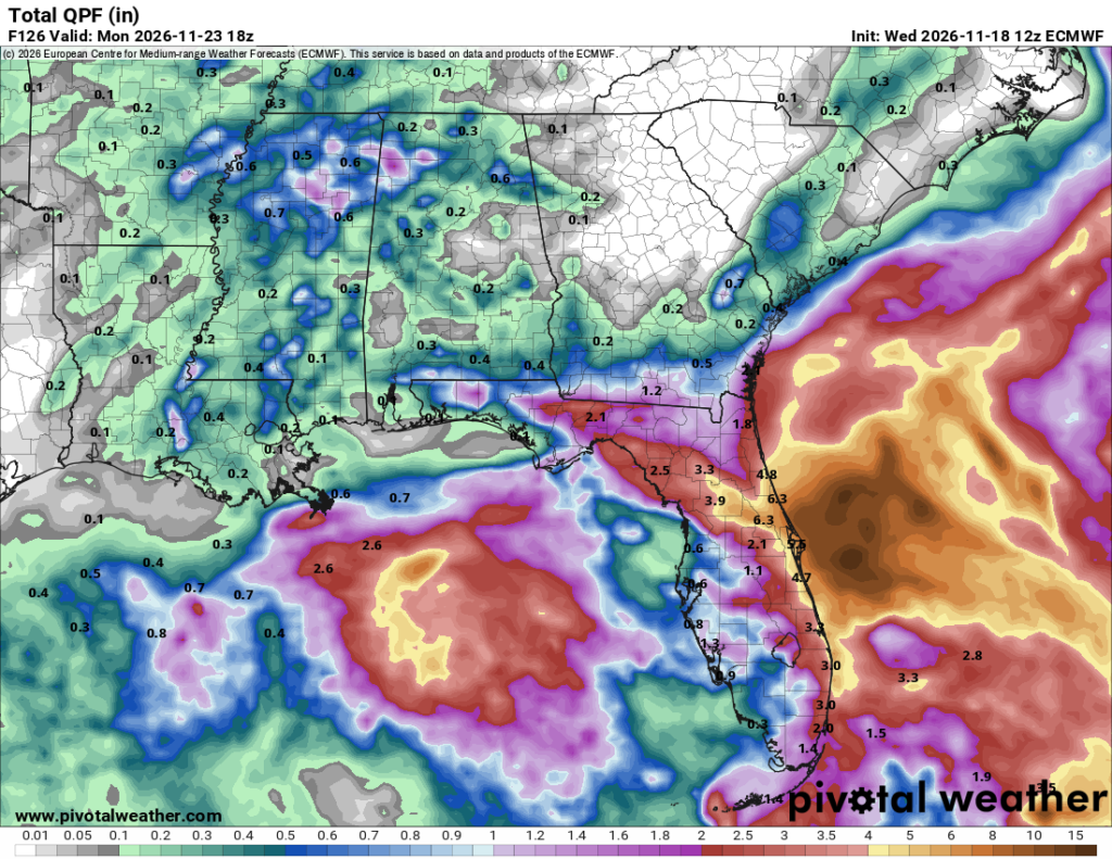
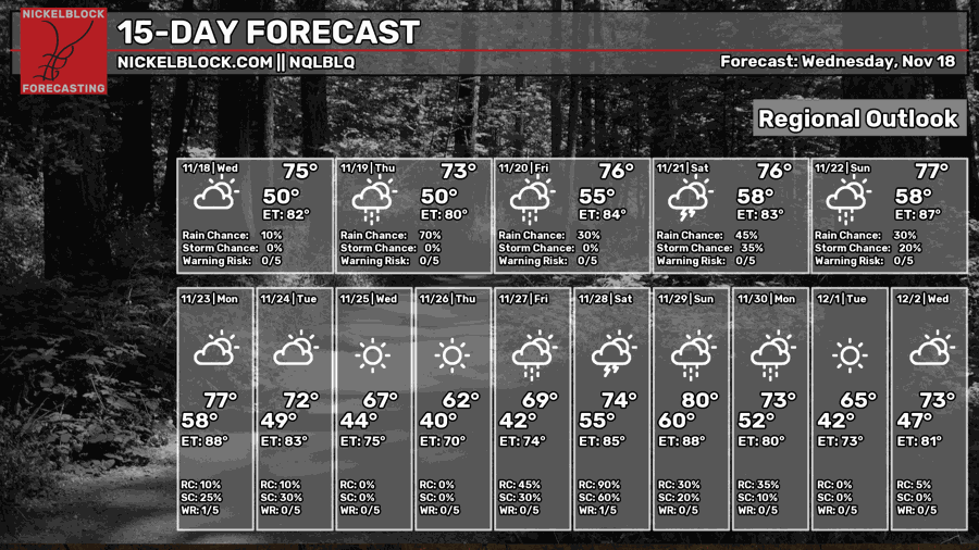
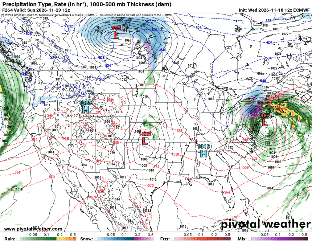
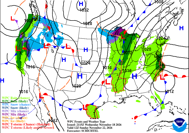
Temperatures have definitely warmed up in the past couple of days and it’s going to stay that way till the end of the weekend! The Gulf disturbance Matt mentioned earlier will gain some traction, enough to form a larger low pressure system and move northward into the Atlantic. While we won’t see the effects of this, those in the northeast will! Now as to how strong it is and what weather it will bring for them, that’s still to be seen as it could be only rain or even some mixed precipitation and snow!

Tonight
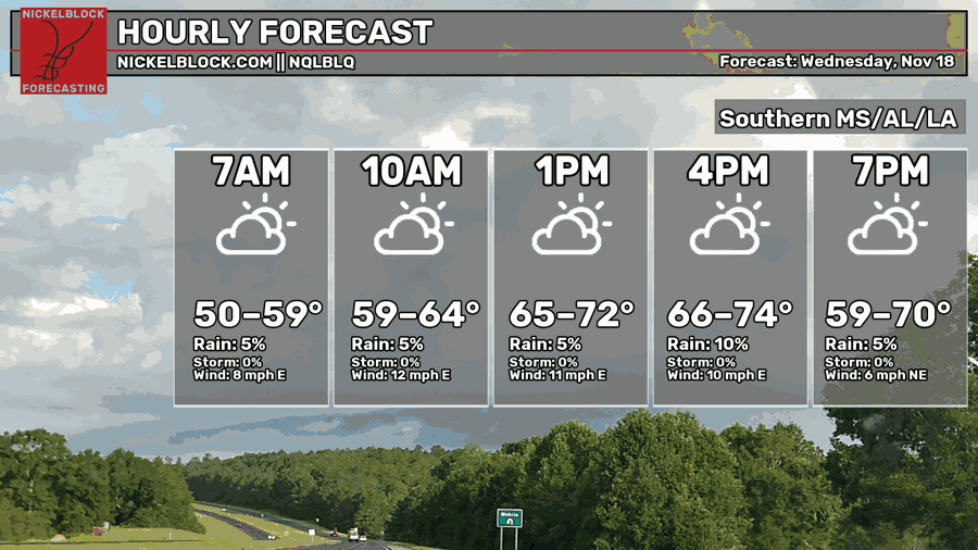
It’s been a much warmer day than the past few days and it’s going to stay mild tonight! More intermittent clouds will move in overnight leading to a few stray showers especially closer to the coast. Lows will be in the low to mid 50s with winds out of the east.

Tomorrow
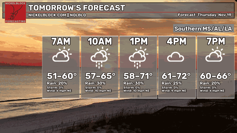
While the NQLBLQ model shows a 30% chance of rain, that’s mainly for people south of Hwy 98. A few stray showers may also reach central MS; however, the HRRR model glitches a bit which makes this a little suspect. I do believe that a few places will see rain further than the coast, though. Most of this rain will appear past midnight and into the early morning hours. A few more will move in by the early afternoon for those on the coast and southeastern Louisiana. Otherwise, expect a mix of clouds and sun during the day with a high in the low 70s. Overnight, clouds will still remain over us with a low in the mid to upper 50s.
Friday
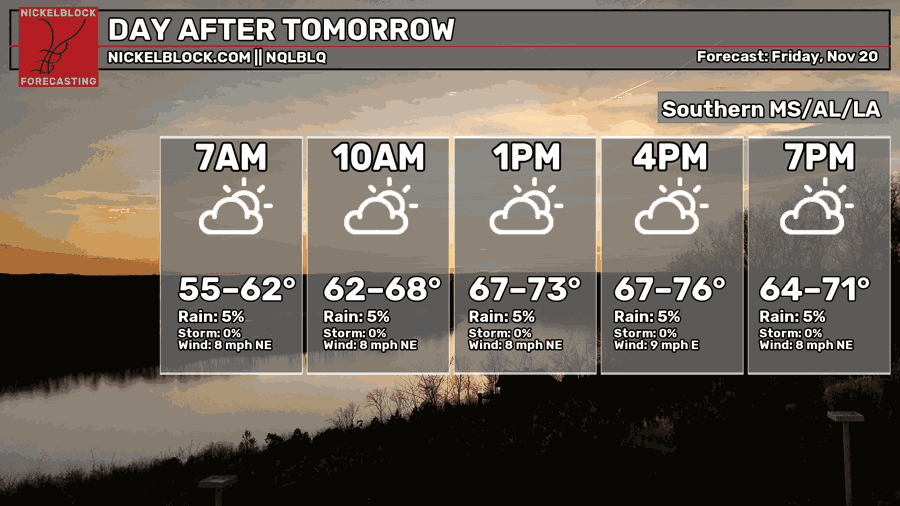
Another partly cloudy day is ahead to end the week with warmer conditions. Winds will be out of the northeast around 5-10mph with some possible wind gusts. Highs will be in the low to mid 70s and lows in the mid to upper 50s again. If you’re out and about going to a game or out on the town, it’ll be a little blustery, but otherwise a nice night out.
The Weekend
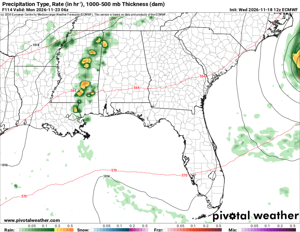
The high pressure system we’ve talked about in the past few days is still affecting how much rain we’re going to receive this weekend. As the pseudo-nor’easter moves up the Atlantic coastline, a cold front will move in from the west and just barely squeeze out some rain for us, if any at all. Saturday will be fairly quiet for us with a few showers meandering up the Louisiana coastline. It’ll be a bit of a gloomy day with mostly cloudy skies.
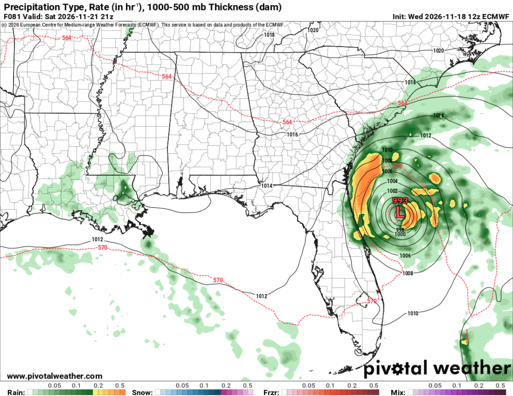
As for Sunday, areas north of I20 will see most of the rain, but overnight storms may roll in around midnight leading into Monday. I don’t expect a lot from these as the front itself is already stretching itself out thin. Rainfall totals from the ECMWF model reach just under 0.15″ for us in the Pine Belt and maybe half an inch in a few other areas. It all depends on whether a thunderstorm can develop and dump more rain.
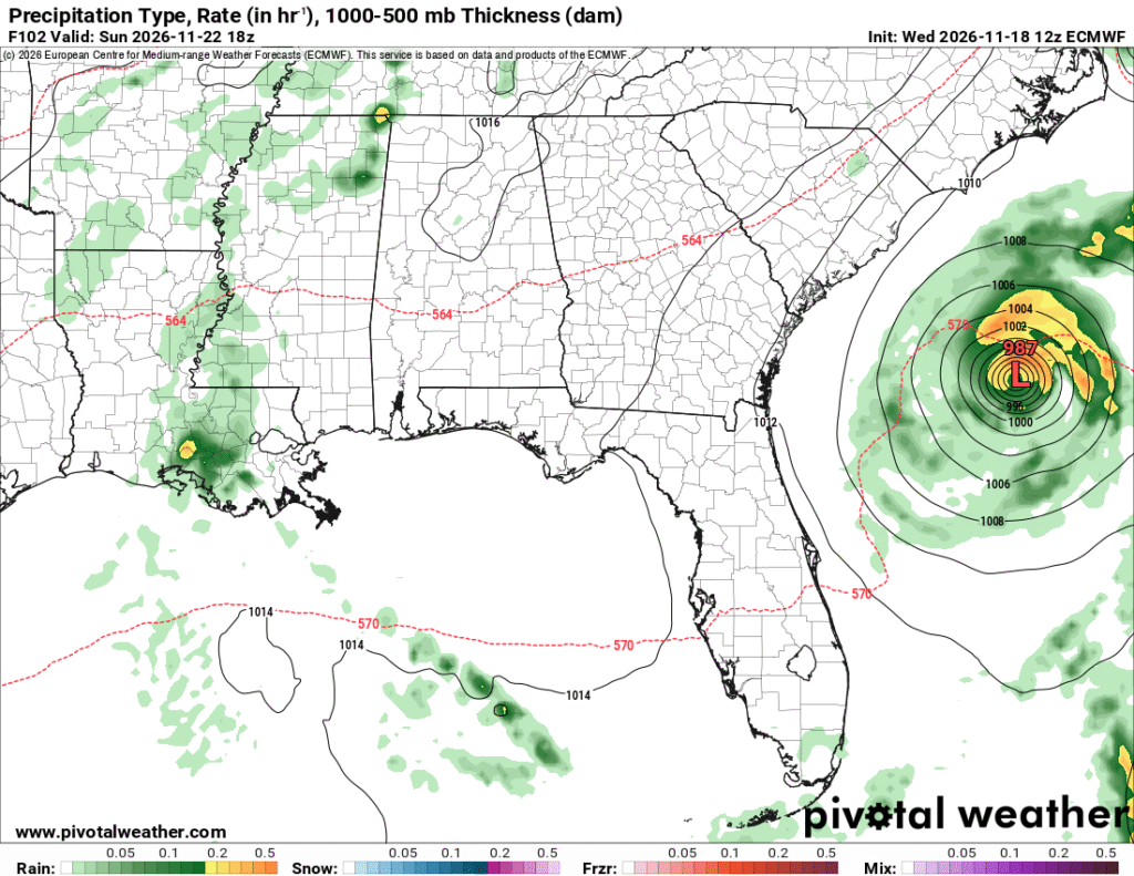
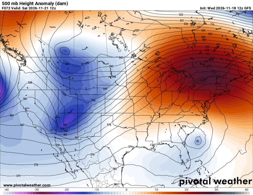
Afterwards, temperatures will cool down a bit more! To start off Thanksgiving week, it’ll feel a bit more like Fall. The average temperature so far is looking like the low to mid 60s during the day and low to mid 40s at night, so not bad for Thanksgiving!