Current Conditions
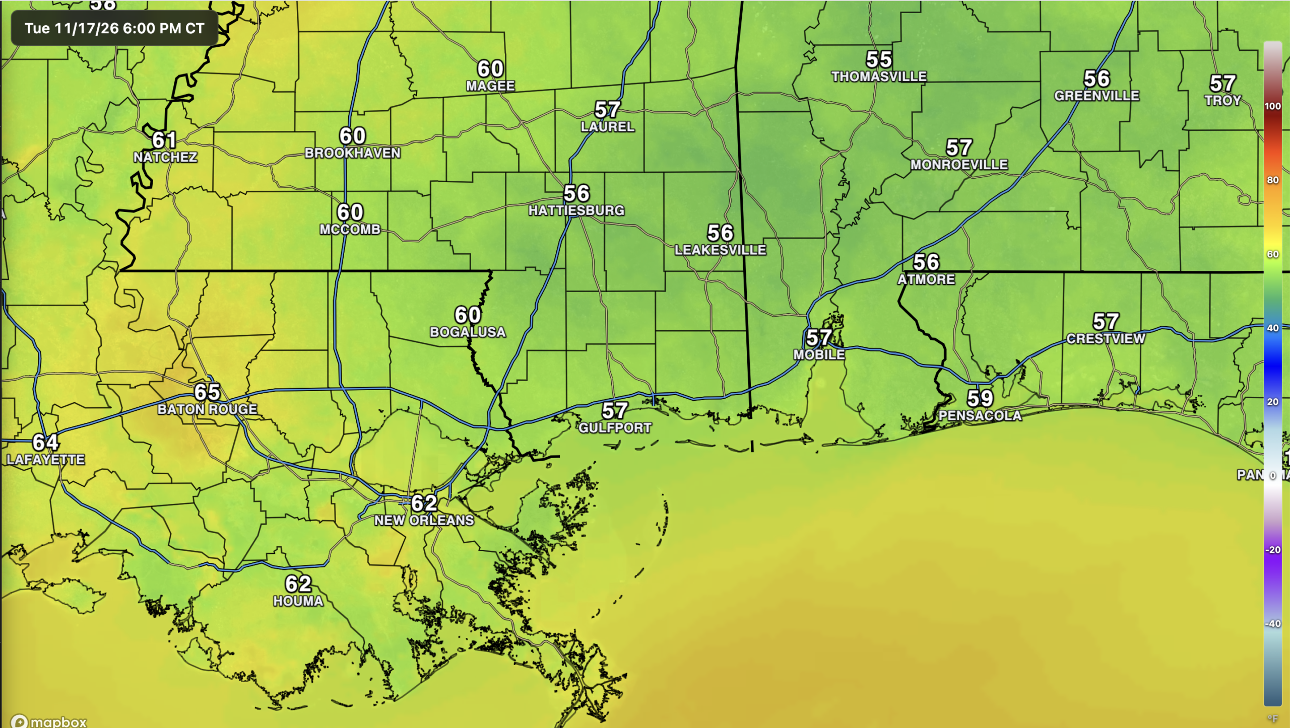
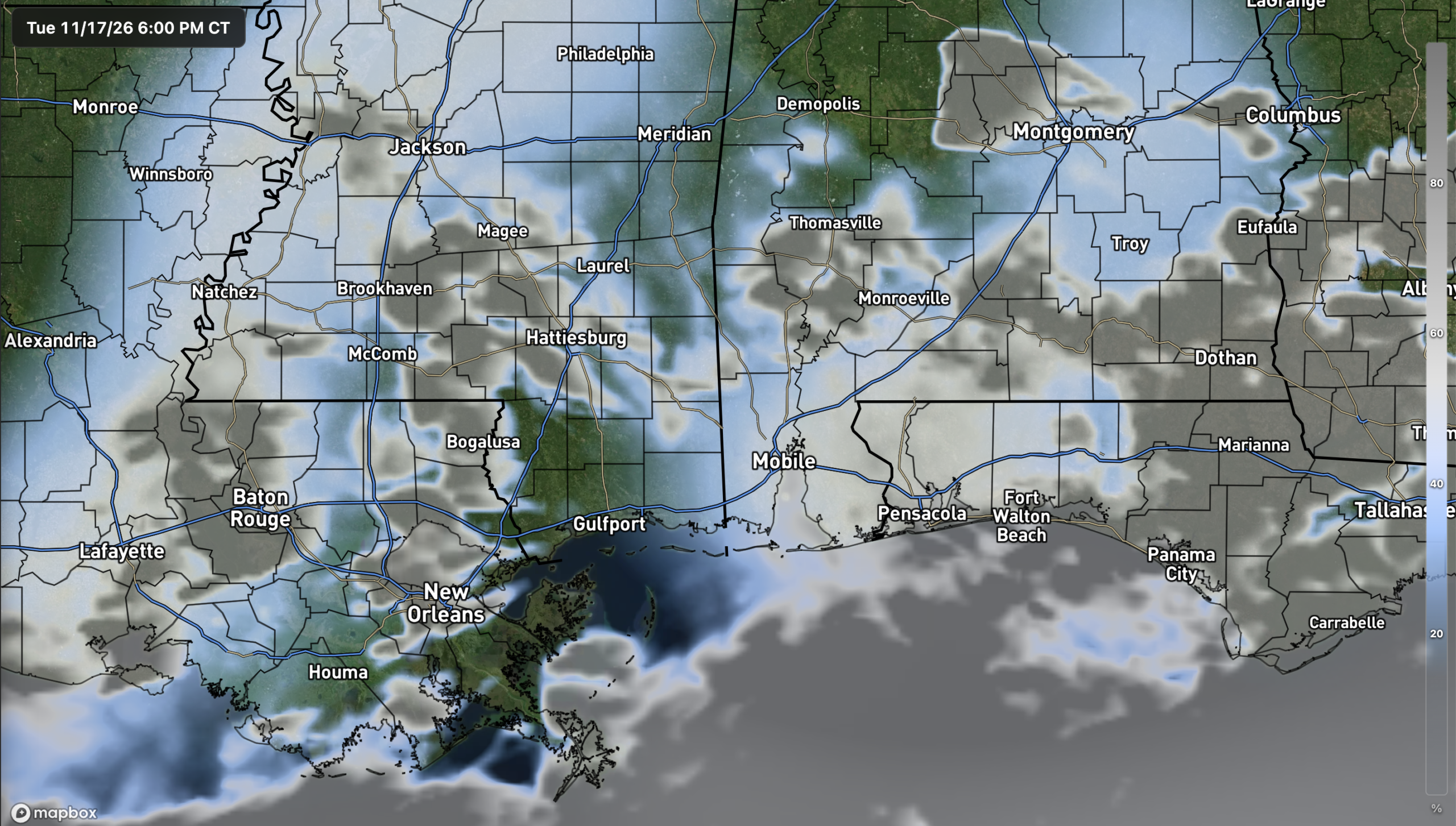
We’re heading into Tuesday evening with temperatures in the mid to upper 50s across much of southern Mississippi and southwest Alabama, while parts of southeast Louisiana are still in the lower to mid 60s. You can see the disturbance hanging out over the eastern Gulf on the water vapor loop above. It’s battering Florida with heavy rain while keeping our region mostly dry under high pressure. A few showers are trying to move in off the Gulf, but the air is so dry that most of the rain is evaporating before it reaches the ground. A few sprinkles could pop up in spots tonight…
The Setup
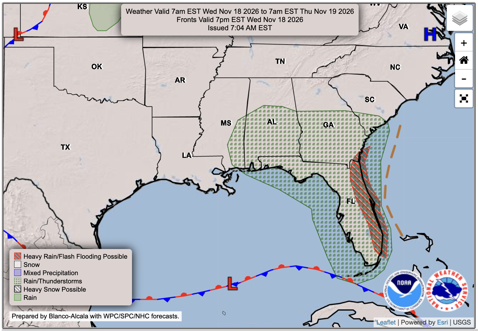
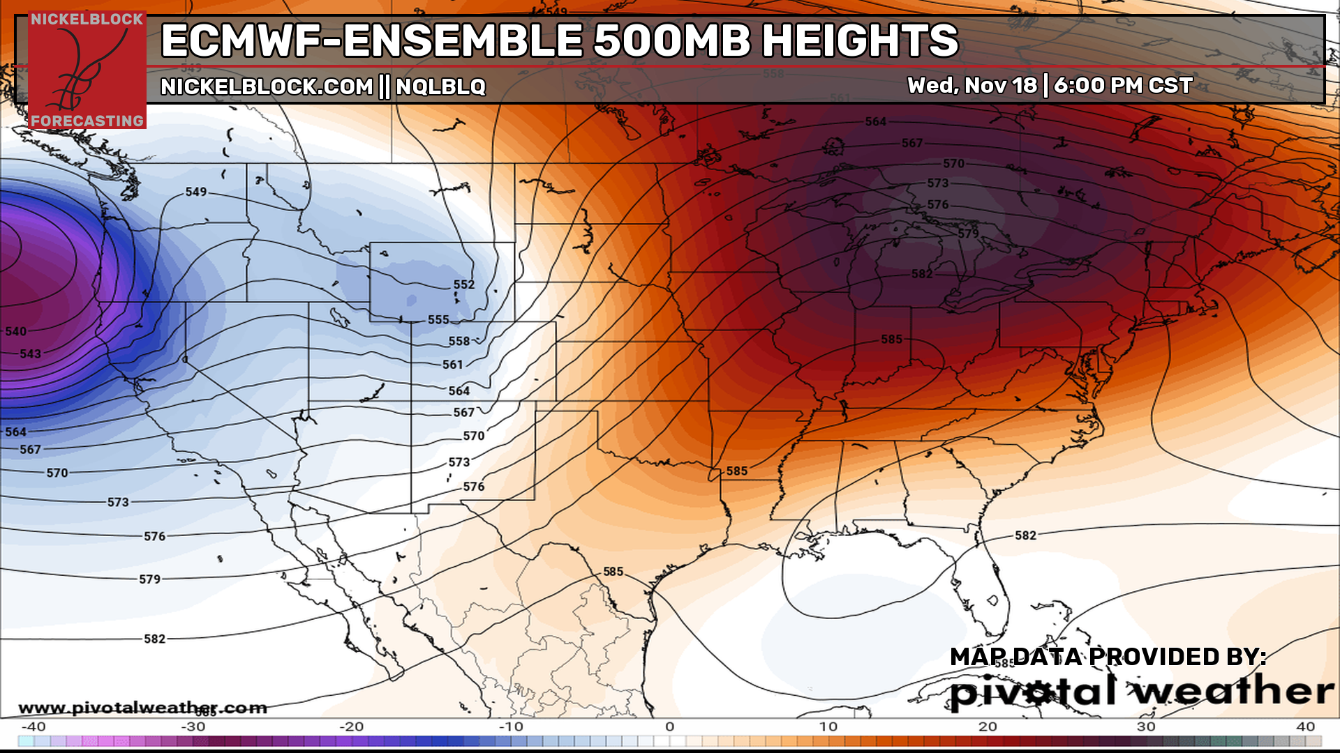
As you can see, there’s a trough over the Gulf tied to an area of low pressure that’ll meander around through the rest of the week before eventually shifting toward the East Coast. That puts us right on the western edge of the rain chances, so an isolated shower or two is possible, mainly closer to the coast. Some models are picking up increased rain chances into the weekend, but for now, most of us should stay mostly dry through the week and into the weekend.

Tonight’s Forecast
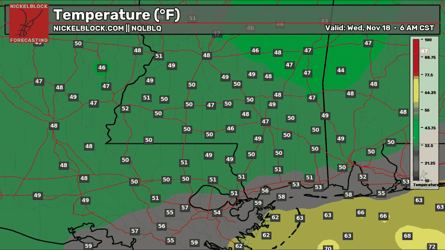
We’ll drop into the upper 40s to near 50 inland by tomorrow morning, while most spots closer to the coast hang on to the lower to upper 50s. Clouds will stick around along the coast, where an isolated shower could try to move in off the Gulf. Most of us will stay dry overnight, with clearer skies farther inland, allowing it to get colder!
Tomorrow’s Forecast: Wednesday, November 18th
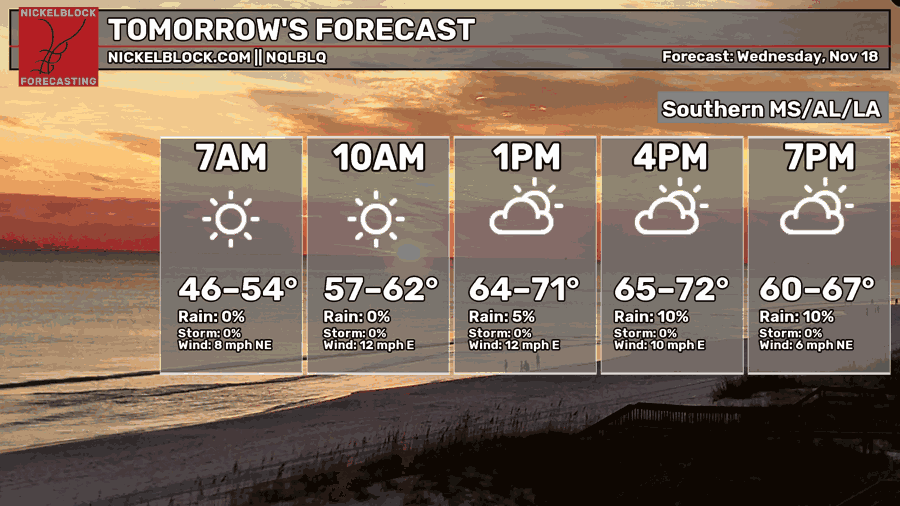
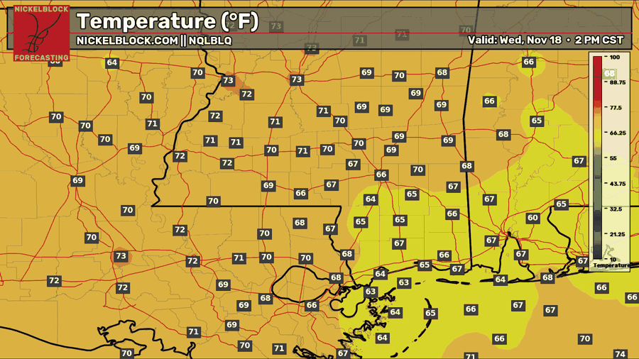
It’ll be a cool start Wednesday morning with temperatures in the mid-40s to lower 50s and a good bit of sunshine for most of us. We’ll warm into the mid-60s to lower 70s by the afternoon, with an east breeze around 10 mph. A few more clouds will move in as the day goes on, especially closer to the coast. That’s also where an isolated shower could sneak in late in the day, but rain chances are very low. Wednesday night won’t be quite as cool, with lows in the mid-to-upper 50s inland and lower 60s along the coast.
Thursday’s Forecast: November 19th
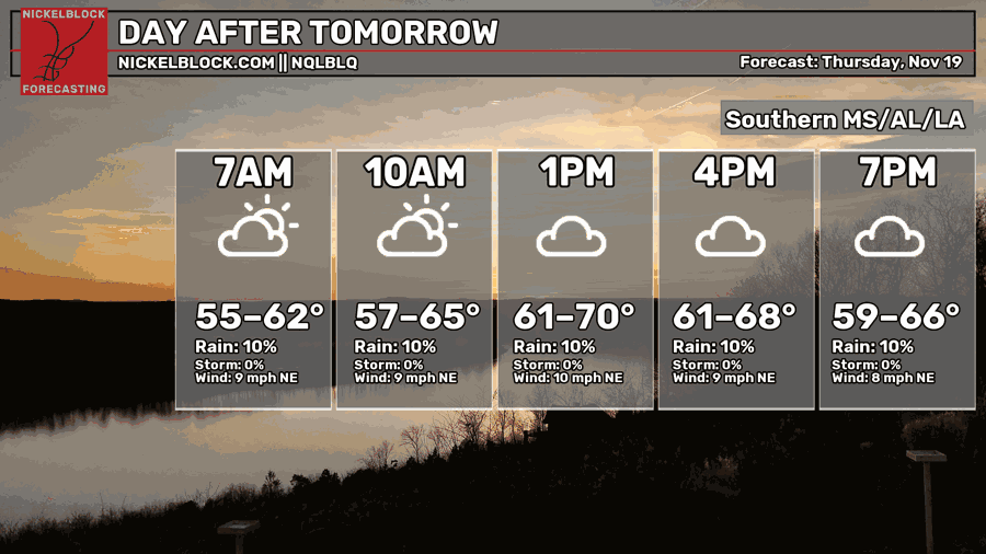
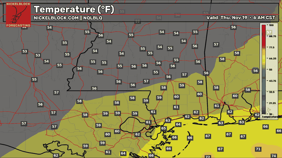
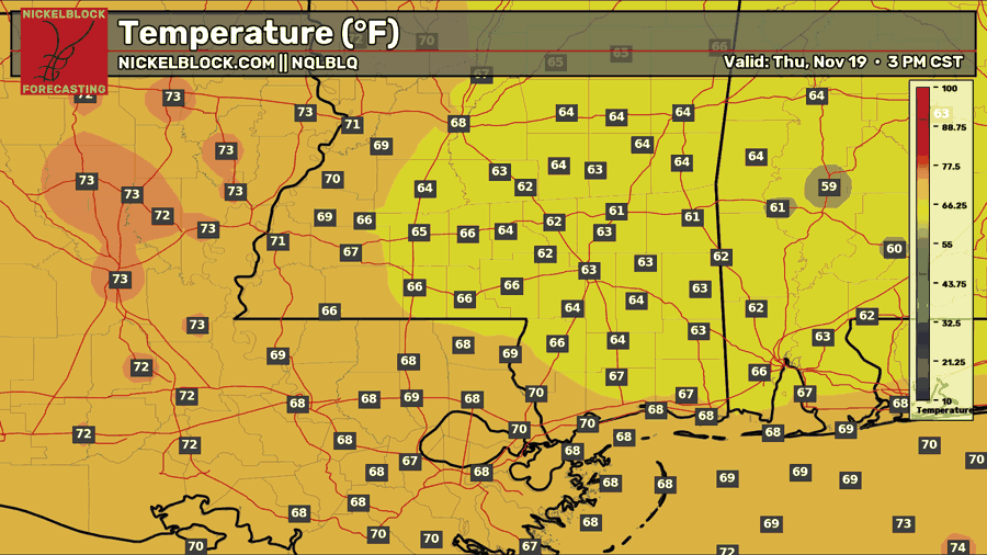
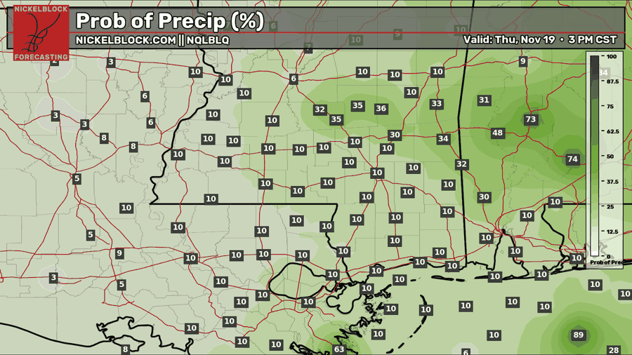
Thursday starts a little milder, with temperatures in the mid-50s to lower 60s. We’ll get some sunshine in the morning before more clouds fill in during the afternoon. Most of us will top out in the lower to upper 60s, with a few spots farther west reaching the lower 70s. We’ll keep a northeast breeze around 10 mph. That disturbance over the Gulf will start to weaken, but there could potentially be a quick sprinkle in a few areas at most. Rain chances are again around 10 percent for most of us, with better chances farther east into Alabama, closer to the area of low pressure.

Extended Local Outlook (Thanksgiving Teaser)
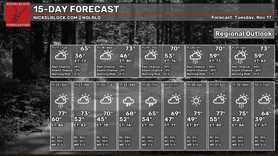
We’ll bump rain chances up to 40 percent Friday and Saturday as that disturbance in the Gulf starts to pull away. It’s more of a spotty shower type of rain, not a washout. If you’ve got plans this weekend, there should still be plenty of dry time. Sunday looks a little warmer and drier, with highs in the mid to upper 70s and just a few showers possible. A weak front comes through Sunday into Monday, which should bring highs back down to the lower 70s to start next week.
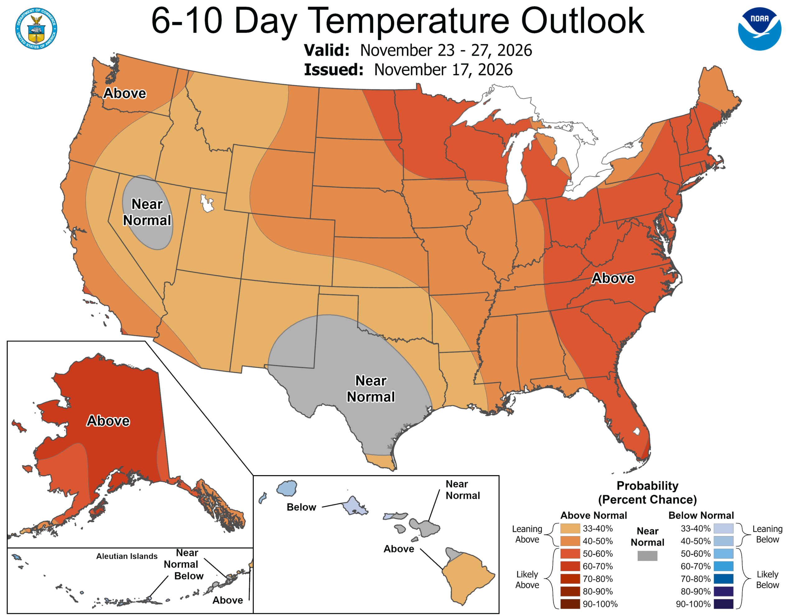
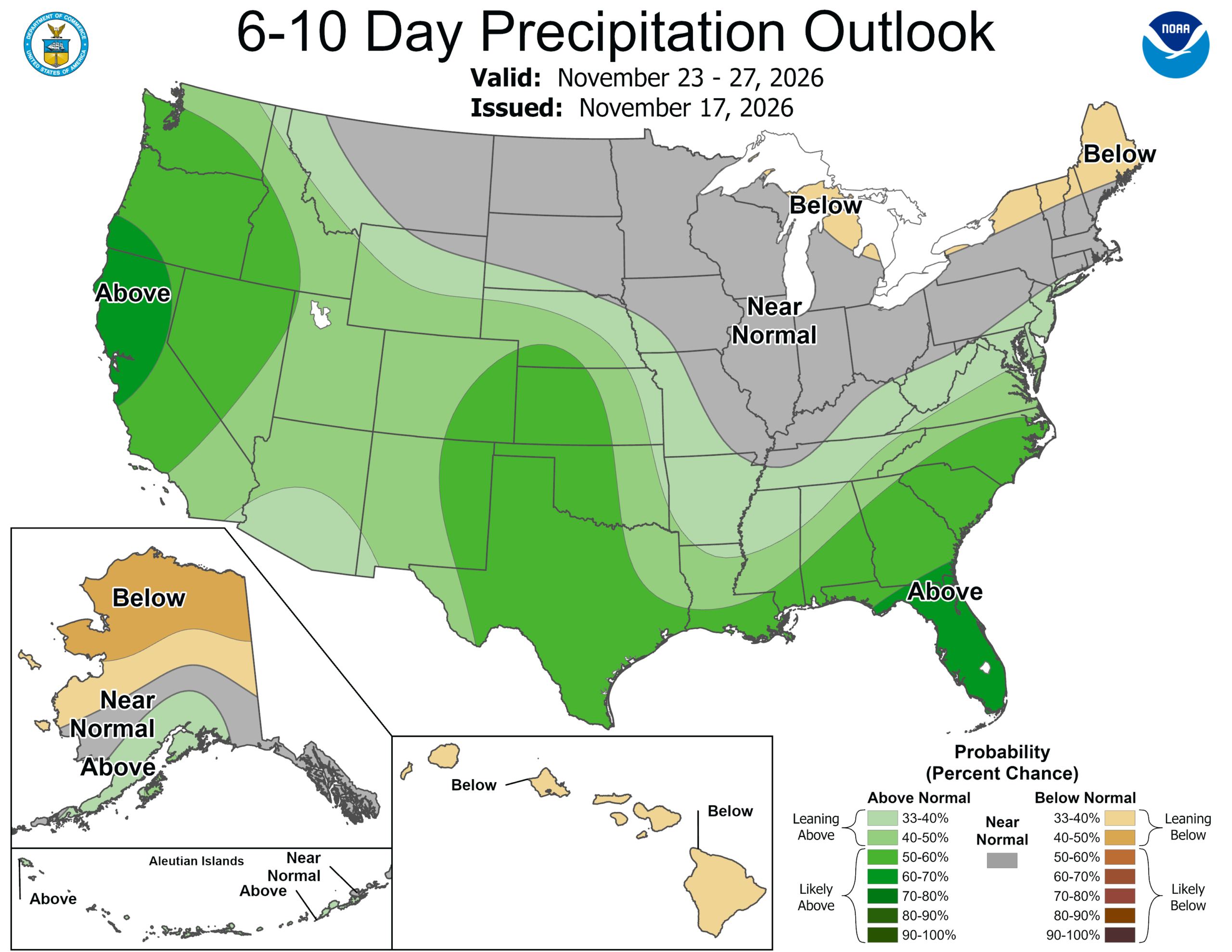
What I’m watching after that is Wednesday into Thanksgiving. The signal is for an above-normal period of rainfall around the time a lot of us will be traveling. We’re still a ways out, so we’ll see how the timing works out and where the better rain chances end up. For now, the outlook for Thanksgiving week is leaning warmer and wetter than usual for our area, thanks to the active subtropical jet that we’ve been seeing, which is typical during El Niño.


