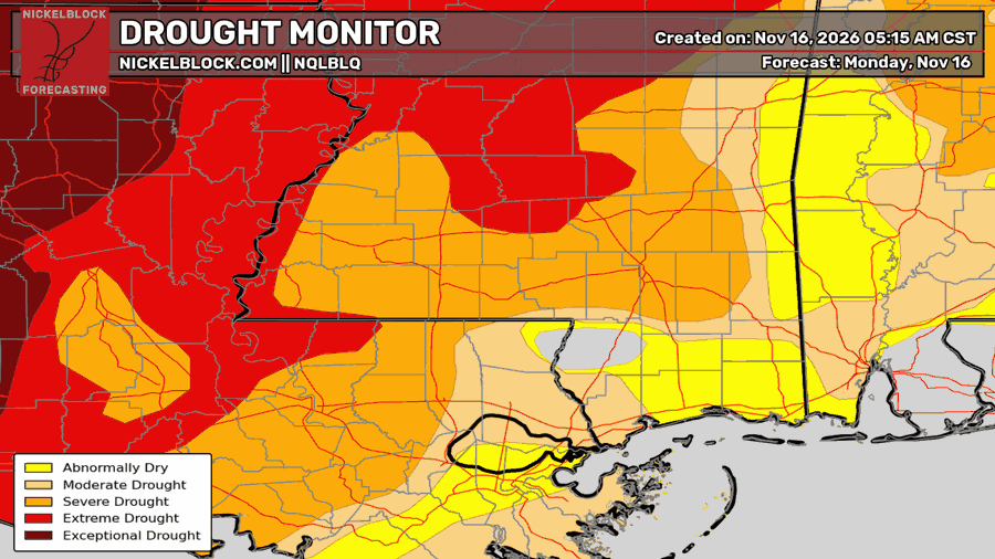
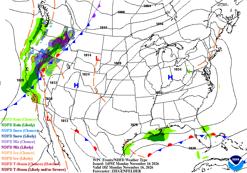
We saw a little bit of rain overnight, but that’s about all we’re getting for a while longer! The high pressure system that is over the eastern US is a little too strong for any moisture to push through, so a lot of it is going around the system into the Gulf. We already have pretty bad drought conditions and are still waiting on a drought-buster to bring us back to normal.

Today
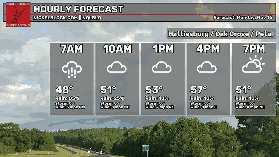
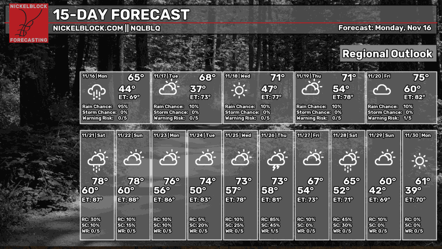
As the rain moves further south this morning, it will eventually dry out over the AL/FL coastline. After that, not much rain to speak of. We’ll still have some clouds here and there during the day and temperatures will be much cooler than average. Highs will be in the upper 50s to low 60s across the area with winds out of the northeast around 5-10mph. Overnight, lows will be in the upper 30s to low 40s.

Tomorrow
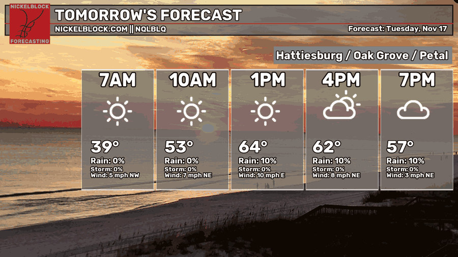
It’ll be a bit of a chilly morning for us tomorrow! The wind won’t be a big help either as we’ll get a decent breeze from the northeast during the day. Temperatures will be in the upper 50s to low 60s with increasing clouds during the evening hours. We’ll be on a warming trend with the low temperatures in the mid 40s to low 50s.
Hump Day
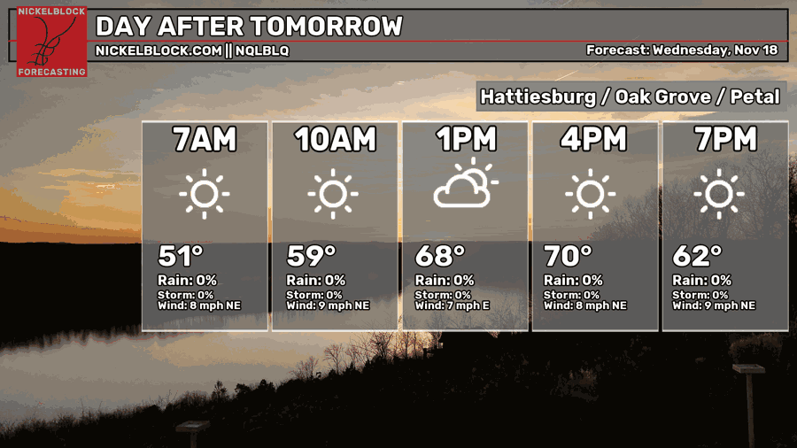
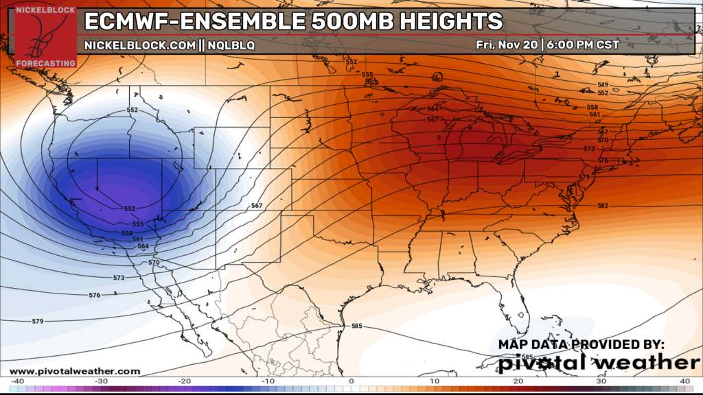
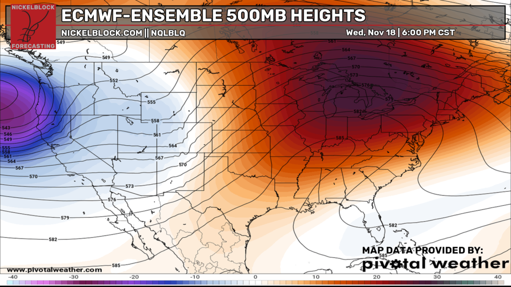
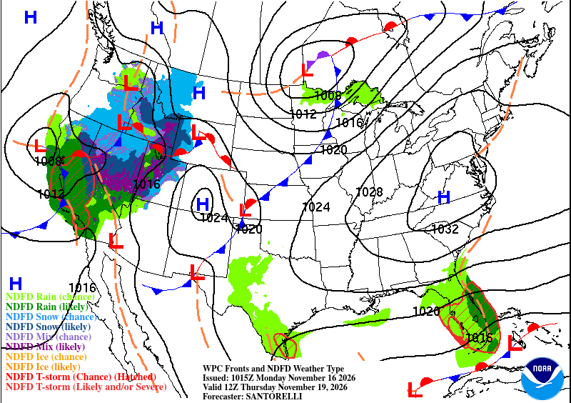
We’ll likely break through to 70 on Wednesday as things begin to churn up in the Plains. Looking at the maps below, a large hump of ridging (left) is developing over the Southeast causing the low pressure systems at the surface (right) to struggle. A large high pressure dome like the one we’ve dealt with will eviscerate any sort of moisture flow and moves it around itself. As the warming trend continues, lows will be in the low to mid 50s.
A Week from Thanksgiving!
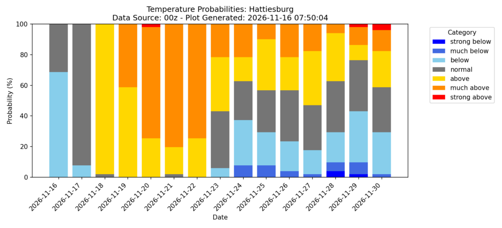
We’re only a week away from Thanksgiving! It’ll be a warm next couple of days as the next cold front tries to move in. It doesn’t look like it’ll make much of a dent in the warmer weather though. We’ll continue into the upper 70s going into the weekend and low to mid 50s. Unfortunately, temperatures won’t really take a dive until closer to Thanksgiving next week, but it’s still looking fairly mild.