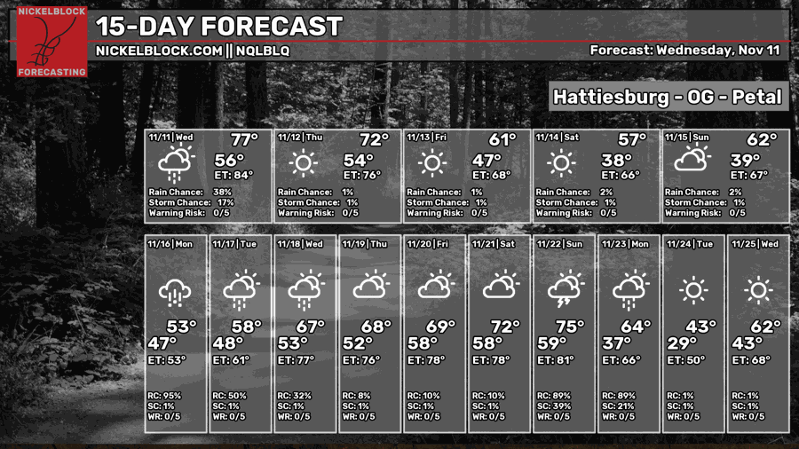
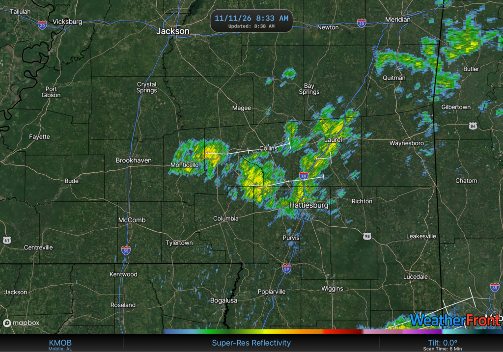
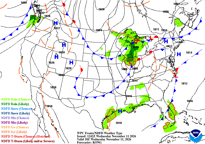
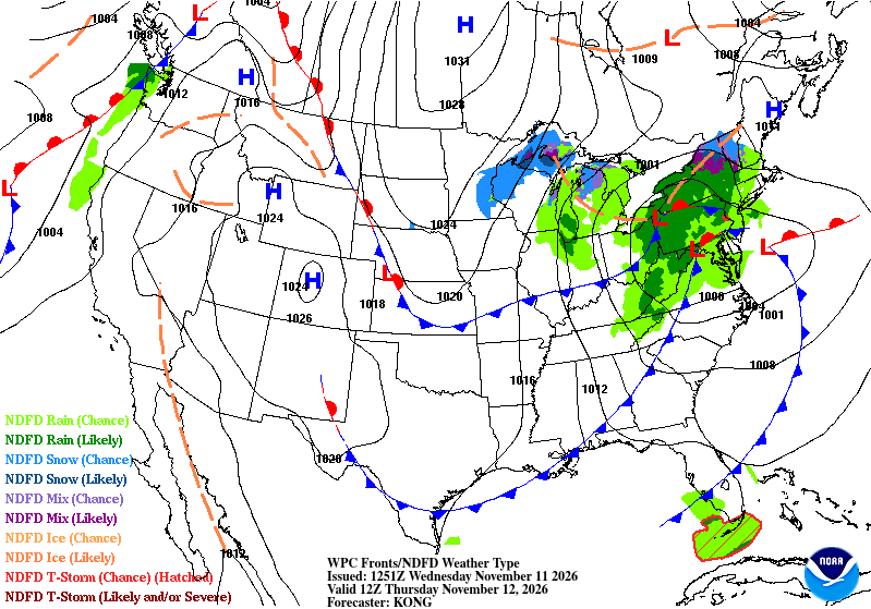
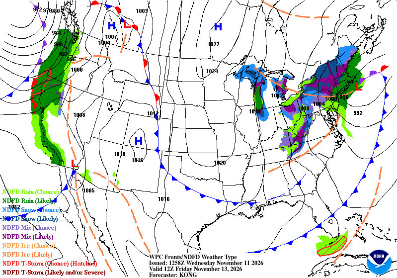
The rain has moved in for the northern end of the Pine Belt and will soon move east into Alabama as the first cold front moves in tonight. There won’t be a massive temperature difference on Thursday, however Friday will be a much cooler day and introduce a cooler weekend. Rain chances look to be suppressed a bit as a large high pressure system will move in from Canada blocking moisture flow and moving it around into the Gulf.


Veterans Day
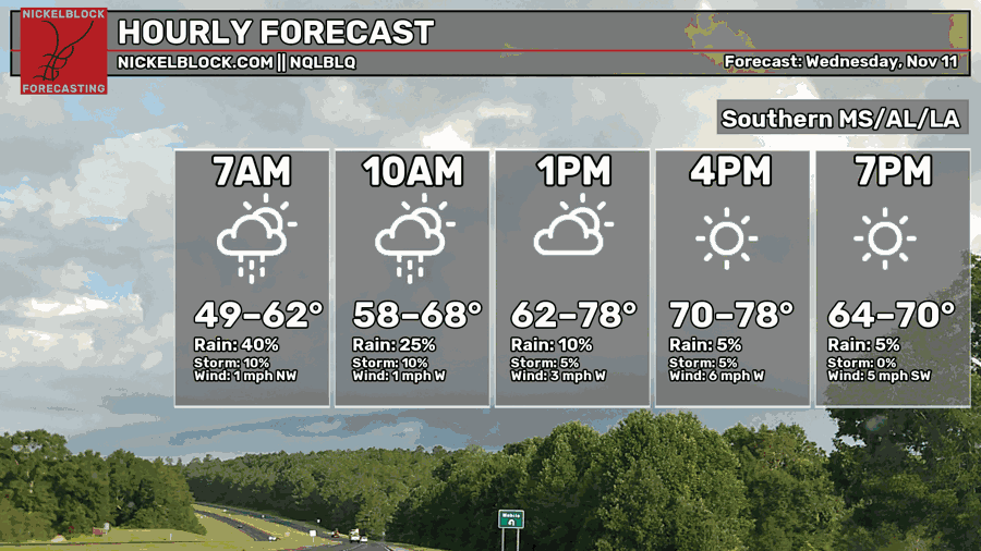
A few showers have made their way into the Pine Belt this morning and will move eastward over the next couple of hours. I don’t expect a lot of rain from these, just enough to dampen the ground. Afterwards the sky will open up by the mid afternoon with highs in the mid 70s. Overnight, the cold front will move in, but won’t have a big effect on temperatures just yet. Lows will be in the mid 50s.

Tomorrow
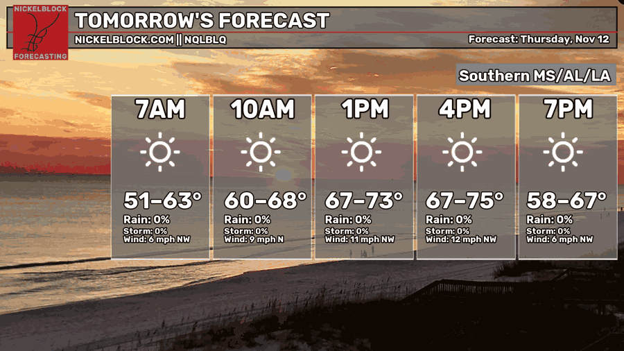
While temperatures look like they’re fairly warm, the winds say otherwise! The winds will cut through from the north and northwest around 10-15 mph making it feel a bit cooler than our actual temperatures. Conditions will also be dry due to the incoming airmass. Highs will be in the upper 60s and lows in the low 40s.
Friday
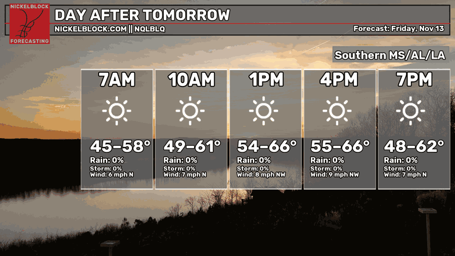
The winds keep coming as the second, and yes, I mean second, cold front moves in! This time the front has a little more “oomph” to it as a Canadian airmass is behind it. It’ll bring temperatures down to the mid 60s and winds will still be blowing from the north and northwest. Overnight, temperatures will reach the mid to upper 30s for most of us in the Pine Belt. Many north of I-20 may see their first frost of the year!
Cool, More Fall-like Weekend Ahead
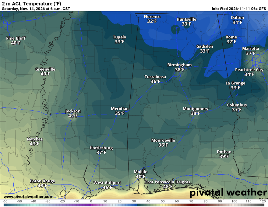
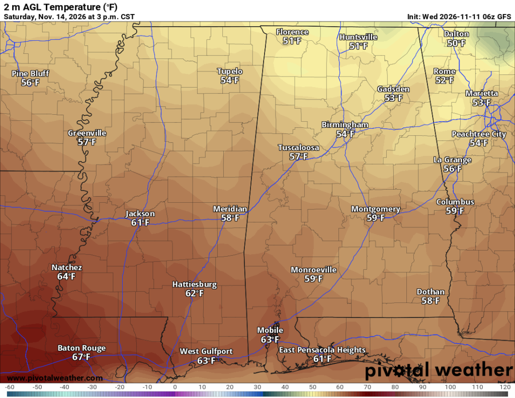
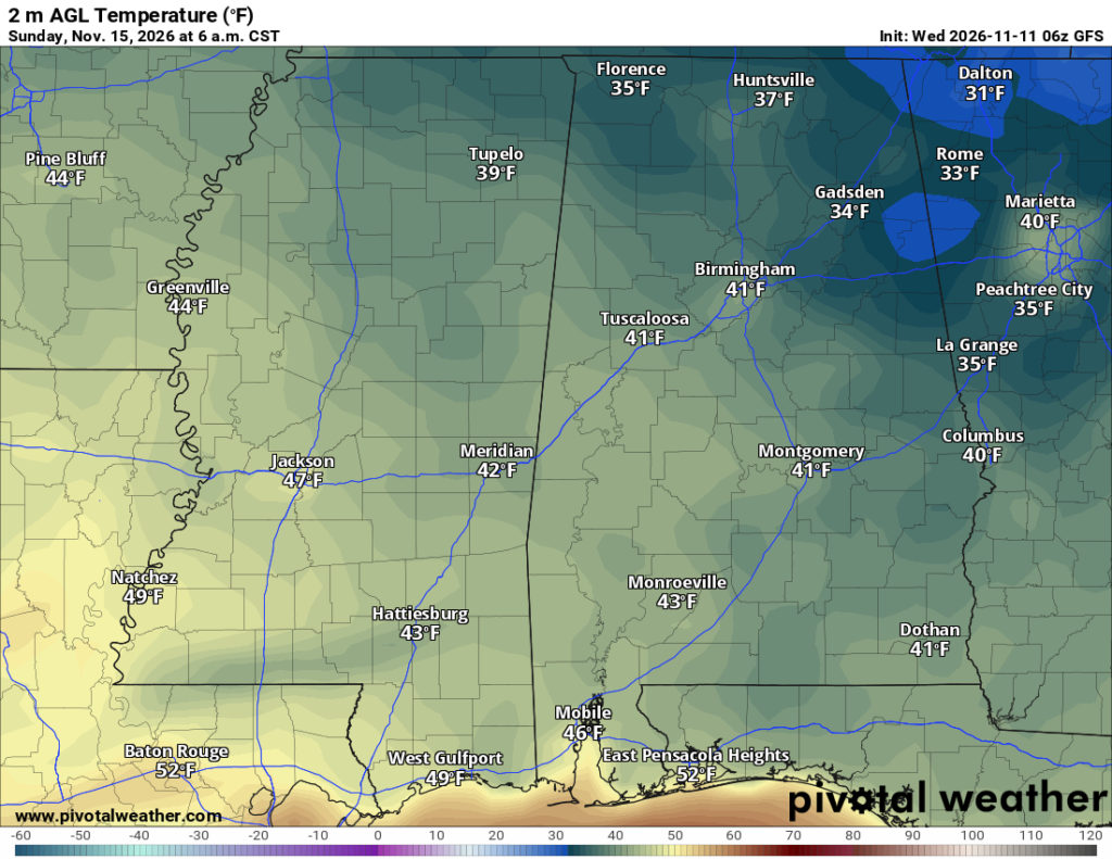
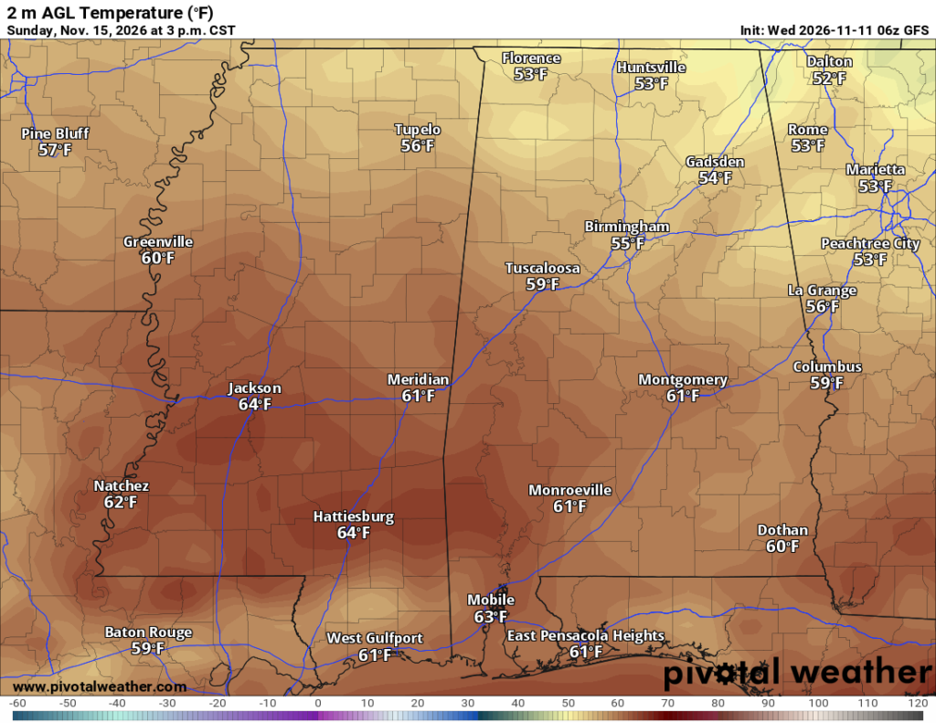
For those of us who want the cooler temperatures that actually feel like Fall in November, you’re in luck! It’ll be a nice couple of days to be outside and enjoy the outdoors. Temperatures will start off in the upper 30s for many of us on Saturday and reach the upper 50s to low 60s. By Sunday, the lows will be in the low 40s and the high in the low 60s again. Honestly, not a bad weekend a couple of weeks before Thanksgiving!
Monday
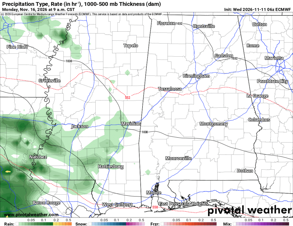
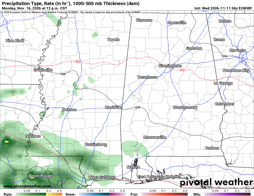
I figured I’d add Monday on here since there is a chance of rain and needs to be discussed. The NQLBLQ model shows a 95% chance of rain and that might be a bit of overkill. The ECMWF model does show a good chance of rain in the early morning hours on Monday. It’s going to move in from Texas and Louisiana and push in past I-55 to the I-59 corridor. Expect some rain Monday morning as you’re going to work, but after that the GFS and the ECMWF models diverge as to its direction. Expect some on and off showers by the afternoon hours with the system moving east or south.