Just to preface this, no, sorry, no White Christmas for us.
You may have noticed that temperatures were quite pleasant yesterday for the second day of winter, barely a bite of cold. We’ll continue this trend on this Christmas Eve eve with highs in the 60s and calm conditions and clouds increasing overnight.
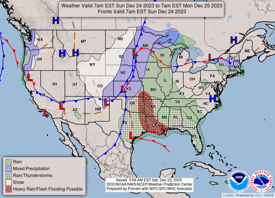
Starting overnight on Sunday, a low pressure system associated with the longitudinal cold front will push ahead to bring us showers and an occasional thunderstorm. The warm front will provide plenty of moisture bringing showers from the southwest. Our main concern for the entire day will be flash flooding since this will bring heavy rain especially to areas closer to the coast. Rainfall amounts between 1-2″ are possible which could lead to streams and creeks rising up and even some flooded roadways. Instability looks fairly low with this system, however, some thunder and lightning may be possible with the heavier storms.

The rain showers will continue into Christmas morning as the rain slowly moves north and eventually to the east. Lingering showers will still be possible with the warm front through the morning, so keep your umbrella with you and your presents covered if you’re taking them somewhere. Temperatures will hover around the upper 60s to low 70s and dip into the 40s overnight.
[wpcode id=”41179″]
Regional Day-to-Day Forecast
Today – Sunny, with a high in the low 70s. Calm wind becoming southeast around 5 mph in the morning.
Tonight – Increasing clouds, with lows in the mid 50s. Calm wind becoming east southeast around 5 mph after midnight.
Sunday – Showers starting in the morning. Highs in the mid 60s. East southeast wind 10 to 15 mph, with gusts as high as 30 mph. Chance of precipitation is 90%. New precipitation amounts between a quarter and half of an inch possible.
Sunday Night – Showers and possibly a thunderstorm. Lows in the upper 50s. East southeast wind 5 to 15 mph becoming south after midnight. Winds could gust as high as 35 mph. Chance of precipitation is 100%. New rainfall amounts between 1 and 2 inches possible.
Christmas Day – A chance of showers and thunderstorms before noon, then a slight chance of showers. Partly sunny, with a high in the lower 70s. West wind around 5 mph. Chance of precipitation is 30%.
Monday Night – Mostly cloudy, with a low in the mid 40s. Northwest wind around 5 mph.
Tuesday – Partly sunny, with a high in the upper 50s. North northwest wind around 5 mph.
Tuesday Night – Mostly cloudy, with a low in the upper 30s. Northwest wind around 5 mph.
WednesdayMostly sunny, with a high in the upper 50s. West wind around 5 mph.
Wednesday Night – Mostly clear, with a low in the mid 30s.
Thursday – Sunny, with a high in the low 50s.
Thursday Night – Mostly clear, with a low in the low 30s.
Friday – Sunny, with a high in the mid 50s.
[wpcode id=”41149″]


