It look slike things will be a bit showery and windy today. The wind is something that looks a bit stronger today than it looked 24 hours ago. Not “bad” wind, but it may shake those Christmas Decorations a bit.
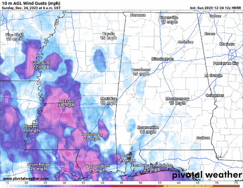
Looking at the model guidance, the wind gusts across the area look to range between about 30 and 40mph through the day today. Sustained wind will likely be between 15mph and 25mph.
Today’s wind will be mainly an easterly wind, which means it won’t be ushering in prime Gulf of Mexico air. That will save us from a threat for severe weather. So, while thunderstorms are in the forecast, most of the storms will be simply a few rumbles of thunder, some heavier rain, and gusty wind.
The HRRR computer weather model shows how the rain will move through today. And it should clear out just in time for tomorrow morning.
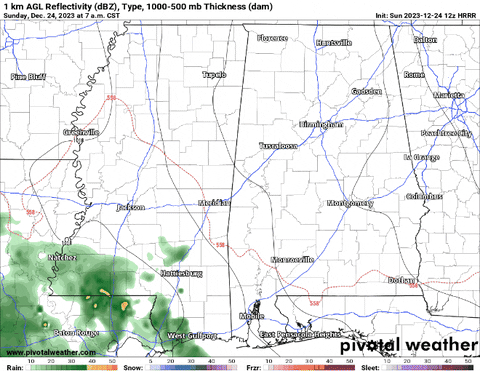
So while Santa may have to dodge a lot of raindrops overnight, you may have a, generally, dry drive back and forth to Grandma’s house tomorrow morning.
Beyond that, there is a growing indication that we may be a bit cooler as we move into the start of 2024. A graphical look at forecast you can see the trend of tumbling temperatures as we move toward new Year’s Day.
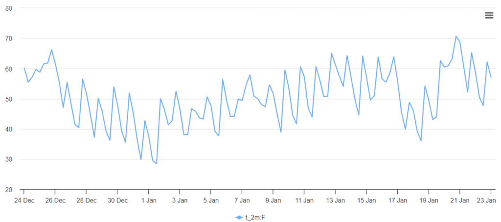
Then the chilly temperatures hold through the first week of January before we start to rebound back toward seasonable temperatures.
REGIONAL DAY TO DAY FORECAST
Sunday: Showers likely in the morning, then showers with a slight chance of thunderstorms in the afternoon. Highs in the mid 60s. East winds 15 to 20 mph with gusts up to 35 mph. Chance of rain 90 percent.
Sunday Night: Showers with a slight chance of thunderstorms. Near steady temperature in the upper 50s. Southeast winds 15 to 20 mph with gusts up to 40 mph. Chance of rain near 100 percent.
Christmas Day: Mostly cloudy with a chance of showers in the morning, then partly sunny in the afternoon. Highs in the lower 70s. Southwest winds 5 to 10 mph. Chance of rain 40 percent.
Monday Night: Mostly cloudy. Cooler with lows in the upper 40s. Northwest winds 5 to 10 mph.
Tuesday: Partly sunny. Cooler with highs in the upper 50s.
Tuesday Night: Mostly cloudy. Lows around 40.
Wednesday: Partly sunny. Highs in the upper 50s.
Wednesday Night: Partly cloudy. Lows in the mid 30s.
Thursday: Sunny. Highs in the mid 50s.
Thursday Night: Mostly clear. Lows in the mid 30s.
Friday: Sunny. Highs in the upper 50s.
Friday Night: Partly cloudy. Lows in the mid 30s.
Saturday: Mostly sunny. Highs in the mid 50s.


