With a more winter-like cool down south this weekend, we’ll see another day of cool weather before we warm up to the 70s by the middle of the week!
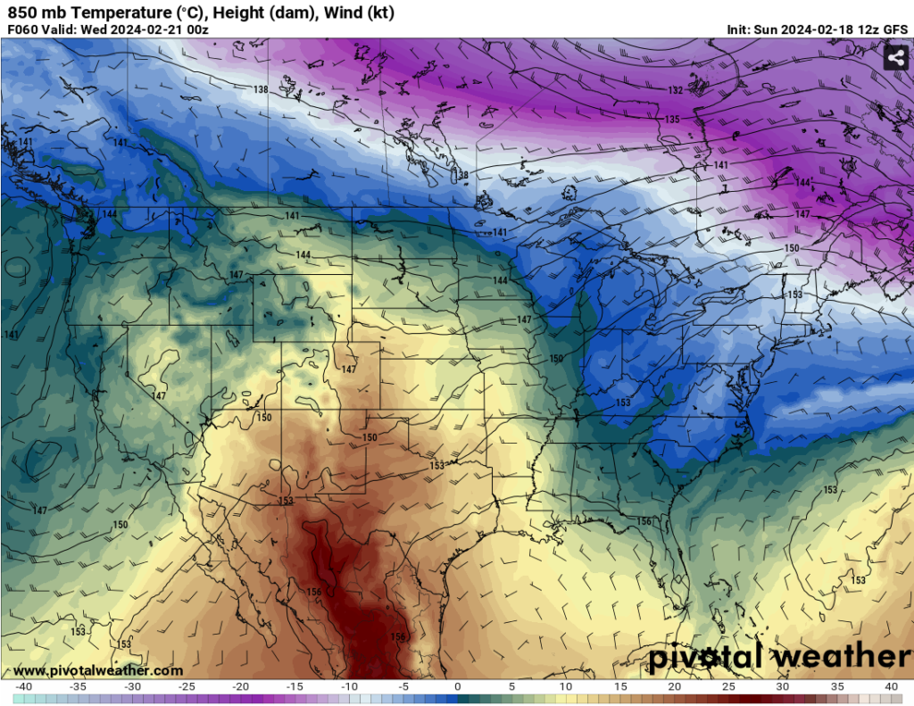
Looking at the 850mb analysis, we’ll be right in the middle of a subtropical ridge by the middle of the week. We’ll see a shift from northerly to more southerly winds up the Deep South which will warm up temperatures quite a bit from Tuesday into Friday. A dry warm front coupled with strong surface high pressure will keep us from any rain but ultimately make it much warmer overall.

By Thursday, a weaker surface low will push from the southwestern US and move east towards the mid-South. Areas around Tennessee and northern Mississippi/Alabama may see some rain from the cold front, however a dryline and strong high pressure system will likely keep most of the rain from coming further south towards the Pinebelt. There won’t be much of a cooldown to speak of after the front has left, and we’ll likely stay around the 70s during the weekend. Conditions will be fairly Spring-like for late February but definitely nice for being outside especially if you’re out and about or starting on some early yard work.
[wpcode id=”41179″]
Regional Day-to-Day Forecast
Tonight – Widespread frost, mainly after midnight. Otherwise, clear, with a low around 27. North wind around 5 mph becoming calm.
Presidents Day – Widespread frost before sunrise. Otherwise, sunny, with a high near 61. Calm wind.
Monday Night – Widespread frost, mainly before sunrise. Otherwise, mostly clear, with a low around 32. Calm wind.
Tuesday – Widespread frost before sunrise. Otherwise, sunny, with a high near 69. Calm wind becoming southwest around 5 mph.
Tuesday Night – Mostly clear, with a low around 44. Calm wind.
Wednesday – Sunny, with a high near 74. Light south southwest wind increasing to 5 to 10 mph in the morning.
Wednesday Night – Partly cloudy, with a low around 53. South southwest wind 5 to 10 mph.
Thursday – Partly sunny, with a high near 76. South southwest wind 5 to 10 mph increasing to 15 to 20 mph in the afternoon. Winds could gust as high as 25 mph.
Thursday Night – Partly cloudy, with a low around 56. Southwest wind 10 to 15 mph becoming north northwest after midnight. Winds could gust as high as 20 mph.
Friday – Sunny, with a high near 71.
Friday Night – Mostly clear, with a low around 42.
Saturday – Sunny, with a high near 71.
Saturday Night – Mostly clear, with a low around 43.
Sunday – Sunny, with a high near 74.
[wpcode id=”41149″]


