We’ve had a breezy past couple of days after a quick but damp cold front ran through on Friday. Temperatures remain warm but pleasant for the weekend with temperatures in the 70s during the day and the 40s by night.
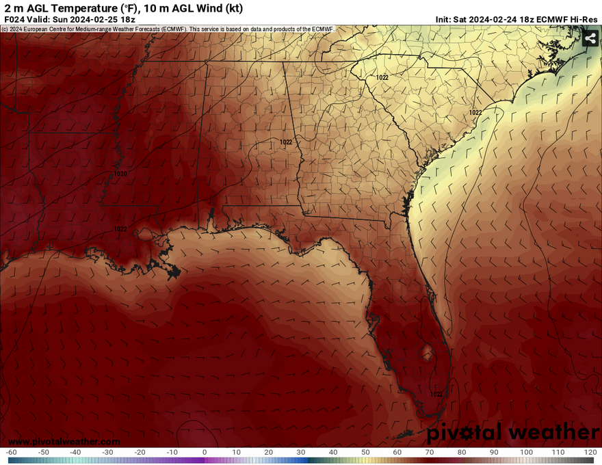
Starting off from Saturday evening into Sunday, we’ll see a significant change in the wind direction overnight. Winds will shift from the northwest to the southeast as the day progresses. A strong high pressure system in the Atlantic will form helping winds to shift to the southeast as it moves further east. Dewpoints are still fairly low at this point which indicates a drier warming trend for the next couple of days.

One thing of note is due to the lack of rain we’ve had like we usually do around the weekend, there is some concern for fire weather to be a concern. Winds will begin to pick up especially around Monday, and any controlled burns may be problematic due to the wind gusts.
Speaking of everybody’s favorite day of the week, we’ll see another dry day ahead with temperatures possibly topping out around 80 in some areas. Humidity will be up a tad with the southern winds pushing from the Gulf. Lows will also start to climb into the 60s for the next couple of days. I wouldn’t be surprised to see some local burn bans take place along with another fire weather outlook ahead, so keep an eye out starting next week.
[wpcode id=”41179″]
Regional Day-to-Day Forecast
Tonight – Mostly clear, with a low around 39. Calm wind.
Sunday – Sunny, with a high near 76. Light southeast wind becoming south southwest 5 to 10 mph in the morning.
Sunday Night – Mostly clear, with a low around 48. South wind around 5 mph becoming calm after midnight.
Monday – Sunny, with a high near 80. South southwest wind 5 to 10 mph increasing to 10 to 15 mph in the afternoon. Winds could gust as high as 20 mph.
Monday Night – Partly cloudy, with a low around 61. South southwest wind around 10 mph, with gusts as high as 20 mph.
Tuesday – Partly sunny, with a high near 82. South wind 10 to 15 mph, with gusts as high as 25 mph.
Tuesday Night – Mostly cloudy, with a low around 65. South wind 10 to 15 mph, with gusts as high as 25 mph.
Wednesday – A 30 percent chance of showers and thunderstorms, mainly in the afternoon. Mostly cloudy, with a high near 80. South southwest wind 10 to 15 mph becoming west in the afternoon. Winds could gust as high as 25 mph.
Wednesday Night – A 20 percent chance of showers and thunderstorms before midnight. Mostly cloudy, with a low around 44. West northwest wind around 10 mph becoming north northeast after midnight. Winds could gust as high as 20 mph.
Thursday – Mostly cloudy, with a high near 59.
Thursday Night – A 30 percent chance of showers and thunderstorms. Mostly cloudy, with a low around 41.
Friday – A 30 percent chance of showers and thunderstorms. Partly sunny, with a high near 68.
Friday Night – A 20 percent chance of showers. Mostly cloudy, with a low around 50.
Saturday – A 20 percent chance of showers and thunderstorms. Mostly cloudy, with a high near 72.
[wpcode id=”41149″]


