Conditions look great and a little warmer than usual to end off February. Temperatures will reach the low 80s by Tuesday and eventually dip back into the 60s after the expansive cold front moves past us on Thursday. Nick hinted at this earlier, but the severe weather threat looks low for both Wednesday and early Friday, and I’ll explain why in a minute.
First off, as I mentioned yesterday, we’ll have a limited fire weather threat possible for the next couple of days until the rain comes in on Wednesday. A strong high pressure system will develop over the eastern Gulf of Mexico and remain steadfast keeping a dry airmass over us. The southern influence of the winds from the Gulf will increase the humidity over the next couple of days but also keep the high pressure over us. Not only that, we’ll see a spike in the winds which will stay around 10-15 mph and possible 30mph wind gusts during the day.
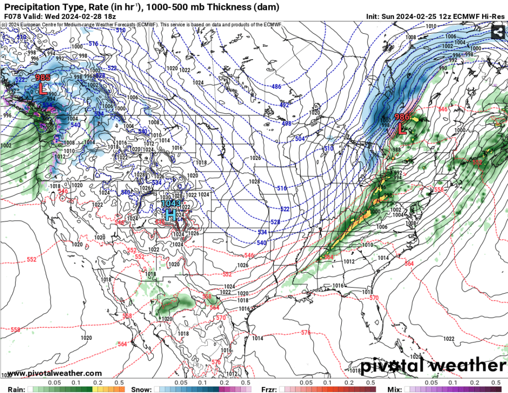
Looking at Wednesday’s possible severe weather, the chances seem pretty low, at least for the Pinebelt. A stout longwave trough over Canada will guide the surface front along, however it looks to be weaker the further south the front is. We’ll see some possible thunderstorms along with the front and up to half an inch of rain in some areas. There isn’t a lot of return flow from the Gulf due to the high pressure system which likely means that severe weather will be hindered, however we’ll have to see what the models may cook up in the next couple of days.
By Thursday we’ll feel the effects of the cold front which will plummet temperatures back into the 60s for the remainder of the week. A weak subtropical jet from the southwest along with a small shortwave in the southwest will contribute to a fairly weak system moving in Thursday night into Friday morning. We’ll see up to 3/4 of an inch of rain overnight and the rain may last until the late morning across most of the Pinebelt.

Due to the stalling of the front in the Gulf from the strong Midwest high, some lingering showers will be present across the weekend. Mainly around the Gulf, but a few could pop up inland. After Sunday, we may have another major system possible going into Monday, however we’ll have to see how strong this front is in the next few days.

[wpcode id=”41179″]
Regional Day-to-Day Forecast
This Afternoon – Widespread haze in the afternoon. Sunny, with a high near 76. South wind 5 to 10 mph.
Tonight – Patchy fog around sunrise. Otherwise, mostly clear, with a low around 48. South wind around 5 mph.
Monday – Patchy fog around sunrise. Otherwise, sunny, with a high near 80. South wind 5 to 15 mph, with gusts as high as 20 mph.
Monday Night – Increasing clouds, with a low around 60. South southwest wind around 10 mph, with gusts as high as 20 mph.
Tuesday – Partly sunny, with a high near 82. South wind 10 to 15 mph, with gusts as high as 30 mph.
Tuesday Night – Mostly cloudy, with a low around 64. South wind 10 to 15 mph, with gusts as high as 30 mph.
Wednesday – A 30 percent chance of showers and thunderstorms after noon. Mostly cloudy, with a high near 81. South wind 10 to 15 mph becoming west in the afternoon. Winds could gust as high as 30 mph.
Wednesday Night – A slight chance of showers and thunderstorms until midnight. Mostly cloudy, with a low around 43. West northwest wind around 15 mph becoming north northeast after midnight. Winds could gust as high as 25 mph. Chance of precipitation is 20%.
Thursday – Partly sunny, with a high near 60. North northeast wind 10 to 15 mph, with gusts as high as 25 mph.
Thursday Night – A chance of showers and thunderstorms after midnight. Partly cloudy, with a low around 42. Chance of precipitation is 30%.
Friday – A 40 percent chance of showers and thunderstorms. Partly sunny, with a high near 67.
Friday Night – A 40 percent chance of showers. Mostly cloudy, with a low around 50.
Saturday – A 30 percent chance of showers and thunderstorms. Partly sunny, with a high near 69.
[wpcode id=”41149″]


