Things still look good for today with highs in the upper 70s. The only downside to the forecast today is the wind. We will have a southerly wind around 15mph.
Clouds will start to increase as we move through the overnight hours tonight and through tomorrow and then we start to get set up with a few shots for rain during the back half of the week and through the weekend.
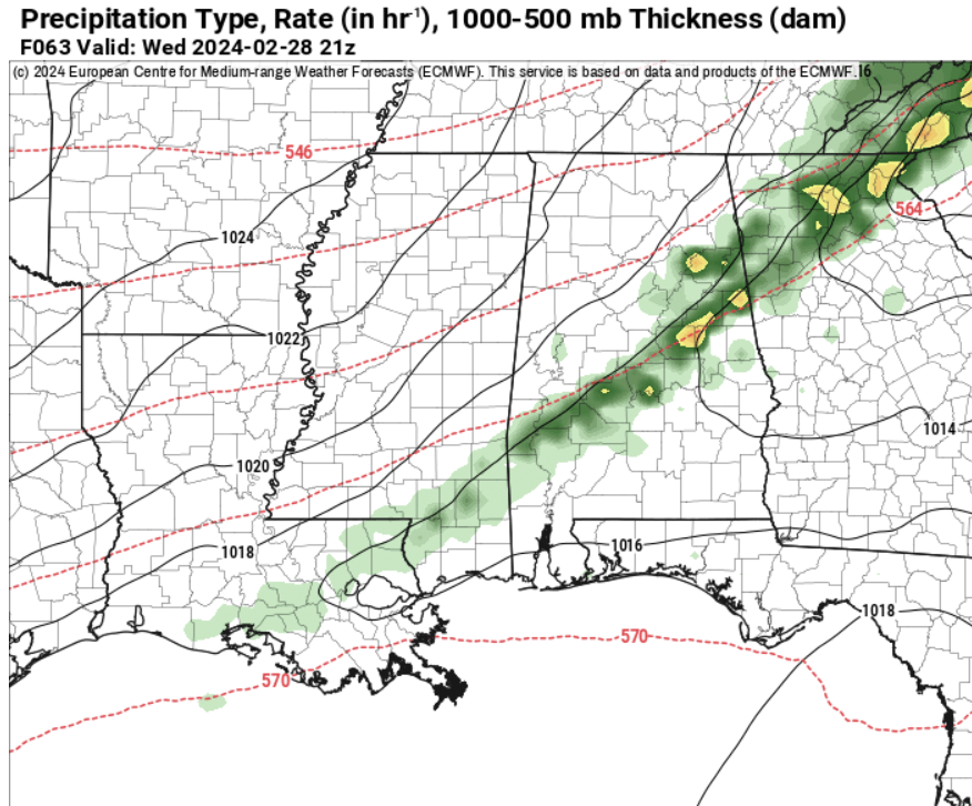
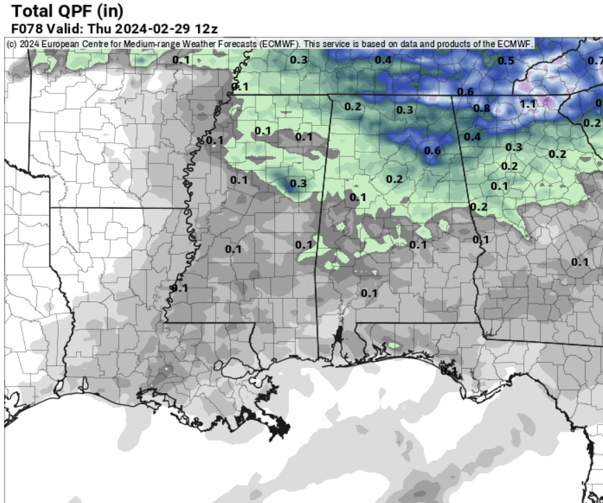
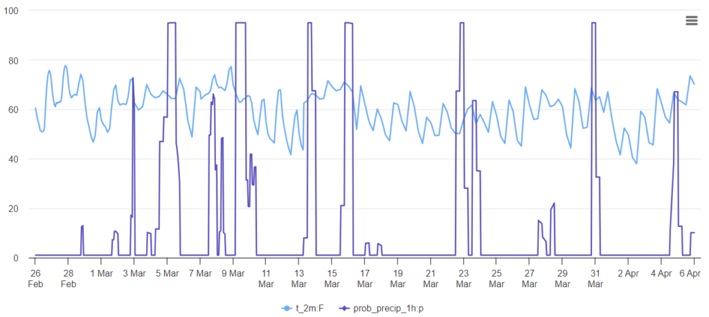
The first shot for rain arrives Wednesday afternoon. But it looks pretty meager.
The next shot for rain arrives Friday. And originally, there was some concern that this round of storms may bring the risk for severe weather, but as we went through the weekend, that risk looked to diminish.
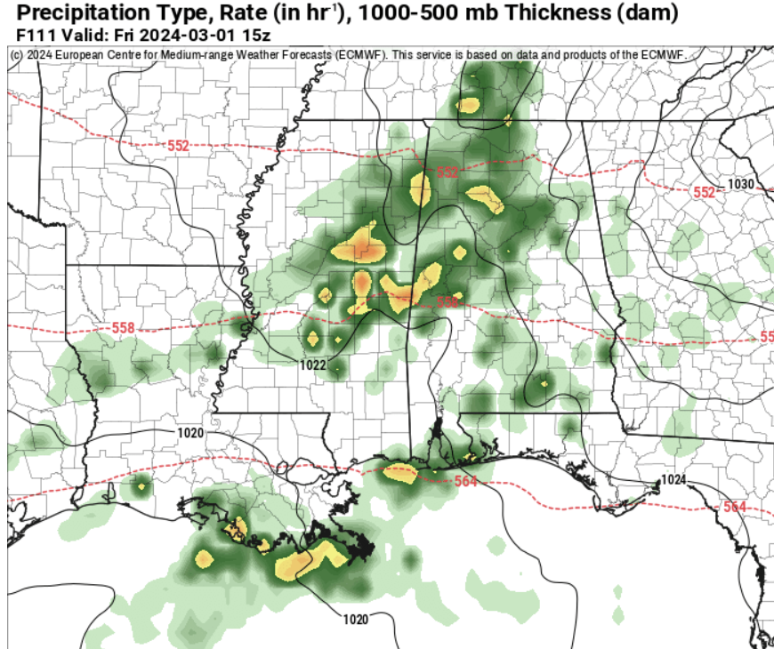
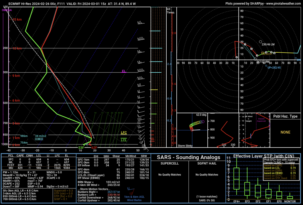
While the storms may pack some brief heavy rain, lightning, gusty wind and small hail, it looks like any threats will be pretty low on the scale and rather brief. And the tornado threat should be nearly zero.
Beyond that, we will see another shot for storms arrive on Saturday and then again next Monday and into Tuesday.
Looking out through the end of March and into April, model guidance isn’t showing much in the way of cold shots and it showing plenty of shots for precipitation — very typical for a weaker El Nino.
REIGONAL DAY TO DAY FORECAST
Monday: Sunny. Highs in the upper 70s. South winds 10 to 15 mph with gusts up to 25 mph.
Monday Night: Mostly clear in the evening, then becoming mostly cloudy. Not as cool with lows around 60. South winds around 10 mph with gusts up to 20 mph.
Tuesday: Partly sunny. Highs in the upper 70s. South winds 15 to 20 mph with gusts up to 30 mph.
Tuesday Night: Mostly cloudy. Near steady temperature in the mid 60s. South winds around 15 mph with gusts up to 25 mph.
Wednesday: Mostly cloudy. A slight chance of showers and thunderstorms in the afternoon. Highs around 80. Chance of rain 20 percent.
Wednesday Night: Mostly cloudy. A slight chance of showers and thunderstorms in the evening. Much cooler with lows in the mid 40s. Chance of rain 20 percent.
Thursday: Mostly cloudy. Much cooler with highs in the lower 60s.
Thursday Night: Mostly cloudy. A slight chance of showers and thunderstorms after midnight. Lows in the mid 40s. Chance of rain 20 percent.
Friday: Mostly cloudy with a chance of showers and thunderstorms. Highs in the mid 60s. Chance of rain 60 percent.
Friday Night: Mostly cloudy with a chance of showers with a slight chance of thunderstorms. Lows in the lower 50s. Chance of rain 40 percent.
Saturday: Mostly cloudy with a chance of showers with a slight chance of thunderstorms. Highs around 70. Chance of rain 40 percent.
Saturday Night: A slight chance of thunderstorms in the evening. Mostly cloudy with a slight chance of showers. Lows in the mid 50s. Chance of rain 20 percent.
Sunday: Partly sunny. A slight chance of showers in the morning, then a chance of showers in the afternoon. Highs in the lower 70s. Chance of rain 30 percent.


Do you think the giant rodent is right this time and Winter is coming to an end?