Hello everybody, there will be another day of very humid and hot weather with some chance for showers in the afternoon. In the morning, there will be partly cloudy skies and the temperature low will be in the upper 70s. The temperature high will be in the upper 90s with the dew point temperature will be low 70s throughout the day. There will be some showers and isolated thunderstorms will be happening in the afternoon and evening.
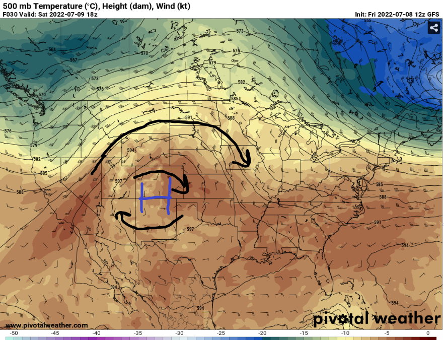
The high pressure will be moving to west to allow a trough from the northeast US will come down to the Southeast in the next few days. With this system will bring more rain relief on Sunday and on Monday. For today, there will very hot day until the trough will come by to the southeast.
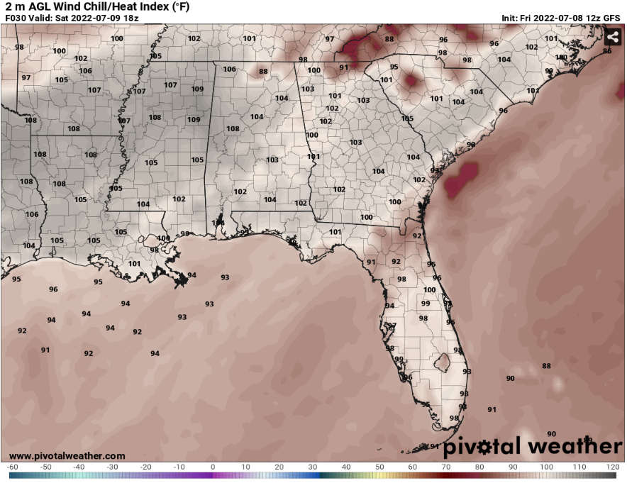
As the heatwave continues, for today the heat index values will go up to 105 degrees or higher. With a high temperature and Humidity will be the reason for a high heat index value for today. With the high dew point will help develop some showers in your area to bring some relief on this hot day.
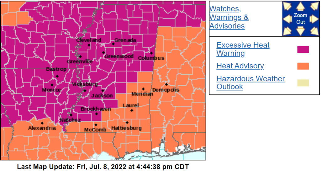
Most of SE MS and SW Alabama will be under the Heat advisory. According from the NWS Jackson office, the excessive heat warning and heat advisory will expire at 8pm CDT on Saturday. There are few ways to stay safe from the heat is by drinking plenty of water and stay in an air-conditioned room as long as possible. Don’t forget to use sunscreen to protect your skin from the high ultraviolet sun rays.
Day to Day Forecast
Saturday
Partly cloudy, with the temperatures high in the mid 90s. The heat index values will go up to 100 -105 degrees. There will be a 50-percent chance for scattered showers and thunderstorms.
Sunday
Scattered thunderstorms and showers throughout the day, with the temperatures high in the low 90s. The heat index values will go up to low 100s. There will be a 70-percent chance for widespread showers and thunderstorms.
Monday
Partly cloudy, with temperatures high in the low 90s. The heat index values will go up to upper 90s. There will be a 50-percent chance of scattered showers and thunderstorms.
Tuesday
Partly cloudy and scattered thunderstorms, with temperatures high in the low 80s to mid 80s. The heat index values will go up to upper 80s to low 90s. There will be a 60-percent chance of scattered showers and thunderstorms.
Wednesday
Partly cloudy, with temperatures high in the mid 80s. The heat index values will go up to low 90s. There will be a 60-percent chance of widespread showers and thunderstorms.
Thursday
Partly cloudy and scattered showers, with temperatures in the mid 80s. The heat index values will go up to low 90s. There will be a 60-percent chance of widespread showers and thunderstorms.
Friday
Mostly cloudy with scattered thunderstorms, with the temperatures in the upper 80s. The heat index values will go up to low 90s to mid 90s. There will be a 50-percent chance of showers and thunderstorms.


