Just when we thought we were done with warmer than average temperatures, summer says it’s not quite done yet. With another surface Ridge residing over us for the next several days, we’ll see temperatures in the mid to upper 80s, but in terms of good news, conditions will be a lot drier.

The National Weather Service in Jackson continues to put us under a wildfire danger risk for the next few days due to the lack of rain. The wind will shift from the southwest to the northeast from Saturday to Sunday, and the fire danger risks will lower slightly. However, the same rules apply to heeding the local burn bans and taking precautionary measures to keep any fires from starting.

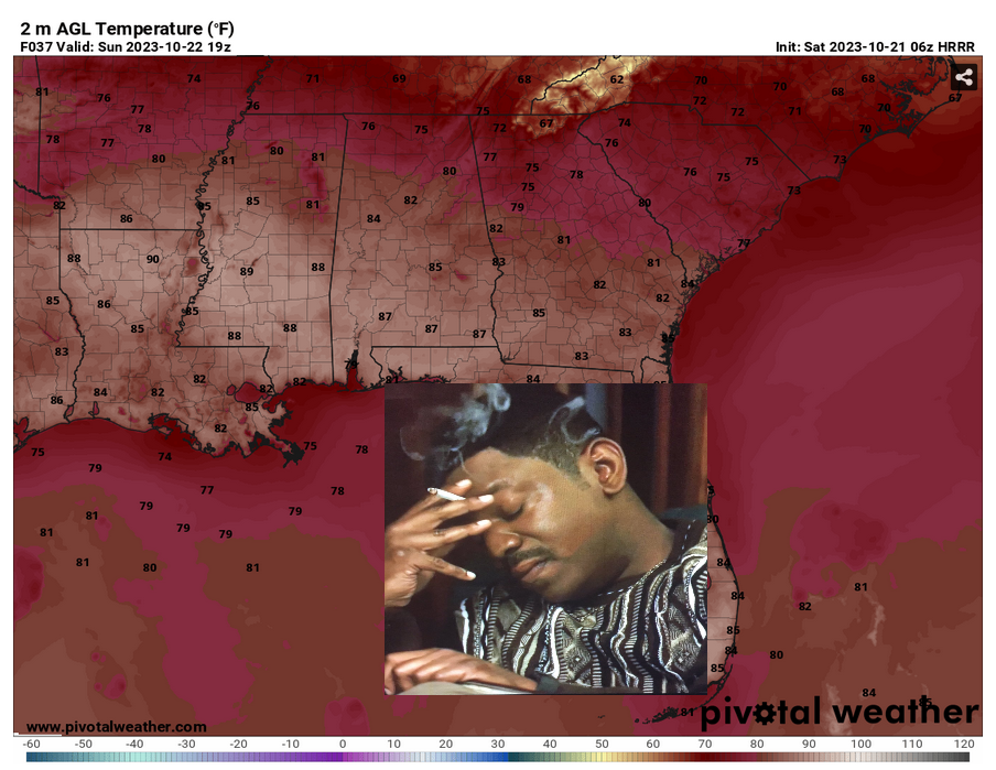
Conditions for the Pinebelt will be warmer than average but also warmer than most of the area surrounding it such as north Mississippi and even parts of southern Louisiana. Temperatures will likely reach the mid to upper 80s during the day this weekend it will reach into the upper 50s to low 60s at night. Cloud cover will increase as a weak front will push through overnight into Sunday.
Considering it’s a bit warmer than normal, I probably wouldn’t dress in anything fall like for the next few days. While out and about for many of the autumn festivities, I’d recommend to bring a little extra water with you if you’re going to be outdoors.
[wpcode id=”41179″]
Regional Day-to-Day Forecast
Today – Mostly sunny, with a high near 87. Calm wind becoming south southwest around 5 mph in the morning.
Tonight – Patchy fog before sunrise. Otherwise, partly cloudy, with a low around 59. South southwest wind around 5 mph becoming calm in the evening.
Sunday – Patchy fog in the morning. Otherwise, mostly cloudy, with a high near 87. Calm wind becoming west northwest around 5 mph in the afternoon.
Sunday Night – Mostly cloudy, with a low around 60. East wind around 5 mph becoming calm after midnight.
Monday – Partly sunny, with a high near 86. Light east wind becoming southeast 5 to 10 mph in the morning.
Monday Night – Partly cloudy, with a low around 57. Southeast wind around 5 mph.
Tuesday – Sunny, with a high near 83. East southeast wind 5 to 10 mph.
Tuesday Night – Mostly clear, with a low around 58. Southeast wind around 10 mph.
Wednesday – Mostly sunny, with a high near 82. Southeast wind 10 to 15 mph, with gusts as high as 20 mph.
Wednesday Night – Partly cloudy, with a low around 59.
Thursday – Mostly sunny, with a high near 83.
Thursday Night – Partly cloudy, with a low around 62.
Friday – Mostly sunny, with a high near 82.
[wpcode id=”41149″]


