As we approach a new week in this fairly brisk January, we’ll have a few warmer than normal days with storms and even some severe weather possible.

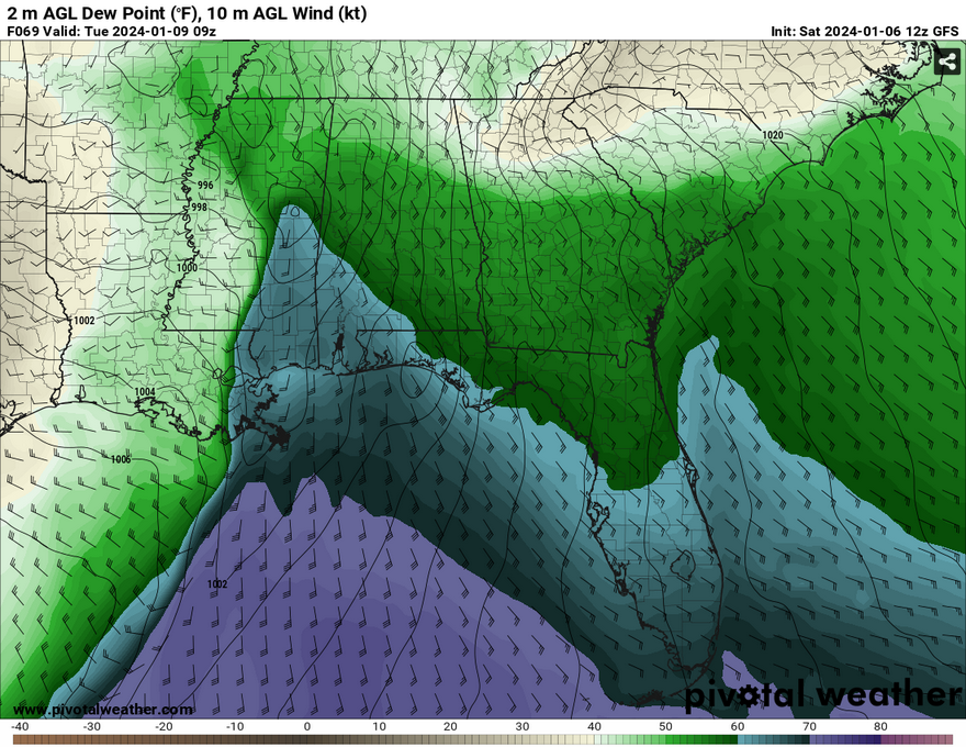
A front from the southern plains will rapidly develop over Texas and around the high pressure system in the deep south. The result of that will be a long warm front that will bring plenty of moisture from the Gulf of Mexico into much of Louisiana, Alabama and Mississippi before the main line fully develops. With this influence of moisture, temperatures and dewpoints will be on the rise overnight into Tuesday. The closed low carrying both fronts will take the influence of moisture and will be able to bring not only heavy rain, but plenty of strong winds (40-50 mph) and even a possible tornado closer to the coastline. Areas of south and central Louisiana along with much of southern Mississippi south of I-20 will be affected and this will likely happen between 9pm-3am as it moves eastward.
The rest of Tuesday and Wednesday will be more pleasant albeit a bit breezy with the cold front passage. Temperatures will reach the 50s during the day and the 30s at night, pretty seasonable for this time of year. Looking at Thursday, temperatures look to climb into the 60s with winds pulling from the South.
Our next chance of rain and thunderstorms will be on Friday. Another front out of the plains will move eastward, however a bit further north. The SPC is out of range on this one, however some similar severe factors may come into play with this system as it develops over parts of Louisiana, Mississippi, Tennessee, and Alabama. A spike in dewpoints is a pretty good indicator of some possible severe weather that may develop over us, so stay tuned over the next few days.
[wpcode id=”41179″]
Regional Day-to-Day Forecast
Today – Partly sunny, with a high in the mid 50s. West wind around 5 mph.
Tonight – Mostly cloudy, with a low in the upper 30s. West northwest wind around 5 mph becoming calm.
Sunday – Mostly sunny, with a high in the upper 50s. West northwest wind around 5 mph becoming east northeast in the afternoon.
Sunday Night – Mostly cloudy, with a low in the upper 30s. East wind around 5 mph.
Monday – Isolated showers, then showers and possibly a thunderstorm after noon. Some of the storms could be severe. High in the low 60s. Windy, with an east southeast wind 10 to 15 mph increasing to 20 to 25 mph in the afternoon. Winds could gust as high as 40 mph. Chance of precipitation is 90%. New rainfall amounts between a half and three quarters of an inch possible.
Monday Night – Showers and possibly a thunderstorm. Some of the storms could be severe and produce heavy rainfall. Low in the mid 40s. Windy, with an east southeast wind 20 to 25 mph becoming southwest after midnight. Winds could gust as high as 45 mph. Chance of precipitation is 100%. New rainfall amounts between 2 and 3 inches possible.
Tuesday – Scattered showers and thunderstorms before noon. Mostly sunny, with a high in the upper 50s. Windy, with a west southwest wind 20 to 25 mph, with gusts as high as 35 mph. Chance of precipitation is 30%.
Tuesday Night – Partly cloudy, with a low in the mid 30s. West wind 15 to 20 mph, with gusts as high as 35 mph.
WednesdaySunny, with a high in the mid 50s. West wind 5 to 15 mph, with gusts as high as 20 mph.
Wednesday Night – Partly cloudy, with a low in the mid 30s.
Thursday – Partly sunny, with a high in the mid 60s.
Thursday Night – Showers likely and possibly a thunderstorm. Mostly cloudy, with a low in the low 50s. Chance of precipitation is 60%.
Friday – Showers likely and possibly a thunderstorm. Partly sunny, with a high in the mid 60s. Chance of precipitation is 60%.
[wpcode id=”41149″]


